Sunnyslope, California

Last updated
Sunnyslope
Riverside County California Incorporated and Unincorporated areas Sunnyslope Highlighted.svg
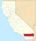
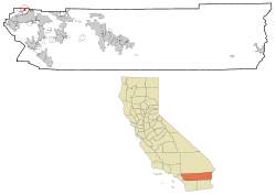
Location in Riverside County and the state of California
Usa edcp location map.svg
Red pog.svg
Sunnyslope
Location in the United States
Coordinates: 34°01′14″N117°25′24″W / 34.02056°N 117.42333°W / 34.02056; -117.42333 Coordinates: 34°01′14″N117°25′24″W / 34.02056°N 117.42333°W / 34.02056; -117.42333
Country Flag of the United States.svg  United States
State Flag of California.svg  California
County Riverside
Inc. into Jurupa Valley July 1, 2011
Area
[1]
  Total1.474 sq mi (3.817 km2)
  Land1.474 sq mi (3.817 km2)
  Water0 sq mi (0 km2)  0%
Elevation
[2]
902 ft (275 m)
Population
 (2010)
  Total5,153
  Density3,500/sq mi (1,400/km2)
Time zone UTC-8 (PST)
  Summer (DST) UTC-7 (PDT)
ZIP code
92509
Area code(s) 951
FIPS code 06-76022
GNIS feature ID 1656638

Sunnyslope was a census-designated place (CDP) in Riverside County, California, United States. The population was 5,153 at the 2010 census, up from 4,437 at the 2000 census. On July 1, 2011, the CDP became part of the City of Jurupa Valley.

Contents

Geography

Sunnyslope is located at 34°1′14″N117°25′24″W / 34.02056°N 117.42333°W / 34.02056; -117.42333 (34.020613, -117.423352). [3]

According to the United States Census Bureau, the CDP has a total area of 1.5 square miles (3.8 km2), all of it land.

Incorporation into the City of Jurupa Valley

On March 8, 2011, voters passed Measure A by a 54.03% YES vote, incorporating the areas of Mira Loma, Pedley, Rubidoux, Glen Avon, and Sunnyslope into the new city Jurupa Valley. The effective date of incorporation was July 1, 2011. [4]

Demographics

2010

The 2010 United States Census [5] reported that Sunnyslope had a population of 5,153. The population density was 3,497.0 inhabitants per square mile (1,350.2/km2). The racial makeup of Sunnyslope was 3,017 (58.5%) White, 96 (1.9%) African American, 55 (1.1%) Native American, 76 (1.5%) Asian, 10 (0.2%) Pacific Islander, 1,696 (32.9%) from other races, and 203 (3.9%) from two or more races. Hispanic or Latino of any race were 3,630 persons (70.4%).

The Census reported that 5,017 people (97.4% of the population) lived in households, 7 (0.1%) lived in non-institutionalized group quarters, and 129 (2.5%) were institutionalized.

There were 1,185 households, out of which 660 (55.7%) had children under the age of 18 living in them, 797 (67.3%) were opposite-sex married couples living together, 137 (11.6%) had a female householder with no husband present, 102 (8.6%) had a male householder with no wife present. There were 75 (6.3%) unmarried opposite-sex partnerships, and 9 (0.8%) same-sex married couples or partnerships. 102 households (8.6%) were made up of individuals, and 35 (3.0%) had someone living alone who was 65 years of age or older. The average household size was 4.23. There were 1,036 families (87.4% of all households); the average family size was 4.41.

The population was spread out, with 1,574 people (30.5%) under the age of 18, 613 people (11.9%) aged 18 to 24, 1,325 people (25.7%) aged 25 to 44, 1,228 people (23.8%) aged 45 to 64, and 413 people (8.0%) who were 65 years of age or older. The median age was 31.1 years. For every 100 females, there were 102.2 males. For every 100 females age 18 and over, there were 101.1 males.

There were 1,242 housing units at an average density of 842.9 per square mile (325.4/km2), of which 959 (80.9%) were owner-occupied, and 226 (19.1%) were occupied by renters. The homeowner vacancy rate was 2.4%; the rental vacancy rate was 3.4%. 3,975 people (77.1% of the population) lived in owner-occupied housing units and 1,042 people (20.2%) lived in rental housing units.

2000

As of the census [6] of 2000, there were 4,437 people, 1,086 households, and 963 families residing in the CDP. The population density was 3,216.9 inhabitants per square mile (1,242.1/km2). There were 1,123 housing units at an average density of 814.2 per square mile (314.4/km2). The racial makeup of the CDP was 57.7% White, 3.9% African American, 1.6% Native American, 2.3% Asian, 0.1% Pacific Islander, 30.6% from other races, and 3.9% from two or more races. Hispanic or Latino of any race were 53.1% of the population.

There were 1,086 households, out of which 51.8% had children under the age of 18 living with them, 71.1% were married couples living together, 11.3% had a female householder with no husband present, and 11.3% were non-families. 8.0% of all households were made up of individuals, and 1.9% had someone living alone who was 65 years of age or older. The average household size was 4.0 and the average family size was 4.1.

In the CDP the population was spread out, with 34.4% under the age of 18, 9.3% from 18 to 24, 28.2% from 25 to 44, 20.1% from 45 to 64, and 8.0% who were 65 years of age or older. The median age was 31 years. For every 100 females, there were 99.4 males. For every 100 females age 18 and over, there were 99.0 males.

The median income for a household in the CDP was $50,208, and the median income for a family was $48,036. Males had a median income of $35,875 versus $26,250 for females. The per capita income for the CDP was $14,055. About 15.7% of families and 18.7% of the population were below the poverty line, including 25.7% of those under age 18 and 9.2% of those age 65 or over.
Government

In the California State Legislature, Sunnyslope is in the 31st Senate District , represented by Democrat Richard Roth, and in the 60th Assembly District , represented by Democrat Sabrina Cervantes. [7]

In the United States House of Representatives, Sunnyslope is in California's 41st congressional district , represented by Democrat Mark Takano. [8]

Related Research Articles

Sylvan Springs, Alabama Town in Alabama, United States

Sylvan Springs is a town in Jefferson County, Alabama, United States, located northwest of the Birmingham suburb of Pleasant Grove. It incorporated on May 22, 1957. At the 2010 census the population was 1,542, up from 1,465 in 2000. This area was damaged by an F5 tornado on April 8, 1998, including the First United Methodist Church of Sylvan Springs.

Fairview, California CDP in California, United States

Fairview is a census-designated place (CDP) in Alameda County, California, United States. It borders on the city of Hayward and the census-designated place of Castro Valley. The population was 11,341 at the 2020 census.

Mountain View, Contra Costa County, California Census designated place in California, United States

Mountain View is a census designated place (CDP) in Contra Costa County, California, United States. The population was 2,372 at the 2010 census.

<span class="mw-page-title-main">Raisin City, California</span> Census-designated place in California, United States

Raisin City is a census-designated place (CDP) in Fresno County, California, United States. The population was 380 at the 2010 census, up from 165 at the 2000 census. Raisin City is located 13 miles (21 km) south-southwest of downtown Fresno, at an elevation of 236 feet.

East San Gabriel, California Census-designated place in California, United States

East San Gabriel is a census-designated place (CDP) in Los Angeles County, California, United States. The population was 14,874 at the 2010 census, up from 14,512 at the 2000 census.

North El Monte, California Census-designated place in California, United States

North El Monte is a census-designated place (CDP) in the San Gabriel Valley, in Los Angeles County, California, United States. The population was 3,723 at the 2010 census, up from 3,703 at the 2000 census.

<span class="mw-page-title-main">West Rancho Dominguez, California</span> Unincorporated community in California, United States

West Rancho Dominguez, formerly known as West Compton, is an unincorporated census-designated place (CDP) located in southern Los Angeles County, California. Per the 2020 census, the population was 24,347. The community lies to the west of the city of Compton. The ZIP Codes encompassing the CDP area are 90220 & 90248.

<span class="mw-page-title-main">Tamalpais-Homestead Valley, California</span> Census-designated place in California, United States

Tamalpais-Homestead Valley is a census-designated place (CDP) in Marin County, California, United States. The population was 11,492 at the 2020 census.

<span class="mw-page-title-main">San Lucas, California</span> Census-designated place in California, United States

San Lucas is a census-designated place (CDP) in Monterey County, California, United States. San Lucas was founded in 1886 and named after the Rancho San Lucas, which was granted in 1842. The post office was first established in 1892.

Glen Avon, California Former census-designated place in California, United States

Glen Avon is a neighborhood and former census-designated place (CDP) in Riverside County, California, United States. The population was 20,199 at the 2010 census, up from 14,853 at the 2000 census. On July 1, 2011, the CDP became part of the newly incorporated city of Jurupa Valley.

Mira Loma, California Former census-designated place in California, United States

Mira Loma, now officially part of Jurupa Valley, was a census-designated place (CDP) in Riverside County, California, United States. Its population was 21,930 in the 2010 census, up from 17,617 in the 2000 census.

Pedley, California Former census-designated place in California, United States

Pedley was a census-designated place (CDP) in Riverside County, California, United States. The population was 12,672 at the 2010 census, up from 11,207 at the 2000 census. On July 1, 2011, the CDP became part of the City of Jurupa Valley.

<span class="mw-page-title-main">Rubidoux, California</span> Former census-designated place in California, United States

Rubidoux was a census-designated place and unincorporated community in Riverside County, California, until July 1, 2011, when it became a neighborhood of the newly formed city of Jurupa Valley. The city is located within Southern California's Inland Empire region, which is part of the Greater Los Angeles Area. Along with the rest of Jurupa Valley, Rubidoux has transformed from a rural area of quarries and dairy farms, in mid to late 20th century, to a suburb of the two larger regions. As of the 2010 census, the population was 34,280, up from 29,180 at the 2000 census.

Bloomington, California Census-designated place in California, United States

Bloomington is a census-designated place (CDP) in San Bernardino County, California, United States. The population was 23,851 at the 2010 census, up from 19,318 at the 2000 census.

Fruitdale, San Jose Place in California, United States

Fruitdale is a district of San Jose, California, located in West San Jose, though some portions are still unincorporated as a census-designated place. The population of the CDP was 935 at the 2010 census.

Citrus Hills, Florida Census-designated place in Florida, US

Citrus Hills is a census-designated place (CDP) in Citrus County, Florida, United States. The population was 7,470 at the 2010 census, up from 4,029 in 2000.

Ponemah, Minnesota Census-designated place in Minnesota, US

Ponemah is a census-designated place (CDP) within the Lower Red Lake unorganized territory in Beltrami County, Minnesota, United States. The population was 724 at the 2010 census.

Green, Oregon Unincorporated community in the state of Oregon, United States

Green is a census-designated place (CDP) and unincorporated community in Douglas County, Oregon, United States. The population was 7,614 at the 2020 census.

Marion, South Dakota City in South Dakota, United States

Marion is a city in Turner County, South Dakota, United States. The population was 849 at the 2020 census.

Sunnyslope, Washington Census-designated place in Washington, United States

Sunnyslope is an unincorporated community and census-designated place (CDP) in Chelan County, Washington, United States. It is part of the Wenatchee–East Wenatchee Metropolitan Statistical Area. The population was 3,252 at the 2010 census, up from 2,521 at the 2000 census.

References

  1. "2010 Census U.S. Gazetteer Files – Places – California". United States Census Bureau.
  2. "Sunnyslope". Geographic Names Information System . United States Geological Survey, United States Department of the Interior . Retrieved November 9, 2014.
  3. "US Gazetteer files: 2010, 2000, and 1990". United States Census Bureau. 2011-02-12. Retrieved 2011-04-23.
  4. Stokley, Sandra (8 March 2011). "Jurupa cityhood approved". The Press-Enterprise. Retrieved 9 March 2011.
  5. "2010 Census Interactive Population Search: CA - Sunnyslope CDP". U.S. Census Bureau. Archived from the original on July 15, 2014. Retrieved July 12, 2014.
  6. "U.S. Census website". United States Census Bureau . Retrieved 2008-01-31.
  7. "Statewide Database". UC Regents. Archived from the original on February 1, 2015. Retrieved December 8, 2014.
  8. "California's 41st Congressional District - Representatives & District Map". Civic Impulse, LLC.