Related Research Articles
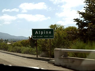
Alpine is a census-designated place (CDP) in the Cuyamaca Mountains of San Diego County, California. Alpine had a population of 14,236 at the 2010 census, up from 13,143 at the 2000 census. The town is largely surrounded by the Cleveland National Forest and borders two reservations of the Kumeyaay Nation, Viejas and Sycuan, and the rural unincorporated areas of the city of El Cajon.

Granite Hills is a census-designated place in San Diego County, California. The name is also applied to a neighborhood within the city limits of El Cajon in the eastern part of that city. The population of the CDP, which does not include the people living within the city of El Cajon, was 3,035 at the 2010 census, down from 3,246 at the 2000 census.
Harbison Canyon is a census-designated place (CDP) in San Diego County, California. Harbison Canyon had a population of 3,841 as of the 2010 census, up from 3,645 as of the 2000 census.

Pine Valley is a community and census-designated place (CDP) in the Cuyamaca Mountains of the Mountain Empire area, in southeastern San Diego County, California. The population was 1,510 at the 2010 census, up from 1,501 at the 2000 census.

Spring Valley is a census-designated place (CDP) in the East County region of San Diego County, California. The population was 28,205 at the 2010 census.

Rancho San Diego is a census-designated place (CDP) in San Diego County, California. The population was 21,208 at the 2010 census, up from 20,155 at the 2000 census. The area was developed as subdivisions beginning in the 1970s.
Boulevard is a census-designated place (CDP) in the Mountain Empire area of southeastern San Diego County, California. At the 2010 census, it had a population of 315. The area is rural desert along the Mexican border near the eastern extent of San Diego County.

Campo is an unincorporated community in the Mountain Empire area of southeastern San Diego County, California, United States. The population was 2,684 at the 2010 census. For statistical purposes, the United States Census Bureau has defined Campo as a census-designated place (CDP). The census definition of the area may not precisely correspond to local understanding of the area with the same name.

Normal Heights is a neighborhood of the mid-city region of San Diego, California.
The Sycuan Band of the Kumeyaay Nation is a federally recognized tribe of Mission Indians from Southern California, located in an unincorporated area of San Diego County just east of El Cajon. The Sycuan band are a Kumeyaay tribe, one of the four ethnic groups indigenous to San Diego County.
Southwest Senior High (SOH), in San Diego, California, United States, is a high school established in 1975. It was built on the site of a small railroad yard owned by the Southern Pacific Railroad along the original San Diego-Tijuana line. It existed until the mid-1930s when the tracks were moved east to the present-day Trolley tracks. Part of the Sweetwater Union High School District, it serves all socioeconomic communities of San Diego, as well as some students living in Chula Vista, Imperial Beach and San Ysidro. The school serves approximately 1,750 students. The school has a rivalry with fellow Sweetwater Union High School District school, Mar Vista, most notably the annual Battle of the Bell football game.
El Capitan High School is a public high school in Lakeside, California, United States, a census-designated place in San Diego, and serves students in grades nine through twelve. Opened in 1959, El Capitan is the fifth of twelve high schools to be constructed in the Grossmont Union High School District. El Capitan High School is accredited by the Western Association of Schools and Colleges.

El Cajon Boulevard is a major east–west thoroughfare through San Diego, La Mesa and El Cajon, California. Before the creation of Interstate 8 it was the principal automobile route from San Diego to El Cajon, the Imperial Valley, and points east as U.S. Route 80; it is now signed as a business loop of Interstate 8.
The Grossmont–Cuyamaca Community College District is a California community college district comprising two colleges, Grossmont College and Cuyamaca College that serve about 28,000 students a year. Grossmont College is located in El Cajon, California and Cuyamaca College is located in Rancho San Diego, California, and primarily serves East San Diego and East County communities.
Singing Hills Memorial Park is a cemetery dedicated in 1996. It is located on the outskirts of El Cajon, California in the Dehesa Valley. A 65 acres (260,000 m2) wildlife preserve surrounds the dedicated 35 acres (140,000 m2) of burial, mausoleum and cremation property.
Rancho Cañada de San Vicente y Mesa del Padre Barona was a 13,316-acre (53.89 km2) Mexican land grant in present-day San Diego County, California given in 1846 by Governor Pío Pico to Juan Bautista Lopez. The grant was located in the San Vicente and Padre Barona Valleys, which lie south of Ramona. The area served as grazing lands for the Mission San Diego. Father José Barona served at the Mission San Diego from 1798 to 1810, before moving to the Mission San Juan Capistrano.

The Barona Group of Capitan Grande Band of Mission Indians of the Barona Reservation is a federally recognized tribe of Kumeyaay Indians, who are sometimes known as Mission Indians.
Anna Prieto Sandoval was an American leader of the Sycuan Band of the Kumeyaay Nation of southern California and a Native American gaming enterprises pioneer. She is credited with lifting the Sycuan Band reservation, which was plagued by poverty and substandard housing, to self-sufficiency by pioneering casino gambling on the reservation.
The Mountain Empire is a rural area in southeastern San Diego County, California. The Mountain Empire subregion consists of the backcountry communities in southeastern San Diego County. The area is also sometimes considered part of the East County region of San Diego County.
Rancho San Juan de Las Secuas also known as Rancho Secuan or Rancho Sequan was unusual in that it was originally a Mission land grant to Apolinaria Lorenzana and its next owner Juan Bautista Lopez failed in an attempt establish it as a Mexican land grant rancho of Alta California and abandoned it.
References
- ↑ "Dehesa (in San Diego County, CA) Populated Place Profile". California Hometown Locator. Retrieved 8 September 2014.
- ↑ U.S. Geological Survey Geographic Names Information System: Dehesa
Coordinates: 32°46′53″N116°51′11″W / 32.781442°N 116.853079°W

| This San Diego County, California–related article is a stub. You can help Wikipedia by expanding it. |