Downtown San Diego

Last updated
Downtown San Diego skyline from Shelter Island San Diego Reflecting Pond.jpg
Downtown San Diego skyline from Shelter Island
Downtown San Diego skyline from the Cabrillo National Monument Downtown San Diego 02.jpg
Downtown San Diego skyline from the Cabrillo National Monument

Downtown San Diego is the city center of San Diego, California, the eighth largest city in the United States. In 2010, the Centre City area had a population of more than 28,000. Downtown San Diego serves as the cultural and financial center and central business district of San Diego, with more than 4,000 businesses and nine districts. The downtown area is the home of the San Diego Symphony and the San Diego Opera as well as multiple theaters and several museums. [1] [2] The San Diego Convention Center and Petco Park, home of the San Diego Padres, are also located downtown. Downtown San Diego houses the major local headquarters of the city, county, state, and federal governments.

Contents

History

The downtown of San Diego was previously inhabited by the Kumeyaay who referred to the area as Tisirr, and also established a village called Pu-Shuyi near what is now Seaport Village. [3] [4]

The city of San Diego was originally focused on Old Town near the Presidio, several miles north of current Downtown. The location was not ideal because it was several miles from navigable water. In 1849 Lt. Andrew B. Gray, a surveyor working with the boundary commission to establish the boundaries of the new state of California, suggested that an area closer to San Diego Bay would be a better location for a city because it would be better for trade. He proposed the idea to William Heath Davis, who recruited four other investors. The partners under Davis's leadership purchased 160 acres (65 ha) of land in what is now Downtown San Diego. They laid out a street plan for New Town and built a wharf and warehouse. [5] Several people built houses there, including the still-standing William Heath Davis House, now a museum. [6] John Judson Ames wrote a prospectus for a newspaper, the San Diego Herald in December 1850, soliciting advertisements and subscriptions from the towns-people; [7] the first issue was published on May 29, 1851. [8] However, New Town did not do well due to a lack of fresh water, a financial depression in 1851, and opposition from the established settlements in Old Town and La Playa. [1] In 1852, a San Diego grand jury called for the removal of several Kumeyaay villages close to any White settlement and the village of Tisirr was razed to the ground. [9]

The Santa Fe Depot, built in 1915 San Diego Train Station.jpg
The Santa Fe Depot, built in 1915

In 1867, Alonzo Horton purchased 800 acres (320 ha) of pueblo lands in the current Downtown area, and in 1869 he added Davis's 160 acres (65 ha) to his holdings; the area was referred to as the Horton Addition. [10] Davis's wharf had fallen to pieces by then, but Horton realized the area was still ideal for a harbor. [11] He built a new wharf at the end of Fifth Avenue in 1869. [12] He vigorously sold property and gave away land to promote development of the area, fueling the first of San Diego's many real estate speculation booms. People flocked to the area, known as New Town, because of its better access to shipping. In 1871 government records were moved to a new county courthouse in New Town. By the 1880s New Town had totally eclipsed Old Town (as it is called to this day) as the heart of the growing city.

A Class 1 streetcar at 5th and Broadway in downtown San Diego, c. 1915 Class 1 Streetcar 5th and Broadway-San Diego-1915.JPG
A Class 1 streetcar at 5th and Broadway in downtown San Diego, c.1915

In 1885, the transcontinental railroad reached San Diego. The Santa Fe railway station opened downtown in 1887 (that station was replaced in 1915 by the Downtown landmark Santa Fe Depot, which is still in use). In 1886 the city's first electric lights and first streetcars were established in New Town. [13] In 1912 the Spreckels Theater opened downtown, the first modern commercial playhouse west of the Mississippi. [14] A new commercial pier, the Broadway Pier, was built by the city in 1913.

In the 1910s, Downtown became one of the many San Diego neighborhoods connected by the Class 1 streetcars and an extensive San Diego public transit system that was spurred by the Panama-California Exposition of 1915 and built by John D. Spreckels. These streetcars became a fixture of the neighborhood until their retirement in 1939. [15]

In 1964 the multi-story City Hall and Community Concourse were dedicated on a four-block-square property at 202 C Street. Recent mayors and city councils have discussed building a replacement city hall, but no replacement plan has been approved.

Petco Park Petco Park, San Diego.jpg
Petco Park

In the 1960s, Centre City began to fall into a state of disrepair and disrepute. Major businesses and stores moved from downtown to suburban shopping malls. Downtown became known as a hangout for homeless people and sailors on liberty. Tattoo parlors, bars, and strip clubs were predominant forms of business. Trash littered the Gaslamp Quarter, many 19th century Victorian houses were rundown, and there were few buildings of significant size (the tallest building at the time was fourteen stories, the locally famous El Cortez). [16] Despite this, low- and mid-rise buildings were beginning construction.

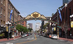
In 1975, redevelopment plans were created for Downtown. [17] In 1985, Downtown underwent more redevelopment with the completion of Horton Plaza, the Gaslamp Quarter revival, and the completion of the San Diego Convention Center. Petco Park, a baseball ballpark used by the San Diego Padres, opened in 2004. [18]

Chinatown

In the 1860s, the first Chinese moved to Downtown. [19] In the 1870s, the Chinese were the primary fishermen in the area. [20] Beginning in the 1880s, a large number of Chinese began to move to San Diego, establishing a concentration; with up to 200 Chinese making up a minority of the 8,600 who lived in all of San Diego. [21] At its peak, about a thousand Chinese lived in San Diego and were faced with discrimination. [22] The concentration became known as Chinatown, and an effort to demolish the area due to the Panama-California Exposition was attempted but the area continued on until World War II. [23] Beginning in the early 1900s, Filipinos began to move to San Diego, and settled in and near Chinatown. [24] In 1995, the Asian Pacific Thematic Historic District was created to preserve the remaining structures that remained from the era when Chinatown, as well as Nihonmachi (Japantown), existed. [25] While a few of the buildings remain, there no longer exist a significant concentration of Chinese Americans in the former neighborhood. [26]

Geography

Aerial view of Downtown San Diego, 2007 DowntownSanDiegoByPhilKonstantin.jpg
Aerial view of Downtown San Diego, 2007
Central portion of San Diego and neighborhood boundaries SanDiegoCentral.gif
Central portion of San Diego and neighborhood boundaries

Located in Central San Diego, Downtown San Diego is delimited by San Diego Bay to the west and southwest, Bankers Hill, Middletown, and Balboa Park to the north, Sherman Heights and Golden Hill to the east, and Barrio Logan and Logan Heights to the southeast. San Diego International Airport is just northwest of downtown.

Districts and neighborhoods

Architecture

Due to San Diego International Airport (Lindbergh Field)'s proximity to downtown, there is a FAA imposed 500-foot height restriction on all buildings within a 1.5-mile radius of the runway. [27] The height regulation exists because when planes approach the airport, any structure taller than 500 feet within the radius could interfere with flight operations and potentially result in a collision. [28]

Government buildings

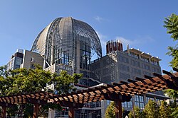
The United States Postal Service operates the downtown San Diego Post Office at 815 E Street. [29] The city's former main public library is located across the street from it at 8th and E streets, but currently is vacant. A new nine-story Central Library opened in 2013 on Park Boulevard at J Street. [30] Other government buildings downtown include City Hall and other city administration buildings, the San Diego Police Headquarters at 14th and Broadway, the State of California office building at 1350 Front Street, and a three-block federal office complex at 8th and Front streets. County and federal courthouses are also located downtown.

Historic landmarks

The Downtown area contains numerous sites that are listed on the National Register of Historic Places. They include:

Gaslamp Quarter Gaslamp Quarter 01.jpg
Gaslamp Quarter
The Horton Grand Hotel Horton Grand Hotel, San Diego.jpg
The Horton Grand Hotel

Arts and culture

The Balboa Theatre Balboa Theatre, San Diego 01.jpg
The Balboa Theatre

The Civic Theatre in the Community Concourse is the home of the San Diego Opera as well as traveling shows. The San Diego Symphony is headquartered at Copley Symphony Hall, a renovated movie palace on 7th Avenue originally built in 1929 as the Fox Theater. The Spreckels Theater at 1st and Broadway, in continuous operation since 1912, hosts local and traveling performances and productions. The Balboa Theatre, built in 1924, re-opened in 2008 after extensive renovations as a venue for live performances and concerts. Both the Spreckels and the Balboa theaters are listed on the National Register of Historic Places. Other downtown theaters include the Lyceum in Horton Plaza, which hosts the San Diego Repertory Theatre as well as concerts and art shows, and the Sledgehammer Theater. Nightclubs such as the House of Blues and Croce's feature well-known musical groups. The Museum of Contemporary Art, also located in downtown San Diego, has displayed work across a collection of media since 1950. [31]

Filming locations

Anchorman: The Legend of Ron Burgundy featured aerial shots of the downtown area. [32] Demolition Man was filmed along Harbor Drive near the San Diego Convention Center and America Plaza Trolley Station. [33] Parts of The Samuel Project were filmed in the Gaslamp district. [34]

Other films shot in the downtown neighborhood include Everybody Dies by the End , [35] Friend of the World , [36] Hacksaw , [37] In God We Tru$t , [38] My Son, My Son, What Have Ye Done? [39] and Scavenger Hunt . [40]

Tourist attractions

The San Diego Convention Center San Diego Convention Center.jpg
The San Diego Convention Center

The Columbia (waterfront) neighborhood of downtown hosts the Midway aircraft carrier museum ship, as well as the eight ships and boats of the San Diego Maritime Museum, headlined by the Star of India.

The San Diego Convention Center and Petco Park are located downtown.

The Horton Plaza and Seaport Village shopping and dining complexes attract visitors as well as local residents.

More than 200 cruise ships a year call at the cruise ship terminal. A passenger ferry connects downtown San Diego with Coronado, and San Diego Bay harbor tours depart from Harbor Drive.

Annual events

Downtown events include the Big Bay Balloon Parade, held in conjunction with the Holiday Bowl; the Martin Luther King Jr. Day Parade and Festival; the Parade of Lights featuring holiday-decorated boats on the Bay; and the San Diego Street Scene music festival. [41] Every mid to late July, downtown San Diego is transformed for San Diego Comic Con, the largest entertainment and comic book convention in the world. San Diego Comic Con is held inside the San Diego Convention Center, but the convention has expanded to other nearby hotels, parks, and plazas which include the Manchester Grand Hyatt Hotel, San Diego Marriott Marquis & Marina, Hilton San Diego Bayfront, Omni San Diego Hotel and Gaslamp Quarter, San Diego as major supporting venues.

Education

The downtown Central Library opened in 2013 San Diego Central Library.jpg
The downtown Central Library opened in 2013

The downtown area is served by the San Diego City Schools. Washington Elementary School is located in the downtown area. San Diego High School and San Diego City College are located in the northeastern corner of downtown adjacent to Balboa Park. Middle school students from downtown attend Roosevelt Middle School in the Balboa Park area. [42] The charter high school e3 Civic High School is located inside the downtown library. The Monarch School, a public K-12 school for students who are homeless or affected by homelessness, is also located downtown.

A few private or religious schools exist in the area. [43] [44] California Western School of Law is located downtown. [45]

Infrastructure

Harbor Drive Harbor Drive, San Diego.jpg
Harbor Drive

Streets are laid out in a grid pattern and many are designated for one-way traffic. North–south roads have both names and numbers. The named roads begin with Harbor Boulevard and then move east past Pacific, Kettner, India, Columbia, State, Union and Front streets. The roads are then numbered and are called avenues, starting at 1st Avenue and continuing to Park Boulevard (12th Avenue). The general pattern is that even numbered streets head south, and odd numbered streets go north. East–west streets are laid out alphabetically from A to K, with the exception of D, H and I, which are replaced with Broadway, Market Street and Island Avenue, respectively. Streets north of A Street are named after trees, starting with Ash Street and going up to Laurel.

Main thoroughfares include Broadway and Market Street (east–west), and Harbor Drive, Pacific Highway and Park Avenue (north–south).

Three freeways either pass through or start/end in downtown San Diego. State Route 163 (SR 163) ends in downtown with the southbound lane of the freeway becoming 10th Avenue and 11th Avenue becoming the northbound lane at Ash Street. Interstate 5 (I-5) passes above the downtown area and is accessible from selected streets outside of the actual downtown area or at the intersection of 10th/11th and Ash (where 163 starts and ends). Additionally, SR 94 enters downtown from the east, with westbound SR 94 becoming F Street and G street becoming eastbound SR 94.

The downtown area is served by the San Diego Metropolitan Transit System, the San Diego Trolley. There is also a commuter train linking downtown with northern San Diego County, called the Coaster, which also stops at communities along the San Diego County costaline, as well as the Amtrak passenger rail system.

Parking is mainly concentrated in various "pay to park" lots, with metered parking spaces alongside most streets. There is also parking available at the County operation center (located between Harbor Drive and Pacific Highway, just north of Ash), as well as Horton Plaza and Seaport Village shopping areas.

See also

Related Research Articles

<span class="mw-page-title-main">Gaslamp Quarter, San Diego</span> United States historic place

The Gaslamp Quarter is a 16½-block neighborhood in the downtown area of San Diego, California. It extends from Broadway to Harbor Drive, and from 4th to 6th Avenue.

<span class="mw-page-title-main">Ocean Beach, San Diego</span> Community of San Diego in California, United States

Ocean Beach is a beachfront neighborhood of San Diego, California.

<span class="mw-page-title-main">San Diego Electric Railway</span> Mass transit system (1892–1949)

The San Diego Electric Railway (SDERy) was a mass transit system in Southern California, United States, using 600 volt DC streetcars and buses.

Jonathan Adams Jerde, was an American architect based in Venice, Los Angeles, California, founder and chairman of The Jerde Partnership, a design architecture and urban planning firm specializing in the design of shopping malls that has created a number of commercial developments around the globe. Jerde became well known as an innovator in the design of malls and related spaces. His firm has grown into a multi-disciplinary firm with offices in Los Angeles, Orange County, California, Hong Kong, and Shanghai.

<span class="mw-page-title-main">College Area, San Diego</span> Community of San Diego in California

The College Area is a residential community in the Mid-City region of San Diego, California, United States. The College Area is dominated by San Diego State University, after which the area is named. Several neighborhoods in the College Area were developed in the 1930s, with others becoming established in the post-war period. The College Area is bordered on the west by Kensington and Talmadge and on the east by the city of La Mesa. El Cajon Boulevard is a busy shopping district; additional retail, entertainment and dining establishments are located in a new housing and commercial complex known as South Campus Plaza on College Avenue at Aztec Center. The College Area includes the neighborhoods of the Catoctin Area, Dennstedt Point, East Falls View Drive, Saranac-Mohawk, and an Orthodox Jewish neighborhood in the area near Congregation Beth Jacob Orthodox Synagogue on College Avenue. The region includes Alvarado Hospital, a 306-bed acute care facility, and the College-Rolando branch of the San Diego Public Library.

<span class="mw-page-title-main">North Park, San Diego</span> Neighborhood in California, US

City Heights is a dense urban community in central San Diego, California, known for its ethnic diversity. The area was previously known as East San Diego. City Heights is located south of Mission Valley and northeast of Balboa Park.

<span class="mw-page-title-main">History of San Diego</span> Aspect of history

The written history of the San Diego, California, region began in the present state of California when Europeans first began inhabiting the San Diego Bay region. As the first area of California in which Europeans settled, San Diego has been described as "the birthplace of California."

<span class="mw-page-title-main">Golden Hill, San Diego</span> Neighborhood in San Diego, California

Golden Hill is a neighborhood of San Diego, California. It is located south of Balboa Park, north of Sherman Heights, Grant Hill and Stockton, and east of Downtown.

<span class="mw-page-title-main">Horton Plaza (shopping mall)</span> Shopping mall in San Diego, California

Horton Plaza, not to be confused with its adjacent namesake Horton Plaza Park, was a five-level outdoor shopping mall located in downtown San Diego. It was known for its bright colors, architectural tricks, and odd spatial rhythms. It stood on 6.5 city blocks adjacent to the city's historic Gaslamp Quarter. Opening in 1985, it was the first successful downtown retail center since the rise of suburban shopping centers decades earlier. In August 2018, the property was sold to developer Stockdale Capital Partners, which plans to convert it into an office-retail complex. RDC is the architect of record. Nordstrom closed in 2016, leaving a vacant anchor store, and the other major anchor, Macy's, closed in spring 2020. Contrary to some reports the mall was not demolished. Massive renovations of the mall began in June 2020.

<span class="mw-page-title-main">East Village, San Diego</span> Neighborhood of San Diego in San Diego, California

East Village is a neighborhood in San Diego, California, United States. It is the largest urban neighborhood in downtown San Diego. It is located east of the Gaslamp Quarter and southeast of the Core district and Cortez Hill in downtown San Diego. East Village encompasses 130 blocks between Seventh Avenue east to 18th Street. It is home to more than 700 businesses.

<span class="mw-page-title-main">San Diego Repertory Theatre</span>

The San Diego Repertory Theatre is a performing arts company in San Diego, California.

<span class="mw-page-title-main">Culture of San Diego</span> Overview of the culture of San Diego

The culture of San Diego, California is influenced heavily by American and Mexican cultures due to its position as a border town, its large Hispanic population, and its history as part of Spanish America and Mexico. San Diego's longtime association with the U.S. military also contributes to its culture. Present-day culture includes many historical and tourist attractions, a thriving musical and theatrical scene, numerous notable special events, a varied cuisine, and a reputation as one of America's premier centers of craft brewing.

<span class="mw-page-title-main">Downtown Oakland</span> Central business district of Oakland, California

Downtown Oakland is the central business district of Oakland, California, United States. It is located roughly bounded by both the Oakland Estuary and Interstate 880 on the southwest, Interstate 980 on the northwest, Grand Avenue on the northeast, and Lake Merritt on the east.

<span class="mw-page-title-main">Cortez Hill, San Diego</span> Neighborhood in San Diego, California

Cortez Hill is a neighborhood located in the northeast part of Downtown San Diego, California.

<span class="mw-page-title-main">Keating Building</span> Historic building in San Diego, California, U.S.

The Keating Building, also known as The Keating Hotel, is a 35-room luxury boutique hotel in San Diego. Located in the center of the Gaslamp Quarter, the Keating is located near the San Diego Convention Center, Balboa Theater, and Petco Park.

<span class="mw-page-title-main">12th & Imperial Transit Center</span> San Diego Trolley and bus station

12th & Imperial Transit Center is a San Diego Trolley station in Downtown San Diego, California. It is located in the East Village neighborhood of the city and serves the high-density residential developments that surround the stop. It is one of two stations from which Petco Park can be reached. The station has historically been used as a major transfer point between the various Trolley lines and is the only station that is directly served by all four Trolley lines.

<span class="mw-page-title-main">Balboa Park (San Diego)</span> Historic San Diego park

Balboa Park is a 1,200-acre (490 ha) historic urban cultural park in San Diego, California, United States. In addition to open space areas, natural vegetation zones, green belts, gardens, and walking paths, it contains museums, several theaters, and the San Diego Zoo. There are also many recreational facilities and several gift shops and restaurants within the boundaries of the park. Placed in reserve in 1835, the park's site is one of the oldest in the United States dedicated to public recreational use. Balboa Park is managed and maintained by the Parks and Recreation Department of the City of San Diego.

The following is a timeline of the history of the city of San Diego, California, United States.

<span class="mw-page-title-main">Horton Plaza Park</span> Urban park in San Diego, California

Horton Plaza Park is an outdoor venue located in the heart of downtown San Diego, which had its grand opening on May 4, 2016. Located on the corner of 4th Avenue and Broadway, the plaza preserves the history and integrity of the original Horton Plaza, while adding key features to enhance the area. In addition to restoring the Broadway Fountain, the park includes an amphitheater for live music acts, retail Pavilions and a new, interactive fountain. The plaza was designated a historical landmark by the City of San Diego on March 19, 1971. The city-owned park was designed by landscape architect Walker Macy and built by Civic San Diego.

References

  1. 1 2 "Abortive Attempt to Establish New San Diego", Smythe's History of San Diego part 2, chapter 14
  2. "Downtown San Diego". downtownsandiego.org. Downtown San Diego Partnership. Retrieved 23 April 2015.
  3. "Kumeyaay Sense of the Land and Landscape". Viejas Band of Kumeyaay Indians. Retrieved 2020-08-28.
  4. Vaughn, Susan. "Invasion of the Tall Buildings | San Diego Reader". www.sandiegoreader.com. Retrieved 2020-10-02.
  5. San Diego Historical Society Biography of William Heath Davis
  6. Gaslamp Museum at the William Heath Davis House
  7. "Early Journalism in San Diego The San Diego Herald and The San Diego Union". San Diego History Center. Retrieved 3 August 2014.
  8. "John Judson Ames (1821 - 1861)". San Diego History Center. Retrieved 3 August 2014.
  9. "Community Plan Update for the Community of Old Town Prehistoric Cultural Resources" (PDF). January 2015.
  10. San Diego Historical Society biography of Alonzo Horton
  11. Engstrand, Iris Wilson, California’s Cornerstone, Sunbelt Publications, Inc., 2005, p. 88
  12. "San Diego Historical Society timeline". Archived from the original on 2015-12-24. Retrieved 2009-09-12.
  13. San Diego Historical Society timeline
  14. San Diego Historical Society: Spreckels Theater
  15. Hurley, Morgan M. (June 8, 2012). "Restored historic streetcar showcased at Trolley Barn Park". San Diego Uptown News. Archived from the original on November 29, 2014. Retrieved June 18, 2014.
  16. Journal of San Diego History, Volume 46, No. 1, Winter 2000
  17. History of the City of San Diego Archived October 25, 2007, at the Wayback Machine . San Diego Government. Retrieved on 2007-10-14.
  18. Hacker, Steven (2005). "The Rhetoric Versus the Facts: What the Brookings Report Fails to Reveal" (PDF). International Association for Exhibition Management. Archived from the original (PDF) on 15 March 2016. Retrieved 21 February 2015.
  19. Stouse, Amanda (11 June 2009). "Asian historic district set to get a makeover". San Diego Union-Tribune. Retrieved 24 May 2018.
  20. Saito, Leland (Winter 2003). Hennessey, Gregg (ed.). Reclamation and Preservation (Report). San Diego Historical Society. Retrieved 24 May 2018.
  21. Chu, Amy (8 April 1982). "The Climb to Gold Mountain: San Diego's Chinatown". San Diego Reader. Retrieved 24 May 2018.
  22. Bay, Carlos (6 February 1975). "Chinatown". San Diego Reader. Retrieved 24 May 2018.
  23. Dotinga, Randy (8 July 2010). "A Closer Look at S.D.'s Chinatown". Voice of San Diego. Retrieved 24 May 2018.
  24. Guevarra Jr., Rudy P. (Winter 2008). ""Skid Row": Filipinos, Race and the Social Construction of Space in San Diego" (PDF). The Journal of San Diego History. 54 (1): 26–38. Retrieved 22 May 2018.
  25. Centre City Development Corporation (March 2006). Final Environmental Impact Report (PDF) (Report). Retrieved 24 May 2018.
  26. Wong, Cliff (2 October 2015). "Exploring San Diego's forgotten Chinatown". Sampan. Boston: Asian American Civic Association. Retrieved 24 May 2018.
  27. Shaw, Gary. "Not Sprawling To Ramona Archived October 10, 2007, at the Wayback Machine ". San Diego Metropolitan (October 2003). Retrieved on 2007-10-13.
  28. FAA Information about San Diego International Airport (SAN). Airport-data.com (2013-12-12). Retrieved on 2014-05-24.
  29. "Post Office Location - DOWNTOWN SAN DIEGO Archived June 3, 2009, at the Wayback Machine ." United States Postal Service . Retrieved on May 5, 2009.
  30. "New main library is a creation in concrete", San Diego Union-Tribune, November 16, 2011
  31. "About MCASD". Museum of Contemporary Art San Diego. MCASD. Retrieved 23 April 2015.
  32. Cámara, Ana Sofia de la (2021-05-20). "10 Movies You Didn't Know Were Filmed In San Diego". Secret San Diego. Retrieved 2023-09-30.
  33. "Demolition Man (1993)". Film Oblivion. 2020-04-08. Retrieved 2023-09-30.
  34. Bell, Diane (2017-03-27). "Column: Old Globe actors use off-stage time to film a movie". San Diego Union-Tribune . Retrieved 2023-09-30.
  35. Pamus, Jacob (2023-09-26). "Everybody Dies by the End: Horror Film Shot in Jamul and San Diego Now Available Online". East County Magazine. Retrieved 2023-09-30.
  36. Stone, Ken (2020-07-25). "San Diego's Spielberg? Q&A With Director Brian Butler Near Sci-Fi Film Premiere". Times of San Diego. Retrieved 2023-09-30.
  37. "Luke Pensabene | Co-Producer – Friend of the World". Charybdis Pictures. Retrieved 2023-09-30.
  38. "San Diego Filmography". San Diego History Center | San Diego, CA | Our City, Our Story. Retrieved 2023-09-30.
  39. Board, Josh (2010-06-10). "MOVIE REVIEW: My Son, My Son, What Have Ye Done | SanDiego.com". SanDiego.com. Archived from the original on 2021-07-28. Retrieved 2023-09-30.
  40. Swil, Warren (1980-01-24). "Welcome to Borderline and other movies made in San Diego | San Diego Reader". San Diego Reader . Retrieved 2023-09-30.
  41. San Diego Street Scene website
  42. San Diego City Schools schoolfinder
  43. Balboa School website
  44. City Tree Christian School website
  45. Cal Western School of Law website Archived 2008-12-16 at the Wayback Machine

32°43′14″N117°9′16″W / 32.72056°N 117.15444°W / 32.72056; -117.15444