University City, San Diego

Last updated
University City, San Diego
University City
UniversityCity2.jpg
University City
Nickname(s): 
"U.C.", "UTC"
Location map Northwestern San Diego.png
Red pog.svg
University City, San Diego
Location within Northwestern San Diego
Coordinates: 32°52′N117°13′W / 32.87°N 117.21°W / 32.87; -117.21
Country Flag of the United States.svg  United States of America
State Flag of California.svg  California
County Flag of San Diego County, California.png San Diego
City Flag of San Diego, California.svg San Diego
Area code 858

University City (UC) is a community in San Diego, California, located in the northwestern portion of the city next to the University of California, San Diego. The area was originally intended to serve as housing for the faculty of the university, hence the name.

Contents

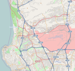
University City is bordered by La Jolla and Interstate 5 to the west, Miramar and Interstate 805 to the east, and North Clairemont and Highway 52 to the south, giving the community a triangular-shaped boundary. Boosters have given it the nickname, The Golden Triangle. University City is a part of District 6, which is represented by Councilmember Kent Lee on the San Diego City Council.

The northern half of the community hosts the large University Towne Centre mall, also known as UTC. The commercial real estate market uses this nickname to refer to all the real estate north of the canyon which runs east-west through the middle of the community. [1] Together with adjacent commercial areas along I-5 and I-805, University City forms part of San Diego's "North City Edge City", the largest such concentration in the county.

History

The area was previously inhabited by the Kumeyaay, where a trade route connecting the villages of Jamo (Pacific Beach), Onap (Rose Canyon), and Ystagua (Sorrento Valley) once existed through what is now Gilman Dr. The route was then adopted into the El Camino Real under the Spanish. [2]

Prior to the establishment of UCSD, the area was largely referred to as Selwyn from the late 1800s. [3]

Camp Calvin B. Matthews was built in 1917 upon US entry in WWI, which was largely used as a rifle range base. The base closed in 1964 to make way for UC San Diego.

University City was a master planned community of 2500 acres acquired in 1959 from Sawday-Sexton. Originally University City was supposed to serve as a residential haven for the University of California, San Diego employees and students, where both college presidents and janitors would be able to live in the same community. [4]

On March 10, 1989, a pipe bomb attached to the minivan of a woman exploded while she was driving near the University Towne Center mall. [5] She was the wife of Will C. Rogers III, the captain of the USS Vincennes (CG-49) who gave the order to shoot down Iran Air Flight 655. She escaped the blast. Initially, it was suspected to be a terrorist retaliation for the downing of the airliner, but the investigation shifted away from this hypothesis. [6] At this time, the bombing is still unsolved.

The San Diego California Temple of the Church of Jesus Christ of Latter-day Saints was completed in 1993. It is the 45th operating temple of the LDS Church in the world.

On August 1, 2003, arson by the Earth Liberation Front, an eco-terrorism group, destroyed a housing complex under construction at the east side of UTC. It destroyed a 50 million dollar housing sprawl project [7] [8] Many residents awoke to find popcorn-shaped ashes littering their backyards and streets.

On December 8, 2008 at approximately 11 AM (PST) a military F/A-18 bound for the nearby military base crashed into several homes destroying them on the southeast corner of Cather Avenue and Huggins Street. The pilot ejected and was not injured. There were four civilians killed on the ground by the impact and fire that followed. [9] [10] [11] [12]

Geography

The campus of the University of California, San Diego, from which the area derives its name, is to the west of the center of the neighborhood. Many of the professors teaching at UCSD live in the neighborhood.

Rose Canyon, the natural border that divides north and south University City. Rose canyon.jpg
Rose Canyon, the natural border that divides north and south University City.

There are two distinct parts of University City divided by Rose Canyon, featuring the Rose Canyon Open Space preserve, and railroad tracks passing through it. South of Rose Canyon lies the older part of University City, built out in the 1960s-1980s and historically referred to as University Square, centered on Governor Drive. [13] [14] [15] It is a mostly residential neighborhood along Governor Drive with many single family homes. In this area, just southwest of the Governor Drive exit from I-805 is a commercially zoned area containing office parks with low-rise buildings.


The topography of University City includes mesas and canyons such as Rose Canyon, San Clemente Canyon, and finger canyons that provide much of the open space. The canyons provide wildlife habitats with about 100 bird species migrating through the area plus natural views and opportunities for hiking, biking, and birding. The canyons are fire-managed and thus present small wildfire risks. In addition, motorists drive around the canyons, with I-5, Genesee Avenue, and the I-805 being about 1 mile apart from each other.

Neighbors

University City's neighbors include:

Fauna and flora

The wildlife in Rose Canyon has over 99 species of birds including the California gnatcatcher and California least tern which are considered endangered and listed federally as threatened species. [16] The flora of the Rose Canyon is known for its vernal pools. The pools are located on the east end of the canyon adjacent to the Marine Corps Air Station Miramar (MCAS Miramar). Endemic endangered species have included the Orcutt's brodiaea ( Brodiaea orcuttii ), San Diego button celery ( Eryngium aristulatum parishii), San Diego golden star ( Muilla clevelandii ), spreading navarretia ( Navarretia fossalis ), prostrate navarretia ( Navarretia prostrata ), California adder's tongue fern ( Ophioglossum californicum ), California Orcutt grass ( Orcuttia californica ), and San Diego mesa mint ( Pogogyne abramsii ). [17]

Economy

An office campus in University City Reflection in pool in University City, San Diego, California.jpg
An office campus in University City

With its large academic, office and retail facilities, University City forms part of adjacent commercial areas in Sorrento Mesa/Sorrento Valley, Torrey Pines, and Del Mar Heights/Carmel Valley – to form San Diego's "North City edge city", edge city being a major center of employment outside a traditional downtown. [18]

University City's economy is anchored by the University of California, San Diego campus which forms the north part of the community. University City has also become a major corporate center in the San Diego region with many real estate, legal, accounting, consulting and other professional services firms relocating from offices in downtown to be closer to clients in the northern parts of the city. Thousands of workers commute from across San Diego County to University City daily. It is one of the region's most significant economic centers.

The commercial real estate market refers to roughly this area (between the 5, 805 and 52 freeways) as the UTC submarket, [1] UTC being the name of the Westfield UTC shopping mall located in the neighborhood. With over 9.5 million square feet it is the largest office space market in the county after Downtown San Diego. [19]

Besides containing three local shopping centers, there is also a large regional shopping mall referred to as Westfield UTC. This shopping mall is located at the southeast corner of the intersection of Genesee Avenue and La Jolla Village Drive, and is anchored by Nordstrom and Macy's. The northeastern mesas of University City started to be developed for industrial and corporate uses in late 1980s to early 1990s, and are home to several biotech, technology, and professional services firms among other businesses. The northern part of University City also contains two major hospitals, Scripps Memorial and UCSD's Jacobs Medical Center, with surrounding medical office buildings. Development and re-development of this area continues today. University City was the site of a 2003 fire bombing of a condominium complex, causing 50 million dollars in damage to the La Jolla Crossroads apartments. [20] The ostensible reason for the bombing concerned the overdevelopment of northern University City.

University City also has multiple parks, three elementary schools, a middle school, and a high school. Solana Beach based private school Fusion Academy opened a campus in 2016. This campus is located inside the Summers Governor Park complex on Shoreham Place. University City is home to a police and fire station, both respectfully sharing the Northern Division name.

The University Square shopping center at Governor Drive and Genesee Avenue is anchored by a Vons grocery store and a Rite Aid pharmacy. Another shopping center to the west at Governor Drive and Regents Road is anchored by Sprouts Farmers Market. A third shopping center is located in the "La Jolla Colony" area in north University City, and it is also anchored by a Vons grocery store.

Transportation

The Rail Authority has mentioned University City as a possible location for a California High-Speed Rail station. [21] However, the location has been removed from current consideration.

Currently, the area is served by the SuperLoop bus rapid transit which circulates through the area, local bus service provided by San Diego Metropolitan Transit System and North County Transit District, and the Blue Line (San Diego Trolley) which connects the area to Old Town (San Diego), Downtown San Diego, South Bay, San Diego, and the San Ysidro Port of Entry. Also, the University City Tunnel has been proposed for existing Pacific Surfliner and Coaster service. However, with an estimate cost of over $450 million, it is not considered a high priority. [22]

The only connection between UTC and South UC (not including the bordering 8-lane freeways Interstate 5 and Interstate 805) is the four-lane Genesee Avenue. The City of San Diego also wants to extend Regents Road by building a bridge over Rose Canyon. [23] This plan has been strongly opposed by a local group calling itself Friends of Rose Canyon. [24] The argument has been going on for years. [25]

Regents Road bridge

During the original planning of University City, Regents Road was planned to be connected by a bridge running through Rose Canyon. With so much construction going on at the same time, Regents Road was put on hold and was not connected from Governor Dr to Nobel Dr. Forty years later, the canyon is now surrounded by residential neighborhoods.

Some residents want the bridge constructed due to the time it takes for emergency vehicles to be transported between southern and northern University City. The fire department claimed that: "A bridge or the widening of Genesee Avenue would shorten response time for emergency vehicles in the neighborhood. It has one of the slowest response times in the city." Along with emergency centers nearby, Rose Canyon provides the perfect environment for wildfires in UC. An emergency such as that would require evacuation, which for the citizens of UC would only leave one escape route, Genesee, already one of the busiest streets in the city. [26]

Other residents want to cancel the construction of the bridge due to the disruption to wildlife and the community. The proposed bridge would be across Rose Canyon. [27] [28]

Education

La Jolla Country Day School La Jolla County Day School sign.jpg
La Jolla Country Day School

There are five public schools in University City:

There are three private schools in University City:

Culture

The San Diego California Temple University City, San Diego, CA, USA - panoramio (1).jpg
The San Diego California Temple

Recreation

Several golf courses are recognized as children-friendly, unique in the area:[ citation needed ]

Several community and neighborhood parks and recreation centers are also available:

Related Research Articles

<span class="mw-page-title-main">San Diego</span> City in Southern California, United States

San Diego is a city in the U.S. state of California located alongside the Pacific Ocean in Southern California. With a population of over 1.3 million residents, the city is the eighth-most populous in the United States and the second-most populous in California after Los Angeles. The city is located immediately adjacent to the Mexico–United States border and is the seat of San Diego County, which has a population of nearly 3.3 million people as of 2021. San Diego is known for its mild year-round Mediterranean climate, extensive beaches and parks, its long association with the United States Navy, and its recent emergence as a healthcare and biotechnology development center.

<span class="mw-page-title-main">La Jolla</span> Neighborhood in San Diego, California, United States

La Jolla is a hilly, seaside special community within San Diego, occupying 7 miles (11 km) of curving coastline along the Pacific Ocean. The population reported in the 2010 census was 46,781.

<span class="mw-page-title-main">Interstate 805</span> Interstate highway in California

Interstate 805 (I-805) is a major north–south auxiliary Interstate Highway in Southern California. It is a bypass auxiliary route of I-5, running roughly through the center of the Greater San Diego region from San Ysidro near the Mexico–U.S. border to near Del Mar. The southern terminus of I-805 at I-5 in San Ysidro is less than 1 mi (1.6 km) north of the Mexican border. I-805 then traverses the cities of Chula Vista and National City before reentering San Diego. The freeway passes through the San Diego neighborhoods of North Park, Mission Valley, Clairemont, and University City before terminating at I-5 in the Sorrento Valley neighborhood near the Del Mar city limit.

Mira Mesa is a community and neighborhood in the city of San Diego, California. The city-recognized Mira Mesa Community Plan Area is roughly bounded by Interstate 15 on the east, Interstate 805 on the west, the Los Peñasquitos Canyon on the north and Marine Corps Air Station Miramar on the south. Most of the community plan area is referred to as Mira Mesa; the community plan area also includes the neighborhoods of Sorrento Valley and Sorrento Mesa.

<span class="mw-page-title-main">California State Route 52</span> Highway in California

State Route 52 (SR 52) is a state highway in San Diego County, California, that extends from La Jolla Parkway at Interstate 5 (I-5) in La Jolla, San Diego, to SR 67 in Santee. It is a freeway for its entire length and serves as a major east–west route through the northern part of the city of San Diego. The road connects the major north–south freeways of the county, including I-5, I-805, SR 163, I-15, SR 125, and SR 67. SR 52 passes north of the Rose Canyon Fault before traversing Marine Corps Air Station Miramar. East of Santo Road and west of SR 125, the highway goes through Mission Trails Regional Park, a large open preserve. SR 52 is also known as the Soledad Freeway and the San Clemente Canyon Freeway.

<span class="mw-page-title-main">Tierrasanta, San Diego</span> Community of San Diego in California

Tierrasanta, Spanish for "holy land," or "holy ground", is a community within the city of San Diego, California. The symbol of Tierrasanta is an encircled Conquistador cross, similar to one atop Montserrat (mountain) near Barcelona, Spain, though it no longer holds any religious meaning. The community is referred to as "The Island in the Hills" by locals and on welcome signs, as there are only four roads that lead to Tierrasanta, all which end within the community.

<span class="mw-page-title-main">Normal Heights, San Diego</span> Community of San Diego in California

Normal Heights is a neighborhood of the mid-city region of San Diego, California.

<span class="mw-page-title-main">Sorrento Valley, San Diego</span> Community of San Diego in California

Sorrento Valley is a neighborhood of San Diego, California. It is located about 17 mi (27 km) north of Downtown San Diego and its main airport, Lindbergh Field. It is roughly bounded by Interstate 5 and Interstate 805, Camino Santa Fe to the east, the Los Peñasquitos Canyon Preserve to the north and Miramar Road to the south, as shown on the San Diego Police Department's neighborhood map. It encompasses Sorrento Mesa and is part of the San Diego Unified School District.

<span class="mw-page-title-main">University of California, San Diego School of Medicine</span> Medical school of UC San Diego

The University of California, San Diego School of Medicine is the graduate medical school of the University of California, San Diego, a public land-grant research university in La Jolla, California. It was the third medical school in the University of California system, after those established at UCSF and UCLA, and is the only medical school in the San Diego metropolitan area. It is closely affiliated with the medical centers that are part of UC San Diego Health.

<span class="mw-page-title-main">Serra Mesa, San Diego</span> Community of San Diego in California, United States

Serra Mesa is a community in San Diego, California, roughly between Interstate 805 and Interstate 15, north of Friars Road and south of Aero Drive. It is named for Junípero Serra, a Majorcan (Spain) Franciscan friar who founded the Mission San Diego de Alcalá. Adjacent communities include Kearny Mesa, Tierrasanta, Mission Valley, and Linda Vista.

<span class="mw-page-title-main">Clairemont, San Diego</span> Community of San Diego in California

Clairemont is a community within the city of San Diego, California, United States. It has a population of about 81,600 residents and an area of roughly 13.3 square miles (34 km2). Clairemont Mesa is bordered by Interstate 805 on the east, Interstate 5 to the west, State Route 52 to the north, and the community of Linda Vista to the south. The community of Clairemont Mesa can be subdivided into the neighborhoods of North Clairemont, Clairemont Mesa East, Clairemont Mesa West, Bay Park, and Bay Ho.

<span class="mw-page-title-main">Torrey Hills, San Diego</span> Community of San Diego in California

Torrey Hills is a community of 784 acres (317 ha) located in northern San Diego, California, United States. Torrey Hills is a part of District 1 which is represented by Councilmember Joe LaCava on the San Diego City Council.

<span class="mw-page-title-main">Sabre Springs, San Diego</span> Community of San Diego in California

Sabre Springs is a community in San Diego, California, located in the northeastern part of the city. It is bounded by the city limits of Poway on the east, Ted Williams Parkway on the north, Interstate 15 on the west, and the community of Miramar Ranch North to the south. Sabre Springs is bisected north-south by Poway Road.

<span class="mw-page-title-main">Torrey Pines, San Diego</span> Neighborhood in San Diego, California

Torrey Pines is a community neighborhood of 2,600 acres (1,100 ha) in the northern coastal area of San Diego, California, residential with large areas of office space along I-5.

Camp Calvin B. Matthews or Marine Corps Rifle Range Camp Matthews or Marine Corps Rifle Range, La Jolla or more simply Camp Matthews was a United States Marine Corps military base from 1917 until 1964, when the base was decommissioned and transferred to the University of California to be part of the new University of California, San Diego campus. Over a million Marine recruits as well as other shooters received their marksmanship training at this military base.

<span class="mw-page-title-main">Birdland, San Diego</span> Community of San Diego in California

Birdland is a neighborhood in San Diego, California. It is located between California State Route 163, Interstate 805 and Mission Valley. Most of the streets in the area are named after different bird species, hence the name of the community.

La Jolla Village is a mixed residential/business neighborhood in the coastal San Diego community of La Jolla. La Jolla Village Square and The Shops at La Jolla Village are in the center of the neighborhood and contain a variety of stores, restaurants, apartments, a post office and two movie theaters.

Otay Mesa West is a residential neighborhood in the southern section of San Diego. It borders Interstate 805 to the east, Interstate 5 to the west, and California State Route 905 to the south. It neighbors Ocean View Hills to the east, Nestor and Palm City to the west and Chula Vista to the north. The northern boundary of Otay Mesa West roughly coincides with the Otay River. Just north of the Otay River the community of Otay resides within the city of Chula Vista. Major thoroughfares include Palm Avenue, Coronado Avenue, Picador Boulevard, Del Sol Boulevard, Beyer Boulevard, and Beyer Way.

Sorrento Mesa is a neighborhood in northwestern San Diego, California. It lies on a mesa with many ridges, north of Carrol Canyon Road, east of Interstate 805, west of Camino Santa Fe, and south of a canyon locally known as Lopez Canyon. The San Diego Police Department's neighborhood map shows Sorrento Mesa as part of the Sorrento Valley neighborhood. Sorrento Mesa is included in the Mira Mesa Community Planning Area.

<span class="mw-page-title-main">1959 San Diego F3H crash</span> Aircraft accident

The 1959 San Diego F3H crash was the crash of a United States Navy McDonnell F3H-2N Demon in San Diego, California, on 4 December 1959. The pilot, Ensign Albert Joseph Hickman from VF-121, chose not to eject from the stricken aircraft, piloting it away from populated areas of Clairemont, including an elementary school, saving "as many as 700 people" on the ground, according to one estimate. The aircraft crashed into a canyon, with the pilot being the sole fatality. Hickman has been memorialized in the naming of an elementary school and a sports complex in San Diego. Several decades later, a similar crash occurred in University City, a neighborhood north of Clairemont.

References

  1. 1 2 Map of UTC submarket CoStar
  2. Levitan, Corey (2018-06-13). "ON A MISSION: Rediscovering the original El Camino Real through La Jolla". La Jolla Light. Retrieved 2020-08-30.
  3. "Official map of San Diego County, California : compiled from latest official maps of U.S. surveys, railroad and irrigation surveys, county records, and other reliable sources, and". Library of Congress, Washington, D.C. 20540 USA. Retrieved 2022-05-23.
  4. "Pictures & History of UC – University City Community Association (UCCA)".
  5. Reinhold, Robert (March 11, 1989). "Blast Wrecks Van of Skipper Who Downed Iran Jet". The New York Times .
  6. "Rogers Bombing Not Terrorists?". Associated Press. October 2, 1989. Retrieved 2007-01-28.
  7. Davis, Kristina (24 September 2013). "Ecoterror arsons unsolved ten years later". San Diego Union-Tribune .
  8. Soto, Onell R. (23 February 2006). "Feds arrest environment radical over S.D. speech". San Diego Union-Tribune . Copley Press . Retrieved 18 December 2008.
  9. F/A-18 military jet slams into San Diego neighborhood
  10. Angelica Martinez and Debbi Baker; Steve Liewer (8 December 2008). "Three dead as military jet crashes into University City neighborhood". San Diego Union-Tribune . Copley Press . Retrieved 18 December 2008.
  11. "Rocky Mountain News".
  12. Tony Manolatos, Steve Liewer and Rick Rogers (11 December 2008). "Hundreds mourn family killed in Marine jet crash". San Diego Union-Tribune . Copley Press . Retrieved 18 December 2008.
  13. Insight Guide San Diego (Insight Pocket Guides) by John Wilcock (2004)
  14. Outdoors San Diego: Hiking, Biking & Camping by Tom Leech and Jack Farnan (2004)
  15. Metropolitan San Diego: How Geography And Lifestyle Shape A New Urban Environment (Metropolitan Portraits) by Larry R. Ford (2004)
  16. KTU+A and Merkel and Associates 2005 Rose Creek Watershed Opportunities Assessment: Existing Conditions Report
  17. City of San Diego Water Dept 2001 Constructed Wetlands in the Rose Creek Watershed. August 2001.
  18. Garreau, Joel (1991). Edge City . Anchor Books. p.  436. ISBN   9780385424349 . Retrieved July 1, 2019.
  19. "San Diego Office Market Report, Q1 2019", Avison Young
  20. Soto, Onell 2005 "Silence sends two to jail in fire probe: Grand jury looks at ELF activist group" San Diego Union Tribune. http://www.signonsandiego.com/uniontrib/20050713/news_6m13elf.html
  21. CA High-Speed Rail Authority. "Route Map". Archived from the original on 2009-03-27. Retrieved 2009-03-15.
  22. Blue_Line_(San_Diego_Trolley)#Mid-Coast_Trolley_extension_project
  23. San Diego City Council minutes
  24. rosecanyon.org
  25. San Diego Union Tribune, Dec. 15, 2004
  26. "The San Diego Union-Tribune - San Diego, California & National News".
  27. "Friends of Rose Canyon /Save Rose Canyon".
  28. http://www.lajollalight.com/news/222831-should-environmental-planning-precede-design-on-regents-road-bridge [ dead link ]
  29. Maria Curie Elementary School
  30. John D Spreckels Elementary School
  31. Doyle Elementary School
  32. Standley Middle School
  33. University City High School
  34. University Community Branch Library
  35. North University Community Library
  36. University Community Library
  37. "Beloved University City golf course going out with a whimper". San Diego Union-Tribune.
  38. "Standley Recreation Center". The City of San Diego.
  39. "Doyle Recreation Center". The City of San Diego. Retrieved September 15, 2009.
  40. "La Jolla Colony Park". Wikimapia. Retrieved September 15, 2009.
  41. "Rose Canyon Open Space Park". The City of San Diego. Archived from the original on November 6, 2009. Retrieved September 15, 2009.