This article needs additional citations for verification .(May 2021) |
Via de la Valle, San Diego | |
---|---|
Via de la Valle | |
Coordinates: 32°58′52.2″N117°14′41.3″W / 32.981167°N 117.244806°W Coordinates: 32°58′52.2″N117°14′41.3″W / 32.981167°N 117.244806°W | |
Country | United States of America |
State | California |
County | San Diego |
City | San Diego |
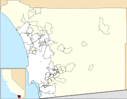
Via de la Valle is a small residential neighborhood in northern San Diego, California. The neighborhood is bordered by the City of Solana Beach to the north and west, the unincorporated San Diego County community of Rancho Santa Fe to the east, and undeveloped natural areas of North City, San Diego to the south. [1] Due to its zip code, properties in the neighborhood typically use a Del Mar, California address despite being within San Diego city limits. Approximately 125 acres (51 ha) in size, Via de la Valle is the smallest community planning area in the City of San Diego.
San Diego is a city in the U.S. state of California on the coast of the Pacific Ocean and immediately adjacent to the Mexican border. With a 2020 population of 1,386,932, San Diego is the eighth most populous city in the United States and second most populous in California. The city is the county seat of San Diego County, the fifth most populous county in the United States, with 3,338,330 estimated residents as of 2019. The city is known for its mild year-round climate, natural deep-water harbor, extensive beaches and parks, long association with the United States Navy and Marine Corps, and recent emergence as a healthcare and biotechnology development center.
La Jolla is a hilly, seaside neighborhood within the city of San Diego, California, occupying 7 miles (11 km) of curving coastline along the Pacific Ocean. The population reported in the 2010 census was 46,781.
North Park is a neighborhood in San Diego, California, United States, as well as a larger "community" as defined by the City of San Diego for planning purposes. The neighborhood is bounded:
Sorrento Valley is a neighborhood of San Diego, California. It is located about 17 mi (27 km) north of Downtown San Diego and its main airport, Lindbergh Field. It is roughly bounded by Interstate 5 and Interstate 805, Camino Santa Fe to the east, the Los Peñasquitos Canyon Preserve to the north and Miramar Road to the south, as shown on the San Diego Police Department's neighborhood map. It encompasses Sorrento Mesa and is part of the San Diego Unified School District.
Tijuana Municipality is a municipality in the Mexican state of Baja California. Its municipal seat is located in the city of Tijuana. According to the 2020 census, the municipality had a population of 1,922,523. Luis Arturo González Cruz of the MORENA is the current municipal president. The municipality comprises the largest part of the Tijuana metropolitan area.
Carmel Valley is a suburban planned community in the northwestern corner of San Diego, California, United States. The community is composed of commercial offices, residential units, hotels, retail stores and restaurants.
Barrio Logan is a neighborhood in south central San Diego, California. It is bordered by the neighborhoods of East Village and Logan Heights to the north, Shelltown and Southcrest to the east, San Diego Bay to the southwest, and National City to the southeast. Interstate 5 forms the northeastern boundary. The Barrio Logan Community Plan Area comprises approximately 1,000 acres, of which slightly more than half is under the jurisdiction of the Port of San Diego or the United States Navy rather than the city of San Diego. The community is subject to the California Coastal Act. Though located near the City's Central core, it has long been considered part of Southeast San Diego by many locals, being directly Southeast of Downtown, and with previous historical records labeling it as part of "Western Southeast San Diego."
University City (UC) is a community in San Diego, California, located in the northwestern portion of the city next to the University of California, San Diego. University City is bordered by La Jolla and Interstate 5 to the west, Miramar and Interstate 805 to the east, and North Clairemont and Highway 52 to the south, giving the community a triangular-shaped boundary. University City is a part of District 1, which is represented by Councilmember Joe LaCava on the San Diego City Council.
Grantville is a middle-class neighborhood in the city of San Diego, in California. It borders the communities of Allied Gardens, San Carlos, Tierrasanta and Mission Valley East.
Clairemont is a community within the city of San Diego, California, United States. It has a population of about 81,600 residents and an area of roughly 13.3 square miles (34 km2). Clairemont Mesa is bordered by Interstate 805 on the east, Interstate 5 to the west, State Route 52 to the north, and the community of Linda Vista to the south. The community of Clairemont Mesa can be subdivided into the neighborhoods of North Clairemont, Clairemont Mesa East, Clairemont Mesa West, Bay Park, and Bay Ho.
San Diego–Tijuana is an international transborder agglomeration, straddling the border of the adjacent North American coastal cities of San Diego, California, United States and Tijuana, Baja California, Mexico. The 2012 population of the region was 4,922,723, making it the largest bi-national conurbation shared between the United States and Mexico, the second-largest shared between the US and another country. In its entirety, the region consists of San Diego County in the United States and the municipalities of Tijuana, Rosarito Beach, and Tecate in Mexico. It is the third most populous region in the California–Baja California region, smaller only than the metropolitan areas of Greater Los Angeles and the San Francisco Bay Area.
Point Loma is a seaside community within the city of San Diego, California. Geographically it is a hilly peninsula that is bordered on the west and south by the Pacific Ocean, the east by the San Diego Bay and Old Town, and the north by the San Diego River. Together with the Silver Strand / Coronado peninsula, the Point Loma peninsula defines San Diego Bay and separates it from the Pacific Ocean. The term "Point Loma" is used to describe both the neighborhood and the peninsula.
Old Town is a neighborhood of San Diego, California. It contains 230 acres (93 ha) and is bounded by Interstate 8 on the north, Interstate 5 on the west, Mission Hills on the east and Bankers Hill on the south. It is the oldest settled area in San Diego and is the site of the first European settlement in present-day California. It contains Old Town San Diego State Historic Park and Presidio Park, both of which are listed on the National Register of Historic Places.
Birdland is a neighborhood in San Diego, California. It is located between California State Route 163, Interstate 805 and Mission Valley. Most of the streets in the area are named after different bird species, hence the name of the community.
Roseville-Fleetridge is a neighborhood in Point Loma, San Diego, California. It is bounded by San Diego Bay and Rosecrans Street on the east, Cañon Street on the south, Catalina Boulevard on the west and Chatsworth and Nimitz Boulevards on the north. Neighboring communities are Point Loma Heights and Loma Portal to the north, Point Loma Village and Liberty Station to the east, La Playa and the Wooded Area to the south, and Sunset Cliffs to the west. It is actually two separate neighborhoods, Roseville and Fleetridge, which the city lumps together for policing purposes.
There are 34 routes assigned to the "S" zone of the California Route Marker Program, which designates county routes in California. The "S" zone includes county highways in Imperial, Orange, Riverside, San Diego, and Santa Barbara counties.
Lomita, also known as Lomita Village, is an urban neighborhood in the southeastern area of San Diego, California. It is bounded by Meadowbrook Drive and Skyline to the west, unincorporated La Presa to the south and east, and Jamacha to the north. Major thoroughfares in the neighborhood include San Vicente Street and Worthington Avenue. The neighborhood is part of the Skyline-Paradise Hills Community Planning Area.
Jamacha is a neighborhood in the southeastern area of San Diego, California. It is generally bounded by the city of Lemon Grove to the north, unincorporated La Presa to the east, Imperial Avenue and Encanto to the west, and Skyline and Lomita Village to the south. Major thoroughfares include Lisbon Street, Jamacha Road, and Woodrow Avenue. The neighborhood is part of the Skyline-Paradise Hills Community Planning Area.
Rolando Park is a neighborhood on the eastern edge of San Diego, California. It is bordered by College Avenue to the west, California State Route 94 to the south, the city of La Mesa to the east and University Avenue to the north. Rolando Park borders the San Diego neighborhoods of Rolando, Redwood Village, and Oak Park.