Shelltown, San Diego

Last updated
Shelltown, San Diego
Shelltown
Shelltown - 1.jpg
An image looking southward on 40th Street, Naval Base San Diego in the distance
SanDiegoSoutheastMap.gif
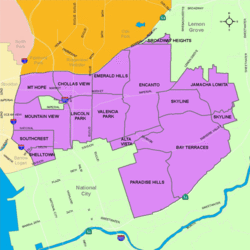
Shelltown is located in the southeastern area of the city of San Diego
Location map Southern San Diego.png
Red pog.svg
Shelltown, San Diego
Location within San Diego
Coordinates: 32°41′12″N117°06′27″W / 32.6868°N 117.1074°W / 32.6868; -117.1074
Country Flag of the United States.svg  United States of America
State Flag of California.svg  California
County Flag of San Diego County, California.png San Diego
City Flag of San Diego, California.svg San Diego
ZIP Code
92113

Shelltown is a neighborhood located within Southeast San Diego, approximately 5 minutes from downtown San Diego by car and 25 minutes by bicycle. It is bordered by National City on the south, Interstate 5 and Barrio Logan on the west, 43rd Avenue (a continuation of Highland Avenue) on the east, and Gamma Court and the neighborhood of Southcrest on the north. [1] Prior to the 1980s the northern border of Shelltown was National Ave and many residents still consider that the northern border. [2]

Contents

Due to the predominance of shells in the sandy soil, the neighborhood became known as "Shelltown." Located on a plateau just north and east of the 32nd Street Naval Station, Shelltown was a favorite location of housing for many of the early naval officers. Their ships were visible from their homes and were only moments away in the event they were called to duty [3] The majority of Shelltown consists of residential homes built between 1920 and 1969. [4] The Naval Base San Diego, an industrial park, and some commercial buildings are located just outside the western border of Shelltown along Main Street.

Mexican Americans have a long history in the area and began living in the area as early as the 1910s.

With the great influx of Filipino immigrants joining the United States Navy, [5] especially from the Vietnam War era on to the 1990s, many Filipinos inhabited the Southeast San Diego neighborhoods of Alta Vista, Bay Terraces, Paradise Hills, Shelltown, Skyline Hills, and Valencia Park, both for the relatively affordable housing prices and its close proximity to Naval Base San Diego. [6]

Shelltown/Southcrest contains a large mural, which is one of three by several artists that were done near three Southeast San Diego neighborhood entrances. Local activist and muralist Mario Torero was the lead artist for the Alpha Street piece. [7]

San Diego’s Southcrest Trails Park is located just north of the Shelltown neighborhood within the Chollas Creek floodplain, part of the smallest watershed in San Diego and containing the highest population density. The Park itself is located south of Boston Avenue and west of South 38th Street. [8] The park was scheduled to be completed in December 2012 [9]

An upgrade to the park was started in March 2017 and was completed on Spring of 2018. [10]

Schools

Balboa Elementary School was recognized as one of six nationwide winners of the 2007 Intel Schools of Distinction awards, for excellence in math education in an elementary school program. [11] [12] [13]

Transportation

The area is served by the San Diego Trolley Blue Line at the Pacific Fleet station and the Route 929 bus via Main Street. The neighborhood also has quick access to Interstate 5, Interstate 15, and Interstate 805.

Related Research Articles

<span class="mw-page-title-main">North Park, San Diego</span>

North Park is a neighborhood in San Diego, California, United States, as well as a larger "community" as defined by the City of San Diego for planning purposes. The neighborhood is bounded:

City Heights is a dense urban community in central San Diego, California, known for its ethnic diversity. The area was previously known as East San Diego. City Heights is located south of Mission Valley and northeast of Balboa Park.

<span class="mw-page-title-main">Normal Heights, San Diego</span> Community of San Diego in California

Normal Heights is a neighborhood of the mid-city region of San Diego, California.

<span class="mw-page-title-main">Barrio Logan, San Diego</span> Community of San Diego in California

Barrio Logan is a neighborhood in south central San Diego, California. It is bordered by the neighborhoods of East Village and Logan Heights to the north, Shelltown and Southcrest to the east, San Diego Bay to the southwest, and National City to the southeast. Interstate 5 forms the northeastern boundary. The Barrio Logan Community Plan Area comprises approximately 1,000 acres, of which slightly more than half is under the jurisdiction of the Port of San Diego or the United States Navy rather than the city of San Diego. The community is subject to the California Coastal Act. Though located near the City's Central core, it has long been considered part of Southeast San Diego by many locals, being directly Southeast of Downtown, and with previous historical records labeling it as part of "Western Southeast San Diego."

<span class="mw-page-title-main">Bankers Hill, San Diego</span> Upscale neighborhood in the California city

Bankers Hill, also known as Park West and formerly known as Florence Heights, is a long-established uptown San Diego neighborhood near Balboa Park. It is bordered to the north by Hillcrest at Upas Street, to the south by Downtown, to the east by Balboa Park, and to the west by Interstate 5, Little Italy and the neighborhood known as Midtown. A more constricted definition of the neighborhood sets its eastern boundary as Fourth Avenue and its western boundary as First Avenue.

<span class="mw-page-title-main">Paradise Hills, San Diego</span> Community of San Diego in California

Paradise Hills is an urban neighborhood in the southeastern area of the city of San Diego, California. It is an outlying neighborhood adjacent to the independent city of National City and the unincorporated communities of Lincoln Acres and certain portions of Bonita. The neighborhood is part of the Skyline-Paradise Hills Community Planning Area.

<span class="mw-page-title-main">Kensington, San Diego</span> Community of San Diego in California

Kensington is a neighborhood of San Diego, California. Its borders are defined by Interstate 15 to the west, Interstate 8 to the north, Fairmount Avenue to the east, and El Cajon Boulevard to the south. Its neighboring communities are Normal Heights to the west, and City Heights to the south. Kensington is part of San Diego City Council District 9. In the United States House of Representatives, Kensington is in California's 53rd congressional district, represented by Democrat Sara Jacobs,

<span class="mw-page-title-main">Encanto, San Diego</span> Community of San Diego in California

Encanto is a hilly urban neighborhood located in the southeastern region of San Diego, California. The neighborhood is bordered by California State Route 94 and the communities of Oak Park and Broadway Heights to the north, O'Farrell to the south, Emerald Hills and Valencia Park to the west and the City of Lemon Grove to the east.

El Cerrito is a neighborhood of the Mid-City region of San Diego, California. El Cerrito is a residential neighborhood, consisting mostly of suburban homes, with some commercial activity along the streets that define its borders.

<span class="mw-page-title-main">Oak Park, San Diego</span> Community of San Diego in California

Oak Park is an urban neighborhood of the Southeast region of San Diego, California.

<span class="mw-page-title-main">Cortez Hill, San Diego</span> Neighborhood in San Diego, California

Cortez Hill is a neighborhood located in the northeast part of Downtown San Diego, California.

<span class="mw-page-title-main">Southeast San Diego</span> Community of San Diego in California

Southeast San Diego refers to the southeastern portion of the City of San Diego and the neighborhoods south of State Route 94 and east of Downtown San Diego. There are three official community planning areas: Skyline-Paradise Hills, Encanto Neighborhoods, and Southeastern.

<span class="mw-page-title-main">Alta Vista, San Diego</span> Community of San Diego in California

Alta Vista is a small neighborhood in southeastern San Diego City, California, United States. It is bordered by National City to the west, Bay Terraces to the east, Encanto and Valencia Park to the north.

<span class="mw-page-title-main">Mountain View, San Diego</span> Community of San Diego in California

Mountain View is an urban community in the southeastern section of the city of San Diego. It is bordered by Mount Hope and Greenwood Memorial Park on the north, Interstate 15 and the neighborhoods of Stockton and Logan Heights on the west, Interstate 805 and Lincoln Park on the east, and Southcrest and National City on the south. Major thoroughfares include Imperial Avenue and Ocean View Boulevard.

<span class="mw-page-title-main">Southcrest, San Diego</span> Community of San Diego in California

Southcrest is an urban community in the southeastern section of the city of San Diego. It is bordered by Mountain View on the north and east, Interstate 5 and the neighborhoods of Barrio Logan and Logan Heights on the west, and Shelltown on the south. Major thoroughfares include National Avenue and 40th Street.

<span class="mw-page-title-main">Chollas View, San Diego</span> Neighborhood in San Diego, California

Chollas View is an urban community in the southeastern section of the city of San Diego. It is bordered by Webster and California State Route 94 on the north, Mount Hope and Interstate 805 on the west, Emerald Hills and Euclid Avenue on the east, and Lincoln Park and the San Diego Trolley on the south. Major thoroughfares include Market Street and 47th Street.

<span class="mw-page-title-main">Lincoln Park, San Diego</span> Community of San Diego in California

Lincoln Park is an urban community in the southeastern section of San Diego, California. It is bordered by Chollas View and the San Diego Trolley on the north, Mountain View and Interstate 805 on the west, Valencia Park and Euclid Avenue on the east, and National City, California on the south. Major thoroughfares include Imperial Avenue, Ocean View Boulevard, and Logan Avenue.

<span class="mw-page-title-main">Emerald Hills, San Diego</span> Community of San Diego in California

Emerald Hills is a community in the southeastern section of the city of San Diego, California, United States. It is bordered by Oak Park and California State Route 94 on the north, Chollas View and Euclid Avenue on the west, Encanto on the east, and Valencia Park and Market Street on the south. Major thoroughfares include Kelton Road and Roswell Street.

<span class="mw-page-title-main">Valencia Park, San Diego</span> Community of San Diego in California

Valencia Park is an urban community in the southeastern section of the city of San Diego. It is bordered by Emerald Hills and Market Street on the north, Lincoln Park and Euclid Avenue on the west, Encanto on the east, and Alta Vista and National City, California on the south. Major thoroughfares include Imperial Avenue, Churchward Street, and Valencia Parkway.

<span class="mw-page-title-main">Memorial, San Diego</span> Community of San Diego in California

Memorial is an urban neighborhood in the southeastern area of San Diego, California. It is generally bounded by Imperial Avenue to the north, California State Route 15 to the east, Interstate 5 to the south, and 28th Street to the west. Major thoroughfares in the neighborhood include Commercial Street, Oceanview Boulevard, and National Avenue. The San Diego Trolley runs through the area. Chollas Creek flows through the eastern edge of the neighborhood.

References

  1. "Neighborhood profile from City-Data.com" . Retrieved 2011-02-09.
  2. "Reunite Shelltown in District 9 | la Prensa San Diego". Archived from the original on 2013-12-27. Retrieved 2013-05-29.
  3. "Southeastern San Diego Plan" (PDF). City of San Diego, Planning Department.
  4. "Shelltown neighborhood in San Diego, California (CA), 92113 subdivision profile - real estate, apartments, condos, homes, community, population, jobs, income, streets".
  5. "Journal of San Diego History" . Retrieved 2007-11-17.
  6. "San Diego Reader - Their Own Paradise" . Retrieved 2020-11-17.
  7. "Three Murals Light up Shelltown". Archived from the original on 2011-03-17. Retrieved 2012-01-26.
  8. "Southcrest Trail Parks. Call for artists/request for qualifications (RFQ)" (PDF). Southeastern Economic Development Corporation.
  9. "Southeastern San Diego Chollas Creek Enhancement Program | Planning Department | City of San Diego Official Website".
  10. "Groundbreaking Held for 2.6-Acre Park in Southcrest". 14 March 2017.
  11. Tintocalis, Ana. "Balboa Elementary Wins $170,000 for Nation's Best Math Programs", KPBS-FM, May 30, 2007. Accessed June 17, 2007. "A San Diego school gets national attention for having one of the country's top math programs. KPBS reporter Ana Tintocalis has more."
  12. "Balboa Named Nation’s Top Math Elementary: Intel’s award goes to Shelltown neighborhood school" Archived 2012-02-08 at the Wayback Machine , San Diego City Schools press release dated June 1, 2007. Accessed June 17, 2007. " Balboa Elementary has been named top elementary school math program in Intel Corporation’s annual Schools of Distinction Award. "
  13. Fabiano, Giovanna. "Bergen Academies wins national math award", The Record (Bergen County) , June 16, 2007. Accessed June 16, 2007.

Coordinates: 32°41′12″N117°6′26″W / 32.68667°N 117.10722°W / 32.68667; -117.10722