Stockton, San Diego | |
---|---|
Stockton | |
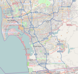
![]() Stockton is located in the central portion of the city of San Diego and part of the Southeastern Planning Area. | |
Coordinates: 32°42′39″N117°07′29″W / 32.7108°N 117.12475°W | |
Country | ![]() |
State | ![]() |
County | ![]() |
City | ![]() |
ZIP Code | 92102 |
Stockton is an urban neighborhood in central San Diego, California, bordered by Golden Hill to the north, Mountain View and Mt. Hope to the east, Grant Hill to the west, and Logan Heights to the south. I-15 forms the eastern boundary. [1] It is part of the Southeastern Planning Area. [2]
This area is named after Robert Field Stockton (1795–1866), a United States Navy commodore, active in the capture of California during the Mexican–American War. He was a naval innovator and an early advocate for a propeller-driven, steam-powered navy. Stockton was from a notable political family and also served as a U.S. Senator from New Jersey.
There was previously a Stockton Elementary, now renamed King-Chavez Academy Tk-5th.
Mount Hope is an ethnically diverse, hilly urban neighborhood in San Diego, California. Located in the southeastern portion of the city, Mount Hope is named for the large municipal Mount Hope Cemetery, which encompasses approximately 115 acres (0.47 km2) of the community. The neighborhood contains a mixture of residential, industrial, commercial, and cemetery uses.
Logan Heights is an urban neighborhood in central San Diego, California. It is bordered by Interstate 5 on the south and west, Interstate 15 on the east, and Imperial Avenue on the north. It is part of the Southeastern Planning Area.
Golden Hill is a neighborhood in San Diego, California. It is located south of Balboa Park, north of Sherman Heights, Grant Hill and Stockton, and east of downtown.
South Park is a neighborhood in San Diego, California, adjacent to the southeast corner of Balboa Park. It stands out in San Diego for its tree-lined streets and walkable business district.
Mission Hills is a neighborhood in San Diego, California, United States. It is located on hills just south of the San Diego River valley and north of downtown San Diego and San Diego International Airport, overlooking downtown, Old Town, and San Diego Bay.
Paradise Hills is an urban neighborhood in the southeastern area of the city of San Diego, California. It is an outlying neighborhood adjacent to the independent city of National City and the unincorporated communities of Lincoln Acres and certain portions of Bonita. The neighborhood is part of the Skyline-Paradise Hills Community Planning Area.
Southeast San Diego refers to the southeastern portion of San Diego, including the neighborhoods south of State Route 94 and east of downtown San Diego. Southeast San Diego has no official definition, but it may be considered coterminous with three official planning areas: Skyline-Paradise Hills, Chollas Valley, and Southeastern.
Grant Hill is a neighborhood in central San Diego, California, bordered by Golden Hill to the north, Stockton to the east, Sherman Heights to the west, and Logan Heights to the south. 30th Street connects Grant Hill to the neighborhood of Golden Hill. Grant Hill is part of the Southeastern Planning Area.
Sherman Heights is an urban neighborhood in central San Diego, California, bordered by Golden Hill to the north, Grant Hill to the east, East Village to the west, and Logan Heights to the south. It is part of the Southeastern Planning Area.
Alta Vista is a small neighborhood in southeastern San Diego, California, United States. It is bordered by National City to the west, Bay Terraces to the east, Encanto and Valencia Park to the north.
Shelltown is a neighborhood in San Diego, California, located within Southeast San Diego. It is bordered by National City to the south, Interstate 5 and Barrio Logan to the west, 43rd Avenue to the east, and Gamma Court and the neighborhood of Southcrest to the north. Prior to the 1980s the northern border of Shelltown was National Ave and many residents still consider that the northern border. Naval Base San Diego, an industrial park, and some commercial buildings are located just outside the western border of Shelltown along Main Street.
Mountain View is an urban community in the southeastern section of San Diego, California. It is bordered by Mount Hope and Greenwood Memorial Park on the north, Interstate 15 and the neighborhoods of Stockton and Logan Heights on the west, Interstate 805 and Lincoln Park on the east, and Southcrest and National City on the south. Major thoroughfares include Imperial Avenue and Ocean View Boulevard.
Southcrest is an urban community in the southeastern section of San Diego, California. It is bordered by Mountain View to the north and east, Interstate 5 and the neighborhoods of Barrio Logan and Logan Heights to the west, and Shelltown to the south. Major thoroughfares include National Avenue and 40th Street.
Chollas View is an urban community in the southeastern section of San Diego, California. It is bordered by Webster and California State Route 94 on the north, Mount Hope and Interstate 805 on the west, Emerald Hills and Euclid Avenue on the east, and Lincoln Park and the San Diego Trolley on the south. Major thoroughfares include Market Street and 47th Street.
Emerald Hills is a neighborhood in the southeastern section of San Diego, California, United States. It is bordered by Oak Park and California State Route 94 on the north, Chollas View and Euclid Avenue on the west, Encanto and Skyline Drive on the east, and Valencia Park and Market Street on the south. Major thoroughfares include Kelton Road and Roswell Street.
Valencia Park is an urban community in the southeastern section of San Diego, California, United States. It is bordered by Emerald Hills and Market Street on the north, Lincoln Park and Euclid Avenue to the West, Encanto to the east, and Alta Vista and National City, California, to the south. Major thoroughfares include Imperial Avenue, Churchward Street, and Valencia Parkway.
Fairmount Park is a neighborhood of San Diego, California. Its borders are defined by Interstate 15 to the west, Interstate 805 to the east and California Highway 94 to the south. Its neighboring communities are South Park and Golden Hill to the west, Azalea Park and City Heights to the east, and Webster to the south. It is primarily residential, mostly single-family homes, with a small commercial area along Home Avenue including several restaurants and convenience stores. Bayridge is a small neighborhood within Fairmount Park on its westernmost knoll, identifiable by its outstanding views and well-maintained townhouse development. Fairmount Park is 3 miles from downtown San Diego. Chollas Creek runs through it.
Memorial is an urban neighborhood in the southeastern area of San Diego, California. It is generally bounded by Imperial Avenue to the north, California State Route 15 to the east, Interstate 5 to the south, and 28th Street to the west. Major thoroughfares in the neighborhood include Commercial Street, Oceanview Boulevard, and National Avenue. The San Diego Trolley runs through the area. Chollas Creek flows through the eastern edge of the neighborhood.
Lomita, also known as Lomita Village, is an urban neighborhood in the southeastern area of San Diego, California. It is bounded by Meadowbrook Drive and Skyline West to the west, unincorporated La Presa to the east and Skyline East to the south, and Jamacha to the north. Major thoroughfares in the neighborhood include San Vicente Street and Worthington Avenue. The neighborhood is part of the Skyline-Paradise Hills Community Planning Area.
Rolando Park is a neighborhood on the eastern edge of San Diego, California. It is bordered by College Avenue to the west, California State Route 94 to the south, the city of La Mesa to the east and University Avenue to the north. Rolando Park borders the San Diego neighborhoods of Rolando, Redwood Village, and Oak Park.