Logan Heights, San Diego

Last updated
Logan Heights, San Diego
Logan Heights
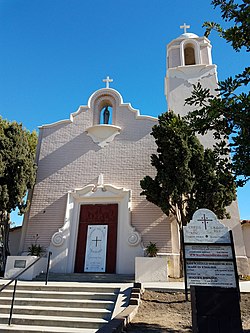
Christ the King Catholic Church.jpg
Nickname(s): 
"Varrio Logan Heights", "L.H." [1]
SanDiegoCentral.gif
Logan Heights is located in the central portion of the city of San Diego and part of the Southeastern Planning Area.
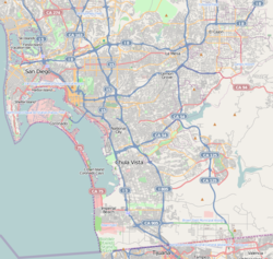
Location map Southern San Diego.png
Red pog.svg
Logan Heights, San Diego
Location within San Diego
Coordinates: 32°41′55″N117°07′46″W / 32.6986°N 117.1294°W / 32.6986; -117.1294
Country Flag of the United States.svg  United States of America
State Flag of California.svg  California
County Flag of San Diego County, California.png San Diego
City Flag of San Diego, California.svg San Diego
ZIP Code
92113

Logan Heights is an urban neighborhood in central San Diego, California. It is bordered by Interstate 5 on the south and west, Interstate 15 on the east, and Imperial Avenue on the north. It is part of the Southeastern Planning Area. [2]
Contents

History

In 1871, Congressman John A. Logan wrote legislation to provide federal land grants and subsidies for a transcontinental railroad ending in San Diego. A street laid in 1881 was named Logan Heights after him, and the name came to be applied to the general area. Plans for a railroad never successfully materialized, and the area was predominantly residential by the start of the 20th century, becoming one of San Diego's oldest communities. Its transformation began in 1910 with the influx of refugees of the Mexican Revolution, who soon became the majority ethnic group. For this reason, the southern part of the original Logan Heights neighborhood came to be called Barrio Logan.

Demographics

Logan Heights is home to one of the highest concentrations of Latinos in the City. Current demographics for the neighborhood are as follows: people of Hispanic/Latino heritage make up 87.6%, followed by African-Americans at 7.1%, then non-Hispanic Whites at 3.7%, Asian at 1.4%, and others at 0.1% [3]

Governance

It is part of City Council District 8 and is represented by Councilwoman Vivian Moreno. [4] The city is currently (2010) updating the community plan. [5]

Culture

Barrio Logan is known as the home of Chicano Park. A new Logan Heights branch of the San Diego Public Library opened in 2007. [6]

See also

Related Research Articles

<span class="mw-page-title-main">Mount Hope, San Diego</span> Community of San Diego in California

Mount Hope is an ethnically diverse, hilly urban neighborhood of the City of San Diego, California. Located in the southeastern portion of the city, Mount Hope is named for the large municipal Mount Hope Cemetery, which encompasses approximately 115 acres (0.47 km2) of the community. The neighborhood contains a mixture of residential, industrial, commercial, and cemetery uses.

City Heights is a dense urban community in central San Diego, California, known for its ethnic diversity. The area was previously known as East San Diego. City Heights is located south of Mission Valley and northeast of Balboa Park.

Normal Heights, San Diego Community of San Diego in California

Normal Heights is a neighborhood of the mid-city region of San Diego, California.

Chicano Park

Chicano Park is a 32,000 square meter park located beneath the San Diego-Coronado Bridge in Barrio Logan, a predominantly Chicano or Mexican American and Mexican-migrant community in central San Diego, California. The park is home to the country's largest collection of outdoor murals, as well as various sculptures, earthworks, and an architectural piece dedicated to the cultural heritage of the community. Because of the magnitude and historical significance of the murals, the park was designated an official historic site by the San Diego Historical Site Board in 1980, and its murals were officially recognized as public art by the San Diego Public Advisory Board in 1987. The park was listed on the National Register of Historic Places in 2013 owing to its association with the Chicano Movement, and was designated a National Historic Landmark in 2016. Chicano Park, like Berkeley's People's Park, was the result of a militant people's land takeover. Every year on April 22, the community celebrates the anniversary of the park's takeover with a celebration called Chicano Park Day.

Barrio Logan, San Diego Community of San Diego in California

Barrio Logan is a neighborhood in south central San Diego, California. It is bordered by the neighborhoods of East Village and Logan Heights to the north, Shelltown and Southcrest to the east, San Diego Bay to the southwest, and National City to the southeast. Interstate 5 forms the northeastern boundary. The Barrio Logan Community Plan Area comprises approximately 1,000 acres, of which slightly more than half is under the jurisdiction of the Port of San Diego or the United States Navy rather than the city of San Diego. The community is subject to the California Coastal Act. Though located near the City's Central core, it has long been considered part of Southeast San Diego by many locals, being directly Southeast of Downtown, and with previous historical records labeling it as part of "Western Southeast San Diego."

Southeast San Diego Community of San Diego in California

Southeast San Diego refers to the southeastern portion of the City of San Diego and the neighborhoods south of State Route 94 and east of Downtown San Diego. There are three official community planning areas: Skyline-Paradise Hills, Encanto Neighborhoods, and Southeastern.

<span class="mw-page-title-main">Grant Hill, San Diego</span> Community of San Diego in California

Grant Hill is an urban neighborhood in central San Diego, California bordered by Golden Hill to the north, Stockton to the east, Sherman Heights to the west, and Logan Heights to the south. 30th Street connects Grant Hill to the neighborhood of Golden Hill. Grant Hill is part of the Southeastern Planning Area.

Sherman Heights, San Diego Community of San Diego in California

Sherman Heights is an urban neighborhood in central San Diego bordered by Golden Hill to the north, Grant Hill to the east, East Village to the west, and Logan Heights to the south. It is part of the Southeastern Planning Area.

Stockton, San Diego Community of San Diego in California

Stockton is an urban neighborhood in central San Diego, California bordered by Golden Hill to the north, Mountain View and Mt. Hope to the east, Grant Hill to the west, and Logan Heights to the south. I-15 forms the eastern boundary. It is part of the Southeastern Planning Area.

Shelltown, San Diego Community of San Diego in California

Shelltown is a neighborhood located within Southeast San Diego, approximately 5 minutes from downtown San Diego by car and 25 minutes by bicycle. It is bordered by National City on the south, Interstate 5 and Barrio Logan on the west, 43rd Avenue on the east, and Gamma Court and the neighborhood of Southcrest on the north. Prior to the 1980s the northern border of Shelltown was National Ave and many residents still consider that the northern border.

Mountain View, San Diego Community of San Diego in California

Mountain View is an urban community in the southeastern section of the city of San Diego. It is bordered by Mount Hope and Greenwood Memorial Park on the north, Interstate 15 and the neighborhoods of Stockton and Logan Heights on the west, Interstate 805 and Lincoln Park on the east, and Southcrest and National City on the south. Major thoroughfares include Imperial Avenue and Ocean View Boulevard.

<span class="mw-page-title-main">Southcrest, San Diego</span> Community of San Diego in California

Southcrest is an urban community in the southeastern section of the city of San Diego. It is bordered by Mountain View on the north and east, Interstate 5 and the neighborhoods of Barrio Logan and Logan Heights on the west, and Shelltown on the south. Major thoroughfares include National Avenue and 40th Street.

Lincoln Park, San Diego Community of San Diego in California

Lincoln Park is an urban community in the southeastern section of San Diego, California. It is bordered by Chollas View and the San Diego Trolley on the north, Mountain View and Interstate 805 on the west, Valencia Park and Euclid Avenue on the east, and National City, California on the south. Major thoroughfares include Imperial Avenue, Ocean View Boulevard, and Logan Avenue.

Valencia Park, San Diego Community of San Diego in California

Valencia Park is an urban community in the southeastern section of the city of San Diego. It is bordered by Emerald Hills and Market Street on the north, Lincoln Park and Euclid Avenue on the west, Encanto on the east, and Alta Vista and National City, California on the south. Major thoroughfares include Imperial Avenue, Churchward Street, and Valencia Parkway.

Bay Terraces, San Diego Community of San Diego in California

Bay Terraces is a hilly urban neighborhood in the southeastern part of San Diego, California, United States. A composite of North Bay Terrace and South Bay Terrace, it is bordered by Skyline to the north, Paradise Hills to the southwest, Alta Vista, South Encanto and National City to the west. The southern end of the neighborhood is bordered by State Route 54 and Bonita. The neighborhood generally includes the ZIP Codes 92114 and 92139 and as such, parts of the area has often been incorrectly referred to as either "Paradise Hills" or "Skyline Hills" due to its proximity and overlapping ZIP Codes. Nevertheless, Bay Terraces is the largest neighborhood in the Skyline-Paradise Hills Community Planning Area.

Hispanic and Latino Californians are residents of the state of California who are of Hispanic or Latino ancestry. As of the 2020 U.S. Census, Hispanics and Latinos of any race were 39.4% of the state's population, making it the largest ethnicity in the state of California.

Memorial, San Diego Community of San Diego in California

Memorial is an urban neighborhood in the southeastern area of San Diego, California. It is generally bounded by Imperial Avenue to the north, California State Route 15 to the east, Interstate 5 to the south, and 28th Street to the west. Major thoroughfares in the neighborhood include Commercial Street, Oceanview Boulevard, and National Avenue. The San Diego Trolley runs through the area. Chollas Creek flows through the eastern edge of the neighborhood.

Lomita, San Diego Community of San Diego in California

Lomita, also known as Lomita Village, is an urban neighborhood in the southeastern area of San Diego, California. It is bounded by Meadowbrook Drive and Skyline West to the west, unincorporated La Presa to the east and Skyline East to the south, and Jamacha to the north. Major thoroughfares in the neighborhood include San Vicente Street and Worthington Avenue. The neighborhood is part of the Skyline-Paradise Hills Community Planning Area.

Jamacha, San Diego Community of San Diego in California

Jamacha is a neighborhood in the southeastern area of San Diego, California. It is generally bounded by the city of Lemon Grove to the north, unincorporated La Presa to the east, Imperial Avenue and Encanto to the west, and Skyline and Lomita Village to the south. Major thoroughfares include Lisbon Street, Jamacha Road, and Woodrow Avenue. The neighborhood is part of the Skyline-Paradise Hills Community Planning Area.

Josephine "Josie" Talamantez is a historian from San Diego, California. She co-founded Chicano Park in 1970 and helped develop it into a cultural National Historic Landmark containing the largest collection of artistic murals in the United States. Talamantez was also the Chief of Programs for the California Arts Council, served as the director of the Centro Cultural de la Raza, and was on the board of the National Association of Latino Arts and Culture.

References

  1. Eways, Andrew; Morales, Gabriel. "Sureños and Cartels - The Story of Logan Heights". Sueno Gangs in the United States. Retrieved November 24, 2014.
  2. "Community Profiles: Southeastern San Diego". City of San Diego. Retrieved 2020-11-22.
  3. ""Race and Ethnicity in Logan Heights, San Diego, California"". Statistical Atlas. Retrieved 2020-11-22.
  4. Council District webpage
  5. City planning department
  6. Logan Heights Library fact sheet

4. sandiegohistory.org/journal, click on Norman Baynard's Logan Heights 1939 - 1985, plus other journals on blacks in Logan Heights and San Diego

Coordinates: 32°42′N117°06′W / 32.7°N 117.1°W / 32.7; -117.1