Fairbanks Ranch Country Club

Last updated

Fairbanks Ranch Country Club, San Diego
Fairbanks Ranch Country Club
San Diego County California Incorporated and Unincorporated areas.svg
Red pog.svg
Fairbanks Ranch Country Club, San Diego
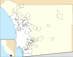
Location within San Diego County
Coordinates: 32°58′29.7″N117°12′54.6″W / 32.974917°N 117.215167°W / 32.974917; -117.215167
Country Flag of the United States.svg  United States of America
State Flag of California.svg  California
County Flag of San Diego County, California.png San Diego
City Flag of San Diego, California.svg San Diego
Government
  TypeCA District 52: Scott Peters
Fairbanks Ranch Country Club
Club information
Established1984
TypePrivate
Owned byBay Club Company, San Francisco
Total holes27
Website www.fairbanksranch.com/Club/Scripts/Home/home.asp

Fairbanks Ranch Country Club is a neighborhood and private golf club located in northern San Diego, California. The area is bordered by the unincorporated San Diego County communities of Rancho Santa Fe to the north and Fairbanks Ranch to the east, the City of San Diego neighborhood of Pacific Highlands Ranch to the south, and undeveloped natural areas of North City, San Diego to the west.

Contents

The club's first head professional was Tag Merritt

Due to its geography and history, residents and establishments in the area align closely with the adjacent communities of Fairbanks Ranch (hence the name), Rancho Santa Fe, and Del Mar. Rancho Santa Fe and Del Mar addresses are used in some parts of the area while being within San Diego city limits.
Neighborhood

The neighborhood consists of several gated housing communities located south of the golf club and San Dieguito Road and one additional gated community as well as the Del Mar Polo Fields located north of the San Dieguito River. The portion of the community located north of the San Dieguito River typically utilizes Del Mar, California addresses despite being within the city limits of San Diego.

Golf club

Founded in 1984, the golf club sits on 274 acres (111 ha) of land owned by the City of San Diego. The club uses a Rancho Santa Fe, California address despite being within San Diego city limits. It was originally member-owned. In July 2016 the members sold it to the Bay Club Company of San Francisco for an undisclosed sum. [1]

The club features an 18-hole championship course designed by Ted Robinson. In 2004 a 9-hole course designed by Ted Robinson Jr. was added. [1]

The club hosted the equestrian endurance portion of the eventing competitions for the 1984 Summer Olympics held in neighboring Los Angeles. [2]

On August 9, 2018, the EEOC sued Fairbanks Ranch Country Club for sexual harassment.

Related Research Articles

<span class="mw-page-title-main">Fairbanks Ranch, California</span> Census-designated place in California, United States

Fairbanks Ranch is a census-designated place (CDP) in San Diego County, California. The population was 3,148 at the 2010 census, up from 2,244 at the 2000 census. The entire population is contained within two gated communities, divided into North and South sections by the formerly private San Dieguito Road.

<span class="mw-page-title-main">Rancho Santa Fe, California</span> Census-designated place in California, United States

Rancho Santa Fe is a census-designated place (CDP) in San Diego County, California, United States, within the San Diego metropolitan area. The population was 3,156 at the 2020 census. The CDP is primarily residential with a few shopping blocks, a middle and elementary school, and several restaurants.

<span class="mw-page-title-main">Solana Beach, California</span> City in California, United States

Solana Beach is a city in San Diego County, located on the South Coast of California. Its population was at 12,940 at the 2020 U.S. Census, up from 12,867 at the 2010 Census.

<span class="mw-page-title-main">North County (San Diego area)</span> Region of the San Diego Metro Area in California

North County is a region in the northern area of San Diego County, California. It is the second-most populous region in the county, with an estimated population of 869,322. North County is well known for its affluence, especially in Encinitas, Carlsbad, Del Mar, Rancho Santa Fe, Poway and Solana Beach, where house prices range, on average, above $1,000,000. Cities along the 78 freeway have more mixed incomes.

<span class="mw-page-title-main">Torrey Pines High School</span> American public high school

Torrey Pines High School is a high school in the North County area of San Diego, California. The school is named after the Torrey pine tree that grows in the area. Torrey Pines High School is a member of the San Dieguito Union High School District and serves the communities of Rancho Santa Fe, Del Mar, Fairbanks Ranch, Solana Beach, and Carmel Valley in San Diego County. Students from Encinitas may attend as well.

<span class="mw-page-title-main">Carmel Valley, San Diego</span> Community of San Diego, California, US

Carmel Valley is a suburban planned community in the northwestern corner of San Diego, California, United States. The community is composed of commercial offices, residential units, hotels, retail stores and restaurants.

<span class="mw-page-title-main">Black Mountain Ranch, San Diego</span> Community of San Diego in California

Black Mountain Ranch is a suburban community in the northern part of the city of San Diego, California. Black Mountain Ranch encompasses 5,100 acres (21 km2) and is located north of Rancho Peñasquitos and Torrey Highlands, south of the Santa Fe Valley, east of Fairbanks Ranch and Rancho Santa Fe, and west of 4S Ranch.

<span class="mw-page-title-main">4S Ranch, California</span> Unincorporated community in California, United States

4S Ranch is a locale of San Diego County, California. It is located about 25 miles (40 km) north of downtown San Diego and 13 miles (21 km) east of the Pacific Ocean in the North County Inland area of San Diego. To the east of 4S Ranch is the San Diego community of Rancho Bernardo. To the west is the Santa Fe Valley, which includes Rancho Santa Fe. Lake Hodges forms the northern border of the community while Black Mountain Ranch, which includes Del Sur and Santaluz, and Rancho Peñasquitos are both situated to the south. The ZIP Code is 92127, and the community is inside area code 858.

San Pasqual Valley, historically spelled as San Pascual, is the northernmost community of San Diego, California. It is named for the Kumeyaay village of San Pasqual that was once located there. It is bordered on the north by the city of Escondido, on the east and west by unincorporated land within San Diego County, and on the south by the city of Poway and the community of Rancho Bernardo. San Pasqual Valley is home to the San Diego Zoo Safari Park.

<span class="mw-page-title-main">Carmel Mountain Ranch, San Diego</span> Community of San Diego in California

Carmel Mountain Ranch, sometimes shortened to simply Carmel Mountain, or abbreviated to CMR by local residents and organizations is a community of San Diego, California, United States, in the northeastern part of the city. Despite its name, Carmel Mountain Ranch is actually in the shadow of Black Mountain. Carmel Mountain proper is about 10 miles west of the Carmel Mountain Ranch neighborhood.

<span class="mw-page-title-main">Sabre Springs, San Diego</span> Community of San Diego in California

Sabre Springs is a community in San Diego, California, located in the northeastern part of the city. It is bounded by the city limits of Poway on the east, Ted Williams Parkway on the north, Interstate 15 on the west, and the community of Miramar Ranch North to the south. Sabre Springs is bisected north-south by Poway Road.

<span class="mw-page-title-main">Torrey Highlands, San Diego</span> Community of San Diego in California

Torrey Highlands is a primarily residential community in northern San Diego, California. Most of the community has been developed from 2000 to present.

<span class="mw-page-title-main">Pacific Highlands Ranch, San Diego</span> Community of San Diego in California

Pacific Highlands Ranch is a primarily residential community of approximately 2,652 acres (1,073 ha) in northern San Diego, California. As part of San Diego City Council District 1, it is represented by Joe LaCava, elected in 2020, and as part of District 3 of the San Diego County Board of Supervisors, it is represented by Terra Lawson-Remer, also elected in 2020. Both had not been elected to those positions before.

San Dieguito Heritage Museum is a history museum in Encinitas, California, in the United States. Founded in 1988, the museum displays historical photographs and artifacts from Encinitas and the entire San Dieguito area.

<span class="mw-page-title-main">Lake Hodges</span> A reservoir in San Diego, California.

Lake Hodges is a lake and reservoir located within the city limits of San Diego, California. It is about 31 miles (50 km) north of downtown San Diego, just north of the Rancho Bernardo community, and just south of the city's border with Escondido. When full, the reservoir has 1,234 acres (4.99 km2), a maximum water depth of 115 feet (35 m), and 27 miles (43 km) of shoreline. Lake Hodges has a total capacity of 30,251 acre-feet of water. Lake Hodges is owned by the city of San Diego, supplies water to the San Dieguito Water District and Santa Fe Irrigation District, and its mailing city address is Escondido.

Rancho San Dieguito was a 8,824-acre (35.71 km2) Mexican land grant in present-day San Diego County, California given in 1845 by Governor Pío Pico to Juan María Osuna. The rancho property was renamed Rancho Santa Fe in 1922 by the Santa Fe Land Company.

North City is a neighborhood in San Diego, California bordered by Solana Beach and Rancho Santa Fe to the north, Del Mar Heights to the west, and Carmel Valley to the south. I-5 forms the western boundary. The name is almost never used by local residents as the area is already included in either Rancho Santa Fe or Carmel Valley. The name is almost exclusively used by the San Diego Police Department for zoning.

<span class="mw-page-title-main">San Dieguito River</span> River in California, United States

The San Dieguito River is a major river in Southern California, United States. Its headwaters rise on the southern slope of the Volcan Mountains in San Diego County and the river flows generally southwest for 23.8 miles (38.3 km), draining 346 square miles (900 km2) before emptying into the Pacific Ocean 20 miles (32 km) north of San Diego.

Theodore G. Robinson was an American golf course architect.

Via de la Valle is a small residential neighborhood in northern San Diego, California. The neighborhood is bordered by the City of Solana Beach to the north and west, the unincorporated San Diego County community of Rancho Santa Fe to the east, and undeveloped natural areas of North City, San Diego to the south. Due to its zip code, properties in the neighborhood typically use a Del Mar, California address despite being within San Diego city limits. Approximately 125 acres in size, Via de la Valle is the smallest community planning area in the City of San Diego.

References

  1. 1 2 Hirsh, Lou (July 20, 2016). "Bay Club Buys Fairbanks Ranch Country Club". San Diego Business Journal. Retrieved July 21, 2016.
  2. 1984 Summer Olympics official report. Archived November 2, 2010, at the Wayback Machine Volume 1. Part 1. pp. 117–22.