Swan Canyon, San Diego

Last updated
Swan Canyon, San Diego
Swan Canyon
Location map Central San Diego.png
Red pog.svg
Swan Canyon, San Diego
Location in Central San Diego
Coordinates: 32°45′N117°10′W / 32.750°N 117.167°W / 32.750; -117.167
Country Flag of the United States.svg  United States of America
State Flag of California.svg  California
County Flag of San Diego County, California.png San Diego
City Flag of San Diego, California.svg San Diego
Area
  Total0.77 km2 (0.296 sq mi)
Population
 (2011) [1]
  Total2,640
ZIP Code
92105

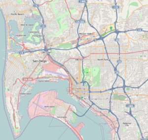
Swan Canyon is a neighborhood in the City Heights community of San Diego, California. It is bounded by Oak Park on the east, Hollywood Park on the west, Fairmount Village on the north and Ridgeview on the south. [1]

City Heights, San Diego Community of San Diego in California

City Heights is a large community in San Diego, California, known for its ethnic diversity. Along the main streets one can find Hispanic, Northeast African, Near Eastern, South Asian and Southeast Asian immigrant businesses. The area was previously known as East San Diego.

San Diego City in California, United States

San Diego is a city in the U.S. state of California on the coast of the Pacific Ocean, approximately 120 miles (190 km) south of Los Angeles and immediately adjacent to the border with Mexico. With an estimated population of 1,419,516 as of July 1, 2017, San Diego is the eighth-largest city in the United States and second-largest in California. It is part of the San Diego–Tijuana conurbation, the second-largest transborder agglomeration between the U.S. and a bordering country after Detroit–Windsor, with a population of 4,922,723 people. The city is known for its mild year-round climate, natural deep-water harbor, extensive beaches, long association with the United States Navy, and recent emergence as a healthcare and biotechnology development center.

California U.S. state in the United States

California is a state in the Pacific Region of the United States. With 39.6 million residents across a total area of about 163,696 square miles (423,970 km2), California is the most populous U.S. state and the third-largest by area. The state capital is Sacramento. The Greater Los Angeles Area and the San Francisco Bay Area are the nation's second- and fifth-most populous urban regions, with 18.7 million and 9.7 million residents respectively. Los Angeles is California's most populous city, and the country's second-most populous, after New York City. California also has the nation's most populous county, Los Angeles County, and its largest county by area, San Bernardino County. The City and County of San Francisco is both the country's second-most densely populated major city after New York City and the fifth-most densely populated county, behind only four of the five New York City boroughs.

The neighborhood is named for Swan Canyon, a small (30 acres (12 ha)) canyon that runs through the middle of it in a north-to-south direction. The canyon is undeveloped and has sometimes been a focus for crime and transient encampments. The state of California's Coastal Conservancy has undertaken a project to restore the canyon so that it can provide usable open space, wildlife habitat, and educational resources. [2] A monthly volunteer cleanup project is organized by San Diego Canyonlands, a local nonprofit organization. [3]

Canyon Deep ravine between cliffs

A canyon or gorge is a deep cleft between escarpments or cliffs resulting from weathering and the erosive activity of a river over geologic timescales. Rivers have a natural tendency to cut through underlying surfaces, eventually wearing away rock layers as sediments are removed downstream. A river bed will gradually reach a baseline elevation, which is the same elevation as the body of water into which the river drains. The processes of weathering and erosion will form canyons when the river's headwaters and estuary are at significantly different elevations, particularly through regions where softer rock layers are intermingled with harder layers more resistant to weathering.

Swan Canyon occupies a total area of 0.296 square miles (77 ha). As of 2011, the total population was 2,640 in which 1,278 were male and 1,362 were female. [1]

Swan Canyon is part of the City Heights Community Plan Area. [4] It is part of City Council District 9. [5]

Hamilton Elementary School is located in the neighborhood. [6]

Related Research Articles

Laguna Niguel, California City in California, United States

Laguna Niguel is a suburban city in Orange County, California in the United States. The name Laguna Niguel is derived from the words "Laguna" and "Niguili". As of the 2010 census, the population was 62,979. Laguna Niguel is located in the San Joaquin Hills in the southeastern corner of Orange County, close to the Pacific Ocean, and borders the cities of Aliso Viejo, Dana Point, Laguna Beach, Laguna Hills, Mission Viejo, and San Juan Capistrano.

Mira Mesa is a community and neighborhood in the city of San Diego, California. The city-recognized Mira Mesa Community Plan Area is roughly bounded by Interstate 15 on the east, Interstate 805 on the west, the Los Peñasquitos Canyon on the north and Marine Corps Air Station Miramar on the south. Most of the community plan area is referred to as Mira Mesa; the community plan area also includes the neighborhoods of Sorrento Valley and Sorrento Mesa.

Tierrasanta, San Diego Community of San Diego in California

Tierrasanta, Spanish for "holy land," or "holy ground", is a community within the city of San Diego, California. The symbol of Tierrasanta is an encircled Conquistador cross, similar to one atop Montserrat (mountain) near Barcelona, Spain, though it no longer holds any religious meaning. The community is referred to as "The Island in the Hills" by locals and on welcome signs.

North Park, San Diego neighborhood in San Diego, California, USA

North Park is a neighborhood in San Diego, California, United States, as well as a larger "community" as defined by the City of San Diego for planning purposes. The neighborhood is bounded:

Normal Heights, San Diego Community of San Diego in California

Normal Heights is a neighborhood of the mid-city region of San Diego, California.

Carmel Valley, San Diego Community of San Diego in California

Carmel Valley is a suburban planned community in the north-western corner of San Diego, California, United States. The community is composed of commercial offices, residential units, hotels, and retail stores and restaurants. This is not to be confused with Carmel Valley Village, an unincorporated community in Monterey County, California.

Barrio Logan, San Diego Community of San Diego in California

Barrio Logan is a neighborhood in south central San Diego, California. It is bordered by the neighborhoods of East Village and Logan Heights to the north, Shelltown and Southcrest to the east, San Diego Bay to the southwest, and National City to the southeast. Interstate 5 forms the northeastern boundary. The Barrio Logan Community Plan Area comprises approximately 1,000 acres, of which slightly more than half is under the jurisdiction of the Port of San Diego or the United States Navy rather than the city of San Diego. The community is subject to the California Coastal Act.

Rancho Bernardo, San Diego Community of San Diego in California

Rancho Bernardo is a master-planned community in the northern hills of the city of San Diego, California.

University Heights, San Diego Community of San Diego in California

University Heights is a neighborhood in Central San Diego, California centered on Park Boulevard and Adams Avenue. According to the City of San Diego Assessor/Recorder/County Clerk parcel maps, University Heights is bounded on the west and north by the edge of the mesa, the southern boundary is Lincoln Avenue, and the eastern boundary is Boundary Street along the western edge of Interstate 805. The area is filled with a number of restaurants, coffee shops, boutiques, and artist studios primarily on Park Boulevard and Adams Avenue. Live entertainment can be found most nights. Adjacent to Hillcrest, Normal Heights and North Park, additional restaurants, bars, coffee shops, and night clubs are within easy reach.

University City, San Diego Community of San Diego in California

University City (UC) is a community in San Diego, California, located in the northwestern portion of the city next to the University of California, San Diego. University City is bordered by La Jolla and Interstate 5 to the west, Miramar and Interstate 805 to the east, and North Clairemont and Highway 52 to the south, giving the community a triangular-shaped boundary. University City is a part of District 1, which is represented by Councilmember Barbara Bry on the San Diego City Council.

Grantville, San Diego Community of San Diego in California

Grantville is a middle-class neighborhood in the city of San Diego, in California. It borders the communities of Allied Gardens, San Carlos, Serra Mesa and Mission Valley East.

Serra Mesa, San Diego Community of San Diego in California, United States

Serra Mesa is a community in San Diego, California. It is located roughly between Interstate 805 and Interstate 15, north of Friars Road and south of Aero Drive. Serra Mesa is named for Junípero Serra, a Majorcan (Spain) Franciscan friar who founded the Mission San Diego de Alcalá. Adjacent communities include Kearny Mesa, Tierrasanta, Mission Valley, and Linda Vista.

Clairemont, San Diego Community of San Diego in California

Clairemont is a community within the city of San Diego, California, United States. It has a population of about 81,600 residents and an area of roughly 13.3 square miles (34 km2). Clairemont Mesa is bordered by Interstate 805 on the east, Interstate 5 to the west, State Route 52 to the north, and the community of Linda Vista to the south. The community of Clairemont Mesa can be subdivided into the neighborhoods of North Clairemont, Bay Ho, Clairemont Mesa East, Clairemont Mesa West, and Bay Park.

Torrey Hills, San Diego Community of San Diego in California

Torrey Hills is a community of 784 acres (317 ha) located in northern San Diego, California, United States. Torrey Hills is a part of District 1 which is represented by Councilmember Barbara Bry on the San Diego City Council.

Torrey Pines, San Diego human settlement in San Diego, California, United States of America

Torrey Pines is a primarily residential community of 2,600 acres (1,100 ha) in the northern coastal area of San Diego, California.

El Cerrito, Spanish for "the little hill," is a neighborhood of the Mid-City region of San Diego, California. El Cerrito is a residential neighborhood, consisting mostly of suburban homes, with some commercial activity along the streets that define its borders.

Southeast San Diego human settlement in San Diego, California, United States of America

Southeast San Diego refers to the southeastern portion of the City of San Diego and the neighborhoods south of State Route 94 and east of Downtown San Diego. There are three official community planning areas: Skyline-Paradise Hills, Encanto Neighborhoods, and Southeastern.

La Jolla Village, San Diego Community of San Diego in California

La Jolla Village is a mixed residential/business neighborhood in the coastal San Diego community of La Jolla. La Jolla Village Square and The Shops at La Jolla Village are in the center of the neighborhood and contain a variety of stores, restaurants, apartments, a post office and two movie theaters.

Memorial is a neighborhood in the southeastern area of San Diego, California. It is generally bounded by Imperial Avenue to the north, California State Route 15 to the east, Interstate 5 to the south, and 28th Street to the west. Major thoroughfares in the neighborhood include Commercial Street, Oceanview Boulevard, and National Avenue. The San Diego Trolley runs through the area. Chollas Creek flows through the eastern edge of the neighborhood.

References

  1. 1 2 3 "Location of Swan Canyon, San Diego" . Retrieved 22 April 2014.
  2. "Swan Canyon restoration" (PDF). Coastal Conservancy. State of California. August 5, 2010. Retrieved 23 April 2014.
  3. "Upcoming events". San Diego Canyonlands. Retrieved 23 April 2014.
  4. "City Heights Community Plan". City of San Diego. Retrieved 22 April 2014.
  5. "City Heights and its neighborhoods".
  6. "Hamilton Elementary School". San Diego Unified School District. Retrieved 23 April 2014.