The Great River Road is a collection of state and local roads that follow the course of the Mississippi River through ten states of the United States. They are Minnesota, Wisconsin, Iowa, Illinois, Missouri, Kentucky, Tennessee, Arkansas, Mississippi and Louisiana. It formerly extended north into Canada, serving the provinces of Ontario and Manitoba. The road is designated as both a National Scenic Byway and an All-American Road in several states along the route.
A Pure Michigan Byway is the designation for a segment of the State Trunkline Highway System in the US state of Michigan that is a "scenic, recreational, or historic route that is representative of Michigan's natural and cultural heritage." The designation was created with the name Michigan Heritage Route by the state legislature on June 22, 1993, and since then six historic, seven recreational and seven scenic byways have been designated by the Michigan Department of Transportation (MDOT), and another two have been proposed. These byways have been designated in both the Upper and Lower peninsulas of the state. The current name was adopted on December 30, 2014, and it references the Pure Michigan tourism marketing campaign.

A National Scenic Byway is a road recognized by the United States Department of Transportation for one or more of six "intrinsic qualities": archeological, cultural, historic, natural, recreational, and scenic. The program was established by Congress in 1991 to preserve and protect the nation's scenic but often less-traveled roads and promote tourism and economic development. The National Scenic Byways Program (NSBP) is administered by the Federal Highway Administration (FHWA).
The Mount Evans Scenic Byway is a 49-mile (79 km) National Forest Scenic Byway and Colorado Scenic and Historic Byway located in Clear Creek and Jefferson counties, Colorado, United States. The byway ascends to 14,140 feet (4,310 m) of elevation near the 14,271-foot (4,350 m) summit of Mount Evans, making it the highest paved road in North America The byway visits Echo Lake Park, the Mount Goliath Natural Area, the Dos Chappell Nature Center, and Summit Lake Park on its way to the summit. A fee is charged to travel State Highway 5 to the summit and vehicles over 30 feet (9.1 m) long are not allowed, although they are allowed on State Highway 103 which reaches its highest elevation of 11,020 feet (3,359 m) at Juniper Pass.

State Trunk Highway 42 is a state highway in the U.S. state of Wisconsin. It runs for 135 miles (217 km) north–south in northeast Wisconsin from Sheboygan to the ferry dock in Northport. Much of the highway is part of the Lake Michigan Circle Tour from the eastern junction with U.S. Highway 10 (US 10) in Manitowoc to its junction with WIS 57 in Sister Bay. WIS 42 parallels I-43 from Sheboygan to Manitowoc, and parallels WIS 57 throughout much of the route, particularly from Manitowoc to Sturgeon Bay, meeting the northern terminus of WIS 57 in Sister Bay.

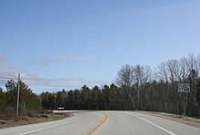
Wisconsin Highway 57 is a 191.82-mile-long (308.70 km) state highway in Wisconsin, United States. It runs from its southern terminus at Wisconsin Highway 59 in Milwaukee to its northern terminus at Wisconsin Highway 42 in Sister Bay. Much of WIS 57 parallels Interstate 43 (I-43) and WIS 42, particularly from Saukville to its northern terminus in Sister Bay. The highway is concurrent with I-43 for 12 miles (19 km) in Ozaukee County. Like most Wisconsin state highways, WIS 57 is maintained by the Wisconsin Department of Transportation (WisDOT).

The Great Lakes Seaway Trail, formerly named and commonly known as the Seaway Trail, is a 518-mile (834 km) National Scenic Byway in the northeastern United States, mostly contained in New York but with a small segment in Pennsylvania. The trail consists of a series of designated roads and highways that travel along the Saint Lawrence Seaway—specifically, Lake Erie, the Niagara River, Lake Ontario, and the Saint Lawrence River. It begins at the Ohio state line in rural Erie County, Pennsylvania, and travels through several cities and villages before ending at the Seaway International Bridge northeast of the village of Massena in St. Lawrence County, New York. It is maintained by the non-profit Seaway Trail, Inc.
The Rustic Road system is a system of Wisconsin scenic roads. They differ from the main trunkline highway system in that they are not meant to be major through routes, but lightly traveled local access, and are to meet minimum standards for natural features. Rustic roads have lower speed limits than those on other highway systems. Each route is marked by brown and yellow signs, with the route number on a small placard below the sign. The letter "R" prefix is followed by the number designation. Wisconsin is the only state to have a system of rustic roads. Wisconsin has a separate system of scenic byways following the development of a national system in the 1990s.

The Lariat Loop National Scenic and Historic Byway is a National Scenic Byway and a Colorado Scenic and Historic Byway located in Jefferson County, Colorado, USA. The byway is a 40-mile (64 km) loop in the Front Range foothills west of Denver through Golden, Lookout Mountain Park, Genesee Park, Evergreen, Morrison, Red Rocks Park, and Dinosaur Ridge. The Lariat Loop connects to the Mount Evans Scenic Byway at Bergen Park.

Crowley's Ridge Parkway is a 212.0-mile-long (341.2 km) National Scenic Byway in northeast Arkansas and the Missouri Bootheel along Crowley's Ridge in the United States. Motorists can access the parkway from US Route 49 (US 49) at its southern terminus near the Helena Bridge over the Mississippi River outside Helena-West Helena, Arkansas, or from Missouri Route 25 (Route 25) near Kennett, Missouri. The parkway runs along Crowley's Ridge, a unique geological formation, and also parts of the St. Francis National Forest, the Mississippi River and the Mississippi Alluvial Plain. Along the route are many National Register of Historic Places properties, Civil War battlefields, parks, and other archeological and culturally significant points.
The Trail of the Ancients is a collection of National Scenic Byways located in the U.S. Four Corners states of Utah, Colorado, New Mexico, and Arizona. These byways comprise:
The River Road National Scenic Byway is a National Scenic Byway and National Forest Scenic Byway in the US state of Michigan. This 23+1⁄2-mile-long (37.8 km) byway follows M-65 and River Road; it extends eastward into the Huron National Forest and ends in the historic community of Oscoda near Lake Huron. The road parallels the historic Au Sable River which has historically been a major transportation route for floating Michigan's giant white pine from the forest to the saw mill towns on Lake Huron. Along its course, the roadway offers access to several recreational areas as well as the local scenery. The section of the River Road that follows M-65 was added to the State Trunkline Highway System in the 1930s. The River Road was given National Forest Scenic Byway status in 1988, and National Scenic Byway status in 2005.

The Wisconsin State Trunk Highway System is the state highway system of the U.S. state of Wisconsin, including Wisconsin's segments of the Interstate Highway System and the United States Numbered Highway System, in addition to its other state trunk highways. These separate types of highways are respectively designated with an I-, US, or STH- prefix. The system also includes minor roads designated as Scenic Byways, four routes intended to promote tourism to scenic and historic areas of the state; and as Rustic Roads, lightly-traveled and often unpaved local roads which the state has deemed worthy of preservation and protection. The state highway system, altogether totaling 11,753 miles (18,915 km) across all of Wisconsin's 72 counties, is maintained by the Wisconsin Department of Transportation (WisDOT).

The High Desert Discovery Scenic Byway is a 127-mile-long (204 km) scenic highway in the southeastern part of the U.S. state of Oregon. It runs through the state's high desert country from the town of Burns to the unincorporated community of Fields. It was designated as an Oregon Scenic Byway in 2003. The highway is maintained by the Oregon Department of Transportation (ODOT). There are a number of points of interest along the route including several that are listed on the National Register of Historic Places.
The South Platte River Trail Scenic and Historic Byway is a 19-mile (31 km) Colorado Scenic and Historic Byway located in Sedgwick County, Colorado, USA. The byway follows the historic trails used during westward expansion. The route, which includes County Road 28 (CR 28) and U.S. Highway 138 (US 138), connects Ovid and Julesburg and encircles the South Platte River. It was designated a Colorado Scenic and Historic Byway in 1991.
Minnesota Scenic Byways are a system of roads in the U.S. state of Minnesota which pass through areas of scenic, cultural, or recreational significance. There are currently 22 scenic byways in the system with a total length of 2,948 miles (4,744 km). Eight of these byways are also designated as National Scenic Byways, and the North Shore Scenic Drive is further designated as an All-American Road.