Cornucopia, Wisconsin

Last updated

Cornucopia, Wisconsin
CornucopiaWI-018-050507.jpg
Cornucopia along Highway 13
USA Wisconsin location map.svg
Red pog.svg
Cornucopia
Coordinates: 46°51′14″N91°06′07″W / 46.85389°N 91.10194°W / 46.85389; -91.10194
Country United States
State Wisconsin
County Bayfield
Town Bell
Area
  Total2.264 sq mi (5.86 km2)
  Land2.264 sq mi (5.86 km2)
  Water0 sq mi (0 km2)
Elevation
623 ft (190 m)
Population
 (2010)
  Total98
  Density43/sq mi (17/km2)
Time zone UTC-6 (Central (CST))
  Summer (DST) UTC-5 (CDT)
ZIP code
54827
Area code(s) 715 and 534
GNIS feature ID1579043 [1]
Mawikwe Bay Sea Caves, part of the Apostle Islands National Lakeshore near Cornucopia SquawBaySeaCaves028-050507.jpg
Mawikwe Bay Sea Caves, part of the Apostle Islands National Lakeshore near Cornucopia
The swimming beach on Lake Superior CornucopiaWI-020-050507.jpg
The swimming beach on Lake Superior
Abandoned boat along Wisconsin Highway 13 in Cornucopia Boat in Cornucopia, Wisconsin.jpg
Abandoned boat along Wisconsin Highway 13 in Cornucopia

Cornucopia is an unincorporated census-designated place in the town of Bell in northern Bayfield County, Wisconsin, United States. [1] [2] It is situated on Lake Superior at the northern end of the Bayfield Peninsula. It is along Wisconsin Highway 13 and County Highway C. As of the 2010 census, its population was 98. [3] The community borders the lake at Siskiwit Bay, between Roman's Point and Mawikwe (formerly Squaw) Point. It is near a mainland portion of the Apostle Islands National Lakeshore, which features the Mawikwe Bay Sea Caves.

Contents

Most residents of the Town of Bell with Cornucopia mailing addresses are considered residents of Cornucopia.

Geography

Cornucopia has an area of 2.264 square miles (5.86 km2), all of it land.

History

The Ojibwe used the Siskiwit Bay area as a temporary camp and a stopover on the way to La Pointe. "Siskiwit" comes from an Ojibwe word for a subspecies of Lake trout known in English as a "fat trout". A historical marker at the Cornucopia beach tells of the Tragedy of the Siskiwit, an Ojibwe battle on that site with a band of Meskwaki that lead to several deaths and the kidnapping of a chief's son.

The first white settlers in the Siskiwit Bay area were loggers who came at the close of the nineteenth century. Remnants of this period include abandoned railroad pilings in Siskiwit Lake and a legend of stolen gold on Gold Hill at the southeastern edge of the community.

The first farmers were "Russians" who came to the Town of Bell from the Austrian Empire via Chicago. They were not Great Russians but Carpatho-Russians or Rusyns, an ethnic group found in the mountainous borderlands of Poland, Slovakia, Ukraine, and, Romania. Rusyn surnames found in Cornucopia include Kaseno, Celinsky, Sveda, Roman, and Pristash.

Commercial fishing for lake trout, whitefish, and freshwater herring has traditionally operated out of Cornucopia's harbor. The Jones, Ehlers, Johnson, and Ivanow families kept the fishing industry going during the twentieth century. Today only the Halvorson family engages in commercial fishing out of Cornucopia.

In 1903, T.J. Stevenson and Albert Wescott, two land speculators from Iowa established a post office and gave the village the name "Cornucopia" for its abundance of resources. A centennial celebration in 2003 recognized this event.

After World War II, Cornucopia's natural environment led tourism to replace logging, farming, and fishing as the dominant industry of the community.[ citation needed ] Today, most working-age residents are engaged in trades, service, or seasonal employment.[ citation needed ]

Landmarks

The Bell Town Hall, a large brick building in the center of the community, was a school until the 1970s. Today children from Cornucopia attend school at the South Shore School in Port Wing, Wisconsin, 15 miles to the west. The town was awarded a grant to remodel the town hall, making it more accessible, building a new kitchen, and replacing windows. It is the site of many weddings and family gatherings and host to community events, such as the annual fish fry. The baseball diamond was the home field of the Cornucopia Little League baseball team.

Cornucopia is the home of three active churches: St. Ann's Roman Catholic, Immanuel Lutheran, and St. Mary's Orthodox Church of America. St. Mary's was originally built as a Russian Orthodox church. Its design includes an enclosed bell tower and a small onion dome.

The Cornucopia Historic (Green Shed) Museum lies on the harbor. It contains displays of photographs, family histories and historic artifacts and is open seasonally from mid June to early October.

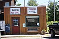
The Cornucopia Post Office is Wisconsin’s northernmost post office.

Economy

Ehlers General Store Ehlers Store Cornucopia Wisconsin.jpg
Ehlers General Store

Siskiwit Bay Marina is near the center of Cornucopia, WI where boaters from all over the midwest come to enjoy their summer times. Siskiwit Bay Marina also hosts a bed and breakfast that serves breakfast every morning. [4]

Lumberman Walter Flieth and fisherman Herman Ehlers started the Flieth-Ehlers Mercantile Company in 1915. Now known as Ehlers' General Store, it has been the social and commercial center of the community since its beginnings. The store was operated by Ehlers' son Harold and grandson Mark until its sale in 2006 to Jayne Norton and Max Taubert.

Cornucopia has a harbor where the Siskiwit River meets Lake Superior. Today, two marinas, one private and one municipal, operate out of Cornucopia. There is also an extensive sand swimming beach. Numerous gift shops and lodging places line the harbor.

The community was once home to the Cornucopia Yacht Club, an imaginary yacht club founded by Hale, Roger, and Scot O'Malley in 1975. The O'Malleys founded the club to gain access to yacht club marinas in other cities, which generally required a reciprocal agreement with another club. While the club printed membership cards and made its own jackets, it never had its own marina or building; its mailing address was "Pier 99", which was actually a post office box at Cornucopia's post office. Membership cost $5 a year, and members were not required to own a boat; the application instead asked what members would name their boats if they had one. The club once boasted over 700 members, including several who had never been to Cornucopia; according to the founders, this tally included former U.S. President Gerald Ford and his wife Betty. [5] [6]

Annual events

Harold Ehlers of Cornucopia(right) is presented the annual Cribbage League trophy by Red Cliff's Mark Duffy. CornucopiaRedCliffCribbage.jpg
Harold Ehlers of Cornucopia(right) is presented the annual Cribbage League trophy by Red Cliff's Mark Duffy.

Cornucopia Day takes place every year on the second Saturday in August. The event, put on for the benefit of the volunteer fire department and ambulance service, includes a 5K Run, bike ride, fish, brats & corn, parade, flea market and raffles.

The Annual Fish Fry takes place on the Sunday closest to July 4.

The Annual Turkey Dinner takes place the first Sunday of the deer hunting season, which is the Sunday before Thanksgiving.

Cribbage League is a five-week cribbage contest between the residents of Cornucopia and the nearby community of Red Cliff, Wisconsin, taking place every January and February.

Images

Related Research Articles

<span class="mw-page-title-main">Bayfield County, Wisconsin</span> County in Wisconsin, United States

Bayfield County is a county located in the U.S. state of Wisconsin. As of the 2020 census, its population is 16,220. Its county seat is Washburn. The county was created in 1845 and organized in 1850. The Red Cliff Band of Lake Superior Chippewa has a reservation in Bayfield County and is the county's largest employer.

<span class="mw-page-title-main">Hendricks Township, Michigan</span> Civil township in Michigan, United States

Hendricks Township is a civil township of Mackinac County in the U.S. state of Michigan. The population was 117 at the 2020 census, down from 153 in 2010.

<span class="mw-page-title-main">La Pointe, Wisconsin</span> Unincorporated community in Wisconsin, United States

La Pointe is an unincorporated community in the town of La Pointe, Ashland County, Wisconsin, United States. It is on the western shore of Madeline Island, the largest of the Apostle Islands. Downtown La Pointe is adjacent to the Madeline Island Ferry dock. La Pointe has a post office with ZIP code 54850.

<span class="mw-page-title-main">Minocqua, Wisconsin</span> Town in Wisconsin, United States

Minocqua is a town in northwestern Oneida County, Wisconsin, United States. The population was 4,388 as of 2017. The census-designated place of Minocqua and the unincorporated community of Rantz are both located in the town. Minocqua is commonly referred to as "The Island City."

<span class="mw-page-title-main">Lake of the Woods</span> Lake on the United States–Canada border

Lake of the Woods is a lake occupying parts of the Canadian provinces of Ontario and Manitoba and the U.S. state of Minnesota. Lake of the Woods is over 70 miles (110 km) long and wide, containing more than 14,552 islands and 65,000 miles (105,000 km) of shoreline. It is fed by the Rainy River, Shoal Lake, Kakagi Lake and other smaller rivers. The lake drains into the Winnipeg River and then into Lake Winnipeg. Ultimately, its outflow goes north through the Nelson River to Hudson Bay.

<span class="mw-page-title-main">Ashland, Wisconsin</span> City in Wisconsin, United States

Ashland is a city in Ashland and Bayfield counties in the U.S. state of Wisconsin. It is the county seat of Ashland County. The city is a port on Lake Superior, near the head of Chequamegon Bay. The population was 7,908 at the 2020 census, all of whom resided in the Ashland County portion of the city. The unpopulated Bayfield County portion is in the city's southwest, bordered by the easternmost part of the Town of Eileen.

<span class="mw-page-title-main">Bayfield, Wisconsin</span> City in Wisconsin, United States

Bayfield is a city in Bayfield County, Wisconsin, United States. The population was 584 at the 2020 census. This makes it the city with the smallest population in Wisconsin. In fact, for a new city to be incorporated today, state regulations require a population of at least 1,000 residents, so it would have to be incorporated as a village instead.

<span class="mw-page-title-main">Lac du Flambeau Band of Lake Superior Chippewa</span> Ojibwa Native American tribe

The Lac du Flambeau Band of Lake Superior Chippewa is a federally recognized Ojibwa Native American tribe. It had 3,415 enrolled members as of 2010. The Lac du Flambeau Indian Reservation lies mostly in the Town of Lac du Flambeau in south-western Vilas County, and in the Town of Sherman in south-eastern Iron County in the U.S. state of Wisconsin. It has a land area of 107.1 square miles (277.4 km2) and a 2020 census resident population of 3,518 persons. Its major settlement is the unincorporated Lac du Flambeau, which had a population of 1,845 persons.

<span class="mw-page-title-main">Apostle Islands National Lakeshore</span> 69,372 acres in Wisconsin (US) managed by the National Park Service

The Apostle Islands National Lakeshore is a U.S. national lakeshore consisting of 21 islands and shoreline encompassing 69,372 acres (28,074 ha) on the northern tip of Wisconsin on the shore of Lake Superior. It is known for its collection of historic lighthouses, sandstone sea caves, a few old-growth remnant forests, and natural animal habitats. It is featured on the America the Beautiful Quarters series.

<span class="mw-page-title-main">Apostle Islands</span> Lake Superior archipelago in northern Wisconsin

The Apostle Islands are a group of 22 islands in Lake Superior, off the Bayfield Peninsula in northern Wisconsin. The majority of the islands are located in Ashland County—only Sand, York, Eagle, and Raspberry Islands are located in Bayfield County. All the islands except for Madeline Island are part of the Apostle Islands National Lakeshore. The islands in Ashland County are all in the Town of La Pointe, except for Long Island, which is in the Town of Sanborn, while those in Bayfield County are in the Towns of Russell and Bayfield.

<span class="mw-page-title-main">Seba Beach</span> Summer village in Alberta, Canada

Seba Beach is a summer village located 85 km (53 mi) west of Edmonton in Alberta, Canada. The main employer to those within the village and surrounding area is the Sundance Generating Plant, a coal-fired power plant located on the south side of the lake, owned and operated by TransAlta Utilities.

<span class="mw-page-title-main">Chequamegon Bay</span> Inlet of Lake Superior in Wisconsin, USA

Chequamegon Bay is an inlet of Lake Superior in Ashland and Bayfield counties in the extreme northern part of Wisconsin.

<span class="mw-page-title-main">Red Cliff Band of Lake Superior Chippewa</span> Band of Ojibwe Native Americans based in Bayfield County, Wisconsin

Red Cliff Band of Lake Superior Chippewa is a band of Ojibwe Native Americans. The Red Cliff Band is located on the Red Cliff Indian Reservation, on Lake Superior in Bayfield County, Wisconsin. Red Cliff, Wisconsin, is the administrative center. Red Cliff is notable for being the band closest to the spiritual center of the Ojibwe nation, Madeline Island. As of November 2010, there were 5,312 enrolled members, with about half living on the reservation and the rest living in the city of Bayfield or the Belanger Settlement.

<span class="mw-page-title-main">Madeline Island</span> Largest of the Apostle Islands in Lake Superior

Madeline Island is an island in Lake Superior. Now part of Ashland County, Wisconsin, it has long been a spiritual center of the Lake Superior Chippewa. Although the largest of the Apostle Islands, it is not included in the Apostle Islands National Lakeshore. It is the only island in the Apostle Island chain open to commercial development and private ownership.

The Tragedy of the Siskiwit was an event that took place in the pre-contact history of the Ojibwe and Meskwaki (Fox) Indian nations in present-day Wisconsin. As part of an ongoing series of conflicts between the two nations, a chief's son was kidnapped, and both groups had their camps destroyed.

<span class="mw-page-title-main">Naubinway, Michigan</span> Census-designated place & unincorporated community in Michigan, United States

Naubinway is an unincorporated community and census-designated place (CDP) in Mackinac County in the U.S. state of Michigan. The population of the CDP was 147 at the 2020 census, which was the first year that it was recorded by the census. The community is located within Garfield Township.

Siskiwit Lake is a small eutrophic lake on the Bayfield Peninsula in Bayfield County in northern Wisconsin in the United States. The lake is located about 4.5 miles (7.2 km) south of Siskiwit Bay, an arm of Lake Superior, and about 2 miles (3.2 km) north of the northern boundary of Chequamegon National Forest. Duluth-Superior is about 48 miles (77 km) to the west. Parts of the small town of Bell border the lake, and there are several houses and vacation cabins on the lake, most on the north shore. The nearest major road, Wisconsin Highway 13, is about 3.5 miles (5.6 km) to the north, and the nearest large town, Washburn, is about 14 miles (23 km) to the southeast, down County Trunk Highway C.

<span class="mw-page-title-main">Minong Traditional Cultural Property</span> United States historic place

The Minong Traditional Cultural Property is a Traditional Cultural Property (TCP), which was listed on the National Register of Historic Places in 2019. Minong is the Ojibwe name for Isle Royale, and the TCP designation recognizes the lasting relationship the Grand Portage Band of Lake Superior Chippewa has with the island. The TCP covers the island itself, the greater archipelago, and the traditional fishing waters surrounding the islands.

<i>Thomas Friant</i> (ship) Wooden-hulled ferry (later fish tug)

Thomas Friant was a wooden-hulled ferry that served on the Great Lakes from her construction in 1884 to her sinking in 1924. In January 1924, while gillnetting out of Two Harbors, Minnesota in Lake Superior, she was holed by ice, and sank with no fatalities. In 2004 her wreck was discovered in over 300 feet (91 m) of water in pristine condition. The wreck of Thomas Friant was listed on the National Register of Historic Places in 2019.

References

  1. 1 2 "Cornucopia, Wisconsin". Geographic Names Information System . United States Geological Survey, United States Department of the Interior.
  2. Cornucopia, Wisconsin
  3. "U.S. Census website". U.S. Census Bureau . Retrieved March 29, 2011.
  4. "Siskiwit Bay Marina & The Fo'c'sle Inn".
  5. Albrecht, Don (March 12, 1989). "No storm can ever shake an imaginary yacht club". The Milwaukee Journal . Retrieved September 7, 2014.
  6. "Obituaries: Hale O'Malley". Ashland Daily Press . September 9, 2003. Archived from the original on September 7, 2014. Retrieved September 7, 2014.