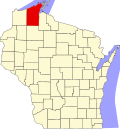
Iron River, Wisconsin | |
---|---|
Coordinates: 46°33′52″N91°24′30″W / 46.56444°N 91.40833°W | |
Country | United States |
State | Wisconsin |
County | Bayfield |
Town | Iron River |
Area | |
• Total | 6.771 sq mi (17.54 km2) |
• Land | 6.245 sq mi (16.17 km2) |
• Water | 0.526 sq mi (1.36 km2) |
Elevation | 1,106 ft (337 m) |
Population (2010) | |
• Total | 761 |
• Density | 110/sq mi (43/km2) |
Time zone | UTC-6 (Central (CST)) |
• Summer (DST) | UTC-5 (CDT) |
ZIP code | 54847 |
Area code(s) | 715 and 534 |
GNIS feature ID | 1566972 [1] |
Iron River is an unincorporated, census-designated place located in the town of Iron River, Bayfield County, Wisconsin, United States.
U.S. Highway 2 serves as a main route in the community. Other routes include County Highways A and H.
Intercity bus service to the community is provided by Indian Trails. [2]
Iron River is 27 miles (43 km) west of the city of Ashland and 37 miles (60 km) east of the city of Superior.
Iron River has a post office with ZIP code 54847. [3]
As of the 2010 census, its population was 761. [4]
Iron River is the home of the Bayfield County Fair. The Fair takes place annually in August.
Bayfield County is a county located in the U.S. state of Wisconsin. As of the 2020 census, its population is 16,220. Its county seat is Washburn. The county was created in 1845 and organized in 1850. The Red Cliff Band of Lake Superior Chippewa has a reservation in Bayfield County and is the county's largest employer.
Ashland County is a county located in the U.S. state of Wisconsin. As of the 2020 census, the population was 16,027. Its county seat is Ashland. The county was formed on March 27, 1860, from La Pointe County. The county partly overlaps with the reservation of the Bad River Band of the Lake Superior Tribe of Chippewa Indians.
Cable is a town in Bayfield County, Wisconsin, United States. Its population was 825 at the 2010 U.S. census. The census-designated place of Cable and the unincorporated communities of Leonards and Radspur are located in the town.
Iron River is a town in Bayfield County, Wisconsin, United States. The population was 1,123 at the 2010 census. The census-designated place of Iron River is located in the town. The unincorporated community of Topside is also located in the town.
Montreal is a city in Iron County, Wisconsin, United States. The population was 807 at the 2010 census. The neighborhood of Gile is part of the city; however, it still has its own post office and ZIP code: 54525. Like Gile, the former unincorporated community of Germania has also been annexed by the city.
Hayward is a city in Sawyer County, Wisconsin, United States, next to the Namekagon River. Its population was 2,318 at the 2010 census. It is the county seat of Sawyer County. The city is surrounded by the Town of Hayward. The City of Hayward was formally organized in 1883.
Topinabee is an unincorporated community in Cheboygan County in the U.S. state of Michigan. The community is located within Mullet Township along the southwestern shores of Mullett Lake.
In the U.S. state of Wisconsin, the Lake Superior Lowland, also known as the Superior Coastal Plain, is a geographical region located in the far northern part of the state bordering Lake Superior. It covers about 1,250 square miles (3,200 km2), and does not extend beyond 20 miles (32 km) from the Lake Superior shore.
Arkansaw is an unincorporated census-designated place in the eastern portion of the town of Waterville, in Pepin County, Wisconsin, United States. Located approximately 3 miles (4.8 km) west of Durand, it has the ZIP code of 54721. As of the 2010 census, its population was 177. From 1881 to 1886, the community was the county seat of Pepin County.
Benoit is an unincorporated community in the towns of Keystone and Mason, Bayfield County, Wisconsin, United States. It is along County Highway F. Benoit is 13 miles southwest of the city of Ashland. Nearby is the junction of U.S. Highway 2 and U.S. Highway 63.
State Trunk Highway 137 is a state highway Bayfield and Ashland counties in northern Wisconsin, United States. It runs from its western terminus at U.S. Route 2 (US 2) west of Ashland to its eastern terminus at WIS 112 in Ashland. Like all Wisconsin state highways, WIS 137 is maintained by the Wisconsin Department of Transportation (WisDOT).
Herbster is a census-designated place (CDP) in the Town of Clover in Bayfield County, Wisconsin, United States, located on the south shore of Lake Superior. Herbster is 7 miles (11 km) east of Port Wing and 8 miles (13 km) west of Cornucopia on Wisconsin Highway 13, the main route through the community. The primary north/south route is by Lenawee Road / Forest Road 262, leading from Lake Superior to the Chequamegon National Forest. As of the 2010 census, its population was 104. Herbster has an area of 5.572 square miles (14.43 km2), all of it land.
Naubinway is an unincorporated community and census-designated place (CDP) in Mackinac County in the U.S. state of Michigan. The population of the CDP was 147 at the 2020 census, the first year that it was recorded by the census. The community is located within Garfield Township.
Grand View is an unincorporated, census-designated place located in the town of Grandview, Bayfield County, Wisconsin, United States.
Florence is a census-designated place in and the county seat of Florence County, Wisconsin, United States. Florence is located in northern Florence County, in the town of Florence. Florence has a post office with ZIP code 54121. The community was named a census-designated place in 2010. As of the 2010 census, its population was 592.
Cable is an unincorporated, census-designated place located in the town of Cable, Bayfield County, Wisconsin, United States.
Drummond is an unincorporated, census-designated place located in the town of Drummond, Bayfield County, Wisconsin, United States.
Three Lakes is an unincorporated census-designated place located in the town of Three Lakes, Oneida County, Wisconsin, United States. Three Lakes is located at the junction of U.S. Route 45 and Wisconsin Highway 32 9 miles (14 km) south-southeast of Eagle River. Three Lakes has a post office with ZIP code 54562. As of the 2010 census, its population is 605.
Brule is an unincorporated, census-designated place; located in the town of Brule, Douglas County, Wisconsin, United States.
Gordon is an unincorporated, census-designated place; located in the town of Gordon, Douglas County, Wisconsin, United States.