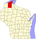
Sioux, Wisconsin

Last updated
Sioux, Wisconsin
USA Wisconsin location map.svg
Red pog.svg
Sioux
Usa edcp location map.svg
Red pog.svg
Sioux
Coordinates: 46°44′14″N90°52′49″W / 46.73722°N 90.88028°W / 46.73722; -90.88028 Coordinates: 46°44′14″N90°52′49″W / 46.73722°N 90.88028°W / 46.73722; -90.88028
Country Flag of the United States.svg  United States
State Flag of Wisconsin.svg  Wisconsin
County Bayfield
Town Bayview
Elevation
185 m (607 ft)
Time zone UTC-6 (Central (CST))
  Summer (DST) UTC-5 (CDT)
Area code(s) 715 and 534
GNIS feature ID1577823 [1]

Sioux is an unincorporated community located in the town of Bayview, Bayfield County, Wisconsin, United States. [1]

This community was named after the Sioux people. [2]

The Sioux Nation

The Sioux Nation consists of large tribes of Native Americans traditionally living in the Great Plains. The three major divisions of Sioux are: Lakota, Eastern Dakota, and Western Dakota. A large number of Sioux tribes were nomadic who moved from place to place following bison herds, and their lifestyle also revolved around hunting bison.

Notes

  1. 1 2 "Sioux, Wisconsin". Geographic Names Information System . United States Geological Survey.
  2. Chicago and North Western Railway Company (1908). A History of the Origin of the Place Names Connected with the Chicago & North Western and Chicago, St. Paul, Minneapolis & Omaha Railways. p. 191.


Related Research Articles

Crow people Indigenous ethnic group in North America

The Crow, whose autonym is Apsáalooke, also spelled Absaroka, are Native Americans living primarily in southern Montana. Today, the Crow people have a federally recognized tribe, the Crow Tribe of Montana, with an Indian reservation located in the south-central part of the state.

Lakota people Indigenous people of the Great Plains

The Lakota are a Native American tribe. Also known as the Teton Sioux, they are one of the three prominent subcultures of the Sioux people. Their current lands are in North and South Dakota. They speak Lakȟótiyapi—the Lakota language, the westernmost of three closely related languages that belong to the Siouan language family.

Sioux Native American and First Nations ethnic group

The Sioux or Oceti Sakowin are groups of Native American tribes and First Nations peoples in North America. The modern Sioux consist of two major divisions based on language divisions: the Dakota and Lakota; collectively they are known as the Očhéthi Šakówiŋ. The term "Sioux" is an exonym created from a French transcription of the Ojibwe term "Nadouessioux", and can refer to any ethnic group within the Great Sioux Nation or to any of the nation's many language dialects.

Effigy Mounds National Monument National monument of prehistoric mounds built by Native Americans, in Iowa, United States

Effigy Mounds National Monument preserves more than 200 prehistoric mounds built by pre-Columbian Mound Builder cultures, mostly in the first millennium AD, during the later part of the Woodland period of pre-Columbian North America. Numerous effigy mounds are shaped like animals, including bears and birds.

Midwestern United States One of the four census regions of the United States of America

The Midwestern United States, also referred to as the Midwest or the American Midwest, is one of four census regions of the United States Census Bureau. It occupies the northern central part of the United States. It was officially named the North Central Region by the Census Bureau until 1984. It is between the Northeastern United States and the Western United States, with Canada to its north and the Southern United States to its south.

Brandon, South Dakota City in South Dakota, United States

Brandon is a city in Minnehaha County, South Dakota, United States. Brandon is located five miles east of Sioux Falls. The population was 11,048 as of 2020 census.

Badlands National Park National park in South Dakota, United States

Badlands National Park is an American national park located in southwestern South Dakota. The park protects 242,756 acres of sharply eroded buttes and pinnacles, along with the largest undisturbed mixed grass prairie in the United States. The National Park Service manages the park, with the South Unit being co-managed with the Oglala Lakota tribe.

Assiniboine First Nations people native to the northern Great Plains of North America

The Assiniboine or Assiniboin people, also known as the Hohe and known by the endonym Nakota, are a First Nations/Native American people originally from the Northern Great Plains of North America.

Owanka, South Dakota Unincorporated community in South Dakota, United States

Owanka is an unincorporated community in Pennington County, South Dakota, United States. Although not tracked by the United States Census Bureau, Owanka has been assigned the ZIP Code of 57767.

The Mdewakanton or Mdewakantonwan are one of the sub-tribes of the Isanti (Santee) Dakota (Sioux). Their historic home is Mille Lacs Lake in central Minnesota. Together with the Wahpekute, they form the so-called Upper Council of the Dakota or Santee Sioux. Today their descendants are members of federally recognized tribes in Minnesota, South Dakota and Nebraska of the United States, and First Nations in Manitoba, Canada.

Standing Rock Indian Reservation Native American reservation in the United States

The Standing Rock Reservation lies across the border between North and South Dakota in the United States, and is inhabited by ethnic "Hunkpapa and Sihasapa bands of Lakota Oyate and the Ihunktuwona and Pabaksa bands of the Dakota Oyate," as well as the Hunkpatina Dakota. The Ihanktonwana Dakota are the Upper Yanktonai, part of the collective of Wiciyena. The sixth-largest Native American reservation in land area in the US, Standing Rock includes all of Sioux County, North Dakota, and all of Corson County, South Dakota, plus slivers of northern Dewey and Ziebach counties in South Dakota, along their northern county lines at Highway 20.

Great Sioux Reservation Former Indian reservation in the United States

The Great Sioux Reservation initially set aside land west of the Missouri River in South Dakota and Nebraska for the use of the Lakota Sioux, who had dominated this territory. The reservation was established in the Fort Laramie Treaty of 1868. It included all of present-day western South Dakota and modern Boyd County, Nebraska. This area was established by the United States as a reservation for the Teton Sioux, also known as the Lakota: the seven western bands of the "Seven Council Fires".

Rosebud Indian Reservation Indian reservation in South Dakota, United States

The Rosebud Indian Reservation (RIR) is an Indian reservation in South Dakota, United States. It is the home of the federally recognized Sicangu Oyate – also known as Sicangu Lakota, and the Rosebud Sioux Tribe (RST), a branch of the Lakota people. The Lakota name Sicangu Oyate translates into English as "Burnt Thigh Nation"; the French term "Brulé Sioux" is also used.

Chicago, St. Paul, Minneapolis and Omaha Railway

The Chicago, St. Paul, Minneapolis and Omaha Railway or Omaha Road was a railroad in the U.S. states of Nebraska, Iowa, Minnesota, Wisconsin and South Dakota. It was incorporated in 1880 as a consolidation of the Chicago, St. Paul and Minneapolis Railway and the North Wisconsin Railway. The Chicago and North Western Railway (C&NW) gained control in 1882. The C&NW leased the Omaha Road in 1957 and merged the company into itself in 1972. Portions of the C. St. P. M. and O. are part of the Union Pacific Railroad network. This includes main lines from Wyeville, Wisconsin, to St. Paul, Minnesota, and St. Paul to Sioux City, Iowa.

Dakota people Native American people in the mid northern U.S. and mid southern Canada

The Dakota are a Native American tribe and First Nations band government in North America. They compose two of the three main subcultures of the Sioux people, and are typically divided into the Eastern Dakota and the Western Dakota.

History of South Dakota Aspect of history

The history of South Dakota describes the history of the U.S. state of South Dakota over the course of several millennia, from its first inhabitants to the recent issues facing the state.

Zell is an unincorporated community in Faulk County, South Dakota, United States, astride U.S. Route 212, and was once a stop on the old Chicago and North Western Railway

Capa, South Dakota

Capa is an unincorporated community in Jones County, South Dakota, United States.

Teton is an unincorporated community in Stanley County, in the U.S. state of South Dakota.