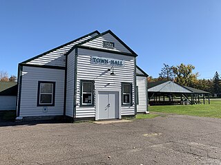
Barnes is a town in Bayfield County, Wisconsin, United States. The population was 769 at the 2010 census. The town was named for an early settler named George Sardis Barnes who opened the first hotel, saloon, and store north of the Eau Claire lakes in the late 1880s.

Bayview is a town in Bayfield County, Wisconsin, United States. The population was 487 at the 2010 census. The unincorporated community of Sioux is located in the town.

Bell is a town in Bayfield County, Wisconsin, United States. The population was 263 at the 2010 census. The unincorporated community of Cornucopia is located within the town.

Clover is a town in Bayfield County, Wisconsin, United States. The population was 223 at the 2010 census. The unincorporated communities of Bark Point and Herbster are located in the town.

Drummond is a town in Bayfield County, Wisconsin, United States. The population was 169 at the 2020 census, down from 463 at the 2010 census. The census-designated place of Drummond is located in the town. The unincorporated community of Lake Owen is also located in the town.

Eileen is a town in Bayfield County, Wisconsin, United States. The population was 681 at the 2010 census. The unincorporated community of Ashland Junction is located in the town.

Grandview is a town in Bayfield County, Wisconsin, United States. The population was 468 at the 2010 census. The unincorporated community of Grand View is located in the town of Grandview.
Hughes is a town in Bayfield County, Wisconsin, United States. The population was 383 at the 2010 census. The unincorporated communities of Muskeg and Wills are located in the town.

Iron River is a town in Bayfield County, Wisconsin, United States. The population was 1,123 at the 2010 census. The census-designated place of Iron River is located in the town. The unincorporated community of Topside is also located in the town.

Kelly is a town in Bayfield County, Wisconsin, United States. The population was 463 at the 2010 census.

Lincoln is a town in Bayfield County, Wisconsin, United States. The population was 287 at the 2010 census.

Namakagon is a town in Bayfield County, Wisconsin, United States. The population was 246 at the 2010 census.

Orienta is a town in Bayfield County, Wisconsin, United States. The population was 122 at the 2010 census.

Pilsen is a town in Bayfield County, Wisconsin, United States. The population was 210 at the 2010 census. The unincorporated community of Moquah is located in the town.
Port Wing is a town in Bayfield County, Wisconsin, United States. The population was 368 at the 2010 census. The unincorporated community of Port Wing is located in the town.

Russell is a town in Bayfield County, Wisconsin, United States. The population was 1,279 at the 2010 census. The unincorporated communities of Red Cliff and Sand Bay are located in Russell. Red Cliff is the administrative center of the Red Cliff Band of Lake Superior Chippewa. York Island and Raspberry Island are part of the town.

Bayfield is a town in Bayfield County, Wisconsin, United States. The population was 680 at the 2010 census. The unincorporated communities of Pureair and Salmo are located in the town, as are Eagle Island and Sand Island of the Apostle Islands.
Mason is a town in Bayfield County, Wisconsin, United States. The population was 315 at the 2010 census. The Village of Mason is located within the town. The unincorporated community of Sutherland is located partially in the town.
Washburn is a town in Bayfield County, Wisconsin, United States. The population was 530 at the 2010 census. The City of Washburn is located just east of and adjacent to the town.

Bayfield is a city in Bayfield County, Wisconsin, United States. The population was 584 at the 2020 census. This makes it the city with the smallest population in Wisconsin. In fact, for a new city to be incorporated today, state regulations require a population of at least 1,000 residents, so it would have to be incorporated as a village instead.

