Bayfield, Wisconsin

Last updated

Bayfield
City
Bayfieldwi.JPG
Bayfield from the harbor
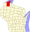
Bayfield County Wisconsin Incorporated and Unincorporated areas Bayfield Highlighted.svg
Location of Bayfield in Bayfield County, Wisconsin.
USA Wisconsin location map.svg
Red pog.svg
Bayfield
Location within the state of Wisconsin
Coordinates: 46°48.7′N90°49.2′W / 46.8117°N 90.8200°W / 46.8117; -90.8200
Country United States
State Wisconsin
County Bayfield
Area
[1]
  Total0.86 sq mi (2.23 km2)
  Land0.86 sq mi (2.23 km2)
  Water0.00 sq mi (0.00 km2)
Elevation
[2]
830 ft (253 m)
Population
 (2020) [3]
  Total584
  Density678.3/sq mi (261.9/km2)
Time zone UTC-6 (Central (CST))
  Summer (DST) UTC-5 (CDT)
ZIP codes
54814
Area codes 715 and 534
FIPS code 55-05350
GNIS feature ID1582764 [2]
Public Transit Bay Area Rural Transit
Website cityofbayfield.com

Bayfield is a city in Bayfield County, Wisconsin, United States. The population was 584 at the 2020 census. [3] This makes it the city with the smallest population in Wisconsin. In fact, for a new city to be incorporated today, state regulations require a population of at least 1,000 residents, so it would have to be incorporated as a village instead. [4]

Contents

Wisconsin Highway 13 serves as a main route in the community. It is a former county seat, lumbering town, and commercial fishing community, which today is a tourist and resort destination. There are many restaurants, hotels, bed & breakfast establishments, specialty shops, and marine services. The local Chamber of Commerce refers to Bayfield as the "Gateway to the Apostle Islands". [5]

History

Bayfield was named in 1856 for Henry Bayfield, a British Royal Topographic Engineer who explored the region in 1822–23. [6] [7] A post office has been in operation at Bayfield since 1856. [8]

Geography

Bayfield is located at 46°48.7′N90°49.2′W / 46.8117°N 90.8200°W / 46.8117; -90.8200 (46.8115, -90.8203). [9]

According to the United States Census Bureau, the city has a total area of 0.87 square miles (2.25 km2), of which, 0.86 square miles (2.23 km2) is land and 0.01 square miles (0.03 km2) is water. [10]

Bayfield is the main gateway to the Apostle Islands National Lakeshore, a group of 21 islands in Lake Superior. Madeline Island is the largest of the Apostle Islands and the only one not in the National Lakeshore. A ferry to Madeline Island links Bayfield with La Pointe, Wisconsin, a community on the island.

Climate

Climate data for Bayfield 6 N, Wisconsin (1991–2020 normals, extremes 1893–2005)
MonthJanFebMarAprMayJunJulAugSepOctNovDecYear
Record high °F (°C)57
(14)
61
(16)
83
(28)
89
(32)
95
(35)
98
(37)
104
(40)
99
(37)
99
(37)
88
(31)
76
(24)
61
(16)
104
(40)
Mean daily maximum °F (°C)21.7
(−5.7)
26.2
(−3.2)
37.0
(2.8)
49.0
(9.4)
62.8
(17.1)
71.3
(21.8)
76.9
(24.9)
75.5
(24.2)
67.5
(19.7)
54.0
(12.2)
39.6
(4.2)
27.6
(−2.4)
50.8
(10.4)
Daily mean °F (°C)14.4
(−9.8)
17.2
(−8.2)
27.5
(−2.5)
39.6
(4.2)
51.7
(10.9)
60.2
(15.7)
66.4
(19.1)
65.9
(18.8)
57.9
(14.4)
46.0
(7.8)
32.6
(0.3)
21.0
(−6.1)
41.7
(5.4)
Mean daily minimum °F (°C)7.2
(−13.8)
8.2
(−13.2)
17.9
(−7.8)
30.2
(−1.0)
40.5
(4.7)
49.1
(9.5)
56.0
(13.3)
56.3
(13.5)
48.4
(9.1)
38.0
(3.3)
25.5
(−3.6)
14.5
(−9.7)
32.6
(0.3)
Record low °F (°C)−34
(−37)
−34
(−37)
−25
(−32)
2
(−17)
17
(−8)
25
(−4)
36
(2)
34
(1)
27
(−3)
15
(−9)
−13
(−25)
−24
(−31)
−34
(−37)
Average precipitation inches (mm)1.70
(43)
1.12
(28)
1.61
(41)
3.08
(78)
3.49
(89)
3.34
(85)
4.11
(104)
3.64
(92)
3.69
(94)
3.15
(80)
2.44
(62)
1.92
(49)
33.29
(846)
Average snowfall inches (cm)29.5
(75)
15.8
(40)
14.6
(37)
5.1
(13)
0.8
(2.0)
0.0
(0.0)
0.0
(0.0)
0.0
(0.0)
0.0
(0.0)
1.0
(2.5)
13.3
(34)
26.2
(67)
106.3
(270)
Average precipitation days (≥ 0.01 in)17.511.411.811.011.811.914.111.214.312.811.914.2153.9
Average snowy days (≥ 0.1 in)19.812.49.94.10.60.00.00.00.00.79.015.271.7
Source: NOAA [11] [12]

Demographics

Historical population
CensusPop.Note
1880 495
1890 1,373177.4%
1900 1,68923.0%
1920 1,441
1930 1,195−17.1%
1940 1,2121.4%
1950 1,153−4.9%
1960 969−16.0%
1970 874−9.8%
1980 778−11.0%
1990 686−11.8%
2000 611−10.9%
2010 487−20.3%
2020 58419.9%
U.S. Decennial Census [13] [3]

2020 census

As of the census of 2020, [3] the population was 584. The population density was 678.3 inhabitants per square mile (261.9/km2). There were 458 housing units at an average density of 531.9 per square mile (205.4/km2). The racial makeup of the city was 80.1% White, 11.0% Native American, 0.7% Black or African American, 0.2% Asian, 0.5% from other races, and 7.5% from two or more races. Ethnically, the population was 1.5% Hispanic or Latino of any race.

2010 census

At the 2010 census there were 487 people in 261 households, including 130 families, in the city. The population density was 566.3 inhabitants per square mile (218.6/km2). There were 482 housing units at an average density of 560.5 per square mile (216.4/km2). The racial makeup of the city was 77.8% White, 0.2% African American, 14.8% Native American, 1.0% Asian, and 6.2% from two or more races. Hispanic or Latino of any race were 1.8%. [14]

Of the 261 households, 16.5% had children under the age of 18 living with them, 39.5% were married couples living together, 8.8% had a female householder with no husband present, 1.5% had a male householder with no wife present, and 50.2% were non-families. 44.1% of households were one person and 18.7% were one person aged 65 or older. The average household size was 1.87 and the average family size was 2.58.

The median age was 53.2 years. 15.4% of residents were under the age of 18; 3.2% were between the ages of 18 and 24; 18.6% were from 25 to 44; 36% were from 45 to 64; 26.9% were 65 or older. The gender makeup of the city was 48.9% male and 51.1% female.

2000 census

At the 2000 census there were 611 people in 289 households, including 167 families, in the city. The population density was 703.3 people per square mile (271.2/km2). There were 403 housing units at an average density of 463.8 per square mile (178.8/km2). The racial makeup of the city was 76.92% White, 0.65% Black or African American, 15.22% Native American, 1.31% from other races, and 5.89% from two or more races. Hispanic or Latino of any race were 0.49%. [15] 10.5% were of American, 10.1% German, 9.4% Norwegian, 8.1% Irish, 7.4% Swedish and 5.4% English ancestry according to Census 2000.

Of the 289 households, 22.8% had children under the age of 18 living with them, 41.2% were married couples living together, 11.4% had a female householder with no spouse present, and 41.9% were non-families. 35.6% of households were one person and 15.9% were one person aged 65 or older. The average household size was 2.10 and the average family size was 2.64.

The age distribution was 20.9% under the age of 18, 6.9% from 18 to 24, 21.4% from 25 to 44, 33.1% from 45 to 64, and 17.7% 65 or older. The median age was 45 years. For every 100 females, there were 89.8 males. For every 100 females age 18 and over, there were 85.8 males.

The median household income was $32,266 and the median family income was $36,500. Males had a median income of $34,375 versus $25,875 for females. The per capita income for the city was $18,377. About 10.5% of families and 11.8% of the population were below the poverty line, including 20.5% of those under age 18 and 4.6% of those age 65 or over.

Arts and culture

Bayfield Maritime Museum Bayfield Maritime Museum.jpg
Bayfield Maritime Museum

The city of Bayfield is known in the Anishinaabe language as Oshki-oodena ("New-town"), as opposed to Superior, Wisconsin, which is known as Gete-oodena ("Old-town"), in reference to the Ojibwa migration.

The Bayfield Maritime Museum and Bayfield Heritage Museum are the city's two museums. There are several art galleries. Nearby is the 950 seats all-canvas tent theater known as Big Top Chautauqua which during its summer season has hosted such entertainers as Willie Nelson and Lyle Lovett. [16]

Bayfield's annual Apple Fest draws about 60,000 visitors during the first weekend in October. Popular summertime events include the Bayfield Race Week regatta, held during the week of the 4th of July, and the Festival of Arts and Gallery Tour, which takes place the third weekend of July. It features artists from across the midwest, along with tours and demos at a diverse array of local galleries.

Recreation

Emily Larson - 2007 Apostle Island Sled Dog Race Emily Apostle Island Sled Dog Race.jpg
Emily Larson - 2007 Apostle Island Sled Dog Race

The Apostle Islands Sled Dog Race takes place the first weekend of February. It is the largest sled dog race in the Midwest, with between 50 and 75 teams competing annually. [17]

Transportation

Bus service to the community is provided by Bay Area Rural Transit.

Local media

Bayfield receives three radio stations from Ashland; WATW, WBSZ and WJJH. Television stations come from the Duluth–Superior market; KDLH, KBJR, WDSE and WDIO.

Notable people

See also

Related Research Articles

<span class="mw-page-title-main">Bayfield County, Wisconsin</span> County in Wisconsin, United States

Bayfield County is a county located in the U.S. state of Wisconsin. As of the 2020 census, its population is 16,220. Its county seat is Washburn. The county was created in 1845 and organized in 1850. The Red Cliff Band of Lake Superior Chippewa has a reservation in Bayfield County and is the county's largest employer.

<span class="mw-page-title-main">Ashland County, Wisconsin</span> County in Wisconsin, United States

Ashland County is a county located in the U.S. state of Wisconsin. As of the 2020 census, the population was 16,027. Its county seat is Ashland. The county was formed on March 27, 1860, from La Pointe County. The county partly overlaps with the reservation of the Bad River Band of the Lake Superior Tribe of Chippewa Indians.

<span class="mw-page-title-main">Barnes, Wisconsin</span> Town in Wisconsin, United States

Barnes is a town in Bayfield County, Wisconsin, United States. The population was 769 at the 2010 census. The town was named for an early settler named George Sardis Barnes who opened the first hotel, saloon, and store north of the Eau Claire lakes in the late 1880s.

<span class="mw-page-title-main">Bayview, Wisconsin</span> Town in Wisconsin, United States

Bayview is a town in Bayfield County, Wisconsin, United States. The population was 487 at the 2010 census. The unincorporated community of Sioux is located in the town.

<span class="mw-page-title-main">Bell, Wisconsin</span> Town in Bayfield County, Wisconsin, United States

Bell is a town in Bayfield County, Wisconsin, United States. The population was 263 at the 2010 census. The unincorporated community of Cornucopia is located within the town.

<span class="mw-page-title-main">Cable, Wisconsin</span> Town in Wisconsin, United States

Cable is a town in Bayfield County, Wisconsin, United States. Its population was 825 at the 2010 U.S. census. The census-designated place of Cable and the unincorporated communities of Leonards and Radspur are located in the town.

<span class="mw-page-title-main">Delta, Wisconsin</span> Town in Wisconsin, United States

Delta is a town in Bayfield County, Wisconsin, United States. The population was 273 at the 2010 census. The unincorporated communities of Delta and Pike River are located in the town. The unincorporated community of Sutherland is located partially in the town.

<span class="mw-page-title-main">Drummond, Wisconsin</span> Town in Wisconsin, United States

Drummond is a town in Bayfield County, Wisconsin, United States. The population was 169 at the 2020 census, down from 463 at the 2010 census. The census-designated place of Drummond is located in the town. The unincorporated community of Lake Owen is also located in the town.

<span class="mw-page-title-main">Eileen, Wisconsin</span> Town in Wisconsin, United States

Eileen is a town in Bayfield County, Wisconsin, United States. The population was 681 at the 2010 census. The unincorporated community of Ashland Junction is located in the town.

<span class="mw-page-title-main">Grandview, Wisconsin</span> Town in Wisconsin, United States

Grandview is a town in Bayfield County, Wisconsin, United States. The population was 468 at the 2010 census. The unincorporated community of Grand View is located in the town of Grandview.

<span class="mw-page-title-main">Iron River, Wisconsin</span> Town in Wisconsin, United States

Iron River is a town in Bayfield County, Wisconsin, United States. The population was 1,123 at the 2010 census. The census-designated place of Iron River is located in the town. The unincorporated community of Topside is also located in the town.

<span class="mw-page-title-main">Kelly, Wisconsin</span> Town in Wisconsin, United States

Kelly is a town in Bayfield County, Wisconsin, United States. The population was 463 at the 2010 census.

<span class="mw-page-title-main">Keystone, Wisconsin</span> Town in Wisconsin, United States

Keystone is a town in Bayfield County, Wisconsin, United States. The population was 378 at the 2010 census. The unincorporated community of Ino is located in the town.

<span class="mw-page-title-main">Lincoln, Bayfield County, Wisconsin</span> Town in Wisconsin, United States

Lincoln is a town in Bayfield County, Wisconsin, United States. The population was 287 at the 2010 census.

<span class="mw-page-title-main">Orienta, Wisconsin</span> Town in Wisconsin, United States

Orienta is a town in Bayfield County, Wisconsin, United States. The population was 122 at the 2010 census.

<span class="mw-page-title-main">Russell, Bayfield County, Wisconsin</span> Town in Wisconsin, United States

Russell is a town in Bayfield County, Wisconsin, United States. The population was 1,279 at the 2010 census. The unincorporated communities of Red Cliff and Sand Bay are located in Russell. Red Cliff is the administrative center of the Red Cliff Band of Lake Superior Chippewa. York Island and Raspberry Island are part of the town.

<span class="mw-page-title-main">Bayfield (town), Wisconsin</span> Town in Wisconsin, United States

Bayfield is a town in Bayfield County, Wisconsin, United States. The population was 680 at the 2010 census. The unincorporated communities of Pureair and Salmo are located in the town, as are Eagle Island and Sand Island of the Apostle Islands.

<span class="mw-page-title-main">Mason, Wisconsin</span> Village in Wisconsin, United States

Mason is a village in Bayfield County, Wisconsin, United States. The population was 93 at the 2010 census. The village is located within the Town of Mason.

Mason is a town in Bayfield County, Wisconsin, United States. The population was 315 at the 2010 census. The Village of Mason is located within the town. The unincorporated community of Sutherland is located partially in the town.

<span class="mw-page-title-main">La Pointe (town), Wisconsin</span> Town in Wisconsin, United States

La Pointe is a town in Ashland County in the U.S. state of Wisconsin. The population was 428 at the 2020 census. The town includes all of the Apostle Islands except for the westernmost four, which lie in the towns of Bayfield and Russell in Bayfield County. The town includes the unincorporated community of La Pointe on Madeline Island, the largest of the Apostle Islands. The communities of Middleport and Old Fort are also located in the town. Its name in the Anishinaabe language is Mooningwanekaaning, meaning "The Home of the Golden Breasted Woodpecker".

References

  1. "2019 U.S. Gazetteer Files". United States Census Bureau. Retrieved August 7, 2020.
  2. 1 2 U.S. Geological Survey Geographic Names Information System: Bayfield, Wisconsin
  3. 1 2 3 4 "2020 Decennial Census: Bayfield city, Wisconsin". data.census.gov. U.S. Census Bureau. Retrieved July 15, 2022.
  4. Wisconsin Legislative Reference Bureau (2015). "Framework of Government" (PDF). State of Wisconsin 2015–2016 Blue Book . Madison, Wisconsin: Wisconsin Legislative Reference Bureau. pp. 227–36. Retrieved November 28, 2015.
  5. "Apostle Islands National Lakeshore". bayfield.org. Bayfield Chamber & Visitor Bureau. Archived from the original on April 11, 2021. Retrieved November 14, 2021.
  6. Eckert, Kathryn Bishop (2000). The sandstone architecture of the Lake Superior region. Wayne State University Press. ISBN   978-0-8143-2807-1 . Retrieved August 18, 2011.
  7. Chicago and North Western Railway Company (1908). A History of the Origin of the Place Names Connected with the Chicago & North Western and Chicago, St. Paul, Minneapolis & Omaha Railways. p. 168.
  8. "Bayfield County". Jim Forte Postal History. Retrieved April 3, 2015.
  9. "US Gazetteer files: 2010, 2000, and 1990". United States Census Bureau. February 12, 2011. Retrieved April 23, 2011.
  10. "US Gazetteer files 2010". United States Census Bureau. Archived from the original on January 25, 2012. Retrieved November 18, 2012.
  11. "Station: Bayfield 6 N, WI". U.S. Climate Normals 2020: U.S. Monthly Climate Normals (1991-2020). National Oceanic and Atmospheric Administration. Retrieved June 13, 2021.
  12. "Monthly Highest Max Temperature and Monthly Lowest Min Temperature for Bayfield 6 N, WI". Applied Climate Information System. Retrieved June 13, 2021.
  13. "Census of Population and Housing". Census.gov. Retrieved June 4, 2015.
  14. "U.S. Census website". United States Census Bureau . Retrieved November 18, 2012.
  15. "U.S. Census website". United States Census Bureau . Retrieved January 31, 2008.
  16. Big Top Chautauqua
  17. "Apostle Islands Sled Dog Race set for Feb. 3-4". Bayfield County Journal. January 25, 2018. Retrieved January 28, 2018.