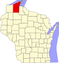
Benoit, Wisconsin | |
---|---|
Coordinates: 46°30′07″N91°04′37″W / 46.50194°N 91.07694°W | |
Country | United States |
State | Wisconsin |
County | Bayfield |
Towns | Keystone, Mason |
Elevation | 275 m (902 ft) |
Time zone | UTC-6 (Central (CST)) |
• Summer (DST) | UTC-5 (CDT) |
ZIP code | 54816 [1] |
Area codes | 715 and 534 |
GNIS feature ID | 1578756 [2] |
Benoit is an unincorporated community in the towns of Keystone and Mason, Bayfield County, Wisconsin, United States. [2] It is along County Highway F. Benoit is 13 miles southwest of the city of Ashland. Nearby is the junction of U.S. Highway 2 and U.S. Highway 63. [3]
The community was named for Antoine Benoit, a pioneer French settler. [4] Other names before Benoit included Thirty Miles Siding, Peckville, Peck and Benoitville. [5]
Bayfield County is a county located in the U.S. state of Wisconsin. As of the 2020 census, its population is 16,220. Its county seat is Washburn. The county was created in 1845 and organized in 1850. The Red Cliff Band of Lake Superior Chippewa has a reservation in Bayfield County and is the county's largest employer.
Eileen is a town in Bayfield County, Wisconsin, United States. The population was 681 at the 2010 census. The unincorporated community of Ashland Junction is located in the town.
Somers is a village in Kenosha County, Wisconsin, United States. The population was 8,402 at the 2020 census. Somers has a post office with ZIP code 53171. The former unincorporated communities of Berryville, Central Park, and Kellogg's Corners are located in the village.
Mason is a village in Bayfield County, Wisconsin, United States. The population was 93 at the 2010 census. The village is located within the Town of Mason.
Elmhurst is an unincorporated community in Langlade County, Wisconsin, United States. It is in the town of Rolling at latitude 45°3'30" North, longitude 89°11'3" West. The community is located near the headwaters of the Middle Branch Embarrass River, approximately 1½ miles west of the junction of WIS 47, WIS 52 and U.S. Highway 45 in the Town of Rolling. A track of the Chicago and North Western Railway runs along the west side of the community. Elmhurst is located at 1,476 feet (450 m) above sea level.
Bayfield is a city in Bayfield County, Wisconsin, United States. The population was 584 at the 2020 census. This makes it the city with the smallest population in Wisconsin. In fact, for a new city to be incorporated today, state regulations require a population of at least 1,000 residents, so it would have to be incorporated as a village instead.
Sugar Bush is an unincorporated community located entirely within the town of Maple Creek in northwest Outagamie County, Wisconsin, United States. Sugar Bush is classified as a Class U6 Community by the USGS, being a populated place located wholly or substantially outside the boundaries of any incorporated place or CDP with a recognized authoritative common name.
Grand View is an unincorporated, census-designated place located in the town of Grandview, Bayfield County, Wisconsin, United States.
Salmo is an unincorporated community in Bayfield County, Wisconsin, United States.
Mountain is an unincorporated census-designated place in Oconto County, Wisconsin, United States. The community is located at the intersection of Wisconsin Highway 32 and Wisconsin Highway 64, in the town of Mountain. It is located at latitude 45.185 and longitude -88.474 and elevation 971 feet. The postal code for Mountain is 54149. As of the 2010 census, its population is 363. Mountain has an area of 6.699 square miles (17.35 km2), all of it land.
Cable is an unincorporated, census-designated place located in the town of Cable, Bayfield County, Wisconsin, United States.
Drummond is an unincorporated, census-designated place located in the town of Drummond, Bayfield County, Wisconsin, United States.
Wascott is an unincorporated community in the town of Wascott, Douglas County, Wisconsin, United States.
Bennett is an unincorporated community in the town of Bennett, Douglas County, Wisconsin, United States.
Whitcomb is an unincorporated community located in the town of Wittenberg, Shawano County, Wisconsin, United States. Whitcomb is located on Wisconsin Highway 153 near its junction with U.S. Route 45, 4 miles (6.4 km) southeast of the village of Wittenberg.
Angus is an unincorporated community in the town of Cedar Lake, Barron County, Wisconsin, United States. Angus is located on Wisconsin Highway 48 2.5 miles (4.0 km) southwest of Birchwood.
Barksdale is an unincorporated community in the town of Barksdale, Bayfield County, Wisconsin, United States. Barksdale is located on Wisconsin Highway 13 4 miles (6.4 km) south-southwest of Washburn.
Earl is an unincorporated community located in the town of Springbrook, Washburn County, Wisconsin, United States. Earl is located at the junction of U.S. Route 63 and County Highway E 8.5 miles (13.7 km) northeast of Spooner; the Wisconsin Great Northern Railroad runs through the community.
Ashland Junction is an unincorporated community located in the town of Eileen, Bayfield County, Wisconsin, United States.
Leonards is an unincorporated community located in the town of Cable, Bayfield County, Wisconsin, United States.