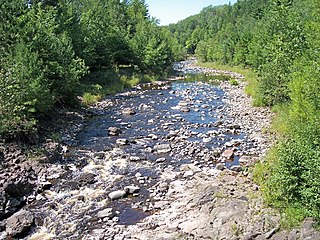
Topside, Wisconsin | |
---|---|
Unincorporated community | |
Coordinates: 46°33′33″N91°19′22″W / 46.55917°N 91.32278°W Coordinates: 46°33′33″N91°19′22″W / 46.55917°N 91.32278°W | |
Country | United States |
State | Wisconsin |
County | Bayfield |
Town | Iron River |
Elevation | 1,158 ft (353 m) |
Time zone | Central (CST) (UTC-6) |
• Summer (DST) | CDT (UTC-5) |
Area code(s) | 715 and 534 |
GNIS feature ID | 1580621 [1] |
Topside is an unincorporated community in the town of Iron River, Bayfield County, Wisconsin, United States. Topside is located near U.S. Route 2, 4.1 miles (6.6 km) east of the community of Iron River. [2]
In law, an unincorporated area is a region of land that is not governed by a local municipal corporation; similarly an unincorporated community is a settlement that is not governed by its own local municipal corporation, but rather is administered as part of larger administrative divisions, such as a township, parish, borough, county, city, canton, state, province or country. Occasionally, municipalities dissolve or disincorporate, which may happen if they become fiscally insolvent, and services become the responsibility of a higher administration. Widespread unincorporated communities and areas are a distinguishing feature of the United States and Canada. In most other countries of the world, there are either no unincorporated areas at all, or these are very rare; typically remote, outlying, sparsely populated or uninhabited areas.
Iron River is a town in Bayfield County, Wisconsin, United States. The population was 1,123 at the 2010 census. The census-designated place of Iron River is located in the town. The unincorporated community of Topside is also located in the town.
Bayfield County is a county located in the U.S. state of Wisconsin. As of the 2010 census, the population was 15,014. Its county seat is Washburn. The county was created in 1845 and organized in 1850.
Ashland County is a county located in the U.S. state of Wisconsin. As of the 2010 census, the population was 16,157. Its county seat is Ashland. The county was formed on March 27, 1860, from La Pointe County.
Bayfield is a town in Bayfield County, Wisconsin, United States. The population was 680 at the 2010 census. The unincorporated communities of Pureair and Salmo are located in the town, as are Eagle Island and Sand Island of the Apostle Islands.
Bayfield is a city in Bayfield County, Wisconsin, United States. The population was 530 at the 2010 census.
The Bad River is a river flowing to Lake Superior in northern Wisconsin in the United States. It flows for 119.6 kilometres (74.3 mi) in Ashland County, draining an area of 1,061 square miles (2,750 km2) in portions of Ashland, Bayfield and Iron counties. The Bad River sloughs were designated a Ramsar Wetland of International Importance on February 2, 2012.
Red Cliff, also known as Miskwaabikaang, is an unincorporated community in the town of Russell, Bayfield County, Wisconsin, United States. Red Cliff is the administrative center of the Red Cliff Band of Lake Superior Chippewa. The reservation population is 924, primarily Native American.
Herbster is a census-designated place (CDP) in the Town of Clover in Bayfield County, Wisconsin, United States, located on the south shore of Lake Superior. Herbster is 7 miles (11 km) east of Port Wing and 8 miles (13 km) west of Cornucopia on Wisconsin Highway 13, the main route through the community. The primary north/south route is by Lenawee Road, leading from Lake Superior to the Chequamegon National Forest. As of the 2010 census, its population was 104. Herbster has an area of 5.572 square miles (14.43 km2), all of it land.
Port Wing is an unincorporated census-designated place in the town of Port Wing, Bayfield County, Wisconsin, United States. The community is located on Wisconsin Highway 13, 30 miles (48 km) west of Bayfield. The Flagg River enters Lake Superior at Port Wing's harbor.
WNXR is a radio station broadcasting a classic hits format. Licensed to Iron River, Wisconsin, the station is currently owned by Heartland Comm. License, LLC, and features programming from Westwood One. It serves Ashland and Bayfield counties, and has a rimshot signal to the Duluth area.
Salmo is an unincorporated community in Bayfield County, Wisconsin, United States.
Iron River is an unincorporated, census-designated place located in the town of Iron River, Bayfield County, Wisconsin, United States.
Barksdale is an unincorporated community in the town of Barksdale, Bayfield County, Wisconsin, United States. Barksdale is located on Wisconsin Highway 13 4 miles (6.4 km) south-southwest of Washburn.
Pureair is an unincorporated community located in the town of Bayfield, Bayfield County, Wisconsin, United States.
Ashland Junction is an unincorporated community located in the town of Eileen, Bayfield County, Wisconsin, United States.
Pike River is an unincorporated community located in the town of Delta, Bayfield County, Wisconsin, United States.
Leonards is an unincorporated community located in the town of Cable, Bayfield County, Wisconsin, United States.
Sevona was a steel hulled lake freighter that sank in Lake Superior off the coast of Sand Island in Bayfield County, Wisconsin, United States. The wreckage site was added to the National Register of Historic Places in 1993.
Oulu is an unincorporated community in the town of Oulu, Bayfield County, Wisconsin, United States. Oulu is located at the junction of County Highways B and FF 7.5 miles (12.1 km) northwest of Iron River.
This article about a location in Bayfield County, Wisconsin is a stub. You can help Wikipedia by expanding it. |