Eileen, Wisconsin

Last updated

Eileen, Wisconsin
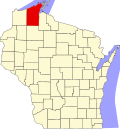
WIMap-doton-Eileen.png
Location of Eileen, Wisconsin
Coordinates: 46°33′37″N90°59′18″W / 46.56028°N 90.98833°W / 46.56028; -90.98833
Country Flag of the United States.svg  United States
State Flag of Wisconsin.svg  Wisconsin
County Bayfield
founded1904
Area
  Total35.3 sq mi (91.4 km2)
  Land35.2 sq mi (91.2 km2)
  Water0.08 sq mi (0.2 km2)
Elevation
[1]
745 ft (227 m)
Population
 (2010)
  Total681
  Density19/sq mi (7.5/km2)
Time zone UTC-6 (Central (CST))
  Summer (DST) UTC-5 (CDT)
Area code(s) 715 & 534
FIPS code 55-22925 [2]
GNIS feature ID1583138 [1]
Website townofeileen.org

Eileen is a town in Bayfield County, Wisconsin, United States. The population was 681 at the 2010 census. [3] The unincorporated community of Ashland Junction is located in the town.

Contents

History

The town was organized in 1904, in large part due to the efforts of state senator A. Pearce Tomkins. [4] The town was named for the senator's daughter, Eileen Tompkins. [5]

Geography

According to the United States Census Bureau, the town of Eileen has a total area of 35.3 square miles (91.4 km2), of which 35.2 square miles (91.2 km2) is land and 0.077 square miles (0.2 km2), or 0.21%, is water. [3] Main routes in the town include U.S. Highways 2 and 63, Wisconsin Highways 118 and 137, and County G.

The town of Eileen is bordered to the east by the city of Ashland and also the town of Gingles in Ashland County. It is bordered to the north by the town of Barksdale in Bayfield County.

Demographics

As of the census [6] of 2000, there were 640 people, 249 households, and 190 families residing in the town. The population density was 18.2 people per square mile (7.0/km2). There were 275 housing units at an average density of 7.8 per square mile (3.0/km2). The racial makeup of the town was 97.81% White, 0.47% Native American, 0.47% Asian, and 1.25% from two or more races.

There were 249 households, out of which 34.9% had children under the age of 18 living with them, 66.3% were married couples living together, 4.8% had a female householder with no husband present, and 23.3% were non-families. 18.5% of all households were made up of individuals, and 9.6% had someone living alone who was 65 years of age or older. The average household size was 2.57 and the average family size was 2.95.

In the town, the population was spread out, with 25.2% under the age of 18, 4.7% from 18 to 24, 27.8% from 25 to 44, 26.9% from 45 to 64, and 15.5% who were 65 years of age or older. The median age was 40 years. For every 100 females, there were 106.5 males. For every 100 females age 18 and over, there were 103.8 males.

The median income for a household in the town was $44,844, and the median income for a family was $52,404. Males had a median income of $38,333 versus $21,964 for females. The per capita income for the town was $19,530. About 6.9% of families and 8.9% of the population were below the poverty line, including 6.0% of those under age 18 and 15.0% of those age 65 or over.

Notable people

Related Research Articles

<span class="mw-page-title-main">Bayfield County, Wisconsin</span> County in Wisconsin, United States

Bayfield County is a county located in the U.S. state of Wisconsin. As of the 2020 census, its population is 16,220. Its county seat is Washburn. The county was created in 1845 and organized in 1850. The Red Cliff Band of Lake Superior Chippewa has a reservation in Bayfield County and is the county's largest employer.

<span class="mw-page-title-main">Marengo, Wisconsin</span> Town in Wisconsin, United States

Marengo is a town in Ashland County in the U.S. state of Wisconsin. The population was 390 at the 2010 census.

<span class="mw-page-title-main">Sanborn, Wisconsin</span> Town in Wisconsin, United States

Sanborn is a town in Ashland County in the U.S. state of Wisconsin. The population was 1,331 at the 2010 census. The unincorporated communities of Bayfront, Birch, Birch Hill, Diaperville, Franks Field, New Odanah, Odanah, and Sedgwick are located in the town. Long Island, one of the Apostle Islands, is also a part of the town. The entire town is part of the Bad River Reservation of the Bad River Band of the Lake Superior Tribe of Chippewa Indians.

<span class="mw-page-title-main">Barksdale, Wisconsin</span> Town in Wisconsin, United States

Barksdale is a town in Bayfield County, Wisconsin, United States. The population was 723 at the 2010 census. The unincorporated community of Barksdale is located in the town. The town was named by William G. Ramsay, the chief engineer for the DuPont Chemical Company, for Hamilton M. Barksdale, vice president of DuPont.

<span class="mw-page-title-main">Barnes, Wisconsin</span> Town in Wisconsin, United States

Barnes is a town in Bayfield County, Wisconsin, United States. The population was 769 at the 2010 census. The town was named for an early settler named George Sardis Barnes who opened the first hotel, saloon, and store north of the Eau Claire lakes in the late 1880s.

<span class="mw-page-title-main">Bayview, Wisconsin</span> Town in Wisconsin, United States

Bayview is a town in Bayfield County, Wisconsin, United States. The population was 487 at the 2010 census. The unincorporated community of Sioux is located in the town.

<span class="mw-page-title-main">Bell, Wisconsin</span> Town in Bayfield County, Wisconsin, United States

Bell is a town in Bayfield County, Wisconsin, United States. The population was 263 at the 2010 census. The unincorporated community of Cornucopia is located within the town.

<span class="mw-page-title-main">Drummond, Wisconsin</span> Town in Wisconsin, United States

Drummond is a town in Bayfield County, Wisconsin, United States. The population was 169 at the 2020 census, down from 463 at the 2010 census. The census-designated place of Drummond is located in the town. The unincorporated community of Lake Owen is also located in the town.

<span class="mw-page-title-main">Grandview, Wisconsin</span> Town in Wisconsin, United States

Grandview is a town in Bayfield County, Wisconsin, United States. The population was 468 at the 2010 census. The unincorporated community of Grand View is located in the town of Grandview.

<span class="mw-page-title-main">Iron River, Wisconsin</span> Town in Wisconsin, United States

Iron River is a town in Bayfield County, Wisconsin, United States. The population was 1,123 at the 2010 census. The census-designated place of Iron River is located in the town. The unincorporated community of Topside is also located in the town.

<span class="mw-page-title-main">Lincoln, Bayfield County, Wisconsin</span> Town in Wisconsin, United States

Lincoln is a town in Bayfield County, Wisconsin, United States. The population was 287 at the 2010 census.

<span class="mw-page-title-main">Namakagon, Wisconsin</span> Town in Wisconsin, United States

Namakagon is a town in Bayfield County, Wisconsin, United States. The population was 246 at the 2010 census.

<span class="mw-page-title-main">Orienta, Wisconsin</span> Town in Wisconsin, United States

Orienta is a town in Bayfield County, Wisconsin, United States. The population was 122 at the 2010 census.

<span class="mw-page-title-main">Pilsen, Wisconsin</span> Town in Wisconsin, United States

Pilsen is a town in Bayfield County, Wisconsin, United States. The population was 210 at the 2010 census. The unincorporated community of Moquah is located in the town.

<span class="mw-page-title-main">Port Wing (town), Wisconsin</span> Town in Wisconsin, United States

Port Wing is a town in Bayfield County, Wisconsin, United States. The population was 368 at the 2010 census. The unincorporated community of Port Wing is located in the town.

<span class="mw-page-title-main">Bayfield (town), Wisconsin</span> Town in Wisconsin, United States

Bayfield is a town in Bayfield County, Wisconsin, United States. The population was 680 at the 2010 census. The unincorporated communities of Pureair and Salmo are located in the town, as are Eagle Island and Sand Island of the Apostle Islands.

<span class="mw-page-title-main">Mason, Wisconsin</span> Village in Wisconsin, United States

Mason is a village in Bayfield County, Wisconsin, United States. The population was 93 at the 2010 census. The village is located within the Town of Mason.

Mason is a town in Bayfield County, Wisconsin, United States. The population was 315 at the 2010 census. The Village of Mason is located within the town. The unincorporated community of Sutherland is located partially in the town.

<span class="mw-page-title-main">Bayfield, Wisconsin</span> City in Wisconsin, United States

Bayfield is a city in Bayfield County, Wisconsin, United States. The population was 584 at the 2020 census. This makes it the city with the smallest population in Wisconsin. In fact, for a new city to be incorporated today, state regulations require a population of at least 1,000 residents, so it would have to be incorporated as a village instead.

<span class="mw-page-title-main">La Pointe (town), Wisconsin</span> Town in Wisconsin, United States

La Pointe is a town in Ashland County in the U.S. state of Wisconsin. The population was 428 at the 2020 census. The town includes all of the Apostle Islands except for the westernmost four, which lie in the towns of Bayfield and Russell in Bayfield County. The town includes the unincorporated community of La Pointe on Madeline Island, the largest of the Apostle Islands. The communities of Middleport and Old Fort are also located in the town. Its name in the Anishinaabe language is Mooningwanekaaning, meaning "The Home of the Golden Breasted Woodpecker".

References

  1. 1 2 "US Board on Geographic Names". United States Geological Survey. October 25, 2007. Retrieved January 31, 2008.
  2. "U.S. Census website". United States Census Bureau . Retrieved January 31, 2008.
  3. 1 2 "Geographic Identifiers: 2010 Demographic Profile Data (G001): Eileen town, Bayfield County, Wisconsin". U.S. Census Bureau, American Factfinder. Archived from the original on February 12, 2020. Retrieved May 8, 2014.
  4. Callary, Edward (2016). Place Names of Wisconsin. Madison, WI: University of Wisconsin Press. p. 85. ISBN   978-0-299-30964-0.
  5. Chicago and North Western Railway Company (1908). A History of the Origin of the Place Names Connected with the Chicago & North Western and Chicago, St. Paul, Minneapolis & Omaha Railways. p. 174.
  6. "American FactFinder - Community Facts". Archived from the original on February 12, 2020. Retrieved March 11, 2010.
  7. 'Wisconsin Blue Book 1915,' Biographical Sketch of A. Pearce Tomkins, pg. 492