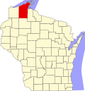
Grand View, Wisconsin

Last updated
Grand View, Wisconsin
Bayfield county IMG 1636 grand view.JPG
Photo:Erlend Bjørtvedt
USA Wisconsin location map.svg
Red pog.svg
Grand
View
Coordinates: 46°22′03″N91°06′30″W / 46.36750°N 91.10833°W / 46.36750; -91.10833 Coordinates: 46°22′03″N91°06′30″W / 46.36750°N 91.10833°W / 46.36750; -91.10833
Country United States
State Wisconsin
County Bayfield
Town Grandview
Area
  Total0.740 sq mi (1.92 km2)
  Land0.740 sq mi (1.92 km2)
  Water0 sq mi (0 km2)
Elevation
1,050 ft (320 m)
Population
 (2010)
  Total163
  Density220/sq mi (85/km2)
Time zone UTC-6 (Central (CST))
  Summer (DST) UTC-5 (CDT)
ZIP code
54839
Area code(s) 715 and 534
GNIS feature ID1579348 [1]

Grand View (also Grandview,Pratt) is an unincorporated, census-designated place located in the town of Grandview, Bayfield County, Wisconsin, United States.

Contents

U.S. Highway 63 serves as a main route in the community. Grand View is located 23 miles southwest of the city of Ashland; and 34 miles northeast of the city of Hayward.

Grand View has a post office with ZIP code 54839. [2] As of the 2010 census, its population is 163. [3]

History

A post office was established as Grandview in 1900; the spelling was changed to Grand View in 1970. [4] The community was named from the scenery. [5]

Notable people

Related Research Articles

Benoit is an unincorporated community in the towns of Keystone and Mason, Bayfield County, Wisconsin, United States. It is along County Highway F. Benoit is 13 miles southwest of the city of Ashland. Nearby is the junction of U.S. Highway 2 and U.S. Highway 63.

<span class="mw-page-title-main">Chili, Wisconsin</span> Census-designated place in Wisconsin, United States

Chili is an unincorporated census-designated place in the Town of Fremont in Clark County, Wisconsin, United States. Chili is west-southwest of Marshfield. Chili has a post office with ZIP code 54420. As of the 2010 census, its population was 226.

<span class="mw-page-title-main">Summit Lake, Wisconsin</span> Census-designated place in Wisconsin, United States

Summit Lake is an unincorporated community and census-designated place (CDP) in Langlade County, Wisconsin, United States. Summit Lake is located along U.S. Route 45 17 miles (27 km) north of Antigo, in the towns of Upham and Elcho. Summit Lake has a post office with ZIP code 54485. As of the 2010 census its population was 144.

Iron River is an unincorporated, census-designated place located in the town of Iron River, Bayfield County, Wisconsin, United States.

Cable is an unincorporated, census-designated place located in the town of Cable, Bayfield County, Wisconsin, United States.

Drummond is an unincorporated, census-designated place located in the town of Drummond, Bayfield County, Wisconsin, United States.

<span class="mw-page-title-main">Mercer (CDP), Wisconsin</span> Census-designated place in Wisconsin, United States

Mercer is an unincorporated census-designated place located in the town of Mercer, Iron County, Wisconsin, United States. Mercer is located on US Highway 51 20.5 miles (33.0 km) south-southeast of Hurley. Mercer has a post office with ZIP code 54547. As of the 2010 census, its population is 516.

<span class="mw-page-title-main">Saxon (CDP), Wisconsin</span> Census-designated place in Wisconsin, United States

Saxon is an unincorporated census-designated place located in the town of Saxon, Iron County, Wisconsin, United States. Saxon is located on Wisconsin Highway 122 11 miles (18 km) west-northwest of Hurley. Saxon has a post office with ZIP code 54559. As of the 2010 census, its population is 90.

<span class="mw-page-title-main">Newton (community), Manitowoc County, Wisconsin</span> Unincorporated community in Wisconsin, United States

Newton is an unincorporated community located in the town of Newton, Manitowoc County, Wisconsin, United States. Newton is located along Interstate 43 near Exit 144, 5.5 miles (8.9 km) east-northeast of Cleveland. Newton has a post office with ZIP code 53063.

Ringle is an unincorporated community located in the town of Ringle, Marathon County, Wisconsin, United States. Ringle is located near Wisconsin Highway 29 6 miles (9.7 km) east of Weston. Ringle has a post office and a Fire department, with a ZIP code of 54471.

Conover is an unincorporated community located in the town of Conover, Vilas County, Wisconsin, United States. Conover is located on U.S. Route 45 and Wisconsin Highway 32 9.5 miles (15.3 km) north of Eagle River. Conover has a post office with ZIP code 54519.

Lake Tomahawk is an unincorporated census-designated place located in the town of Lake Tomahawk, Oneida County, Wisconsin, United States. Lake Tomahawk is located on Wisconsin Highway 47 15 miles (24 km) northwest of Rhinelander. Lake Tomahawk has a post office with ZIP code 54539. As of the 2010 census, its population was 228.

<span class="mw-page-title-main">Three Lakes (CDP), Wisconsin</span> Census-designated place in Wisconsin, United States

Three Lakes is an unincorporated census-designated place located in the town of Three Lakes, Oneida County, Wisconsin, United States. Three Lakes is located at the junction of U.S. Route 45 and Wisconsin Highway 32 9 miles (14 km) south-southeast of Eagle River. Three Lakes has a post office with ZIP code 54562. As of the 2010 census, its population is 605.

Green Valley is an unincorporated census-designated place located in the town of Green Valley, Shawano County, Wisconsin, United States. Green Valley is 16.5 miles (26.6 km) east of Shawano. As of the 2010 census, its population was 133.

<span class="mw-page-title-main">Lakewood (CDP), Wisconsin</span> Census-designated place in Wisconsin, United States

Lakewood is an unincorporated census-designated place located in the town of Lakewood, Oconto County, Wisconsin, United States. Lakewood is located on Wisconsin Highway 32 22 miles (35 km) north-northwest of Suring. Lakewood has a post office with ZIP code 54138. As of the 2010 census, its population was 323.

Gordon is an unincorporated, census-designated place; located in the town of Gordon, Douglas County, Wisconsin, United States.

Hawthorne is an unincorporated community, located in the town of Hawthorne, Douglas County, Wisconsin, United States.

Barronett is an unincorporated census-designated place located in the town of Lakeland, Barron County, Wisconsin, United States. Barronett is located on U.S. Route 63 7.5 miles (12.1 km) north-northeast of Cumberland. Barronett has a post office with ZIP code 54813. As of the 2010 census, its population is 111.

Springbrook is an unincorporated community and census-designated place located in the town of Springbrook, Washburn County, Wisconsin, United States. Springbrook is located on U.S. Route 63 13 miles (21 km) northeast of Spooner. Springbrook has a post office with ZIP code 54875. Its population was 76 in 2017.

Trego is an unincorporated census-designated place located in the town of Trego, Washburn County, Wisconsin, United States.

References

  1. U.S. Geological Survey Geographic Names Information System: Grand View, Wisconsin
  2. ZIP Code Lookup
  3. "U.S. Census website". U.S. Census Bureau . Retrieved 4 April 2011.
  4. "Bayfield County". Jim Forte Postal History. Retrieved 4 April 2015.
  5. Chicago and North Western Railway Company (1908). A History of the Origin of the Place Names Connected with the Chicago & North Western and Chicago, St. Paul, Minneapolis & Omaha Railways. p. 177.
  6. 'Wisconsin Blue Book 1958,' Biographical Sketch of Vic C. Wallin, pg. 33