Sand Bay, Wisconsin

Last updated
Sand Bay, Wisconsin
USA Wisconsin location map.svg
Red pog.svg
Sand Bay
Usa edcp location map.svg
Red pog.svg
Sand Bay
Coordinates: 46°56′45″N90°53′28″W / 46.94583°N 90.89111°W / 46.94583; -90.89111 Coordinates: 46°56′45″N90°53′28″W / 46.94583°N 90.89111°W / 46.94583; -90.89111
Country Flag of the United States.svg  United States
State Flag of Wisconsin.svg  Wisconsin
County Bayfield
Town Russell
Elevation
190 m (630 ft)
Time zone UTC-6 (Central (CST))
  Summer (DST) UTC-5 (CDT)
Area code(s) 715 and 534
GNIS feature ID1573653 [1]

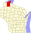
Sand Bay is an unincorporated community in the town of Russell, Bayfield County, Wisconsin, United States. The community is located within the Red Cliff Indian Reservation.

Unincorporated area Region of land not governed by own local government

In law, an unincorporated area is a region of land that is not governed by a local municipal corporation; similarly an unincorporated community is a settlement that is not governed by its own local municipal corporation, but rather is administered as part of larger administrative divisions, such as a township, parish, borough, county, city, canton, state, province or country. Occasionally, municipalities dissolve or disincorporate, which may happen if they become fiscally insolvent, and services become the responsibility of a higher administration. Widespread unincorporated communities and areas are a distinguishing feature of the United States and Canada. In most other countries of the world, there are either no unincorporated areas at all, or these are very rare; typically remote, outlying, sparsely populated or uninhabited areas.

Russell, Bayfield County, Wisconsin Town in Wisconsin, United States

Russell is a town in Bayfield County, Wisconsin, United States. The population was 1,279 at the 2010 census. The unincorporated communities of Red Cliff and Sand Bay are located in Russell. Red Cliff is the administrative center of the Red Cliff Band of Lake Superior Chippewa. York Island and Raspberry Island are part of the town.

Bayfield County, Wisconsin County in the United States

Bayfield County is a county located in the U.S. state of Wisconsin. As of the 2010 census, the population was 15,014. Its county seat is Washburn. The county was created in 1845 and organized in 1850.

Sand Bay is located on the South Shore of Lake Superior, 14 miles (23 km) north-northwest of the city of Bayfield. The community is also located 37 miles north-northwest of the city of Ashland.

The South Shore of Lake Superior stretches from Superior, Wisconsin, United States, at the southwestern end of the lake along the Upper Peninsula of Michigan to Sault Ste Marie, Michigan, United States, in the east.

Lake Superior largest of the Great Lakes of North America

Lake Superior, the largest of the Great Lakes of North America, is also the world's largest freshwater lake by surface area, and the third largest freshwater lake by volume. The lake is shared by the Canadian province of Ontario to the north, the U.S. state of Minnesota to the west, and Wisconsin and the Upper Peninsula of Michigan to the south. The farthest north and west of the Great Lakes chain, Superior has the highest elevation of all five great lakes and drains into the St. Mary's River.

Bayfield, Wisconsin City in Wisconsin, United States

Bayfield is a city in Bayfield County, Wisconsin, United States. The population was 530 at the 2010 census.

Related Research Articles

Ashland County, Wisconsin County in the United States

Ashland County is a county located in the U.S. state of Wisconsin. As of the 2010 census, the population was 16,157. Its county seat is Ashland. The county was formed on March 27, 1860, from La Pointe County.

Barksdale, Wisconsin Town in Wisconsin, United States

Barksdale is a town in Bayfield County, Wisconsin, United States. The population was 723 at the 2010 census. The unincorporated community of Barksdale is located in the town. The town was named by William G. Ramsay, the chief engineer for the DuPont Chemical Company, for Hamilton M. Barksdale, vice president of DuPont.

Bayfield (town), Wisconsin Town in Wisconsin, United States

Bayfield is a town in Bayfield County, Wisconsin, United States. The population was 680 at the 2010 census. The unincorporated communities of Pureair and Salmo are located in the town, as are Eagle Island and Sand Island of the Apostle Islands.

Apostle Islands National Lakeshore protected area in Wisconsin

The Apostle Islands National Lakeshore is a U.S. national lakeshore consisting of 21 islands and shoreline encompassing 69,372 acres (28,074 ha) on the northern tip of Wisconsin on the shore of Lake Superior. It is known for its collection of historic lighthouses, sandstone sea caves, a few old-growth remnant forests, and natural animal habitats. It is featured on the America the Beautiful Quarters series.

Apostle Islands

The Apostle Islands are a group of 22 islands in Lake Superior, off the Bayfield Peninsula in northern Wisconsin. The majority of the islands are located in Ashland County—only Sand, York, Eagle, and Raspberry Islands are located in Bayfield County. All the islands except for Madeline Island are part of the Apostle Islands National Lakeshore. The islands in Ashland County are all in the Town of La Pointe, except for Long Island, which is in the Town of Sanborn, while those in Bayfield County are in the Towns of Russell and Bayfield.

Chequamegon Bay

Chequamegon Bay is an inlet of Lake Superior, 12 miles (19 km) NE-SW and 2-6 miles (10 km) wide, in Ashland and Bayfield counties in the extreme northern part of Wisconsin.

Benoit, Wisconsin unincorporated community in Wisconsin, United States

Benoit is an unincorporated community in the towns of Keystone and Mason, Bayfield County, Wisconsin, United States. It is located two miles southwest of the intersection of U.S. Highway 2 and U.S. Highway 63; and located 14 miles southwest of the city of Ashland.

Red Cliff, Wisconsin Unincorporated community in Wisconsin, United States

Red Cliff, also known as Miskwaabikaang, is an unincorporated community in the town of Russell, Bayfield County, Wisconsin, United States. Red Cliff is the administrative center of the Red Cliff Band of Lake Superior Chippewa. The reservation population is 924, primarily Native American.

State Trunk Highway 13 is a Wisconsin state highway running north–south across northwest and central Wisconsin. WIS 13 serves as a major north–south route connecting the communities of Wisconsin Dells, Wisconsin Rapids, Marshfield and Ashland. Highway 13 is part of the Lake Superior Circle Tour from its northern/western terminus to Ashland at is eastern junction with U.S. Highway 2. The road also provides access to the Apostle Islands National Lakeshore off the Lake Superior shoreline at Bayfield. The highway is two-lane surface road with the exception of various urban multilane road sections.

Herbster, Wisconsin Census-designated place in Wisconsin, United States

Herbster is a census-designated place (CDP) in the Town of Clover in Bayfield County, Wisconsin, United States, located on the south shore of Lake Superior. Herbster is 7 miles (11 km) east of Port Wing and 8 miles (13 km) west of Cornucopia on Wisconsin Highway 13, the main route through the community. The primary north/south route is by Lenawee Road, leading from Lake Superior to the Chequamegon National Forest. As of the 2010 census, its population was 104. Herbster has an area of 5.572 square miles (14.43 km2), all of it land.

Sand Island (Wisconsin)

Sand Island is one of the Apostle Islands, in northern Wisconsin, in Lake Superior, and is part of the Apostle Islands National Lakeshore. It is located in the Town of Bayfield in Bayfield County. The Sand Island Light, Hokenson Fishing Dock, the Sevona Cabin, the Shaw Farm and the West Bay Club are located on the island. There is another Sand Island Lake Chippewa in Sawyer County, Wisconsin.

Grand View, Wisconsin Census-designated place in Wisconsin, United States

Grand View is an unincorporated, census-designated place located in the town of Grandview, Bayfield County, Wisconsin, United States.

Salmo, Wisconsin Unincorporated community in Wisconsin, United States

Salmo is an unincorporated community in Bayfield County, Wisconsin, United States.

Drummond (CDP), Wisconsin Census-designated place in Wisconsin, United States

Drummond is an unincorporated, census-designated place located in the town of Drummond, Bayfield County, Wisconsin, United States.

Namekagon, Wisconsin Unincorporated community in Wisconsin, United States

Namekagon is an unincorporated community in the town of Namakagon, Bayfield County, Wisconsin, United States. Namekagon is located on the eastern shore of Garden Lake; it is 7.5 miles (12.1 km) west-northwest of Clam Lake, 25 miles (40 km) northeast of Hayward, and 27 miles (43 km) south-southwest of Ashland.

Bark Point, Wisconsin unincorporated community in Wisconsin, United States

Bark Point is an unincorporated community in the town of Clover, Bayfield County, Wisconsin, United States. Bark Point is located on Lake Superior at the tip of a landmass also called Bark Point, 5 miles (8.0 km) northeast of Herbster and 18 miles (29 km) west-northwest of Bayfield.

Oulu (community), Wisconsin Unincorporated community in Wisconsin, United States

Oulu is an unincorporated community in the town of Oulu, Bayfield County, Wisconsin, United States. Oulu is located at the junction of County Highways B and FF 7.5 miles (12.1 km) northwest of Iron River.

Siskiwit Lake is a small eutrophic lake on the Bayfield Peninsula in Bayfield County in northern Wisconsin in the United States. The lake is located about 4.5 miles (7.2 km) south of Siskiwit Bay, an arm of Lake Superior, and about 2 miles (3.2 km) north of the northern boundary of Chequamegon National Forest. Duluth-Superior is about 48 miles (77 km) to the west. Parts of the small town of Bell border the lake, and there are several houses and vacation cabins on the lake, most on the north shore. The nearest major road, Wisconsin Highway 13, is about 3.5 miles (5.6 km) to the north, and the nearest large town, Washburn, is about 14 miles (23 km) to the southeast, down County Highway C.

References