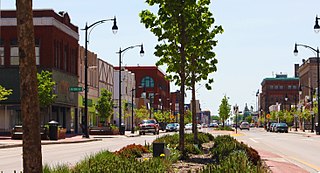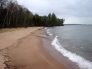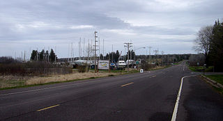
Vilas County is a county in the state of Wisconsin, United States. As of the 2010 census, the population was 21,430. Its county seat is Eagle River.

Bayfield County is a county located in the U.S. state of Wisconsin. As of the 2010 census, the population was 15,014. Its county seat is Washburn. The county was created in 1845 and organized in 1850.

Clover is a town in Bayfield County, Wisconsin, United States. The population was 223 at the 2010 census. The unincorporated communities of Bark Point and Herbster are located in the town.

Port Wing is a town in Bayfield County, Wisconsin, United States. The population was 368 at the 2010 census. The unincorporated community of Port Wing is located in the town.

Bayfield is a town in Bayfield County, Wisconsin, United States. The population was 680 at the 2010 census. The unincorporated communities of Pureair and Salmo are located in the town, as are Eagle Island and Sand Island of the Apostle Islands.

Superior is a city in, and the county seat of, Douglas County in the state of Wisconsin. The population was 27,244 at the 2010 census. Located at the junction of U.S. Highway 2 and U.S. Highway 53, it is immediately north of, and adjacent to, both the Village of Superior and the Town of Superior. Its neighborhoods include Billings Park, North End, South Superior, Central Park, East End, Allouez, and Itasca. Billings Park, South Superior, East End, and North End each have small business districts.

Bayfield is a city in Bayfield County, Wisconsin, United States. The population was 487 at the 2010 census.

The Apostle Islands National Lakeshore is a U.S. national lakeshore consisting of 21 islands and shoreline encompassing 69,372 acres (28,074 ha) on the northern tip of Wisconsin on the shore of Lake Superior. It is known for its collection of historic lighthouses, sandstone sea caves, a few old-growth remnant forests, and natural animal habitats. It is featured on the America the Beautiful Quarters series.

Cornucopia is an unincorporated census-designated place in the town of Bell in northern Bayfield County, Wisconsin, United States. It is situated on Lake Superior at the northern end of the Bayfield Peninsula. It is along Wisconsin Highway 13 and County Highway C. As of the 2010 census, its population was 98. The community borders the lake at Siskiwit Bay, between Roman's Point and Mawikwe Point. It is near a mainland portion of the Apostle Islands National Lakeshore, which features the Mawikwe Bay Sea Caves.

In the U.S. state of Wisconsin, the Lake Superior Lowland, also known as the Superior Coastal Plain, is a geographical region located in the far northern part of the state bordering Lake Superior. It covers about 1,250 square miles (3,200 km2), and does not extend beyond 20 miles (32 km) from the Lake Superior shore.

Red Cliff, also known as Miskwaabikaang, is an unincorporated community in the town of Russell, Bayfield County, Wisconsin, United States. Red Cliff is the administrative center of the Red Cliff Band of Lake Superior Chippewa. The reservation population is 924, primarily Native American.
State Trunk Highway 13 is a Wisconsin state highway running north–south across northwest and central Wisconsin. WIS 13 serves as a major north–south route connecting the communities of Wisconsin Dells, Wisconsin Rapids, Marshfield and Ashland. Highway 13 is part of the Lake Superior Circle Tour from its northern/western terminus to Ashland at is eastern junction with U.S. Highway 2. The road also provides access to the Apostle Islands National Lakeshore off the Lake Superior shoreline at Bayfield. The highway is two-lane surface road with the exception of various urban multilane road sections.
Francis K. (Frank) Koehn is an American activist and politician in Northern Wisconsin. He was the first Green Party candidate to be elected to office in the United States when he was elected Bayfield County supervisor on the Lake Superior Greens ticket in 1986. Koehn's 12 years on the Board of Supervisors (1986–1998) is one of the longest tenures in elected office for any Green Party member, and after Dave Conley is the second longest among Wisconsin Greens. Koehn has also been active in environmental, treaty rights and human rights causes including opposition to the Crandon and White Pine mines, support of Ojibwe treaty rights, and support for the proposed Seventh-Generation Amendment to the US Constitution. Koehn has paid particular efforts to preserving Lake Superior. In many of these causes, Koehn worked closely with Walter Bresette. He is considered a founding member of the Wisconsin Green Party and remains active in it. Koehn was also a schoolteacher in the South Shore Schools in Port Wing, Wisconsin until recently. He currently lives in Herbster, Wisconsin.

Port Wing is an unincorporated census-designated place in the town of Port Wing, Bayfield County, Wisconsin, United States. The community is along Wisconsin Highway 13 and Bayfield County Highway A. It is 30 miles (48 km) west of Bayfield. The Flag River enters Lake Superior at Port Wing's harbor.

The Bayfield Peninsula is a peninsula on Lake Superior. It is located in Bayfield County, Wisconsin USA. It is the northernmost region of mainland Wisconsin, with the south shore of Lake Superior to the west and the Chequamegon Bay to the east. The peninsula is part of the Lake Superior Lowland, though the interior southeast of Cornucopia and west of Bayfield has some higher ground including Pratt's Peak, Bayfield County's second-highest point. Highway 13 runs around the peninsula along the Superior shoreline. The communities of Port Wing, Herbster, Cornucopia, Red Cliff, Bayfield, Washburn, and Ashland lie on this stretch of highway. The interior of the peninsula is mostly the northern end of the Chequamegon National Forest, an area of jackpine growth known as the Moquah Barrens. The Apostle Islands surround the end of the peninsula.
US Highway 2 (US 2) is a part of the United States Numbered Highway System that runs from Everett, Washington, to St. Ignace, Michigan. In Wisconsin, the highway enters runs east–west across the northwestern part of the state and re-enters the state in the northeast part. It runs from the Richard I. Bong Memorial Bridge over the Saint Louis Bay at Superior, where it enters from Minnesota, east to the Michigan state line near Hurley. Further east, US 2 re-enters Wisconsin from Michigan in Florence County and briefly traverses that county before re-entering Michigan. US 2 is a Wisconsin Corridors 2020 Connecting route east of its concurrency with US 53. The section concurrent with US 53 is a Wisconsin Corridors 2020 Backbone route.
South Shore School District is located in Port Wing, Wisconsin and serves students in grades Pre-K through 12. It is located on School Road and Washington Avenue. The name South Shore was suggested in 1942 by Alice Okkonen, an elementary school teacher from Herbster, Wisconsin.

Bark Point is an unincorporated community in the town of Clover, Bayfield County, Wisconsin, United States. Bark Point is located on Lake Superior at the tip of a landmass also called Bark Point, 5 miles (8.0 km) northeast of Herbster and 18 miles (29 km) west-northwest of Bayfield.
Siskiwit Lake is a small eutrophic lake on the Bayfield Peninsula in Bayfield County in northern Wisconsin in the United States. The lake is located about 4.5 miles (7.2 km) south of Siskiwit Bay, an arm of Lake Superior, and about 2 miles (3.2 km) north of the northern boundary of Chequamegon National Forest. Duluth-Superior is about 48 miles (77 km) to the west. Parts of the small town of Bell border the lake, and there are several houses and vacation cabins on the lake, most on the north shore. The nearest major road, Wisconsin Highway 13, is about 3.5 miles (5.6 km) to the north, and the nearest large town, Washburn, is about 14 miles (23 km) to the southeast, down County Highway C.


