Mason, Wisconsin

Last updated
Mason, Wisconsin
Mason Wisconsin Depot.jpg
The Mason Depot, home of the Mason Area Historical Society
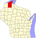
Bayfield County Wisconsin Incorporated and Unincorporated areas Mason Highlighted.svg
Location of Mason in Bayfield County, Wisconsin.
Coordinates: 46°27′38″N91°6′11″W / 46.46056°N 91.10306°W / 46.46056; -91.10306 Coordinates: 46°27′38″N91°6′11″W / 46.46056°N 91.10306°W / 46.46056; -91.10306
Country Flag of the United States.svg  United States
State Flag of Wisconsin.svg  Wisconsin
County Bayfield
Area
[1]
  Total0.71 sq mi (1.85 km2)
  Land0.71 sq mi (1.85 km2)
  Water0.00 sq mi (0.00 km2)
Elevation
[2]
945 ft (288 m)
Population
 (2020) [3]
  Total101
  Density131.84/sq mi (50.89/km2)
Time zone UTC-6 (Central (CST))
  Summer (DST) UTC-5 (CDT)
ZIP code
54856
Area code(s) 715 and 534
FIPS code 55-49925 [4]
GNIS feature ID1569112 [2]

Mason is a village in Bayfield County, Wisconsin, United States. The population was 93 at the 2010 census. The village is located within the Town of Mason.

Contents

U.S. Highway 63 serves as a main route in the community.

History

A post office called Mason has been in operation since 1883. [5] The village's name honors Freemasonry. [6]

Geography

Mason is located at 46°26′1″N91°3′43″W / 46.43361°N 91.06194°W / 46.43361; -91.06194 (46.433678, -91.06204). [7]

According to the United States Census Bureau, the village has a total area of 0.71 square miles (1.84 km2), all of it land. [8]

Mason is located 17 miles southwest of the city of Ashland; and 41 miles northeast of the city of Hayward.

Demographics

Historical population
CensusPop.
1930 153
1940 152−0.7%
1950 140−7.9%
1960 100−28.6%
1970 11919.0%
1980 102−14.3%
1990 1020.0%
2000 72−29.4%
2010 9329.2%
2019 (est.)94 [9] 1.1%
U.S. Decennial Census [10]

2010 census

As of the census [3] of 2010, there were 93 people, 34 households, and 21 families living in the village. The population density was 131.0 inhabitants per square mile (50.6/km2). There were 43 housing units at an average density of 60.6 per square mile (23.4/km2). The racial makeup of the village was 81.7% White, 5.4% African American, 2.2% Native American, and 10.8% from two or more races. Hispanic or Latino of any race were 3.2% of the population.

There were 34 households, of which 41.2% had children under the age of 18 living with them, 44.1% were married couples living together, 11.8% had a female householder with no husband present, 5.9% had a male householder with no wife present, and 38.2% were non-families. 20.6% of all households were made up of individuals, and 14.7% had someone living alone who was 65 years of age or older. The average household size was 2.74 and the average family size was 2.90.

The median age in the village was 36.2 years. 28% of residents were under the age of 18; 8.5% were between the ages of 18 and 24; 22.6% were from 25 to 44; 28% were from 45 to 64; and 12.9% were 65 years of age or older. The gender makeup of the village was 50.5% male and 49.5% female.

2000 census

As of the census [4] of 2000, there were 72 people, 26 households, and 19 families living in the village. The population density was 141.8 people per square mile (54.5/km2). There were 35 housing units at an average density of 68.9 per square mile (26.5/km2). The racial makeup of the village was 87.50% White, 4.17% Native American, 4.17% Asian, and 4.17% from two or more races.

There were 26 households, out of which 30.8% had children under the age of 18 living with them, 69.2% were married couples living together, 7.7% had a female householder with no husband present, and 23.1% were non-families. 23.1% of all households were made up of individuals, and 7.7% had someone living alone who was 65 years of age or older. The average household size was 2.77 and the average family size was 3.30.

In the village, the population was spread out, with 31.9% under the age of 18, 4.2% from 18 to 24, 26.4% from 25 to 44, 20.8% from 45 to 64, and 16.7% who were 65 years of age or older. The median age was 37 years. For every 100 females, there were 100.0 males. For every 100 females age 18 and over, there were 96.0 males.

The median income for a household in the village was $32,917, and the median income for a family was $34,583. Males had a median income of $19,583 versus $13,125 for females. The per capita income for the village was $12,742. There were 15.4% of families and 30.6% of the population living below the poverty line, including 100.0% of under eighteens and none of those over 64.

Notable people

Related Research Articles

<span class="mw-page-title-main">Meadow Valley, California</span> Census-designated place in California, United States

Meadow Valley is a census-designated place (CDP) in Plumas County, California, United States. The population was 453 at the 2020 census, down from 464 at the 2010 census.

<span class="mw-page-title-main">Fussels Corner, Florida</span> Census-designated place in Florida, United States

Fussels Corner is a census-designated place (CDP) in Polk County, Florida, United States. The population was 5,313 at time of the 2000 census. It is part of the Lakeland–Winter Haven Metropolitan Statistical Area.

<span class="mw-page-title-main">Alsey, Illinois</span> Village in Illinois, United States

Alsey is a village in Scott County, Illinois, USA. The population was 246 at the 2000 census. It is part of the Jacksonville Micropolitan Statistical Area.

<span class="mw-page-title-main">Millhousen, Indiana</span> Town in Indiana, United States

Millhousen is a town in Marion Township, Decatur County, Indiana, United States. The population was 149 at the 2020 census. Millhousen is perhaps best known for being the home of the Immaculate Conception Church, one of only four Roman Catholic churches in Decatur County, and Stone's Family Restaurant, one of the best known restaurants in Decatur County.

<span class="mw-page-title-main">Wellsburg, Iowa</span> City in Iowa, United States

Wellsburg is a city in Grundy County, Iowa, United States. The population was 720 at the 2020 census, a slight increase from 716 in 2000. It is part of the Waterloo–Cedar Falls Metropolitan Statistical Area. The city is named for George Wells, an early settler in the region.

<span class="mw-page-title-main">New Castle, Kentucky</span> City in Kentucky, United States

New Castle is a home rule-class city in Henry County, Kentucky, in the United States. It is the seat of its county. As of the 2010 census the population was 912.

Beddington is a town in Washington County, Maine, United States. The population was 60 at the 2020 census. It is the third-smallest organized town in Maine after Frye Island and Frenchboro.

<span class="mw-page-title-main">Mays Chapel, Maryland</span> Census-designated place in Maryland, United States

Mays Chapel is an unincorporated community and census-designated place in Baltimore County, Maryland, United States. The population was 11,420 at the 2010 census.

<span class="mw-page-title-main">Fountain, Michigan</span> Village in Michigan, United States

Fountain is a village in Mason County in the U.S. state of Michigan. The population was 193 at the 2010 census. The village is within Sherman Township.

<span class="mw-page-title-main">Clinton, Minnesota</span> Village in Minnesota, United States

Clinton is a city in Big Stone County, Minnesota, United States. The city was named for New York Governor DeWitt Clinton. The population was 386 at the 2020 census.

<span class="mw-page-title-main">Mason City, Nebraska</span> Village in Nebraska, United States

Mason City is a village in Custer County, Nebraska, United States. The population was 171 at the 2010 census.

<span class="mw-page-title-main">Lyons, Ohio</span> Village in Ohio, United States

Lyons is a village in Fulton County, Ohio, United States. The population was 562 at the 2010 census.

<span class="mw-page-title-main">Liberty Center, Ohio</span> Village in Ohio, United States

Liberty Center is a village in Henry County, Ohio, United States. The population was 1,180 at the 2010 census.

<span class="mw-page-title-main">New Bavaria, Ohio</span> Village in Ohio, United States

New Bavaria is a village in Henry County, Ohio, United States. The population was 86 at the 2020 census.

<span class="mw-page-title-main">Rosita, Texas</span> CDP in Texas, United States

Rosita, formerly known as Rosita South, is a census-designated place (CDP) in Maverick County, Texas, United States. The population was 2,704 as of the 2010 census. The Kickapoo Indian Reservation of Texas is located within the community.

<span class="mw-page-title-main">Mason, West Virginia</span> Town in West Virginia, United States

Mason, also known as Mason City, is a town in Mason County, West Virginia, United States. The population was 865 at the 2020 census. It is part of the Point Pleasant, WV–OH Micropolitan Statistical Area.

<span class="mw-page-title-main">Deposit (village), New York</span> Village in New York, United States

Deposit is a village in Broome and Delaware counties in the U.S. state of New York. The population was 1,663 at the 2010 census.

<span class="mw-page-title-main">Shelter Island (CDP), New York</span> Hamlet and census-designated place in New York, United States

Shelter Island is a hamlet and census-designated place (CDP) within the Town of Shelter Island in Suffolk County, New York, United States. The population was 1,333 at the 2010 census. The village of Dering Harbor and the CDP of Shelter Island Heights make up the rest of the town.

Mason is a town in Bayfield County, Wisconsin, United States. The population was 315 at the 2010 census. The Village of Mason is located within the town. The unincorporated community of Sutherland is located partially in the town.

Plover is a town in Portage County, Wisconsin, United States. As of December 2020 the town reported on its website a population of 1,731.

References

  1. "2019 U.S. Gazetteer Files". United States Census Bureau. Retrieved August 7, 2020.
  2. 1 2 "US Board on Geographic Names". United States Geological Survey. 2007-10-25. Retrieved 2008-01-31.
  3. 1 2 "U.S. Census website". United States Census Bureau . Retrieved 2012-11-18.
  4. 1 2 "U.S. Census website". United States Census Bureau . Retrieved 2008-01-31.
  5. "Bayfield County". Jim Forte Postal History. Retrieved 4 April 2015.
  6. Chicago and North Western Railway Company (1908). A History of the Origin of the Place Names Connected with the Chicago & North Western and Chicago, St. Paul, Minneapolis & Omaha Railways. p. 183.
  7. "US Gazetteer files: 2010, 2000, and 1990". United States Census Bureau. 2011-02-12. Retrieved 2011-04-23.
  8. "US Gazetteer files 2010". United States Census Bureau. Archived from the original on 2012-01-25. Retrieved 2012-11-18.
  9. "Population and Housing Unit Estimates". United States Census Bureau. May 24, 2020. Retrieved May 27, 2020.
  10. "Census of Population and Housing". Census.gov. Retrieved June 4, 2015.
  11. 'The Biographical Dictionary of World War II General and Fleet Admirals: The US Armed Forces,' R. Manning Arcell, Christine Miller, Greenwood Press, Westport, Connecticut: 1996, pg. 615
  12. Members of the Assembly