Marked Tree, Arkansas | |
|---|---|
 | |
 Flag  Seal | |
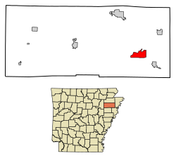 Location of Marked Tree in Poinsett County, Arkansas. | |
| Coordinates: 35°31′30″N90°25′31″W / 35.52500°N 90.42528°W [1] | |
| Country | United States |
| State | Arkansas |
| County | Poinsett |
| Area | |
• Total | 5.81 sq mi (15.05 km2) |
| • Land | 5.77 sq mi (14.95 km2) |
| • Water | 0.04 sq mi (0.10 km2) |
| Elevation | 203 ft (62 m) |
| Population (2020) | |
• Total | 2,286 |
• Estimate (2024) | 2,191 |
| • Density | 396.05/sq mi (152.92/km2) |
| Time zone | UTC-6 (Central (CST)) |
| • Summer (DST) | UTC-5 (CDT) |
| ZIP code | 72365 |
| Area code | 870 |
| FIPS code | 05-44210 |
| GNIS feature ID | 2405025 [1] |
Marked Tree is a city in Poinsett County, Arkansas, United States, along the St. Francis River, at the mouth of the Little River. The population was 2,286 at the 2020 census. It is included in the Jonesboro, Arkansas, metropolitan statistical area.
Contents
- History
- Geography
- Demographics
- 2020 census
- 2000 census
- Education
- Notable people
- See also
- References
- External links
Geologically, the area marks the southern end of the New Madrid Fault.[ citation needed ]
