Pyatt, Arkansas

Last updated
Pyatt, Arkansas
Marion County Arkansas Incorporated and Unincorporated areas Pyatt Highlighted 0557890.svg
Location in Marion County, Arkansas
Coordinates: 36°15′03″N92°50′40″W / 36.25083°N 92.84444°W / 36.25083; -92.84444
Country United States
State Arkansas
County Marion
Area
[1]
  Total1.28 sq mi (3.33 km2)
  Land1.26 sq mi (3.25 km2)
  Water0.03 sq mi (0.07 km2)
Elevation
[2]
742 ft (226 m)
Population
 (2020) [3]
  Total181
  Density144.11/sq mi (55.62/km2)
Time zone UTC-6 (Central (CST))
  Summer (DST) UTC-5 (CDT)
ZIP code
72672
Area code 870
FIPS code 05-57890
GNIS feature ID2407167 [2]
Website www.pyatt.net

Pyatt is a town in western Marion County, Arkansas, United States. The population was 181 at the 2020 census, [3] down from 221 in 2010.

Contents

Geography

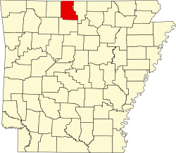
Pyatt is located in western Marion County in the valley of Crooked Creek, an east-flowing tributary of the White River.

U.S. Routes 412 and 62 pass through the southern part of the town, leading east 10 miles (16 km) to Yellville, the county seat, and west 17 miles (27 km) to Harrison.

According to the United States Census Bureau, Pyatt has a total area of 1.3 square miles (3.4 km2), of which 0.03 square miles (0.08 km2), or 2.18%, are water. [1]

List of highways

Demographics

Historical population
CensusPop.Note
1930 254
1940 224−11.8%
1950 25714.7%
1960 144−44.0%
1970 137−4.9%
1980 21758.4%
1990 185−14.7%
2000 25336.8%
2010 221−12.6%
2020 181−18.1%
U.S. Decennial Census [4]

As of the census [5] of 2000, there were 253 people, 97 households, and 62 families residing in the town. The population density was 198.3 inhabitants per square mile (76.6/km2). There were 119 housing units at an average density of 93.3 per square mile (36.0/km2). The racial makeup of the town was 98.81% White, 0.40% Black or African American, 0.40% Native American and 0.40% Pacific Islander. 0.40% of the population were Hispanic or Latino of any race.

There were 97 households, out of which 40.2% had children under the age of 18 living with them, 55.7% were married couples living together, 4.1% had a female householder with no husband present, and 35.1% were non-families. 34.0% of all households were made up of individuals, and 18.6% had someone living alone who was 65 years of age or older. The average household size was 2.61 and the average family size was 3.35.

In the town, the population was spread out, with 33.2% under the age of 18, 7.9% from 18 to 24, 28.9% from 25 to 44, 17.0% from 45 to 64, and 13.0% who were 65 years of age or older. The median age was 30 years. For every 100 females, there were 97.7 males. For every 100 females age 18 and over, there were 103.6 males.

The median income for a household in the town was $19,583, and the median income for a family was $26,250. Males had a median income of $22,321 versus $18,214 for females. The per capita income for the town was $8,633. About 10.5% of families and 16.7% of the population were below the poverty line, including 12.9% of those under the age of 18 and 20.7% of those 65 or over.

Education

Public education is available from the Ozark Mountain School District that includes Bruno–Pyatt High School.

On July 1, 2004, the former Bruno-Pyatt School District consolidated into the Ozark Mountain School District. [6]

Related Research Articles

<span class="mw-page-title-main">Sharp County, Arkansas</span> County in Arkansas, United States

Sharp County is a county located in the U.S. state of Arkansas. As of the 2020 census, the population was 17,271. The county seat is Ash Flat. The county was formed on July 18, 1868, and named for Ephraim Sharp, a state legislator from the area.

<span class="mw-page-title-main">Marion County, Arkansas</span> County in Arkansas, United States

Marion County is located in the Ozark Mountains in the U.S. state of Arkansas. The county is named for Francis Marion, the famous "Swamp Fox" of the Revolutionary War. Created as Arkansas's 35th county in 1836, Marion County is home to one incorporated town and four incorporated cities, including Yellville, the county seat. The county is also the site of numerous unincorporated communities and ghost towns. The county included part of what is now Searcy County, Arkansas, with many opposing to dividing them, which helped fueled the bloody Tutt-Everett War between 1844 and 1850.

<span class="mw-page-title-main">Johnson County, Arkansas</span> County in Arkansas, United States

Johnson County is a county located in the U.S. state of Arkansas. As of the 2020 census, the population was 25,749. The county seat is Clarksville. Johnson County is Arkansas's 30th county, formed on November 16, 1833, from a portion of Pope County and named for Benjamin Johnson, a Territorial Judge. It is an alcohol prohibition or dry county.

<span class="mw-page-title-main">Fulton County, Arkansas</span> County in Arkansas, United States

Fulton County is a county located in the U.S. state of Arkansas. As of the 2020 census, the population was 12,075. The county seat is Salem. Fulton County was formed on December 21, 1842, and named for William Fulton, the last governor of the Arkansas Territory. It is an alcohol prohibition or dry county.

<span class="mw-page-title-main">Franklin County, Arkansas</span> County in Arkansas, United States

Franklin County is a county in Arkansas. As of the 2020 census, the population was 17,097. The county has two county seats, Charleston and Ozark. The county was formed on December 19, 1837, and named for Benjamin Franklin, American statesman. Franklin County is a damp county, with alcohol sales allowed except in Prairie & Alix townships, and limits on liquor sales in the city of Branch.

<span class="mw-page-title-main">Benton County, Arkansas</span> County in Arkansas, United States

Benton County is a county within the Northwest Arkansas region with a culture, economy, and history that have transitioned from rural and agricultural to suburban and white collar since the growth of Walmart, which is headquartered in Benton County. Created as Arkansas's 35th county on September 30, 1836, Benton County contains thirteen incorporated municipalities, including Bentonville, the county seat, and Rogers, the most populous city. The county was named after Thomas Hart Benton, a U.S. Senator from Missouri influential in Arkansas statehood.

<span class="mw-page-title-main">Cotter, Arkansas</span> City in Arkansas, United States

Cotter is a city in Baxter County, Arkansas, United States. The population was 886 at the 2020 census.

<span class="mw-page-title-main">Gateway, Arkansas</span> Town in Arkansas, United States

Gateway is a town in Benton County, Arkansas, United States. The population was 436 at the 2020 census, up from 405 in 2010. It is part of the Northwest Arkansas region. The town's name reflects its situation as the "gateway" to and from Arkansas.

<span class="mw-page-title-main">Everton, Arkansas</span> Town in Arkansas, United States

Everton is a town in Boone County, Arkansas, United States. The population was 133 at the 2010 census. It is part of the Harrison Micropolitan Statistical Area.

<span class="mw-page-title-main">Beaver, Arkansas</span> Town in Arkansas, United States

Beaver is a town in Carroll County, Arkansas, United States. As of the 2020 census it had a population of 67. The community is located on the White River at the western limits of Table Rock Lake deep in the Ozark Mountains. Located north of Eureka Springs, the small town has been featured in movies for its picturesque scenery. The town is known for the Beaver Bridge, a two-panel suspension bridge over the White River listed on the National Register of Historic Places.

<span class="mw-page-title-main">Denning, Arkansas</span> Town in Arkansas, United States

Denning is a town in Franklin County, Arkansas, United States. It is part of the Fort Smith, Arkansas-Oklahoma Metropolitan Statistical Area. The population was 314 at the 2010 census, up from 270 at the 2000 census.

<span class="mw-page-title-main">Viola, Arkansas</span> Town in Arkansas, United States

Viola is a town in Fulton County, Arkansas, United States. The population was 337 at the 2010 census, down from 381 in 2000.

<span class="mw-page-title-main">Hartman, Arkansas</span> City in Arkansas, United States

Hartman is a city in Johnson County, Arkansas, United States. The population was 519 at the 2010 census.

<span class="mw-page-title-main">Black Rock, Arkansas</span> City in Arkansas, United States

Black Rock is a city in Lawrence County, Arkansas, United States, along the Black River. The population was 662 at the 2010 census.

<span class="mw-page-title-main">Portia, Arkansas</span> Town in Arkansas, United States

Portia is a town in Lawrence County, Arkansas, United States. The population was 437 at the 2010 census.

<span class="mw-page-title-main">Ravenden, Arkansas</span> Town in Arkansas, United States

Ravenden is a town in Lawrence County, Arkansas, United States. The population was 470 at the 2010 census. The town is in the valley of the Spring River along U.S. Highway 63 and the Burlington-Northern Railroad.

<span class="mw-page-title-main">Smithville, Arkansas</span> Town in Arkansas, United States

Smithville is a town in Lawrence County, Arkansas, United States. The population was 78 at the 2010 census.

<span class="mw-page-title-main">Hindsville, Arkansas</span> Town in Arkansas, United States

Hindsville is a town in Madison County, Arkansas, United States. The population was 90 at the 2020 census. It is part of the Northwest Arkansas region.

<span class="mw-page-title-main">Yellville, Arkansas</span> City in Arkansas, United States

Yellville is a city and county seat in Marion County, Arkansas, United States. Yellville is located in the Ozark Mountains along the banks of Crooked Creek, and neighbors the small town of Summit to the north. The population was 1,178 at the 2020 census. The town's original name is preserved in the Shawnee Town Branch, a local creek. The town also holds an annual Turkey Trot Festival.

<span class="mw-page-title-main">Pindall, Arkansas</span> Town in Arkansas, United States

Pindall is a town in Searcy County, Arkansas, United States. The population was 112 at the 2010 census. The town is said to be named for Governor Xenophon Overton Pindall.

References

  1. 1 2 "2021 U.S. Gazetteer Files: Arkansas". United States Census Bureau. Retrieved May 31, 2022.
  2. 1 2 U.S. Geological Survey Geographic Names Information System: Pyatt, Arkansas
  3. 1 2 "P1. Race – Pyatt town, Arkansas: 2020 DEC Redistricting Data (PL 94-171)". U.S. Census Bureau. Retrieved May 31, 2022.
  4. "Census of Population and Housing". Census.gov. Retrieved June 4, 2015.
  5. "U.S. Census website". United States Census Bureau . Retrieved 2008-01-31.
  6. "ConsolidationAnnex_from_1983.xls." Arkansas Department of Education. Retrieved on May 23, 2018.