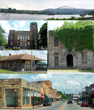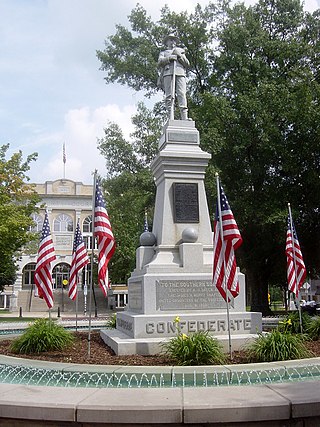
Franklin County is a county in Arkansas. As of the 2020 census, the population was 17,097. The county has two county seats, Charleston and Ozark. The county was formed on December 19, 1837, and named for Benjamin Franklin, American statesman. Franklin County is a damp county, with alcohol sales allowed except in Prairie & Alix townships, and limits on liquor sales in the city of Branch.

Ozark is a city in Franklin County, Arkansas, United States and one of the county's two seats of government. The community is located along the Arkansas River in the Arkansas River Valley on the southern edge of the Ozark Mountains. As of the 2010 census it had a population of 3,684.

Fayetteville is the second-most populous city in the U.S. state of Arkansas, the county seat of Washington County, and the most populous city in Northwest Arkansas. The city had a population of 93,949 as of the 2020 census, which was estimated to have increased to 101,680 by 2023. The city is on the outskirts of the Boston Mountains, within the Ozarks. It was named after Fayetteville, Tennessee, from which many settlers had come, and was incorporated on November 3, 1836. Fayetteville is included in the three-county Fayetteville–Springdale–Rogers metropolitan statistical area, with 576,403 residents in 2020.

Arkansas Highway 10 is an east–west state highway in western Arkansas. The route runs 135.4 miles (217.9 km) from the Oklahoma state line east to Interstate 30 (I-30) in Little Rock, the state's capitol. The highway serves both the Fort Smith metropolitan area and the Little Rock – North Little Rock – Conway metropolitan area.

The Sycamore Historic District is a meandering area encompassing 99 acres (400,000 m2) of the land in and around the downtown of the DeKalb County, Illinois county seat, Sycamore. The area includes historic buildings and a number of historical and Victorian homes. Some significant structures are among those located within the Historic District including the DeKalb County Courthouse and the Sycamore Public Library. The district has been listed on the National Register of Historic Places since May 2, 1978.

U.S. Route 64 is a U.S. route running from Teec Nos Pos, Arizona east to Nags Head, North Carolina. In the U.S. state of Arkansas, the route runs 246.35 miles (396.46 km) from the Oklahoma border in Fort Smith east to the Tennessee border in Memphis. The route passes through several cities and towns, including Fort Smith, Clarksville, Russellville, Conway, Searcy, and West Memphis. US 64 runs parallel to Interstate 40 (I-40) until Conway, when I-40 takes a more southerly route.

Arkansas Highway 14 is a designation for two state highways in Arkansas. One segment of 208.12 miles (334.94 km) begins east of Table Rock Lake and runs east to Interstate 555 (I-555) at Payneway. A second segment of 19.23 miles (30.95 km) runs from Highway 140 in Lepanto east to Mississippi CR S449 at Golden Lake. Segments of the highway are part of two Arkansas Scenic Byways: Sylamore Scenic Byway in the Ozark National Forest and the Crowley's Ridge Parkway atop Crowley's Ridge.

Highway 201 is a north–south state highway in Baxter County, Arkansas. The route runs 24.05 miles (38.70 km) from Arkansas Highway 341 in Salesville north to the Missouri state line through Mountain Home, the county seat of Baxter County.

Highway 215 is a designation for three north–south state highways in northwest Arkansas. A southern route of 8.80 miles (14.16 km) runs north from Franklin County Road 31 and Franklin County Road 221 (CR 31/CR 221) at Dahoma to Highway 96 near the Arkansas River. A second route of 15.94 miles (25.65 km) begins at US Route 64/Highway 917 (US 64/AR 917) in Mulberry and runs north to CR 77/CR 102 in the Ozark National Forest. A third segment of 16.44 miles (26.46 km) begins at Highway 23 at Cass and runs north to Johnson CR 36 at Oark.

Arkansas Highway 219 is a designation for two state highways in Franklin County, Arkansas. The southern segment of 1.50 miles (2.41 km) runs from Youth with a Mission Ozarks northeast to Ozark. A northern segment of 10.88 miles (17.51 km) runs from U.S. Route 64 (US 64) through Ozark northeast to the Missouri state line.

Sixteen special routes of U.S. Route 62 currently exist. Seven of them lie within the state of Arkansas. Three existed in the past but have since been decommissioned.

A total of eight special routes of U.S. Route 65 exist, divided between the U.S. states of Arkansas and Missouri. Currently, they are all business loops, although a spur route in Pine Bluff, Arkansas and bypass routes in Baton Rouge, Louisiana and Springfield, Missouri both existed in the past.

Highway 95 is a designation for a north–south state highway in north central Arkansas. The route runs 49.40 miles (79.50 km) runs north from US Highway 64 and Highway 113 in Morrilton north to Highway 330.

Twelve special routes of U.S. Route 63 currently exist. Arkansas and Missouri each contain five, with two in Iowa. There are also five former routings that have been removed from the system.

The Fayetteville Historic Square, in Fayetteville, Arkansas, includes the original Fayetteville post office, the Old Bank of Fayetteville Building, the Lewis Brothers Building, the Mrs. Young Building, and the Guisinger Building. These buildings are listed in the National Register of Historic Places. There are several more recent buildings located on the Square.

Highway 255 is a designation for two north–south state highways in Sebastian County. An eastern route of 7.37 miles (11.86 km) runs north from Highway 22 through Lavaca to terminate at Highway 22 in Central City. A second route of 17.21 miles (27.70 km) begins at Highway 22 in Barling and runs to US Route 64/U.S. Route 71B (US 64/US 71B).

Downtown Bentonville is the historic business district of Bentonville, Arkansas. The region is the location of Walmart Home Office; city and county government facilities; and most of Bentonville's tourist attractions for the city and contains many historically and architecturally significant properties. Downtown measures approximately 1.5 square miles (3.9 km2) and is defined as the region between Tiger Boulevard to the north, Highway 102 (AR 102) to the south, Walton Boulevard to the west and J Street to the east. Similar to other central business districts in the US, Downtown has recently undergone a transformation that included the construction of new condos and lofts, renovation of historic buildings, and arrival of new residents and businesses. Upon opening of Crystal Bridges Museum of American Art the increased tourist traffic related to the museum has made Downtown Bentonville one of the state's most popular tourism destinations.

The Newport Downtown Historic District encompasses the 19th century heart of Newport, New Hampshire, the county seat of Sullivan County. The district includes the major commercial and civic buildings which line Main Street between Depot Street and the Sugar River. The district was listed on the National Register of Historic Places in 1985.

The DeQueen Commercial Historic District encompasses part of the commercial heart of downtown De Queen, Arkansas. The district is centered on the block containing the Sevier County Courthouse, a three-story brick Colonial Revival structure built in 1930. It includes buildings facing the courthouse square on West DeQueen Avenue, West Stilwell Avenue, and North Third Street, and extends an additional block eastward to North Second Street. This commercial heart of the city was developed mainly between 1900 and 1920, and includes 21 historically significant buildings. Notable among them is the former Hayes Hardware Building at 314 West DeQueen, built c. 1900, and the Bank of DeQueen at 221 West DeQueen, also built c. 1900.

The DeWitt Commercial Historic District encompasses part of the historic downtown of De Witt, Arkansas, the seat of the southern district of Arkansas County. It consists of roughly six square blocks, focused on Courthouse Square, location of the Southern District Courthouse. This area was platted out when De Witt was established as the new county seat of Arkansas County in 1854, replacing the Arkansas Post, which was not centrally located within the county after numerous other counties had been carved out of its territory. The city's growth remained modest until the arrival of the railroad in the 1890s, and saw most of its civic growth between then and the 1920s. The district includes 54 historically significant buildings, 32 of which face Courthouse Square. The oldest buildings in the district lie just north of Courthouse Square, either facing the square or in North Main or Gibson Streets.


