Red River of the South

Last updated
Red River
Rivière Rouge (former French name), Río Colorado (former Spanish name)
Redriverbonhamtx.jpg
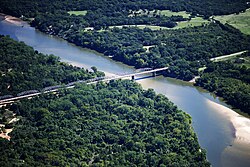
Red River looking east, north of Bonham, Texas: Texas is to the right, Oklahoma is on the left, and the border between the two states runs along the south (right) bank of the river.
Redrivermap1.jpg
Map of the Red River watershed
Native nameBah'hatteno (Caddo) [1]
Location
Country United States
States Texas, Oklahoma, Arkansas and Louisiana
Physical characteristics
Source 
  locationConfluence of the Prairie Dog Town Fork and Buck Creek, Harmon County, Oklahoma [2]
  coordinates 34°34′35″N99°57′54″W / 34.57639°N 99.96500°W / 34.57639; -99.96500
  elevation1,535 ft (468 m)[ citation needed ]
Mouth  
  location
Atchafalaya River
  coordinates
31°01′10″N91°44′52″W / 31.01944°N 91.74778°W / 31.01944; -91.74778
  elevation
30 ft (9.1 m)
Length1,360 mi (2,190 km)
Basin size65,595 sq mi (169,890 km2)
Discharge 
  locationmouth; max and min at Alexandria, LA
  average57,000 cu ft/s (1,600 m3/s)
  minimum1,472 cu ft/s (41.7 m3/s)
  maximum233,000 cu ft/s (6,600 m3/s)

The Red River, or sometimes the Red River of the South to differentiate it from the Red River in the north of the continent, is a major river in the Southern United States. [3] It was named for its reddish water color from passing through red-bed country in its watershed. [4] It is known as the Red River of the South to distinguish it from the Red River of the North, which flows between Minnesota and North Dakota into the Canadian province of Manitoba. Although once a tributary of the Mississippi River, the Red River is now a tributary of the Atchafalaya River, a distributary of the Mississippi that flows separately into the Gulf of Mexico. This confluence is connected to the Mississippi River by the Old River Control Structure.

Contents

The south bank of the Red River formed part of the US–Mexico border from the Adams–Onís Treaty (in force 1821) until the Texas Annexation and the Treaty of Guadalupe Hidalgo.

The Red River is the second-largest river basin in the southern Great Plains. [5] It rises in two branches in the Texas Panhandle and flows east, where it serves as the border between the states of Texas and Oklahoma. It forms a short border between Texas and Arkansas before entering Arkansas. It forms much of the eastern border of Miller County, Arkansas, turning south near Fulton and flowing into Louisiana, where it feeds the Atchafalaya River. The total length of the river is 1,360 miles (2,190 km), with a mean flow of over 57,000 cubic feet per second (1,600 m3/s) at the mouth.[ citation needed ]

Geography

Course

The Red River begins at the junction of Buck Creek and Prairie Dog Town Fork, in Harmon County, Oklahoma. [6] [2] [note 1]

Specialists have debated whether the North Fork or the Prairie Dog Town Fork is the true stem. [5] Because of a cartographic error, the land between the north and south forks were claimed by both the state of Texas and the United States federal government. In 1852, Randolph B. Marcy's expedition had followed the Prairie Dog Town Fork. [5] Originally called Greer County, Texas, the US Supreme Court ruled that it belonged to the United States, which at the time oversaw the Oklahoma Territory. That territory was later incorporated into the state of Oklahoma, whose southern border follows the south fork. Today, the southern Prairie Dog Town Fork is considered the main fork, though the North Fork is as long and normally has a greater water flow. [5]

The southern fork is generally considered the main stem of the Red River and about 120 miles (190 km) long. It is formed in Randall County, Texas, near the county seat of Canyon, by the confluence of Tierra Blanca Creek and intermittent Palo Duro Creek (not to be confused with another Palo Duro Creek 75 miles to the north, which drains into the North Canadian River). It turns and flows southeast through Palo Duro Canyon in Palo Duro Canyon State Park at an elevation of 3,440 feet (1,050 m), [5] and past Newlin, Texas, to cross the Oklahoma state line. About 2 miles south of Elmer, Oklahoma, the Salt Fork of the Red River joins from the north. These combined waters receive the North Fork Red River from the north about 10 mi (16 km) west-southwest of Frederick, Oklahoma to form the Red River proper.[ citation needed ]

Point bars, abandoned meander loops, oxbow lakes in Lafayette and Miller counties, Arkansas RedRiverMeandersArkansas1.jpg
Point bars, abandoned meander loops, oxbow lakes in Lafayette and Miller counties, Arkansas
State Highway No. 78 Bridge at the Red River between Oklahoma and Texas, photographed on the Oklahoma side State Highway 78 Bridge at the Red River.jpg
State Highway No. 78 Bridge at the Red River between Oklahoma and Texas, photographed on the Oklahoma side
Crossing the Red River at the Texas-Oklahoma border from I-35 HPIM2184.JPG
Crossing the Red River at the Texas–Oklahoma border from I-35
The Red River took a new channel near Natchitoches, Louisiana, and left behind Cane River Lake. Cane River Lake of the Red River, Natchitoches, LA IMG 1914.JPG
The Red River took a new channel near Natchitoches, Louisiana, and left behind Cane River Lake.

The combined river proceeds to follow a winding course east through one of the most arid parts of the Great Plains, receiving the Wichita River about 25 miles northeast of the city of Wichita Falls. Near Denison, the river exits the eastern end of Lake Texoma, a reservoir formed by the Denison Dam. The lake is also fed by the Washita River from the north. Beyond the dam it runs generally east towards Arkansas and receives Oklahoma's Muddy Boggy Creek on the left bank before turning southward near Texarkana.[ citation needed ]

Soon after, the waterway crosses south into Louisiana. The sister cities of Shreveport and Bossier City were developed on either bank of the river, as were the downriver cities of Alexandria and Pineville. After being joined from the north by the Black River (downstream name of the Ouachita River, its largest tributary) about 1.5 miles south of Acme, the river broadens into a complex network of marshlands west of the Mississippi River. Its waters eventually become a tributary of the Atchafalaya River [7] and flow generally southward into the Gulf of Mexico.

Tributaries

Tributaries include the Little Red River, Prairie Dog Town Fork Red River, Salt Fork Red River, North Fork Red River, Pease River, Washita River, Kiamichi River, Wichita River, Little Wichita River, Little River, Sulphur River, Bayou Brevelle, Loggy Bayou (through Lake Bistineau and Dorcheat Bayou) as well as the Ouachita River (also known as the Black River at that point) not far (at Acme, Louisiana) from the mouth.

Saltwater river

Salt beds in the Red River Little Red River Texas 2015.jpg
Salt beds in the Red River

The Red River is salty through tributaries above Lake Texoma. The saltiness is caused by a natural phenomenon that dates back to ancient times. About 250 million years ago, an inland sea blanketed parts of what is now those states. As time passed, that sea evaporated, leaving salt deposits – mostly sodium chloride. Rock and silt eventually buried the deposits, but the salt continues to leach through natural seeps in tributaries above Lake Texoma, sending as much as 3,450 tons of salt per day flowing down the Red River. [8] [9]

Watershed

The Red River's watershed covers 65,590 square miles (169,900 km2) [5] and is the southernmost major river system in the Great Plains. Its drainage basin is mostly in the states of Texas and Oklahoma, but also covers parts of New Mexico, Arkansas and Louisiana. Its basin is characterized by flat, fertile agricultural land, with only a few major cities. The drainage basin of the Red River is very arid and receives little precipitation. As a result, much of the river above the Texas–Oklahoma border is intermittent, and until the river is past its great bend south in Arkansas, the flow varies widely. Most of the agriculture in the basin is sustained by groundwater, which is recharged with rainfall and riverflow. The lower course of the river flows through a series of marshes and swamps, where its flow is dramatically moderated.[ citation needed ]

History

Native Americans

Native American cultures along the river were diverse, developing specialized adaptations to the many different environments. [5] Starting near the headwaters, the Plains division of the Lipan Apache dominated the western Red River area until the 18th century, when they were displaced by invading Comanche from the north. [5] The middle part of the Red River was dominated by the Wichita and Tonkawa. This area was prairie, where Native Americans constructed portable and temporary tepees for housing. They practiced limited farming and followed game in seasonal, nomadic hunting cycles. [5] By the time of European contact, the eastern Piney Woods of the lower river courses were dominated by the numerous historic tribes of the Caddo Confederacy. They found plentiful game and fish, and also had good land for cultivating staple crops. [5]

American exploration and settlement, 1806 onwards

Crossing the North Fork of the Red River near Granite, Oklahoma, 1921. Theb0771 - Flickr - NOAA Photo Library.jpg
Crossing the North Fork of the Red River near Granite, Oklahoma, 1921.
Pontoon bridge crossing Red River at Lake End, Louisiana in 1942 Louisiana - Lake End through Mansfield - NARA - 23940421 (cropped).jpg
Pontoon bridge crossing Red River at Lake End, Louisiana in 1942

In 1806, President Thomas Jefferson commissioned the Red River Expedition to explore parts of the new lands of the 1803 Louisiana Purchase by traveling up the Red River. Jefferson wrote that the river was "in truth, next to the Missouri, the most interesting water of the Mississippi", in a letter to explorer William Dunbar. [10] Having threaded the maze of bayous at the river's confluence, and the "Great Raft" of lodged driftwood, the expedition was stopped by the Spanish near present-day New Boston, Texas.

In 1806, Lieutenant Zebulon Pike, under orders to ascertain the source of the Red River, ascended the Arkansas River, made his way downstream on what turned out to be the Rio Grande, and was sent home by the Spanish authorities. A more successful exploration of the river's upper reaches to both its sources came with the 1852 expedition under Capt. Randolph Barnes Marcy, assisted by Brevet Capt. George B. McClellan. [11] (A decade later McClellan became an important general in the American Civil War.)

In April 1815, Captain Henry Miller Shreve was the first person to bring a steamboat, the Enterprise, up the Red River. Fulton and Livingston, who claimed the exclusive right to navigate Louisiana waters by steamboat, sued Shreve in the District Court of New Orleans. The judge ruled that the monopoly claimed by the plaintiffs was illegal. That decision, along with a similar outcome in Gibbons v. Ogden, freed navigation on every river, lake or harbor in the United States from interference by monopolies. [12]

When John Quincy Adams became Secretary of State in 1817, one of his highest priorities was to negotiate with Spain about the boundaries of the Louisiana Purchase. He negotiated with Luis de Onís, the Spanish Minister to the United States, and finally concluded the Adams–Onis Treaty, also known as the Treaty of 1819. The treaty defined the south bank of the river as the boundary between the United States and Spain, as of when it was surveyed and demarcated following 1819. That boundary continued to be recognized when Mexico gained its independence from Spain in 1821, and ongoingly when Texas became independent from Mexico in 1835-1836. It remained an official boundary [12] until the United States Congress consented in October 2000 to the Red River Boundary Compact adopted in 1999 by the states of Oklahoma and Texas. This set the jurisdictional boundary between these states at the vegetation line on the south bank, but left title of adjacent property owners at the south bank. (The Red River actively meanders, as shown by a comparison of maps of the political boundaries defined by the river's course decades ago and currently.)

The Red River Campaign (March–May 1864) was fought along the Red River Valley in Louisiana during the American Civil War. It was part of a failed attempt by the Union to occupy eastern Texas. Confederate commander Richard Taylor succeeded in repelling an army under Nathaniel Banks that was three times bigger than his own.

In Louisiana, the area of present-day Natchitoches Parish was settled by French Creole and mixed-race Louisiana Creole people, starting before 1800. The Cane River National Heritage Area is recognized to mark this area of influence, with plantations and churches founded by Louisiana Creoles. Some of the sites are designated as destinations on the Louisiana African American Heritage Trail, established from 2008 onwards.

The area along the lower Red River of Grant Parish, Louisiana and neighboring parishes had a mixture of hill-country farms and cotton plantations.

Great Raft

Red River, Texas Red River Texas.jpg
Red River, Texas

In the early 19th century, settlers found that much of the river's length in Louisiana was unnavigable because of a collection of fallen trees that formed a Great Raft over 160 miles (260 km) long. In 1839, Captain Henry Miller Shreve began clearing the log jam, but it was not completely cleared until the 1870s, when dynamite became available. The river was thereafter navigable, but north of Natchitoches it was restricted to small craft. Removal of the raft further connected the Red and Atchafalaya rivers, accelerating the development of the Atchafalaya River channel. [7]

"Toll Bridge War"

The Red River Bridge War of 1931 was a boundary conflict between Oklahoma and Texas over an existing toll bridge and a new free bridge crossing the Red River. A joint project to build a free bridge between Durant, Oklahoma and Denison, Texas turned into a major dispute when the Governor of Texas blocked traffic from entering his state on the new bridge. The Red River Bridge Company of Texas owned the original toll bridge and had a dispute over its purchase deal. Oklahoma Governor William H. Murray sent the Oklahoma National Guard to reopen the bridge that July. Texas had to retreat when lawyers determined that Oklahoma had jurisdiction over both banks of the river. [13]

2015 Red River flood

In June 2015, the Red River flooded parts of northeast Texas, southwest Arkansas, southeast Oklahoma and Louisiana, from Denison Dam, to just south of Alexandria, Louisiana. [14]

Red River LA 2 Bridge, not the Jimmie Davis Bridge, atop the Red River between Bossier and Caddo parishes near Shreveport Revised bridge atop Red River in LA IMG 6337.jpg
Red River LA 2 Bridge, not the Jimmie Davis Bridge, atop the Red River between Bossier and Caddo parishes near Shreveport
Popular pedestrian walkway along the Red River in Alexandria, Louisiana Pedestrian walkway at Red River, Alexandria, LA IMG 4300.JPG
Popular pedestrian walkway along the Red River in Alexandria, Louisiana

Recreation

In 1943, Denison Dam was built on the Red River to form Lake Texoma, a large reservoir of 89,000 acres (360 km2), some 70 miles (110 km) north of Dallas. Other reservoirs on the river's tributaries serve as flood control.[ citation needed ]

See also

Notes

  1. According to the USGS. Previous versions of this article (source unclear) claim the stretch downstream of Buck Creek as a continuation of the Prairie Dog Town Fork, with the Red River beginning at Salt Fork.

Related Research Articles

<span class="mw-page-title-main">Sabine River (Texas–Louisiana)</span> River in the United States

The Sabine River is a 360-mile (580 km) long river in the Southern U.S. states of Texas and Louisiana, From the 32nd parallel north and downstream, it serves as part of the boundary between the two states and empties into Sabine Lake, an estuary of the Gulf of Mexico.

<span class="mw-page-title-main">Arkansas River</span> Major tributary of the Mississippi River, United States

The Arkansas River is a major tributary of the Mississippi River. It generally flows to the east and southeast as it traverses the U.S. states of Colorado, Kansas, Oklahoma, and Arkansas. The river's source basin lies in Colorado, specifically the Arkansas River Valley. The headwaters derive from the snowpack in the Sawatch and Mosquito mountain ranges. It flows east into Kansas and finally through Oklahoma and Arkansas, where it meets the Mississippi River.

<span class="mw-page-title-main">Ouachita River</span> River in Arkansas and Louisiana, United States

The Ouachita River is a 605-mile-long (974 km) river that runs south and east through the U.S. states of Arkansas and Louisiana, joining the Tensas River to form the Black River near Jonesville, Louisiana. It is the 25th-longest river in the United States.

<span class="mw-page-title-main">Atchafalaya River</span> Distributary of the Mississippi River in Louisiana, United States

The Atchafalaya River is a 137-mile-long (220 km) distributary of the Mississippi River and Red River in south central Louisiana in the United States. It flows south, just west of the Mississippi River, and is the fifth largest river in North America, by discharge. The name Atchafalaya comes from Choctaw for 'long river', from hachcha, 'river', and falaya, 'long'.

<span class="mw-page-title-main">Canadian River</span> Major tributary of the Arkansas River

The Canadian River is the longest tributary of the Arkansas River in the United States. It is about 1,026 miles (1,651 km) long, starting in Colorado and traveling through New Mexico, the Texas Panhandle, and Oklahoma. The drainage area is about 47,700 square miles (124,000 km2).

<span class="mw-page-title-main">Lake Texoma</span> Man-made lake on Red river in Texas

Lake Texoma is one of the largest reservoirs in the United States, the 12th-largest US Army Corps of Engineers' (USACE) lake, and the largest in USACE Tulsa District. Lake Texoma is formed by Denison Dam on the Red River in Bryan County, Oklahoma, and Grayson County, Texas, about 726 miles (1,168 km) upstream from the mouth of the river. It is located at the confluence of the Red and Washita Rivers. The project was completed in 1944. The damsite is about 5 miles (8.0 km) northwest of Denison, Texas, and 15 miles (24 km) southwest of Durant, Oklahoma. Lake Texoma is the most developed and most popular lake within the USACE Tulsa District, attracting around 6 million visitors a year. Oklahoma has more of the lake within its boundaries than Texas.

<span class="mw-page-title-main">Texoma</span> Region

Texoma is an interstate region in the United States, split between Oklahoma and Texas. The name is a portmanteau of Texas and Oklahoma. Businesses use the term in their names to describe their intended service area. This includes 8 counties with a population estimate of 319,455.

<span class="mw-page-title-main">Kiamichi River</span> River in Oklahoma, United States

The Kiamichi River is a river in southeastern Oklahoma, United States of America. A tributary of the Red River of the South, its headwaters rise on Pine Mountain in the Ouachita Mountains near the Arkansas border. From its source in Polk County, Arkansas, it flows approximately 177 miles (285 km) to its confluence with the Red River at Hugo, Oklahoma.

<span class="mw-page-title-main">Prairie Dog Town Fork Red River</span> River in the United States

Prairie Dog Town Fork Red River is a sandy-braided stream about 120 mi (193 km) long, formed at the confluence of Palo Duro Creek and Tierra Blanca Creek, about 1.8 mi (2.9 km) northeast of Canyon in Randall County, Texas, and flowing east-southeastward to the Red River about 1 mi (2 km) east of the 100th meridian, 8 mi (13 km) south-southwest of Hollis, Oklahoma.

<span class="mw-page-title-main">Sulphur River</span> River in Texas and Arkansas in the United States

The Sulphur River is a 175-mile-long (282 km) river in northeast Texas and southwest Arkansas in the United States.

<span class="mw-page-title-main">Little River (Red River tributary)</span> River in Oklahoma and Arkansas, United States

The Little River is a tributary of the Red River, with a total length of 217 miles (349 km), 130 miles (210 km) within the Choctaw Indian Reservation in southeastern Oklahoma and 87 miles (140 km) in southwestern Arkansas in the United States. Via the Red, it is part of the watershed of the Mississippi River. Six large reservoirs impound the Little River and its tributaries. The drainage basin of the river totals 4,204 square miles (10,890 km2), 2,204 square miles (5,710 km2) in Oklahoma and 2,036 square miles (5,270 km2) in Arkansas. The Little River and its upper tributaries are popular for recreational canoeing and kayaking.

<span class="mw-page-title-main">Big Cypress Creek</span> River in the United States

Big Cypress Creek is an 86-mile-long (138 km) river in Texas. It is part of the Red River watershed, with its water eventually flowing to the Atchafalaya River through the Atchafalaya Basin and entering the Gulf of Mexico.

<span class="mw-page-title-main">North Fork Red River</span> River

The North Fork Red River, sometimes called simply the "North Fork", is a tributary of the Red River of the South about 271 mi (436 km) long, heading along the eastern Caprock Escarpment of the Llano Estacado about 11.4 mi (18.3 km) southwest of Pampa, Texas. Rising in Gray County, Texas, it terminates at the confluence with Prairie Dog Town Fork of the Red River at the Texas-Oklahoma border.

Muddy Boggy Creek, also known as the Muddy Boggy River, is a 175-mile-long (282 km) river in south central Oklahoma. The stream headwaters arise just east of Ada in Pontotoc County. It is a major tributary of the Red River in south central Oklahoma. Clear Boggy Creek is a major tributary which enters the Muddy Boggy at a location known as River Mile 24 in Choctaw County. The river is inhabited by over one hundred species of fish.

<span class="mw-page-title-main">Little Red River (Texas)</span> River

The Little Red River is an intermittent stream about 30 mi (48 km) long, formed at the confluence of the North Prong and South Prong Little Red River in Briscoe County, Texas, and flowing east-northeastward to join the Prairie Dog Town Fork Red River in Hall County, Texas.

References

  1. Caddo name. Meredith, Howard. "Caddo (Kadohadacho)." Archived 2010-07-19 at the Wayback Machine Oklahoma Historical Society's Encyclopedia of Oklahoma History and Culture. Retrieved 9 Sept 2012)
  2. 1 2 "Red River", Feature Details for ID 558278. 31 Dec 1981. https://edits.nationalmap.gov/apps/gaz-domestic/public/gaz-record/558728
  3. Tyson, Carl N. The Red River in Southwestern History. Norman: University of Oklahoma Press, 1981. ISBN   0-8061-1659-5
  4. "Red River Basin". Texas Water Development Board. Retrieved 5 Dec 2020.
  5. 1 2 3 4 5 6 7 8 9 10 Benke, Arthur; Colbert Cushing (2005). River of North America. Academic Press. p. 1144. ISBN   9780120882533.
  6. U.S. Geological Survey, 1985, USGS 1:24000-scale Quadrangle for Hollis SW, OK 1985: U.S. Geological Survey. https://www.sciencebase.gov/catalog/item/5a8a481ee4b00f54eb3fad49
  7. 1 2 Piazza, Bryan P (2014). The Atchafalaya River Basin: History and Ecology of an American Wetland. Texas A&M University Press. ISBN   978-1-62349-039-3.
  8. Malewitz, Jim (21 November 2013). "Communities Along Red River Seek Feds' Help". The Texas Tribune. Retrieved 20 May 2019.
  9. "U.S. Geological Survey Fact Sheet 170-97". USGS. 1997. Retrieved 20 May 2019.
  10. Jefferson to Dunbar, 25 May 1805, quoted in T. Lindsay Baker, ed., The Texas Red River country: the official surveys of the headwaters, 1876, 1998: "Foreword", v, and in D.L. Flores, "The Ecology of the Red River in 1806: Peter Custis and Early", The Southwestern Historical Quarterly 88,.1, (July 1984).
  11. R.B. Marcy, Exploration of the Red River of Louisiana: in the year 1852... with Reports on the Natural History of the Country, Washington, 1853.
  12. 1 2 Harbour, Emma Estill. "A Brief History of the Red River County since 1803", Chronicles of Oklahoma. Vol. 16. No. 1. March 1938. Archived 2006-12-08 at the Wayback Machine Retrieved September 7, 2013.
  13. Rusty Williams, The Red River Bridge War: A Texas-Oklahoma Border Battle (Texas A&M University Press, 2016).
  14. Fuller, Bill (June 11, 2015). "With homes underwater in Louisiana, recovery teams head out". MSN. AP. Retrieved 20 May 2019.
  15. "Red River of the South". Bridgehunter.com. Retrieved 2017-01-07.
Geology