Pineville | |
---|---|
![]() | |
![]() Location of Pineville in Rapides Parish, Louisiana. | |
![]() Location of Louisiana in the United States | |
Coordinates: 31°20′20″N92°24′45″W / 31.33889°N 92.41250°W | |
Country | United States |
State | Louisiana |
Parish | Rapides |
Government | |
• Mayor | Rich Dupree (R) |
Area | |
• Total | 13.14 sq mi (34.04 km2) |
• Land | 12.62 sq mi (32.68 km2) |
• Water | 0.52 sq mi (1.36 km2) |
Elevation | 118 ft (36 m) |
Population (2020) | |
• Total | 14,384 |
• Rank | RA: 2nd |
• Density | 1,139.96/sq mi (440.15/km2) |
Time zone | UTC-6 (CST) |
• Summer (DST) | UTC-5 (CDT) |
ZIP code | 71360 [2] |
FIPS code | 22-60530 |
Website | City of Pineville |
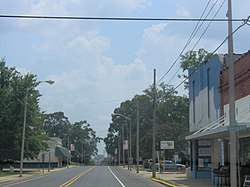
Pineville is a city in Rapides Parish, Louisiana, United States. It is located across the Red River from the larger Alexandria, and is part of the Alexandria Metropolitan Statistical Area. The population was 14,555 at the 2010 census. It had been 13,829 in 2000; population hence grew by 5 percent over the preceding decade. [3]
The Central Louisiana State Hospital, the Pinecrest Supports and Services Center, the Huey P. Long Memorial Hospital (closed), the Alexandria Veterans Administration Medical Center, and the Alexandria National Cemetery are all located in Pineville. The city is also home to several large non-government employers including Baker Manufacturing, Procter & Gamble, and Crest Industries.
Louisiana State University was founded by the Louisiana General Assembly in 1853. It was founded under the name Louisiana State Seminary of Learning & Military Academy and was located near Pineville. The first academic session began on January 2, 1860, with General William Tecumseh Sherman of Ohio as superintendent. [4]
Pineville was historically a "dry" city, with no alcohol legally available in the community. In a referendum held in the 1980s, voters continued to support a ban on alcohol. Mayor Clarence Fields, who took office in 1999, supported holding another referendum to permit the sale of liquor in restaurants. In a special election in 2013, voters approved liquor sales in restaurants. [5]
According to the United States Census Bureau, the city has a total area of 12.1 square miles (31.3 km2), of which 11.5 square miles (29.7 km2) is land and 0.6 square mile (1.6 km2) (4.97%) is water.
This climatic region is typified by large seasonal temperature differences, with warm to hot and humid summers and mild winters. According to the Köppen Climate Classification system, Pineville has a humid subtropical climate, abbreviated "Cfa" on climate maps. [6]
Climate data for Pineville, Louisiana | |||||||||||||
---|---|---|---|---|---|---|---|---|---|---|---|---|---|
Month | Jan | Feb | Mar | Apr | May | Jun | Jul | Aug | Sep | Oct | Nov | Dec | Year |
Mean daily maximum °F (°C) | 59 (15) | 63 (17) | 70 (21) | 77 (25) | 85 (29) | 90 (32) | 93 (34) | 93 (34) | 89 (32) | 79 (26) | 69 (21) | 60 (16) | 77 (25) |
Mean daily minimum °F (°C) | 38 (3) | 42 (6) | 49 (9) | 56 (13) | 65 (18) | 71 (22) | 74 (23) | 73 (23) | 68 (20) | 57 (14) | 48 (9) | 40 (4) | 54 (12) |
Average precipitation inches (mm) | 5.44 (138) | 5.53 (140) | 5.3 (130) | 4.55 (116) | 4.72 (120) | 5.38 (137) | 4.39 (112) | 4.11 (104) | 3.93 (100) | 5.27 (134) | 6.19 (157) | 6.24 (158) | 61.05 (1,546) |
Source: Accuweather [7] |
Census | Pop. | Note | %± |
---|---|---|---|
1860 | 393 | — | |
1870 | 414 | 5.3% | |
1880 | 763 | 84.3% | |
1890 | 540 | −29.2% | |
1900 | 617 | 14.3% | |
1910 | 1,212 | 96.4% | |
1920 | 2,188 | 80.5% | |
1930 | 3,612 | 65.1% | |
1940 | 4,297 | 19.0% | |
1950 | 6,423 | 49.5% | |
1960 | 8,636 | 34.5% | |
1970 | 8,951 | 3.6% | |
1980 | 12,034 | 34.4% | |
1990 | 12,251 | 1.8% | |
2000 | 13,829 | 12.9% | |
2010 | 14,555 | 5.2% | |
2020 | 14,384 | −1.2% | |
U.S. Decennial Census [8] |
Race | Number | Percentage |
---|---|---|
White (non-Hispanic) | 8,013 | 55.71% |
Black or African American (non-Hispanic) | 4,753 | 33.04% |
Native American | 68 | 0.47% |
Asian | 253 | 1.76% |
Pacific Islander | 8 | 0.06% |
Other/Mixed | 798 | 5.55% |
Hispanic or Latino | 491 | 3.41% |
As of the 2020 United States census, there were 14,384 people, 5,065 households, and 3,063 families residing in the city.
As of the census [10] of 2000, there were 13,829 people, 4,994 households, and 3,121 families residing in the city. The population density was 1,204.8 inhabitants per square mile (465.2/km2). There were 5,448 housing units at an average density of 474.6 per square mile (183.2/km2). The racial makeup of the city was 69.57% White, 26.08% African American, 0.51% Native American, 1.90% Asian, 0.09% Pacific Islander, 0.30% from other races, and 1.55% from two or more races. Hispanic or Latino of any race were 1.14% of the population.
There were 4,994 households, out of which 30.8% had children under the age of eighteen living with them, 44.4% were married couples living together, 14.6% had a female householder with no husband present, and 37.5% were non-families. 32.5% of all households were made up of individuals, and 12.2% had someone living alone who was 65 years of age or older. The average household size was 2.35 and the average family size was 3.00.
In the city, the population was spread out, with 22.5% under the age of 18, 13.1% from 18 to 24, 29.1% from 25 to 44, 22.2% from 45 to 64, and 13.1% who were 65 years of age or older. The median age was 35 years. For every 100 females, there were 97.8 males. For every 100 females age 18 and over, there were 97.3 males.
The median income for a household in the city was $29,159, and the median income for a family was $37,735. Males had a median income of $30,205 versus $21,154 for females. The per capita income for the city was $15,969. About 14.3% of families and 20.8% of the population were below the poverty line, including 20.5% of those under age 18 and 19.9% of those age 65 or over.
Louisiana Maneuvers Museum is located at Louisiana National Guard Training Center Pineville.[ citation needed ]
Old Town Hall Museum "is the only museum in the entire state of Louisiana dedicated to municipal government". [11]
In 1906, the Southern Baptist–affiliated Louisiana College opened in Pineville. The Rapides Parish School Board operates public schools.
The J. Levy Dabadie Correctional Center was located at Camp Beauregard. [12] [13] It closed in July 2012. [14]
From 1939 to 2014, the Huey P. Long Medical Center, a state charity hospital named former governor Huey Long, operated Pineville. [15]
The Curtis-Coleman Memorial Bridge, the replacement for the former O. K. Allen Bridge, named for former Governor Oscar K. Allen, links Alexandria and Pineville across the Red River. The bridge is named for one African-American politician, and William George "Willie" Goleman. [16]
Louisiana National Guard Training Center Pineville, formerly Camp Beauregard, in Pineville is operated by the Louisiana Army National Guard. It is the headquarters of the 225th Engineer Brigade and is one of the largest engineer units in the US Army.
Pineville is the second-most populous city of the Alexandria media market for radio.
Pineville is part of the Alexandria media market for television.
Alexandria is the ninth-largest city in the state of Louisiana and is the parish seat and largest city of Rapides Parish, Louisiana, United States. It lies on the south bank of the Red River in almost the exact geographic center of the state. It is the principal city of the Alexandria metropolitan area which encompasses all of Rapides and Grant parishes. Its neighboring city is Pineville. In 2010, the population was 47,723, an increase of 3 percent from the 2000 census.
Washington Parish is a parish located in the interior southeast corner of the U.S. state of Louisiana, one of the Florida Parishes. As of the 2020 census, the population was 45,463. Its parish seat is Franklinton. Its largest city is Bogalusa. The parish was founded in 1819.
St. Mary Parish is a parish located in the U.S. state of Louisiana. As of the 2020 census, the population was 49,406. The parish seat is Franklin. The parish was created in 1811.
Rapides Parish is a parish located in the U.S. state of Louisiana. As of the 2020 census, the population was 130,023. The parish seat and largest city is Alexandria, which developed along the Red River of the South. Rapides is the French word for "rapids". The parish was created in 1807 after the United States acquired this territory in the Louisiana Purchase.
Morehouse Parish is a parish located in the U.S. state of Louisiana. As of the 2020 census, the population was 25,629. The parish seat is Bastrop. The parish was formed in 1844.
Livingston Parish is a parish in the U.S. state of Louisiana. Its parish seat is the town of Livingston. Livingston Parish is one of the Florida Parishes, a region which, unlike the rest of the state, was part of the Spanish Empire rather than the French Empire.
Grant Parish is a parish located in the North Central portion of the U.S. state of Louisiana. As of the 2020 census, the population was 22,169. The parish seat is Colfax. The parish was founded in 1869 during the Reconstruction era.
East Feliciana Parish is a parish located in the U.S. state of Louisiana. At the 2020 census, the population was 19,531. The parish seat is Clinton.
Bienville Parish is a parish located in the northwestern portion of the U.S. state of Louisiana. At the 2020 census, the population was 12,981. The parish seat and most populous municipality is Arcadia.
Oakdale is a city in Allen Parish in south Louisiana, United States. The population was 7,780 at the 2010 census.
Mount Lebanon is a town in Bienville Parish, Louisiana, United States. The population was 83 at the 2010 census.
Mooringsport is an incorporated municipality in the U.S. state of Louisiana, located in Caddo Parish. Part of the Shreveport–Bossier City metropolitan area and located approximately 18 miles (29 km) outside of the principal city of Shreveport, the town of Mooringsport had a population of 748 at the 2020 U.S. census.
Jackson is a town in East Feliciana Parish, Louisiana, United States. The population was 3,842 at the 2010 U.S. census, down from 4,130 in 2000; the 2020 population estimates program determined Jackson had a population of 3,707. It is part of the Baton Rouge metropolitan statistical area.
Georgetown is a village in Grant Parish, Louisiana, United States. It is part of the Alexandria, Louisiana Metropolitan Statistical Area. The population was 327 at the 2010 census.
St. Gabriel is a city in Iberville Parish, Louisiana, United States. The city of St. Gabriel includes the Carville neighborhood and portions of Sunchine. Part of the Baton Rouge metropolitan statistical area, it had a population of 6,677 at the 2010 U.S. census, and 6,433 at the 2020 census.
Ball is a town in Rapides Parish, just north of Pineville, Louisiana, United States. Established in 1972, it is part of the Alexandria, Louisiana Metropolitan Statistical Area. The population was 4,000 at the 2010 census, an increase of 8.7 percent over the 2000 tabulation of 3,681.
Cheneyville is a town in Rapides Parish, Louisiana, United States. It is part of the Alexandria, Louisiana Metropolitan Statistical Area. The population was 625 at the 2010 census.
Lecompte is a town in Rapides Parish, Louisiana, United States. Lecompte is situated along the banks of Bayou Boeuf in central Louisiana. US Highway 71, Louisiana’s major north-south route which connects Baton Rouge and Shreveport, runs through Lecompte. Lecompte is named after the famous race horse called LeComte, which was named after horse breeder Ambrose LeComte. It is part of the Alexandria, Louisiana metropolitan area. The population was 1,227 at the 2010 and had dropped to 845 at the 2020 Census.
Angie is a village in Washington Parish, Louisiana, United States. The population was 240 at the 2000 census. It is part of the Bogalusa Micropolitan Statistical Area.
Caddo Parish is a parish located in the northwestern corner of the U.S. state of Louisiana. According to the 2020 U.S. census, the parish had a population of 237,848. The parish seat and largest city is Shreveport, which developed along the Red River.
{{cite web}}
: CS1 maint: archived copy as title (link)