Boyce, Louisiana

Last updated

Boyce, Louisiana
Town
Town of Boyce
Rapides Parish Louisiana Incorporated and Unincorporated areas Boyce Highlighted.svg
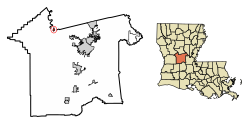
Location of Boyce in Rapides Parish, Louisiana.
Louisiana in United States (US48).svg
Location of Louisiana in the United States
Coordinates: 31°23′12″N92°40′14″W / 31.38667°N 92.67056°W / 31.38667; -92.67056
CountryUnited States
StateLouisiana
Parish Rapides
Government
  MayorKelvin V. McCoy (D)
  Police ChiefRonald Lamont Goudeau (D) [1]
Area
[2]
  Total0.62 sq mi (1.60 km2)
  Land0.46 sq mi (1.19 km2)
  Water0.16 sq mi (0.41 km2)
Elevation
85 ft (26 m)
Population
 (2020)
  Total888
  Density1,930.43/sq mi (745.97/km2)
Time zone UTC-6 (CST)
  Summer (DST) UTC-5 (CDT)
ZIP code
71409 [3]
Area code 318
FIPS code 22-09165

Boyce is a town in northern Rapides Parish, Louisiana, United States. It is part of the Alexandria, Louisiana Metropolitan Statistical Area. The population was 888 at the 2020 census. The community is nearly 70 percent African American.

Contents

History

Originally called Cotile Landing, the name was changed to Boyce in 1880, when the Texas and Pacific Railroad made Boyce its terminal point. The town was named for Judge Henry Boyce, who owned the land on which the town was located. Being of Irish descent, Boyce, and/or his son Henry Archinard Boyce, gave all the streets Irish names as he did his own cotton farmland, Ulster, which was immediately adjacent to the town along Bayou Jeunes des Gens (Jean de Jean). The post office was moved more than once but was returned to Boyce in 1883 and the Postal Service chose Boyce, even though there was a majority opposition, because the train depot already carried that name. Under charter of May 7, 1887, Boyce was organized and a council elected. [4]

Geography

Boyce is located at 31°23′12″N92°40′14″W / 31.38667°N 92.67056°W / 31.38667; -92.67056 (31.386778, -92.670577). [5]

According to the United States Census Bureau, the town has a total area of 0.6 square miles (1.6 km2), of which 0.5 square miles (1.3 km2) is land and 0.1 square miles (0.26 km2) (8.62%) is water.

A number of small bayous, such as Bayou Jean de Jean and Bayou Helen, are located just outside the town.

An island in the Red River North of the town was created with the straightening of the portion of the river next to the Town by the Army Corps of Engineers. The owners of the Island named it St. Alfred Island, after Alfred Boyce Wettermark, (1916-2010).

Climate

Climate data for Boyce 3 WNW, Louisiana (1991–2020 normals, extremes 1976–present)
MonthJanFebMarAprMayJunJulAugSepOctNovDecYear
Record high °F (°C)81
(27)
86
(30)
87
(31)
95
(35)
102
(39)
101
(38)
104
(40)
107
(42)
106
(41)
94
(34)
86
(30)
82
(28)
107
(42)
Mean daily maximum °F (°C)56.2
(13.4)
60.0
(15.6)
67.3
(19.6)
74.3
(23.5)
81.2
(27.3)
86.6
(30.3)
88.9
(31.6)
89.0
(31.7)
84.5
(29.2)
76.0
(24.4)
65.4
(18.6)
57.8
(14.3)
73.9
(23.3)
Daily mean °F (°C)47.5
(8.6)
50.9
(10.5)
57.9
(14.4)
65.0
(18.3)
72.5
(22.5)
78.4
(25.8)
80.6
(27.0)
80.6
(27.0)
75.8
(24.3)
66.1
(18.9)
55.8
(13.2)
49.2
(9.6)
65.0
(18.3)
Mean daily minimum °F (°C)38.7
(3.7)
41.9
(5.5)
48.5
(9.2)
55.6
(13.1)
63.7
(17.6)
70.2
(21.2)
72.4
(22.4)
72.1
(22.3)
67.0
(19.4)
56.3
(13.5)
46.2
(7.9)
40.6
(4.8)
56.1
(13.4)
Record low °F (°C)9
(−13)
7
(−14)
23
(−5)
31
(−1)
42
(6)
55
(13)
59
(15)
56
(13)
43
(6)
30
(−1)
20
(−7)
7
(−14)
7
(−14)
Average precipitation inches (mm)5.78
(147)
5.04
(128)
5.79
(147)
5.61
(142)
4.37
(111)
5.19
(132)
4.85
(123)
3.35
(85)
4.25
(108)
5.12
(130)
5.39
(137)
6.03
(153)
60.77
(1,544)
Average precipitation days (≥ 0.01 in)10.310.09.18.18.610.310.08.37.26.88.711.2108.6
Average snowy days (≥ 0.1 in)0.10.00.00.00.00.00.00.00.00.00.00.00.1
Source: NOAA [6] [7]

Demographics

Historical population
CensusPop.Note
1890 301
1900 832176.4%
1910 8654.0%
1920 1,06022.5%
1930 820−22.6%
1940 732−10.7%
1950 98134.0%
1960 1,09411.5%
1970 1,24013.3%
1980 1,198−3.4%
1990 1,36113.6%
2000 1,190−12.6%
2010 1,004−15.6%
2020 888−11.6%
U.S. Decennial Census [8]

2020 census

Boyce racial composition [9]
RaceNumberPercentage
White (non-Hispanic)20723.31%
Black or African American (non-Hispanic)61569.26%
Native American 60.68%
Asian 10.11%
Other/Mixed 273.04%
Hispanic or Latino 323.6%

As of the 2020 United States census, there were 888 people, 352 households, and 227 families residing in the town.

2000 census

As of the census [10] of 2000, there were 1,190 people, 426 households, and 310 families residing in the town. The population density was 2,239.5 inhabitants per square mile (864.7/km2). There were 485 housing units at an average density of 912.7 per square mile (352.4/km2). The racial makeup of the town was 23.19% White, 74.37% African American, 0.08% Native American, 0.42% Asian, 0.25% from other races, and 1.68% from two or more races. Hispanic or Latino of any race were 0.67% of the population.

There were 426 households, out of which 40.4% had children under the age of 18 living with them, 35.0% were married couples living together, 35.0% had a female householder with no husband present, and 27.2% were non-families. 23.2% of all households were made up of individuals, and 11.5% had someone living alone who was 65 years of age or older. The average household size was 2.79 and the average family size was 3.32.

In the town, the population was spread out, with 34.8% under the age of 18, 11.8% from 18 to 24, 23.3% from 25 to 44, 18.1% from 45 to 64, and 12.1% who were 65 years of age or older. The median age was 29 years. For every 100 females, there were 77.1 males. For every 100 females age 18 and over, there were 67.2 males.

The median income for a household in the town was $17,727, and the median income for a family was $20,000. Males had a median income of $24,000 versus $13,600 for females. The per capita income for the town was $9,616. About 37.9% of families and 40.7% of the population were below the poverty line, including 52.3% of those under age 18 and 27.1% of those age 65 or over.

Education

Boyce is served by Northwood High School, which opened in 1988, as a new consolidation of the old Boyce Junior High School and the former A. (Alfred) Wettermark High School.

Notable people

Related Research Articles

<span class="mw-page-title-main">Vermilion Parish, Louisiana</span> Parish in Louisiana, United States

Vermilion Parish is a parish located in the U.S. state of Louisiana, created in 1844. The parish seat is Abbeville. Vermilion Parish is part of the Lafayette metropolitan statistical area, and located in southern Acadiana. At the 2020 U.S. census, the population was 57,359.

<span class="mw-page-title-main">St. Martin Parish, Louisiana</span> Parish in Louisiana, United States

St. Martin Parish is a parish located in the U.S. state of Louisiana, founded in 1811. Its parish seat is St. Martinville, and the largest city is Breaux Bridge. At the 2020 census, the population was 51,767. St. Martin Parish is part of the Lafayette metropolitan area in the region of Acadiana, along the Gulf Coast.

<span class="mw-page-title-main">Rapides Parish, Louisiana</span> Parish in Louisiana, United States

Rapides Parish is a parish located in the U.S. state of Louisiana. As of the 2020 census, the population was 130,023. The parish seat is Alexandria, which developed along the Red River of the South. Rapides is the French word for "rapids". The parish was created in 1807 after the United States acquired this territory in the Louisiana Purchase.

<span class="mw-page-title-main">Oberlin, Louisiana</span> Town in Louisiana, United States

Oberlin is a town in and the parish seat of Allen Parish, Louisiana, United States. The population was 1,770 at the 2010 census. The town is named after Johann Friedrich Oberlin.

<span class="mw-page-title-main">Cottonport, Louisiana</span> Town in Louisiana, United States

Cottonport is a town in Avoyelles Parish, Louisiana, United States. The population was 2,006 at the 2010 census.

<span class="mw-page-title-main">Evergreen, Louisiana</span> Town in Louisiana, United States

Evergreen is a town in Avoyelles Parish, Louisiana, United States. The population was 310 at the 2010 census. Evergreen is located east of Bunkie.

<span class="mw-page-title-main">Maringouin, Louisiana</span> Town in Louisiana, United States

Maringouin is a town in Iberville Parish, Louisiana, United States. The population was 1,098 at the 2010 census, down from 1,262 at the 2000 census. At the 2020 population estimates program, its population was 966. It is part of the Baton Rouge metropolitan statistical area.

<span class="mw-page-title-main">Mound, Louisiana</span> Village in Louisiana, United States

Mound is a village in Madison Parish, Louisiana, United States. With a population of 12 at the 2020 census, it is Louisiana's smallest village by population. Its ZIP Code is 71282. It is part of the Tallulah Micropolitan Statistical Area.

<span class="mw-page-title-main">Richmond, Louisiana</span> Village in Louisiana, United States

Richmond is a village in Madison Parish, Louisiana, United States, located on Brushy Bayou. The population was 511 at the 2020 census, down from 577 in 2010. It is part of the Tallulah Micropolitan Statistical Area.

<span class="mw-page-title-main">Bonita, Louisiana</span> Village in Louisiana, United States

Bonita is a village in Morehouse Parish, Louisiana, United States. The population was 170 at the 2020 census, down from 284 in 2010.

<span class="mw-page-title-main">Fordoche, Louisiana</span> Town in Louisiana, United States

Fordoche is a town in Pointe Coupee Parish, Louisiana, United States. The population was 928 at the 2010 census. It is part of the Baton Rouge Metropolitan Statistical Area.

<span class="mw-page-title-main">Ball, Louisiana</span> Town in Louisiana, United States

Ball is a town in Rapides Parish, just north of Pineville, Louisiana, United States. Established in 1972, it is part of the Alexandria, Louisiana Metropolitan Statistical Area. The population was 4,000 at the 2010 census, an increase of 8.7 percent over the 2000 tabulation of 3,681.

Deville is a census-designated place (CDP) in Rapides Parish, Louisiana, United States. It is part of the Alexandria, Louisiana Metropolitan Statistical Area. The population was 1,007 at the 2000 census.

<span class="mw-page-title-main">Glenmora, Louisiana</span> Town in Louisiana, United States

Glenmora is a town in Rapides Parish, Louisiana, United States. It is part of the Alexandria, Louisiana Metropolitan Statistical Area. The population was 1,342 at the 2010 census.

<span class="mw-page-title-main">Lecompte, Louisiana</span> Town in Louisiana, United States

Lecompte is a town in Rapides Parish, Louisiana, United States. Lecompte is situated along the banks of Bayou Boeuf in central Louisiana. US Highway 71, Louisiana’s major north-south route which connects Baton Rouge and Shreveport, runs through Lecompte. Lecompte is named after the famous race horse called LeComte, which was named after horse breeder Ambrose LeComte. It is part of the Alexandria, Louisiana metropolitan area. The population was 1,227 at the 2010 and had dropped to 845 at the 2020 Census.

<span class="mw-page-title-main">Port Barre, Louisiana</span> Town in Louisiana, United States

Port Barre (BAH-ree) is a town in St. Landry Parish, Louisiana, United States. The town began in 1760 as an Indian trading post at the place where Bayou Teche flows out of Bayou Courtableau. The population was 2,055 at the 2010 census, down from 2,287 in 2000. It is part of the Opelousas–Eunice Micropolitan Statistical Area and home to the Port Barre High School Red Devils.

<span class="mw-page-title-main">Parks, Louisiana</span> Village in Louisiana, United States

Parks is a village in St. Martin Parish, Louisiana, United States. The population was 653 at the 2010 census, and 696 at the 2020 population estimates program. It is part of the Lafayette metropolitan statistical area.

<span class="mw-page-title-main">Maurice, Louisiana</span> Town in Louisiana, United States

Maurice is a town in Vermilion Parish, Louisiana, United States. The population was 964 at the 2010 census and 2,118 for the 2020 Census. It is part of the Abbeville micropolitan statistical area.

<span class="mw-page-title-main">Duson, Louisiana</span> Town in Louisiana, United States

Duson is a town in Acadia and Lafayette parishes in the U.S. state of Louisiana. The town was named after Curley Duson, a sheriff of St. Landry Parish. At the 2010 U.S. census, the town had a population of 1,716; in 2020, at the population estimates program, its population was 1,761. The Lafayette Parish portion of Duson is part of the Lafayette metropolitan statistical area, while the Acadia Parish portion is part of the Crowley micropolitan statistical area. Duson also has a ghost town affiliated with it, a tiny neighborhood that was made but never finished. It is currently blocked off by the town's police.

<span class="mw-page-title-main">Tullos, Louisiana</span> Town in Louisiana, United States

Tullos is a town in LaSalle and Winn parishes in the U.S. state of Louisiana, along Castor Creek. The population was 385 at the 2010 census.

References

  1. "Election Returns: Rapides Parish". Louisiana Secretary of State. November 6, 2018. Retrieved November 9, 2018.
  2. "2020 U.S. Gazetteer Files". United States Census Bureau. Retrieved March 20, 2022.
  3. "Boyce LA ZIP Code". zipdatamaps.com. 2023. Retrieved June 16, 2023.
  4. Rapides Parish, Louisiana History and Genealogy (par. 18-19)- Retrieved 2017-12-03
  5. "US Gazetteer files: 2010, 2000, and 1990". United States Census Bureau. February 12, 2011. Retrieved April 23, 2011.
  6. "NowData - NOAA Online Weather Data". National Oceanic and Atmospheric Administration. Retrieved August 27, 2021.
  7. "Station: Boyce 3 WNW, LA". U.S. Climate Normals 2020: U.S. Monthly Climate Normals (1991-2020). National Oceanic and Atmospheric Administration. Retrieved August 27, 2021.
  8. "Census of Population and Housing". Census.gov. Retrieved June 4, 2015.
  9. "Explore Census Data". data.census.gov. Retrieved December 29, 2021.
  10. "U.S. Census website". United States Census Bureau . Retrieved January 31, 2008.