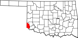
Harmon County, Oklahoma

Last updated

Harmon County
Harmon County Courthouse.jpg
Harmon County Courthouse in January 2015
Map of Oklahoma highlighting Harmon County.svg
Location within the U.S. state of Oklahoma
Oklahoma in United States.svg
Oklahoma's location within the U.S.
Coordinates: 34°44′N99°50′W / 34.74°N 99.84°W / 34.74; -99.84
CountryFlag of the United States.svg United States
StateFlag of Oklahoma.svg  Oklahoma
Founded1909
Seat Hollis
Largest cityHollis
Area
  Total539 sq mi (1,400 km2)
  Land537 sq mi (1,390 km2)
  Water1.5 sq mi (4 km2)  0.3%%
Population
 (2020)
  Total2,488
  Density4.6/sq mi (1.8/km2)
Time zone UTC−6 (Central)
  Summer (DST) UTC−5 (CDT)
Congressional district 3rd

Harmon County is a county in the southwest corner of the U.S. state of Oklahoma. As of the 2020 Census, the population was 2,488, [1] making it the second-least populous county in Oklahoma, behind only Cimarron County. It has lost population in every census since 1930. The county seat is Hollis. [2]

Contents

History

Following an election on May 22, 1909, Harmon County was created by proclamation of Governor Lee Cruce on June 2. Carved from adjacent Greer County, the new county was named in honor of Judson Harmon, who was Governor of Ohio at the time. [3] The area now covered by Harmon County had been a part of Texas until the U. S. Supreme Court awarded it to Oklahoma Territory in 1896. [4]

Another election held September 1, 1909, confirmed Hollis as the county seat. There were two other contestants: the towns of Harmon and Rosser. County offices operated in rented space until a courthouse was built in Hollis in 1926. In 1930, the U.S. Supreme Court ruled that the boundary between Texas and Oklahoma was actually 3,800 feet (1,200 m) farther east than originally believed. It returned the disputed land to Texas, reducing the county's area to its present size. [4]

A railroad built from Altus, Oklahoma to the Texas state line came to Hollis and Gould in 1910. The line was built by the Altus, Wichita Falls and Hollis Railway (later acquired by the Missouri, Kansas and Texas Railroad). [4]

Geography

According to the U.S. Census Bureau, the county has an area of 539 square miles (1,400 km2), of which 537 square miles (1,390 km2) is land and 1.5 square miles (3.9 km2) (0.3%) is water. [5] It lies in the Gypsum Hills physiographic region, and is drained by the Red River and its tributaries, the Salt and Elm forks of the Red River and Lebos and Turkey creeks. [4]

Major highways

Adjacent counties

Demographics

Historical population
CensusPop.Note
1910 11,328
1920 11,261−0.6%
1930 13,83422.8%
1940 10,019−27.6%
1950 8,079−19.4%
1960 5,853−27.6%
1970 5,136−12.3%
1980 4,519−12.0%
1990 3,793−16.1%
2000 3,283−13.4%
2010 2,922−11.0%
2020 2,488−14.9%
U.S. Decennial Census [6]
1790-1960 [7] 1900-1990 [8]
1990-2000 [9] 2010 [10]

As of the census [11] of 2000, there were 3,283 people, 1,266 households, and 863 families residing in the county. The population density was six persons per square mile (2 km2). There were 1,647 housing units at an average density of three per square mile (1/km2). The racial makeup of the county was 72.65% White, 9.78% Black or African American, 1.13% Native American, 0.18% Asian, 0.03% Pacific Islander, 14.32% from other races, and 1.92% from two or more races. The population was 22.78% Hispanic or Latino.

There were 1,266 households, out of which 30.20% had children under the age of 18 living with them, 55.70% were married couples living together, 9.20% had a female householder with no husband present, and 31.80% were non-families. 29.00% of all households were made up of individuals, and 17.50% had someone living alone who was 65 years of age or older. The average household size was 2.47 and the average family size was 3.03.

In the county, the population was spread out, with 25.90% under the age of 18, 7.90% from 18 to 24, 24.10% from 25 to 44, 21.10% from 45 to 64, and 21.00% who were 65 years of age or older. The median age was 40 years. For every 100 females there were 94.10 males. For every 100 females age 18 and over, there were 89.80 males.

The median income for a household in the county was $22,365, and the median income for a family was $29,063. Males had a median income of $21,530 versus $16,658 for females. The per capita income for the county was $13,464. About 23.50% of families and 29.70% of the population were below the poverty line, including 38.20% of those under age 18 and 19.90% of those age 65 or over.

Population decline

Common to many rural counties in the Great Plains the population of Harmon county has declined steadily since 1930. Between 1930 and 2020, Harmon County lost a greater percentage of its population than any other Oklahoma county, from 13,834 in 1930 to 2,488 in 2020, a decrease of 82.1%. [12]

Politics

Voter Registration and Party Enrollment as of January 15, 2019 [13]
PartyNumber of VotersPercentage
Democratic 83859.14%
Republican 43730.84%
Others14210.02%
Total1,417100%
United States presidential election results for Harmon County, Oklahoma [14]
Year Republican Democratic Third party
No.%No.%No.%
2020 74780.06%17718.97%90.96%
2016 71573.18%22523.03%373.79%
2012 65971.40%26428.60%00.00%
2008 75769.45%33330.55%00.00%
2004 83870.30%35429.70%00.00%
2000 69257.43%50742.07%60.50%
1996 44833.76%72954.94%15011.30%
1992 49630.79%78348.60%33220.61%
1988 61140.63%89059.18%30.20%
1984 1,00955.90%78543.49%110.61%
1980 67640.48%96157.54%331.98%
1976 66632.57%1,37167.04%80.39%
1972 1,31968.38%56829.45%422.18%
1968 64430.04%1,09751.17%40318.80%
1964 60226.55%1,66573.45%00.00%
1960 1,14247.44%1,26552.56%00.00%
1956 83732.44%1,74367.56%00.00%
1952 1,05735.70%1,90464.30%00.00%
1948 26610.21%2,34089.79%00.00%
1944 50320.56%1,93379.03%100.41%
1940 73124.04%2,29275.37%180.59%
1936 33111.37%2,57088.26%110.38%
1932 1895.85%3,04294.15%00.00%
1928 1,43156.85%1,06042.11%261.03%
1924 33923.28%1,04972.05%684.67%
1920 64334.18%1,12359.70%1156.11%
1916 1479.84%1,09173.03%25617.14%
1912 19714.25%89564.76%29020.98%

Economy

Agriculture has been the main component of the county economy. Cotton, wheat and sorghum have been the principal crops. By 1930, farmers had sizable holdings of cattle, poultry, horses, mules, swine, sheep and goats. [4]

Communities

See also

Related Research Articles

<span class="mw-page-title-main">Sherman County, Texas</span> County in Texas, United States

Sherman County is a county located in the U.S. state of Texas. As of the 2020 census, its population was 2,782. Its county seat is Stratford. The county was created in 1876 and organized in 1889. It is named for Sidney Sherman, who fought in the Texas Revolution.

<span class="mw-page-title-main">Collingsworth County, Texas</span> County in Texas, United States

Collingsworth County is a county in the U.S. state of Texas. As of the 2020 census, its population was 2,652. Its county seat is Wellington. The county was created in 1876 and later organized in 1890. It is named for James Collinsworth, a signer of the Texas Declaration of Independence and first chief justice of the Republic of Texas. Collingsworth County was one of 30 prohibition, or entirely dry, counties in Texas, but a vote in 2017 changed this law.

<span class="mw-page-title-main">Childress County, Texas</span> County in Texas, United States

Childress County is a county located in the U.S. state of Texas. As of the 2020 census, its population was 6,664. The county seat is Childress. The county was created in 1876 and later organized in 1887. It is named for George Campbell Childress, the author of the Texas Declaration of Independence.

<span class="mw-page-title-main">Roger Mills County, Oklahoma</span> County in Oklahoma, United States

Roger Mills County is a county located in the western part of the U.S. state of Oklahoma. As of the 2010 census, the population was 3,647, making it the third-least populous county in Oklahoma. Its county seat is Cheyenne. The county was created in 1891.

<span class="mw-page-title-main">Kiowa County, Oklahoma</span> County in Oklahoma, United States

Kiowa County is a county located in the southwestern part of the U.S. state of Oklahoma. As of the 2020 census, the population was 8,509. Its county seat is Hobart. The county was created in 1901 as part of Oklahoma Territory. It was named for the Kiowa people.

<span class="mw-page-title-main">Jackson County, Oklahoma</span> County in Oklahoma, United States

Jackson County is a county located in the southwestern corner of the U.S. state of Oklahoma. As of the 2020 census, the population was 24,785. Its county seat is Altus. According to the Encyclopedia of Oklahoma History and Culture, the county was named for two historical figures: President Andrew Jackson and Confederate General Stonewall Jackson. One source states that the county was named only for the former President, while an earlier source states it was named only for General Stonewall Jackson.

<span class="mw-page-title-main">Harper County, Oklahoma</span> County in Oklahoma, United States

Harper County is a county located in the U.S. state of Oklahoma. As of the 2020 census, the population was 3,272, making it the third-least populous county in Oklahoma. The county seat is Buffalo. It was created in 1907 from the northwestern part of Woodward County, and named for Oscar Green Harper, who was clerk of the Oklahoma Constitutional Convention.

<span class="mw-page-title-main">Greer County, Oklahoma</span> County in Oklahoma, United States

Greer County is a county located along the southwest border of the U.S. state of Oklahoma. As of the 2020 census, the population was 5,491. Its county seat is Mangum. From 1860 to 1896, the state of Texas claimed an area known as Greer County, Texas, which included present-day Greer County along with neighboring areas. In 1896 it was designated as a county in Oklahoma Territory under a ruling by the US Supreme Court. The rural Greer County is home to Quartz Mountain State Park, near the community of Lone Wolf, Oklahoma. It is also home to the Oklahoma State Reformatory, located in Granite. Its population has declined since 1930 due to changes in agriculture and migration to cities for work.

<span class="mw-page-title-main">Garvin County, Oklahoma</span> County in Oklahoma, United States

Garvin County is a county in south-central Oklahoma, United States. As of the 2020 census, the population was 25,656. Its county seat is Pauls Valley. In 1906, delegates to Constitution Convention formed Garvin County from part of the Chickasaw Nation, Indian Territory. The county was named for Samuel J. Garvin, a local Chickasaw rancher, merchant and banker. Its economy is largely based on farming, ranching and oil production.

<span class="mw-page-title-main">Ellis County, Oklahoma</span> County in Oklahoma, United States

Ellis County is a county located on the western border of the U.S. state of Oklahoma. As of the 2020 census, the population was 3,749, making it the fifth-least populous county in Oklahoma. Its county seat is Arnett.

<span class="mw-page-title-main">Cotton County, Oklahoma</span> County in Oklahoma, United States

Cotton County is a county located in the U.S. state of Oklahoma. As of the 2020 census, the population was 5,527. Its county seat is Walters. When Oklahoma achieved statehood in 1907, the area which is now Cotton County fell within the boundaries of Comanche County. It was split off in 1912, becoming the last county created in Oklahoma; it was named for the county's primary crop.

<span class="mw-page-title-main">Beckham County, Oklahoma</span> County in Oklahoma, United States

Beckham County is a county located on the western border of the U.S. state of Oklahoma. As of the 2020 census, the population was 22,410. Its county seat is Sayre. Founded upon statehood in 1907, Beckham County was named for J. C. W. Beckham, who was Governor of Kentucky and the first popularly elected member of the United States Senate from Kentucky. Beckham County comprises the Elk City, OK Micropolitan Statistical Area.

<span class="mw-page-title-main">Altus, Arkansas</span> City in Arkansas, United States

Altus is a city in Franklin County, Arkansas, United States. Located within the Arkansas River Valley at the edge of the Ozark Mountains, the city is within the Fort Smith metropolitan area. The epicenter of the Altus American Viticultural Area (AVA) within Arkansas Wine Country, the city is home to four wineries. Although founded as a coal mining community, the wine industry has driven the Altus economy since the first vineyards were planted in 1872. The population was 758 at the 2010 census, down from 817 at the 2000 census.

<span class="mw-page-title-main">Granite, Oklahoma</span> Town in Oklahoma, United States

Granite is a town in Greer County, Oklahoma, United States. The population was 1,628 at the 2020 census.

<span class="mw-page-title-main">Mangum, Oklahoma</span> City in Oklahoma, United States

Mangum is a city in and county seat of Greer County, Oklahoma, United States. The population was 3,010 at the 2010 census. It was originally part of Old Greer County in the Texas panhandle. The community was named for A. S. Mangum, who owned the land on which the town was founded in 1882. It became part of the Oklahoma Territory in 1896, and thus part of the state of Oklahoma on November 16, 1907.

<span class="mw-page-title-main">Hollis, Oklahoma</span> City in Oklahoma, United States

Hollis is a city in and the county seat of Harmon County, Oklahoma, United States. The population was 2,060 at the 2010 census.

<span class="mw-page-title-main">Altus, Oklahoma</span> City in Oklahoma, United States

Altus is a city in and the county seat of Jackson County, Oklahoma, United States. The population was 18,729 at the 2020 census.

<span class="mw-page-title-main">Dodson, Texas</span> Town in Texas, United States

Dodson is a town in Collingsworth County, Texas, United States. The population was 109 at the 2010 census.

<span class="mw-page-title-main">Wellington, Texas</span> City in Texas, United States

Wellington is a city and county seat of Collingsworth County, Texas, United States. The population was 2,189 at the 2010 census.

<span class="mw-page-title-main">Quanah, Texas</span> City in Texas, United States

Quanah is a city in and the county seat of Hardeman County, Texas, United States. As of the 2010 census the population was 2,641, down from 3,022 at the 2000 census.

References

  1. "Harmon County, Oklahoma". United States Census Bureau . Retrieved May 13, 2023.
  2. "Find a County". National Association of Counties. Retrieved June 7, 2011.
  3. Joseph Nathan Kane, The American Counties (4th Ed.), (The Scarecrow Press, 1983), p149; Arrell Morgan Gibson, Oklahoma: A History of Five Centuries (University of Oklahoma Press, 1981), p208.
  4. 1 2 3 4 5 Wilson, Linda D. "Harmon County," Encyclopedia of Oklahoma History and Culture, Oklahoma Historical Society, 2009. Accessed April 4, 2015.
  5. "2010 Census Gazetteer Files". United States Census Bureau. August 22, 2012. Retrieved February 21, 2015.
  6. "U.S. Decennial Census". United States Census Bureau. Retrieved February 21, 2015.
  7. "Historical Census Browser". University of Virginia Library. Retrieved February 21, 2015.
  8. Forstall, Richard L., ed. (March 27, 1995). "Population of Counties by Decennial Census: 1900 to 1990". United States Census Bureau. Retrieved February 21, 2015.
  9. "Census 2000 PHC-T-4. Ranking Tables for Counties: 1990 and 2000" (PDF). United States Census Bureau. April 2, 2001. Archived (PDF) from the original on October 9, 2022. Retrieved February 21, 2015.
  10. "State & County QuickFacts". United States Census Bureau. Archived from the original on June 6, 2011. Retrieved November 9, 2013.
  11. "U.S. Census website". United States Census Bureau . Retrieved January 31, 2008.
  12. "Oklahoma: Population of Counties by Dicennial Census," https://www.census.gov/population/www/censusdata/cencounts/files/ok190090.txt, accessed May 11, 2018
  13. "Oklahoma Registration Statistics by County" (PDF). OK.gov. January 15, 2019. Retrieved February 27, 2019.
  14. Leip, David. "Dave Leip's Atlas of U.S. Presidential Elections". uselectionatlas.org. Retrieved March 29, 2018.

Coordinates: 34°44′N99°50′W / 34.74°N 99.84°W / 34.74; -99.84