Choctaw Country

Last updated
One definition of Southeastern Oklahoma, but not the Choctaw Country designation by the Oklahoma Department of Tourism and Recreation Little Dixie, Oklahoma.svg
One definition of Southeastern Oklahoma, but not the Choctaw Country designation by the Oklahoma Department of Tourism and Recreation
The flag of the Choctaw Nation Choctaw flag.svg
The flag of the Choctaw Nation

Choctaw Country is the Oklahoma Department of Tourism and Recreation's official tourism designation for Southeastern Oklahoma. [1] The name was previously Kiamichi Country until changed in honor of the Choctaw Nation headquartered there. The current definition of Choctaw Country includes ten counties, being Coal, Atoka, Bryan, Choctaw, McCurtain, Pushmataha, Le Flore, Latimer, Haskell, and Pittsburg counties. [1] The department created the term as one of six designated travel regions within the state. [1] However, other definitions of Southeastern Oklahoma may include additional counties.

Contents

The original name of Kiamichi was applied by French explorers who came to the area in the early 18th century. They discovered, among other things, a very large, noisy woodpecker that they called Kiamichi, their word for "raucous bird." [2] This name was also applied to the Kiamichi Mountains (Choctaw: Nʋnih Chaha Kiamitia), a subset of the Ouachita Mountains.

Due to an influx of southerners seeking less expensive frontier lands during the post-Civil War Reconstruction era, Choctaw Country developed a culture that is more southern than the rest of the state. This region has also been called "Little Dixie".

Lightly populated, heavily mountainous and forested, the region is popular for outdoor recreation. It supports water sports, mountain biking, hiking, hunting, horse back riding, fishing, and national scenic drives. The area of jurisdiction of the Choctaw Nation covers much of this territory.

History

After this area was acquired by the United States from France through the Louisiana Purchase of 1803, it was organized as part of the new Arkansas Territory. On April 1, 1820, Arkansas created Miller County, which included most of the land that would be classified as Little Dixie. A post office at Miller Courthouse was established on September 7, 1824.

In the meantime, the United States was organizing to remove the Five Civilized Tribes from the Southeast, in order to make their lands available for development by European Americans. There was great pressure on these tribes as settlers encroached on their lands and competed for resources.

Some Choctaw had started moving into the region from Mississippi since the Treaty of Doak's Stand in 1820. Per a treaty signed by the United States on January 20, 1825, with the Choctaw, the land west of a line "one hundred paces east of Fort Smith, and running thence, due south, to Red river" was ceded to the Choctaw. The residents west of the line made a futile attempt to be exempted from the treaty but failed. They burned the courthouse and most of the records before they left.

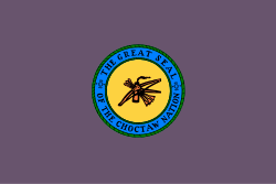
Following passage of the Indian Removal Act of 1830, and ratification of the Treaty of Dancing Rabbit Creek with Choctaw leaders in 1830, by which they ceded most of their land in the Southeast, the federal government began forced removal of the Choctaw. By 1834, nearly 8,000 Choctaw had arrived in their new land over the "trail of tears and death". At Nanih Waiya, near the present Tuskahoma Council House, they established a capital and adopted the first constitution ever written in what is now Oklahoma.

The Choctaw actively supported the Confederacy during the American Civil War, and retained their reservation land in eastern Indian Territory under the new treaty required after the war by the United States. In 1898, after intense pressure from Washington and with no clear alternative, they agreed to an allotment plan administered by the Dawes Commission. Their lands and those of the allied Chickasaw were thereby opened to settlement by non-Indians.

By the Oklahoma Enabling Act of 1906, the United States erected a state government over Choctaw Nation. During the 1900s, state court judges approved and ordered the transfer of tribal allotments in proceedings with under evidentiary rules that enabled systematic probate fraud. A common tactic of settlers was to take newly orphaned Choctaw girls, marry them, and have them intervene in the state court’s administration of the land allotment inherited by the orphan. In at least some cases, demonstrably fake identities were named as the plaintiff and wife of the settler to achieve the transfer of tribal land to settlers.

Court orders disposing of property in this way frequently describe highly dubious land transactions, such as settlers obtaining court ordered transfers of the land of Choctaw women who died with no living heirs, and proving ownership by claiming a cash transaction occurred just prior to her death, the receipt to which signed only with her X, and accepted as valid by the court. In normal circumstances, a judge presented with such a claim would not accept the story as true without substantial evidence that the receipt for the land sale was authentic, or that the deceased woman spent or died in possession of the money she allegedly received for the land. And because these proceedings were uncontested—-that is, conducted without any tribal members present—-no one objected and drew attention to whether settlers might have been the cause of the death in the first place, in which case the Slayer Rule would invalidate any claim to the estate.

By shutting tribal interests out of the legal process for legitimating and recording land ownership, significant land reserved for Choctaw Nation was transferred to settlers and US corporations in violation of the terms of the Treaty of Dancing Rabbit Creek. To wit, the majority opinion authored by Justice Neil Gorsuch in McGirt v. Oklahoma devotes substantial attention to the role of state courts during this period in violating this binding and living treaty. This chapter was a deep loss and is continuing pain for the Choctaw.

The damage of the Civil War and a long decline in cotton prices meant years of a poor economy in the mostly rural South. Many persons migrated from the South to seek opportunities in new western lands. When the Indian lands were opened, Southerners flocked to the Indian Nations for a new start, especially to the old Choctaw reserve. So many homesteaded in the area that they markedly influenced the politics and culture of the region. They made much of what is now southeastern Oklahoma culturally a southern state.

Geography

Ouachita Mountains in Southeast Oklahoma Talimenavista1.jpg
Ouachita Mountains in Southeast Oklahoma

Southeast Oklahoma is far more mountainous and forested than any other part of the state, containing most of the Ouachita Mountains in Oklahoma, the Arbuckle Mountains, and five other mountain ranges. The Ouachita National Forest, Oklahoma's only national forest, is also in this area.

Choctaw Country also houses "The World's Highest Hill," a 1,999-foot peak near Poteau, as the official designation for a "mountain" is land that is 2,000-feet or taller. [3]

The region contains Oklahoma's largest lake by surface area, Lake Eufaula. Other major lakes include Robert S. Kerr Reservoir, Sardis Lake, Hugo Lake, McGee Creek Reservoir, Pine Creek Lake, Broken Bow Lake, Lake Wister, Lake Atoka Reservoir, and on Choctaw Country's southwestern border, Lake Texoma.

Politics

The region's voters are overwhelmingly Democratic around 80%. Many of the citizens refer to themselves as yellow-dog Democrats. But an increasing number of conservative white and American Indian voters have joined the Republican trend in Oklahoma. Others register as Democrats to vote in primaries but vote for Republican candidates in general elections.

From statehood until 2003, most of the region was in its own Congressional district, the 3rd District (numbered the 4th District from 1907 until 1915). Its best-known congressman was Carl Albert, from McAlester, who represented the district for 30 years, the last six as Speaker of the House. Albert became synonymous with the region. At 5 feet 4 inches (1.63 m) tall, he was known affectionately as the Little Giant from Little Dixie.

Albert retired in 1977 and was succeeded by Wes Watkins, who held the seat for 14 years. He decided to run for governor in 1990. However, the Democratic campaign tactics during the primary forced Watkins from the race (and eventually from the Democratic Party). Watkins later shifted his party affiliation and registered as a Republican. In 1996, he easily won back his seat on the strength of his personal connection with the region's voters. He was the first Republican to win this seat since statehood. Watkins's victory seemed a catalyst for several other local Republican victories in the region.

After the 2000 U.S. Census, Oklahoma lost one seat in Congress. Most of the Little Dixie region was combined with northeastern Oklahoma to become Oklahoma's 2nd congressional district. The region remains strongly Democratic politically. However, most of the Democrats in this region are fairly conservative culturally by national standards. A majority of Native Americans generally support the Republican Party on social issues, gun rights, limited government and national security. From 2005 to 2013, Dan Boren, son of former Oklahoma governor and United States Senator David Boren, represented the district in the House. According to the Chicago Tribune , Boren of Oklahoma was the Democrat in the House who backed President George W. Bush most often, with 77.9 percent of his votes, a higher score than set by 26 House Republicans. Markwayne Mullin, a Republican from Westville, currently holds the 2nd congressional district seat; he is the second Republican elected for this seat since 1921.

Republican presidential nominee Donald Trump swept the region in the 2016 election, and he also carried the critical Native American vote in Choctaw Country and the state-at-large (most likely due to his conservative and limited-government appeal to both white and Native American voters in the region). According to The New York Times exit polls, Trump also won the Native American vote nationally over Hillary Clinton by a narrow 2 point margin. [4]

Tourism

A view from Talimena Drive. Ouachitanationalforestpicture.jpg
A view from Talimena Drive.

Choctaw Country bills itself as the "Deer Capital of the World." [3] Main tourism draws include award-winning scenic drives through the Ouachita Mountains, 13 major lakes, the nearby Chickasaw National Recreation Area, state parks, and whitewater rapids sports. The Talimena Scenic Drive is also an attraction, as travelers pass through the Ouachita National Forest in the Winding Stair Mountains.

Demographics

Per the 2000 census, the region had 305,395 people. Whites equal about 76% of the total, American Indians total a little over 17%, and Blacks, nearly 4%. Many of the African Americans area descendants of Choctaw freedmen (enslaved persons emancipated after the Civil War; a number have mixed Choctaw and African-American ancestry). The median per capita income in the region is $13,948, almost $10,000 less than the state average of $23,517.

Cities and towns

The city of McAlester serves as the region's primary urban center. A major urban center to the south is Durant, which is ranked as one of the fastest-growing cities in the United States.

Other important cities and towns include Atoka, Poteau, Hugo, Idabel, Broken Bow, Talihina, Clayton, Antlers, Coalgate, Wilburton and Watson.

Related Research Articles

<span class="mw-page-title-main">Indian Territory</span> Evolving areas set aside by the US government for relocation of Native Americans

The Indian Territory and the Indian Territories are terms that generally described an evolving land area set aside by the United States government for the relocation of Native Americans who held aboriginal title to their land as a sovereign independent state. The tribes ceded land they occupied in exchange for land grants in 1803. The concept of an Indian Territory was an outcome of the U.S. federal government's 18th- and 19th-century policy of Indian removal. After the American Civil War (1861–1865), the policy of the U.S. government was one of assimilation.

<span class="mw-page-title-main">Pushmataha County, Oklahoma</span> County in Oklahoma, United States

Pushmataha County is a county in the southeastern part of the U.S. state of Oklahoma. As of the 2010 census, the population was 11,572. Its county seat is Antlers.

<span class="mw-page-title-main">Choctaw County, Oklahoma</span> County in Oklahoma, United States

Choctaw County is a county located in the U.S. state of Oklahoma. As of the 2010 census, the population was 15,205. Its county seat is Hugo.

<span class="mw-page-title-main">Atoka County, Oklahoma</span> County in Oklahoma, United States

Atoka County is a county located in the U.S. state of Oklahoma. As of the 2010 census, the population was 14,007. Its county seat is Atoka. The county was formed before statehood from Choctaw Lands, and its name honors a Choctaw Chief named Atoka.

<span class="mw-page-title-main">Hugo, Oklahoma</span> City in Oklahoma, United States

Hugo is a city in and the county seat of Choctaw County, Oklahoma, United States. It is located in southeastern Oklahoma, approximately 9 miles (14 km) north of the Texas state line. As of the 2010 census, the city population was 5,310.

<span class="mw-page-title-main">Broken Bow, Oklahoma</span> City in Oklahoma, United States

Broken Bow is a city in McCurtain County, Oklahoma, United States. The population was 4,120 at the 2010 census. It is named after Broken Bow, Nebraska, the former hometown of the city's founders, the Dierks brothers. Other Dierks-associated legacies in town include Dierks Elementary School, Dierks Street, and Dierks Train #227 which is preserved in Broken Bow.

<span class="mw-page-title-main">Antlers, Oklahoma</span> City in Oklahoma, United States

Antlers is a city in and the county seat of Pushmataha County, Oklahoma, United States. The population was 2,453 at the 2010 census, a 3.9 percent decline from 2,552 in 2000. The town was named for a kind of tree that becomes festooned with antlers shed by deer, and is taken as a sign of the location of a spring frequented by deer.

<span class="mw-page-title-main">Little Dixie (Oklahoma)</span>

Little Dixie is a name given to southeast Oklahoma, which in the past was strongly influenced by Southern ("Dixie") culture, as its white settlers were chiefly Southerners seeking a start in new lands following the American Civil War. In addition, it incorporated lands of some of the Five Civilized Tribes, which had been removed from the Southeast. A number of its white settlers were slaveholders, and they generally allied with the Confederacy during the Civil War.

<span class="mw-page-title-main">Kiamichi River</span> River in Oklahoma, United States

The Kiamichi River is a river in southeastern Oklahoma, United States of America. A tributary of the Red River of the South, its headwaters rise on Pine Mountain in the Ouachita Mountains near the Arkansas border. From its source in Polk County, Arkansas, it flows approximately 177 miles (285 km) to its confluence with the Red River at Hugo, Oklahoma.

<span class="mw-page-title-main">Choctaw Nation of Oklahoma</span> Indian reservation

The Choctaw Nation is a Native American territory covering about 6,952,960 acres, occupying portions of southeastern Oklahoma in the United States. The Choctaw Nation is the third-largest federally recognized tribe in the United States and the second-largest Indian reservation in area after the Navajo. As of 2011, the tribe has 223,279 enrolled members, of whom 84,670 live within the state of Oklahoma and 41,616 live within the Choctaw Nation's jurisdiction. A total of 233,126 people live within these boundaries, with its tribal jurisdictional area comprising 10.5 counties in the state, with the seat of government being located in Durant, Oklahoma. It shares borders with the reservations of the Chickasaw, Muscogee, and Cherokee, as well as the U.S. states of Texas and Arkansas. By area, the Choctaw Nation is larger than eight U.S. states.

<span class="mw-page-title-main">Oklahoma's 2nd congressional district</span> U.S. House district for Oklahoma

Oklahoma's 2nd congressional district is one of five United States congressional districts in Oklahoma and covers approximately one-fourth of the state in the east. The district borders Arkansas, Kansas, Missouri, and Texas and includes a total of 24 counties.

<span class="mw-page-title-main">Curtis Act of 1898</span>

The Curtis Act of 1898 was an amendment to the United States Dawes Act; it resulted in the break-up of tribal governments and communal lands in Indian Territory of the Five Civilized Tribes of Indian Territory: the Choctaw, Chickasaw, Muscogee (Creek), Cherokee, and Seminole. These tribes had been previously exempt from the 1887 General Allotment Act because of the terms of their treaties. In total, the tribes immediately lost control of about 90 million acres of their communal lands; they lost more in subsequent years.

<span class="mw-page-title-main">Sardis Lake (Oklahoma)</span> Body of water

Sardis Lake is a reservoir in Pushmataha and Latimer counties in Oklahoma, USA. It was created about 1980 as the result of a dam constructed on Jackfork Creek, a tributary of the Kiamichi River, by the United States Corps of Engineers under contract to the state. It is named for the now-defunct town of Sardis, Oklahoma, which had to be abandoned before the area was submerged in the flooding of the lake.. The lake is located approximately 5 miles (8.0 km) north of Clayton. It is part of the Kiamichi Basin.

<span class="mw-page-title-main">South Central Oklahoma</span>

South Central Oklahoma is an amorphous region in the state of Oklahoma, perhaps encompassing 10 counties. It is centered on the Arbuckle Mountains, an ancient, eroded range traversing some 70 miles (110 km) across the region, and surrounded by rivers and lakes, notably Lake Texoma, Lake Murray and Lake of the Arbuckles. For tourism purposes, the Oklahoma Department of Tourism has more narrowly defined South Central Oklahoma, which they refer to as Chickasaw Country, as being a seven-county region including Pontotoc, Johnston, Marshall, Garvin, Murray, Carter, and Love counties. A ten-county definition might also include Coal, Atoka, and Bryan counties, although the Department of Tourism includes those in Choctaw Country. The Choctaw Nation of Oklahoma covers the eastern third of the region. Its headquarters is in Durant, and its capitol building, now a museum, is in Tuskahoma. The Chickasaw Nation lies within the region, with the tribal capitol building located at Tishomingo and its headquarters in Ada. The Chickasaw Nation, which runs "Chickasawcountry.com"., promotes the idea of Chickasaw Country as the 13 south-central Oklahoma counties that comprise the Chickasaw Nation, being the Tourism Department’s seven counties plus Coal, Bryan, Jefferson, Stephens, Grady, and McClain counties.

<span class="mw-page-title-main">Kiamichi Mountains</span> United States mountain range

The Kiamichi Mountains are a mountain range in southeastern Oklahoma. A subrange within the larger Ouachita Mountains that extend from Oklahoma to western Arkansas, the Kiamichi Mountains sit within Le Flore, Pushmataha and McCurtain counties near the towns of Poteau, Albion and Smithville. The foothills of the Kiamichi Mountains sit within Haskell County, Northern Latimer County and Northern Pittsburg County. Its peaks, which line up south of the Kiamichi River, reach 2,500 feet in elevation. The range was the namesake of Kiamichi Country, the official tourism designation for southeastern Oklahoma, until the designation was changed to Choctaw Country.

Muddy Boggy Creek, also known as the Muddy Boggy River, is a 175-mile-long (282 km) river in south central Oklahoma. The stream headwaters arise just east of Ada in Pontotoc County. It is a major tributary of the Red River in south central Oklahoma. Clear Boggy Creek is a major tributary which enters the Muddy Boggy at a location known as River Mile 24 in Choctaw County. The river is inhabited by over one hundred species of fish.

<span class="mw-page-title-main">Pushmataha County, Sequoyah</span> Proposed U.S. political subdivision

Pushmataha County was a proposed political subdivision created by the Sequoyah Constitutional Convention. The convention, meeting in Muskogee, Indian Territory in 1905, established the political and administrative layout of a prospective U.S. state it called the State of Sequoyah.

The Atoka Agreement is a document signed by representatives of the Choctaw and Chickasaw Indian Nations and members of the United States Dawes Commission on April 23, 1897, at Atoka, Indian Territory. It provided for the allotment of communal tribal lands of the Choctaw and Chickasaw nations in the Indian Territory to individual households of members of the tribes, who were certified as citizens of the tribes. Land in excess of the allotments could be sold to non-natives. Provisions of this agreement were later incorporated into the Curtis Act of 1898, which provided for widespread allotment of communal tribal lands.

<span class="mw-page-title-main">Oklahoma Organic Act</span> Statute used by the United States Congress

An Organic Act is a generic name for a statute used by the United States Congress to describe a territory, in anticipation of being admitted to the Union as a state. Because of Oklahoma's unique history an explanation of the Oklahoma Organic Act needs a historic perspective. In general, the Oklahoma Organic Act may be viewed as one of a series of legislative acts, from the time of Reconstruction, enacted by Congress in preparation for the creation of a united State of Oklahoma. The Organic Act created Oklahoma Territory, and Indian Territory that were Organized incorporated territories of the United States out of the old "unorganized" Indian Territory. The Oklahoma Organic Act was one of several acts whose intent was the assimilation of the tribes in Oklahoma and Indian Territories through the elimination of tribes' communal ownership of property.

Sharp v. Murphy, 591 U.S. ___ (2020), was a Supreme Court of the United States case of whether Congress disestablished the Muscogee (Creek) Nation reservation. After holding the case from the 2018 term, the case was decided on July 9, 2020, in a per curiam decision following McGirt v. Oklahoma that, for the purposes of the Major Crimes Act, the reservations were never disestablished and remain Native American country.

References

  1. 1 2 3 "Counties & Regions". Oklahoma Tourism and Recreation Department (Travel Promotion Division). Retrieved February 5, 2019.
  2. "Welcome to Hugo." K-Ten CommunityInfo - Hugo, OK. Retrieved August 8, 2014.
  3. 1 2 [Oklahoma Department of Tourism]
  4. "Election 2016: Exit Polls". The New York Times. Retrieved 2016-11-09.

Coordinates: 34°30′N95°00′W / 34.5°N 95.0°W / 34.5; -95.0