Moore, Oklahoma

Last updated

Moore, Oklahoma
Moore NW 12th St & City Ave.jpg
Seal of Moore, Oklahoma.png
Cleveland County, Oklahoma Incorporated and Unincorporated areas highlighting Moore.svg
Location within Cleveland County and Oklahoma
Usa edcp location map.svg
Red pog.svg
Moore, Oklahoma
Location in the United States
Coordinates: 35°19′45″N97°28′32″W / 35.32917°N 97.47556°W / 35.32917; -97.47556
CountryUnited States
State Oklahoma
County Cleveland
Founded1889
Incorporated 1893
Government
   Mayor Glenn Lewis
  City ManagerBrooks Mitchell
Area
[1]
  Total22.34 sq mi (57.86 km2)
  Land22.09 sq mi (57.21 km2)
  Water0.25 sq mi (0.64 km2)
Elevation
[2]
1,207 ft (368 m)
Population
 (2020)
  Total62,793
  Density2,842.47/sq mi (1,097.49/km2)
Time zone UTC−6 (Central (CST))
  Summer (DST) UTC−5 (CDT)
ZIP codes
73160, 73165, 73170 [3]
Area code(s) 405/572
FIPS code 40-49200
GNIS feature ID2411155 [2]
Website cityofmoore.com

Moore is a city in Cleveland County, Oklahoma, United States, [2] and is part of the Oklahoma City metropolitan area. The population was 62,793 at the 2020 census, [4] making Moore the seventh-largest city in the state of Oklahoma.

Contents

Located between Oklahoma City and Norman, the city has been the site of several devastating tornadoes, with those occurring in 1999 and 2013 receiving international attention. The 3 costliest tornadoes in Oklahoma history all occurred in Moore. [5]

History

The Moore post office was established May 27, 1889, during the Land Run of 1889 and was named for Al Moore, an Atchison, Topeka and Santa Fe Railway employee. According to the town history he was a "conductor or a brakeman, lived in a boxcar at the camp and had difficulty receiving his mail. He painted his name – "Moore" – on a board and nailed it on the boxcar. When a postmaster was appointed, he continued to call the settlement Moore. When the town incorporated in 1893 the name was legalized." [6] [7]

The city's history notes that the community before the post office may have been called "Verbeck" by the railroad. [6] However, other histories indicate that Verbeck was actually the original name of the nearby telegraph station "Oklahoma" which became the basis for the founding of Oklahoma City. [8]

The community remained small until 1961, when it annexed 21.6 square miles (56 km2), becoming a full-fledged city in 1962, which in turn increased its population from 1,221 in 1960 to 18,761 in 1970 and 55,081 in 2010. [6] Moore's 1961 annexation kept it an independent city at a time when Oklahoma City through annexations increased its size from 25 square miles (65 km2) to 643 square miles (1,670 km2) surrounding Moore on three sides (north, east, west). Norman forms its southern border. [9]

In 1966 the Hillsdale Free Will Baptist College, after moving through various locations around Oklahoma, opened in the community.

The Moore post office turned into a branch of the Oklahoma City post office on January 7, 1972. [7]

In the 1970s the city launched a "Smile America" campaign in which giant red, white and blue smileys were painted on the town water towers. A smiley also adorns the city's official logo (as does a water tower). [10] Some of the water towers now have a sign that says, "Moore - Home of Toby Keith." [11] [12]

On September 24, 2014, at the local Vaughan Foods food processing plant, one employee was beheaded with a knife and another coworker had her throat slit and was injured, but survived. The alleged attacker, 30-year-old Alton Nolen, who was on suspension from the plant prior to the attack due to interactions with the employee who survived the attack, was shot and wounded by company owner Mark Vaughan. [13] [14] Nolen was convicted of murder and assault in October 2017. A jury recommended that he receive the death penalty, [15] and, on December 15, 2017, a judge sentenced Nolen to death by lethal injection. [16]

Geography

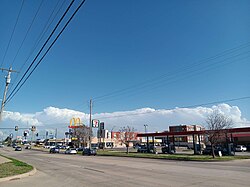
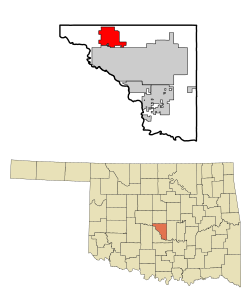
Moore is located just south of Oklahoma City and north of Norman, in central Oklahoma. According to the United States Census Bureau, the city has a total area of 22.2 square miles (57.4 km2), of which 21.8 square miles (56.5 km2) is land and 0.35 square miles (0.9 km2), or 1.52%, is water. [17]

The city lies in the Sandstone Hills region of Oklahoma, known for hills, blackjack oak, and post oak. [18]

Climate

Moore has a humid subtropical climate with frequent variations in weather during part of the year and consistently hot summers. Prolonged and severe droughts often lead to wildfires and heavy rainfall often leads to flash flooding and flooding. Consistent winds, usually from the south or south-southeast during the summer, help temper the hotter weather. Consistent northerly winds during the winter can intensify cold periods. Severe ice storms and snowstorms happen sporadically during the winter.

Tornado history

The Oklahoma City metropolitan area (of which Moore is a part) is located in Tornado Alley and is subject to frequent and severe tornadoes and hailstorms, making it one of the most tornado-prone major metropolitan areas in the world.

Moore itself has seen nine tornadoes between 1998 and 2015, three of them big enough to claim lives and cause catastrophic damage. [19] The city of Moore was damaged by significant tornadoes on October 4, 1998; May 3, 1999; May 8, 2003; May 10, 2010; and May 20, 2013, with weaker tornadoes striking at other times, notably May 31, 2013 and March 25, 2015. Moore is located in Tornado Alley, a colloquial term for the area of the United States where tornadoes are most frequent. About 20 tornadoes occurred in the immediate vicinity of Moore from 1890 to 2013. [20] The most significant tornadoes to hit Moore occurred in 1893, 1999, and 2013.

1999 tornado

During the tornado outbreak on May 3, 1999, a tornado hit Moore and nearby areas. The tornado, which was rated an F5 on the Fujita scale, was the most costly tornado in history at the time (not adjusted for changes in inflation and population). [21] The tornado had an approximate recorded wind speed of 301 mph (484 km/h) as sampled by mobile Doppler radar, [22] the highest wind speed ever recorded on Earth. It left a swath of destruction over 1 mile (1.6 km) wide at times, and 38 miles (60 km) long. It killed a total of 36 people in the Oklahoma City metropolitan area. This was the deadliest F5 tornado recorded since the Delhi, Louisiana tornado in 1971 until this mark was eclipsed by several tornadoes in 2011.

2013 tornado

2013 tornado southwest of Moore May 20, 2013 Moore, Oklahoma tornado.JPG
2013 tornado southwest of Moore
Aerial view of 2013 Moore tornado damage FEMA Aerial view of May 20, 2013 Moore, Oklahoma tornado damage.jpg
Aerial view of 2013 Moore tornado damage

On May 20, 2013, parts of Moore and neighboring Newcastle and southern Oklahoma City, were affected by a violent tornado. [23] Classified as EF5 on the Enhanced Fujita scale, it had estimated wind speeds of 200–210 mph (320–340 km/h), a maximum width of 1.3 miles (2 km), and a path length of 17 miles (30 km). [24] [25] Entire subdivisions were destroyed; the tornado struck Briarwood and Plaza Towers elementary schools in Moore while school was in session. The Oklahoma Medical Examiner's office reported that 24 people were killed, including 10 children. Over 140 patients, including at least 70 children, were treated at hospitals following the tornado. [26] It was the deadliest U.S. tornado since the Joplin, Missouri tornado that killed 158 people in 2011. [27]

Demographics

Historical population
CensusPop.Note
1900 129
1910 22574.4%
1920 25412.9%
1930 538111.8%
1940 499−7.2%
1950 94288.8%
1960 1,22129.6%
1970 19,7611,518.4%
1980 35,06377.4%
1990 40,31815.0%
2000 41,1382.0%
2010 55,08133.9%
2020 62,79314.0%
U.S. Decennial Census [28]

As of the census of 2000, [29] there were 41,138 people, 14,848 households, and 11,566 families residing in the city. The population density was 1,892.8 inhabitants per square mile (730.8/km2). There were 15,801 housing units at an average density of 727.0 per square mile (280.7/km2). The racial makeup of the city was 84.63% White, 2.92% Black, 4.14% Native American, 1.62% Asian, 0.05% Pacific Islander, 1.75% from other races, and 4.89% from two or more races. Hispanic or Latino of any race were 5.10% of the population.

There were 14,848 households, out of which 41.8% had children under the age of 18 living with them, 60.4% were married couples living together, 13.3% had a female householder with no husband present, and 22.1% were non-families. 18.2% of all households were made up of individuals, and 5.1% had someone living alone who was 65 years of age or older. The average household size was 2.75 and the average family size was 3.13.

The city population age spread was 29.4% under 18, 9.3% from 18 to 24, .5% from 25 to 44, 21.5% from 45 to 64, and 7.2% who were 65 or older. The median age was 32 years. For every 100 females, there were 93.7 males. For every 100 females age 18 and over, there were 90.6 males.

The median income for a household in the city was $43,409, and the median income for a family was $47,773. Males had a median income of $33,394 versus $24,753 for females. The per capita income for the city was $17,689. About 6.3% of families and 7.6% of the population were below the poverty line, including 11.6% of those under age 18 and 4.4% of those age 65 or over.

Education

Higher education

The only post-secondary school physically within Moore is the Randall University which has an enrollment of about 225. Moore's neighbor immediately to the south is Norman, Oklahoma, home of the University of Oklahoma. The Moore Norman Technology Center is a public career and technology education center. Its campuses however are outside of Moore in Norman and South Oklahoma City.

Primary and secondary schools

Moore Public Schools has three high schools: Moore, Southmoore, and Westmoore; six junior high schools: Brink, Central, Highland East, Highland West, Moore West, and Southridge; and 25 elementary schools: Apple Creek, Briarwood, Broadmoore, Bryant, Central, Earlywine, Eastlake, Fairview, Fisher, Heritage Trails, Houchin, Kelley, Kingsgate, Northmoor, Oakridge, Plaza Towers, Red Oak, Santa Fe, Sky Ranch, Sooner, South Lake, Southgate-Rippetoe, Timber Creek, Wayland Anders Bonds and Winding Creek.

On May 20, 2013, while classes were in progress, several of Moore's schools were damaged or destroyed by the 2013 Moore Tornado, most notably Plaza Towers Elementary, Briarwood Elementary and Highland East Junior High. However, these schools were rebuilt and reopened for the 2014–15 school year.

Libraries

Moore is served by the Moore Public Library, which is part of the Pioneer Library System. [30]

Media

Three media outlets focus on the Moore community. 19th Street Magazine publishes a free issue every month focusing on high school sports, community events and local businesses. Moore Monthly publishes a free monthly print publication while its website provides daily stories and videos about Moore, Norman and south Oklahoma City. The other media outlet is the Moore American.

Moore Veterans Memorial

The City of Moore has funded the construction of a memorial to honor America's veterans and their families. The city renamed JD Estates Park to Veterans Memorial Park, and a memorial was constructed at the park entrance.

The main feature of the memorial is a 15-foot (4.6 m) black granite obelisk that has the inscription, "May this hallowed ground honor the sacrifice of America's finest veterans, civilians, and their families- past, present, and future. We will never forget." Another major feature of the memorial are five black granite tablets with the seal of the five branches of the American armed forces. At the center of the memorial is a flag plaza with a 30-foot (9.1 m) pole for the American flag and two 25-foot (7.6 m) poles for the Oklahoma flag and the POW/MIA flag. The flag plaza is surrounded by a polished concrete walking area with a stained five-pointed star stretching the entire width and height of the walking area.

A committee was formed to plan the second phase of the Moore Veterans Memorial. A campaign to sell bricks to be placed in the memorial was completed in early 2009. Over 190 bricks were purchased by supporters from the community and surrounding areas. The bricks were placed in the Memorial Wall and Phase II was completed in May 2009.

The Soldiers' Memorial was dedicated on May 15, 2010. It consists of four carved wooden soldiers representing the four major wars since the end of World War I. They include World War II, Korea, Vietnam, and the Afghanistan/Iraq War. [31]

After being destroyed by the May 2013 tornado, the park won the title of "America's Favorite Park"[ citation needed ] in an online competition sponsored by Coca-Cola, beating out numerous other parks from around the country. First prize was a $100,000 grant, which was combined with other funds to cover the estimated $200,000 in rebuilding expenses. The first steps toward rebuilding began in November 2013, during a groundbreaking ceremony and the awarding of the grant to Mayor Glenn Lewis. [32] The park's playgrounds are now open to the public.

Notable people

Related Research Articles

<span class="mw-page-title-main">Oklahoma City</span> Capital city of Oklahoma, United States

Oklahoma City, officially the City of Oklahoma City, and often shortened to OKC, is the capital and most populous city of the U.S. state of Oklahoma. The county seat of Oklahoma County, it ranks 20th among United States cities in population, and is the 8th largest city in the Southern United States. The population grew following the 2010 census and reached 681,054 in the 2020 census. The Oklahoma City metropolitan area had a population of 1,396,445, and the Oklahoma City–Shawnee Combined Statistical Area had a population of 1,469,124, making it Oklahoma's largest municipality and metropolitan area by population.

<span class="mw-page-title-main">Cleveland County, Oklahoma</span> County in Oklahoma, United States

Cleveland County is a county in the central part of the U.S. state of Oklahoma. The population was 295,528 at the 2020 United States census, making it the third-most populous county in Oklahoma. Its county seat is Norman. The county was named for U.S. President Grover Cleveland.

<span class="mw-page-title-main">Stringtown, Oklahoma</span> Town in Oklahoma, United States

Stringtown is a town in Atoka County, Oklahoma, United States. The population was 410 at the 2010 census, an increase of 3.5 percent from the figure of 396 recorded in 2000. It is the second largest town in Atoka County.

<span class="mw-page-title-main">El Reno, Oklahoma</span> City in Oklahoma, United States

El Reno is a city in and county seat of Canadian County, Oklahoma, United States. As of the 2020 census, the city population was 16,989, marking a change of 1.55% from 16,729, recorded in the 2010 census. The city was begun shortly after the 1889 land rush and named for the nearby Fort Reno. It is located in Central Oklahoma, about 25 miles (40 km) west of downtown Oklahoma City.

<span class="mw-page-title-main">Union City, Oklahoma</span> Town in Oklahoma, United States

Union City is a town in Canadian County, Oklahoma, United States. The population was 1,645 at the 2010 census, a 19.6 percent increase from 1,375 in 2000. It is part of the Oklahoma City metropolitan statistical area.

<span class="mw-page-title-main">Lone Grove, Oklahoma</span> City in Oklahoma, United States

Lone Grove is a city in Carter County, Oklahoma, United States. The population was 5,054 at the 2010 census. It is part of the Micropolitan Statistical Area of Ardmore.

<span class="mw-page-title-main">Norman, Oklahoma</span> City in Oklahoma, United States

Norman is the 3rd most populous city in the U.S. state of Oklahoma, with a population of 128,026 as of the 2020 census. It is the most populous city and the county seat of Cleveland County and the second-most populous city in the Oklahoma City metropolitan area after the state capital, Oklahoma City, 20 miles north of Norman.

<span class="mw-page-title-main">Newcastle, Oklahoma</span> City in Oklahoma, United States

Newcastle is a city in McClain County, Oklahoma, United States, and part of the Oklahoma City Metropolitan Area. The population was 10,984 at the 2020 census.

<span class="mw-page-title-main">Broken Bow, Oklahoma</span> City in Oklahoma, United States

Broken Bow is a city in McCurtain County, Oklahoma, United States. The population was 4,120 at the 2010 census. It is named after Broken Bow, Nebraska, the former hometown of the city's founders, the Dierks brothers. Other Dierks-associated legacies in town include Dierks Elementary School, Dierks Street, and Dierks Train #227 which is preserved in Broken Bow.

<span class="mw-page-title-main">Del City, Oklahoma</span> City in Oklahoma, United States

Del City is a city in Oklahoma County, Oklahoma, United States, and a part of the Oklahoma City metropolitan area. The population was 21,822 at the United States Census, 2020, a 2.3% increase from 2010.

<span class="mw-page-title-main">Edmond, Oklahoma</span> City in Oklahoma, United States

Edmond is a city in Oklahoma County, Oklahoma, United States, and a part of the Oklahoma City metropolitan area in the central part of the state. The population was 94,428 according to the 2020 United States Census, a 16% increase from 2010. making it the 5th most populous city in Oklahoma.

<span class="mw-page-title-main">Midwest City, Oklahoma</span> City in Oklahoma, United States

Midwest City is a city in Oklahoma County, Oklahoma, United States, and a part of the Oklahoma City metropolitan area. As of the 2020 census, the population was 58,409, making it the eighth largest city in the state.

<span class="mw-page-title-main">Warr Acres, Oklahoma</span> City in Oklahoma, United States

Warr Acres is a city in Oklahoma County, Oklahoma, United States, and a part of the Oklahoma City metropolitan area. It was established after World War II by C.B. Warr, a dynamic businessman, builder, and commercial developer. The population was 10,452 at the 2020 census, a 4.1% increase from 2010.

<span class="mw-page-title-main">Bethel Acres, Oklahoma</span> Town in Oklahoma, United States

Bethel Acres is a town in Pottawatomie County, Oklahoma, United States. The population was 2,895 at the time of the 2010 census, an increase of 5.9 percent from the figure of 2,735 in 2000. It is primarily a bedroom community for people who work in the three nearby larger cities of Shawnee, Tecumseh and Oklahoma City.

<span class="mw-page-title-main">1999 Oklahoma tornado outbreak</span> Tornado outbreak in May 1999

The 1999 Oklahoma tornado outbreak was a significant tornado outbreak that affected much of the Central and parts of the Eastern United States, with the highest record-breaking wind speeds of 301 ± 20 mph (484 ± 32 km/h). During this week-long event, 154 tornadoes touched down. More than half of them were on May 3 and 4 when activity reached its peak over Oklahoma, Kansas, Nebraska, Texas, and Arkansas.

<span class="mw-page-title-main">Moore Public Schools</span> School district in Oklahoma

The Moore Public School District, also known as Moore Public Schools, is a public school district in Moore, Oklahoma. The school district is the third largest in the state of Oklahoma, after Oklahoma City Public Schools and Tulsa Public Schools, with an enrollment of 24,075 as of the 2023-2024 school year.

Bridge Creek is a town in Grady County, Oklahoma, United States. As of the 2020 census, the town population was 336, a 0% change from 2010.

<span class="mw-page-title-main">1999 Bridge Creek–Moore tornado</span> 1999 tornado in Oklahoma, US

The 1999 Bridge Creek–Moore tornado was a large and exceptionally powerful F5 tornado in which the highest wind speeds ever measured globally were recorded at 301 ± 20 miles per hour (484 ± 32 km/h) by a Doppler on Wheels (DOW) radar. Considered the strongest tornado ever recorded to have affected the metropolitan area, the tornado while near peak intensity devastated southern portions of Oklahoma City, Oklahoma, United States, along with surrounding suburbs and towns to the south and southwest of the city during the early evening of Monday, May 3, 1999. Parts of Bridge Creek were rendered unrecognizable. The tornado covered 38 miles (61 km) during its 85-minute existence, destroying thousands of homes, killing 36 people, and leaving US$1 billion in damage, ranking it as the fifth-costliest on record not accounting for inflation. Its severity prompted the first-ever use of the tornado emergency statement by the National Weather Service.

<span class="mw-page-title-main">2013 Moore tornado</span> 2013 EF5 tornado in Moore, Oklahoma

On the afternoon of May 20, 2013, a large and extremely violent EF5 tornado ravaged Moore, Oklahoma, and adjacent areas, with peak winds estimated at 210 miles per hour (340 km/h), killing 24 people and injuring 212 others. The tornado was part of a larger weather system that had produced several other tornadoes across the Great Plains over the previous two days, including five that struck portions of Central Oklahoma the day prior on May 19.

Plaza Towers Elementary School is a public elementary school in Moore, Oklahoma, in the Oklahoma City metropolitan area. It is a part of Moore Public Schools. Plaza Towers is located in southwest Moore within a neighborhood of the same name. The school's mascot is the panther, named "Paws". The school's current building opened in 2014 after the previous facility was destroyed by the 2013 Moore tornado; seven students at the school died as a result of the tornado's impact.

References

  1. "ArcGIS REST Services Directory". United States Census Bureau. Retrieved September 20, 2022.
  2. 1 2 3 U.S. Geological Survey Geographic Names Information System: Moore, Oklahoma
  3. United States Postal Service (2012). "USPS - Look Up a ZIP Code" . Retrieved February 15, 2012.
  4. "QuickFacts: Moore city, Oklahoma". U.S. Census Bureau, QuickFacts. Retrieved March 14, 2022.
  5. Top Ten Costliest Oklahoma Tornadoes (1950-Present), National Weather Service Norman, Oklahoma
  6. 1 2 3 "A Brief History of Moore". City of Moore. Archived from the original on June 7, 2013. Retrieved May 23, 2013.
  7. 1 2 Shirk, George H. (January 7, 1972). Oklahoma Place Names - Georg Shirk - Google Books. University of Oklahoma Press. ISBN   9780806120287 . Retrieved May 23, 2013.
  8. Kelley, E. H. "WHEN OKLAHOMA CITY WAS SEYMOUR AND VERBECK Archived 2013-10-04 at the Wayback Machine ," Chronicles of Oklahoma. (accessed October 2, 2013)
  9. "Explosive Growth".
  10. "triptrivia.com". www.triptrivia.com. Archived from the original on April 8, 2018. Retrieved April 7, 2018.
  11. "Toby Keith Expresses Sorrow Over Hometown Tornado Devastation". yahoo.com. May 21, 2013. Retrieved April 7, 2018.
  12. "Page 3: Why Your City Sucks: Moore". thelostogle.com. March 25, 2010. Retrieved April 7, 2018.
  13. "Oklahoma Woman Beheaded By Fired Coworker: Cops". Huffington Post. September 26, 2014.
  14. "Quick Links". CNN.
  15. "Jury recommends death penalty for Alton Nolen murder conviction". KOCO 5 News. October 12, 2017.
  16. "Oklahoma man sentenced to death for beheading his co-worker". Fox News. December 15, 2017.
  17. "Geographic Identifiers: 2010 Demographic Profile Data (G001): Moore city, Oklahoma". U.S. Census Bureau, American Factfinder. Archived from the original on February 20, 2015. Retrieved February 20, 2015.
  18. Oklahoma Geography, NetState.com. (accessed October 1, 2013)
  19. Jason Sickles (March 26, 2015). "Is Moore, Okla., the 'tornado alley of tornado alley'? - Yahoo News". News.yahoo.com. Retrieved March 28, 2015.
  20. "Moore, Oklahoma Tornadoes (1890-Present)". noaa.gov. Retrieved April 7, 2018.
  21. Brooks, Harold E.; C. A. Doswell III (February 2001). "Normalized Damage from Major Tornadoes in the United States: 1890–1999". Weather Forecast. 16 (1): 168–76. Bibcode:2001WtFor..16..168B. doi: 10.1175/1520-0434(2001)016<0168:NDFMTI>2.0.CO;2 .
  22. Wurman, Joshua; C. Alexander; P. Robinson; Y. Richardson (January 2007). "Low-Level Winds in Tornadoes and Potential Catastrophic Tornado Impacts in Urban Areas". Bulletin of the American Meteorological Society . American Meteorological Society. 88 (1): 31–46. Bibcode:2007BAMS...88...31W. doi: 10.1175/BAMS-88-1-31 .
  23. "Deadly tornado strikes near Oklahoma City". www.aljazeera.com. Retrieved April 7, 2018.
  24. "NWSChat". NOAA. Retrieved May 21, 2013.
  25. "Mile-wide tornado touches down near Oklahoma City, causing damage for second day in a row". Fox News. May 20, 2013.
  26. "Hospitals treat more than 140 after Oklahoma tornado, including 70 children". New Haven Register. Associated Press. Retrieved May 21, 2013.
  27. Gillam, Carey; Simpson, Ian (May 21, 2013). "Whole neighborhoods razed by Oklahoma tornado that killed 24". Reuters. Retrieved May 22, 2013.
  28. "U.S. Decennial Census". Census.gov. Retrieved May 25, 2017.
  29. "U.S. Census website". United States Census Bureau . Retrieved January 31, 2008.
  30. Pioneer Library System Archived 2013-05-01 at the Wayback Machine (accessed May 24, 2013)
  31. Archived August 3, 2011, at the Wayback Machine
  32. "Breaking Ground and Reopening Happiness in Moore, Okla". coca-colacompany.com. Retrieved April 7, 2018.