Forest Park, Oklahoma

Last updated

Forest Park, Oklahoma
Oklahoma County Oklahoma Incorporated and Unincorporated areas Forest Park highlighted.svg
Location in Oklahoma County and the state of Oklahoma.
Coordinates: 35°30′26″N97°26′50″W / 35.50722°N 97.44722°W / 35.50722; -97.44722
Country United States
State Oklahoma
County Oklahoma
Area
[1]
  Total1.83 sq mi (4.75 km2)
  Land1.83 sq mi (4.75 km2)
  Water0.00 sq mi (0.00 km2)
Elevation
[2]
1,184 ft (361 m)
Population
 (2020)
  Total1,049
  Density571.97/sq mi (220.88/km2)
Time zone UTC-6 (Central (CST))
  Summer (DST) UTC-5 (CDT)
FIPS code 40-26850 [3]
GNIS feature ID2412636 [2]

Forest Park is a town in Oklahoma County, Oklahoma, United States, and a part of the Oklahoma City metropolitan area. The population was 998 at the 2010 census. [4]

Contents

Geography

According to the United States Census Bureau, the town has a total area of 2.1 square miles (5.4 km2), all land.

Demographics

Historical population
CensusPop.Note
1960 766
1970 8359.0%
1980 1,14837.5%
1990 1,2498.8%
2000 1,066−14.7%
2010 998−6.4%
2020 1,0495.1%
U.S. Decennial Census [5]

2020 census

Forest Park town, Oklahoma – Racial and ethnic composition
Note: the US Census treats Hispanic/Latino as an ethnic category. This table excludes Latinos from the racial categories and assigns them to a separate category. Hispanics/Latinos may be of any race.
Race / Ethnicity (NH = Non-Hispanic)Pop 2010 [6] Pop 2020 [7] % 2010% 2020
White alone (NH)16421516.43%20.50%
Black or African American alone (NH)72970173.05%66.83%
Native American or Alaska Native alone (NH)12121.20%1.14%
Asian alone (NH)20232.00%2.19%
Pacific Islander alone (NH)000.00%0.00%
Other race alone (NH)010.00%0.10%
Mixed race or Multiracial (NH)52665.21%6.29%
Hispanic or Latino (any race)21312.10%2.96%
Total9981,049100.00%100.00%

2010 census

As of the census of 2010, there were 998 people living in the town. [4] The population density was 501.7 inhabitants per square mile (193.7/km2). There were 462 housing units at an average density of 210.4 per square mile (81.2/km2). [4] The racial makeup of the town was 22.70% White, 72.14% African American, 1.03% Native American, 0.66% Asian, and 3.47% from two or more races. Hispanic or Latino of any race were 0.75% of the population.

There were 432 households in the town, [4] out of which 19.9% had children under the age of 18 living with them, 60.3% were married couples living together, 11.5% had a female householder with no husband present, and 24.9% were non-families. 21.9% of all households were made up of individuals, and 11.1% had someone living alone who was 65 years of age or older. The average household size was 2.46 and the average family size was 2.85.

In the town, the population was spread out, with 18.9% under the age of 18, 6.2% from 18 to 24, 18.5% from 25 to 44, 33.9% from 45 to 64, and 22.5% who were 65 years of age or older. The median age was 49 years. For every 100 females, there were 88.7 males. For every 100 females age 18 and over, there were 87.0 males.

The median income for a household in the town was $55,536, and the median income for a family was $60,163. Males had a median income of $37,000 versus $28,250 for females. The per capita income for the town was $25,300. About 4.7% of families and 5.1% of the population were below the poverty line, including 9.1% of those under age 18 and 6.8% of those age 65 or over.

Education

Most of Forest Park is in Midwest City-Del City Schools. A portion is in Millwood Public Schools. [8]

The zoned schools of the Mid-Del portion are Pleasant Hills Elementary School, Del Crest Junior High School, and Del City High School. [9]

Notable people

Related Research Articles

<span class="mw-page-title-main">Harrell, Arkansas</span> Town in Arkansas, United States

Harrell is a town in Calhoun County, Arkansas, United States. The population was 254 at the 2010 census. It is part of the Camden Micropolitan Statistical Area.

<span class="mw-page-title-main">Sunset, Arkansas</span> Town in Arkansas, United States

Sunset is a town in Crittenden County, Arkansas, United States. The population was 198 at the 2010 census.

<span class="mw-page-title-main">Reed, Arkansas</span> Town in Arkansas, United States

Reed is a town in Desha County, Arkansas, United States. The population was 141 at the 2010 census.

<span class="mw-page-title-main">Rondo, Arkansas</span> Town in Arkansas, United States

Rondo is a town in Lee County, Arkansas, United States. The population was 198 at the 2010 census, down from 237 at the 2000 census.

<span class="mw-page-title-main">Layton, Florida</span> City in Florida, United States

Layton is a city located on the island of Long Key in Monroe County, Florida, United States. The city is part of the Florida Keys. The population was 210 at the 2020 census.

<span class="mw-page-title-main">Broadview, Illinois</span> Village in Illinois, United States

Broadview is a village in Cook County, Illinois, 12 miles (19 km) west of downtown Chicago. As of the 2020 census it had a population of 7,998.
<span class="mw-page-title-main">Deer Park, Illinois</span> Village in Illinois, United States

Deer Park is a village in Lake and Cook Counties, Illinois. Per the 2020 census, the population was 3,681. The village is one of the few left in the Chicago area that enjoy a green belt which is bordered by two large natural areas providing outdoor recreation and open space. The village is home to popular shopping and dining destinations: Deer Park Town Center and the Town Center Promenade. The town is also home to the Vehe Farm, an Illinois Centennial Farm.

<span class="mw-page-title-main">Forest View, Illinois</span> Village in Illinois, United States

Forest View is a village in Cook County, Illinois, United States. Per the 2020 census, the population was 792. It is primarily an industrial corridor adjacent to the Chicago neighborhood of Garfield Ridge, which is on the village's southern border.

<span class="mw-page-title-main">Monticello, Louisiana</span> Census-designated place in Louisiana, United States

Monticello is a census-designated place (CDP) in East Baton Rouge Parish, Louisiana, United States. The population was 5,172 at the 2010 census, up from 4,763 in 2000. It is part of the Baton Rouge Metropolitan Statistical Area.

<span class="mw-page-title-main">Pace, Mississippi</span> Town in Mississippi, United States

Pace is a town in Bolivar County, Mississippi, United States. Per the 2020 census, the population was 183.

<span class="mw-page-title-main">Calverton Park, Missouri</span> City in Missouri, United States

Calverton Park is a city in St. Louis County, Missouri, United States. The population was 1,293 at the 2010 census. The Village of Calverton Park incorporated as the City of Calverton Park in 2014.

<span class="mw-page-title-main">Baker, Missouri</span> Village in Missouri, United States

Baker is an inactive incorporated village in Stoddard County, Missouri, United States. Per the 2020 census, the population was 3. As of 2017, it is Missouri's smallest incorporated settlement.
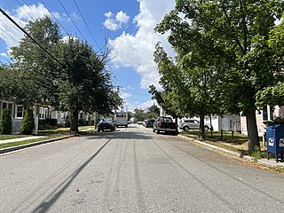
<span class="mw-page-title-main">Bellerose Terrace, New York</span> Hamlet and census-designated place in New York, United States

Bellerose Terrace is a hamlet and census-designated place (CDP) in the Town of Hempstead in Nassau County, on Long Island, in New York, United States. The population was 2,329 at the 2020 census.
<span class="mw-page-title-main">Ansonville, North Carolina</span> Town in North Carolina, United States

Ansonville is a town in Anson County, North Carolina, United States. The population was 440 at the 2020 census. The town has a total area of 1.5 square miles (3.8 km2), all land. It is located on the northern edge of Anson County, about a mile west of the Pee Dee River.

<span class="mw-page-title-main">Forest Park, Ohio</span> City in Ohio, United States

Forest Park is the second most populous city in Hamilton County, Ohio, United States. It is a suburb of Cincinnati. The population was 20,189 at the 2020 census.
<span class="mw-page-title-main">Langston, Oklahoma</span> Town in Oklahoma, United States

Langston is a town in Logan County, Oklahoma, United States, and is part of the Oklahoma City Metropolitan Statistical Area. The population was 1,619 as of the 2020 United States census. Langston is home to Langston University, the only historically black college in Oklahoma.

Meridian is a town in eastern Logan County, Oklahoma, United States. The population was 38 at the 2010 census, a decline of 29.5 percent from the figure of 54 in 2000. It is part of the Oklahoma City Metropolitan Statistical Area. The community name was chosen because of its location on the Indian meridian.

<span class="mw-page-title-main">Arcadia, Oklahoma</span> Town in Oklahoma County, Oklahoma

Arcadia is a town in Oklahoma County, Oklahoma, United States, and a part of the Oklahoma City metropolitan area. The population was 247 at the 2010 census, a decrease of 11.5 percent from the figure of 279 in 2000.

<span class="mw-page-title-main">Villa del Sol, Texas</span> Census-designated place in Texas, United States

Villa del Sol is a census-designated place (CDP) in Cameron County, Texas, United States. The population was 153 at the 2020 census. It is part of the Brownsville–Harlingen Metropolitan Statistical Area.

<span class="mw-page-title-main">Northfork, West Virginia</span> Town in West Virginia, United States

Northfork is a town in McDowell County, West Virginia, United States, located on U.S. Route 52 between Welch and Bluefield.

References

  1. "ArcGIS REST Services Directory". United States Census Bureau. Retrieved September 20, 2022.
  2. 1 2 U.S. Geological Survey Geographic Names Information System: Forest Park, Oklahoma
  3. "U.S. Census website". United States Census Bureau . Retrieved October 31, 2008.
  4. 1 2 3 4 "2010 City Population and Housing Occupancy Status". U.S. Census Bureau. Retrieved October 18, 2013.[ dead link ]
  5. "Census of Population and Housing". Census.gov. Retrieved June 4, 2015.
  6. "P2 Hispanic or Latino, and Not Hispanic or Latino by Race – 2010: DEC Redistricting Data (PL 94-171) – Forest Park town, Oklahoma". United States Census Bureau .
  7. "P2 Hispanic or Latino, and Not Hispanic or Latino by Race – 2020: DEC Redistricting Data (PL 94-171) - Forest Park town, Oklahoma". United States Census Bureau .
  8. "2020 CENSUS - SCHOOL DISTRICT REFERENCE MAP: Oklahoma County, OK" (PDF). U.S. Census Bureau . Retrieved January 28, 2024.
  9. "Mid-Del Map" (PDF). Mid-Del School District . Retrieved January 28, 2024. - Location of Forest Park indicated. - See also Census Map 2020 of Smith Village