Crutcho, Oklahoma

Last updated

Crutcho
USA Oklahoma location map.svg
Red pog.svg
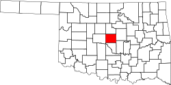
Crutcho
Location within the state of Oklahoma
Usa edcp location map.svg
Red pog.svg
Crutcho
Crutcho (the United States)
Coordinates: 35°29′23″N97°24′36″W / 35.48972°N 97.41000°W / 35.48972; -97.41000
Country United States
State Oklahoma
County Oklahoma
Time zone UTC-6 (Central (CST))
  Summer (DST) UTC-5 (CDT)

Crutcho is an unincorporated community in Oklahoma County, Oklahoma, United States, on the outskirts of Oklahoma City. It is located near the intersection of US Highway 62 (Northeast 23rd Street) and Air Depot Boulevard. It took its name from Crutcho Creek, which flows through the community. The creek, in turn, took its name from the Crutch-O Ranch which operated in the area prior to opening of Old Oklahoma for settlement.

Sources


Related Research Articles

<span class="mw-page-title-main">McIntosh County, Oklahoma</span> County in Oklahoma, United States

McIntosh County is a county located in the U.S. state of Oklahoma. As of the 2020 census, the population was 18,941. Its county seat is Eufaula. The county is named for an influential Muscogee Creek family, whose members led the migration of the Lower Towns to Indian Territory and served as leaders for generations.

<span class="mw-page-title-main">Scouting in Oklahoma</span> Youth movement

Scouting in Oklahoma has a long history, from the 1910s to the present day, serving thousands of youth in programs that suit the environment in which they live.

<span class="mw-page-title-main">Pryor Creek, Oklahoma</span> City in Oklahoma, United States

Pryor Creek or Pryor is a city in and county seat of Mayes County, Oklahoma, United States. The population was 8,659 at the 2000 census and 9,539 in the 2010 census.

<span class="mw-page-title-main">Coweta, Oklahoma</span> City in Oklahoma, United States

Coweta is a city in Wagoner County, Oklahoma, United States, a suburb of Tulsa. As of 2010, its population was 9,943. Part of the Creek Nation in Indian Territory before Oklahoma became a U.S. state, the town was first settled in 1840.

<span class="mw-page-title-main">Skiatook, Oklahoma</span> City in Oklahoma, United States

Skiatook is a city in Osage and Tulsa counties in the U.S. state of Oklahoma located in the northeastern part of the state, approximately 20 miles north and west of Tulsa. Due to its location on the border between Osage County and Tulsa County, Skiatook has been referred to as "the Gateway to the Osage." The town includes the state highway junction of Oklahoma State Highway 11 and Oklahoma State Highway 20. The population was 8,450 at the 2020 census, an increase of 14.24 percent over the figure of 7,397 recorded in 2010.

<span class="mw-page-title-main">Owasso, Oklahoma</span> City in Oklahoma, United States

Owasso is a city in Rogers and Tulsa Counties in the U.S. state of Oklahoma, and the largest northern suburb of Tulsa. The population was 38,732 persons as of the 2021 census estimate, compared to 28,915 at the 2010 census, a gain of 32.24 percent. Originally settled in 1881 in Indian Territory, the town was incorporated in 1904 just before Oklahoma statehood and was chartered as a city in 1972.

<span class="mw-page-title-main">Broken Arrow, Oklahoma</span> City in Oklahoma, United States

Broken Arrow is a city located in the northeastern part of the U.S. state of Oklahoma, primarily in Tulsa County, with a portion in western Wagoner County. It is the largest suburb of Tulsa. According to the 2020 census, Broken Arrow has a population of 113,540 residents and is the fourth-largest city in the state. The city is part of the Tulsa Metropolitan Area, which has a population of 1,023,988 residents.

<span class="mw-page-title-main">Seminole</span> Native American people originally from Florida

The Seminoles are a Native American people who developed in Florida in the 18th century. Today, they live in Oklahoma and Florida, and comprise three federally recognized tribes: the Seminole Nation of Oklahoma, the Seminole Tribe of Florida, and the Miccosukee Tribe of Indians of Florida, as well as independent groups. The Seminole people emerged in a process of ethnogenesis from various Native American groups who settled in Spanish Florida beginning in the early 1700s, most significantly northern Muscogee Creeks from what is now Georgia and Alabama.

<span class="mw-page-title-main">Land Rush of 1889</span> 1889 land run in Oklahoma, US

The Oklahoma Land Rush of 1889 was the first land run into the Unassigned Lands of former Indian Territory, which had earlier been assigned to the Creek and Seminole peoples. The area that was opened to settlement included all or part of Canadian, Cleveland, Kingfisher, Logan, Oklahoma, and Payne counties of the present-day US state of Oklahoma.

<span class="mw-page-title-main">Black Seminoles</span> Ethnic group

The Black Seminoles, or Afro-Seminoles, are Native American-Africans associated with the Seminole people in Florida and Oklahoma. They are mostly blood descendants of the Seminole people, free Africans, and escaped former slaves, who allied with Seminole groups in Spanish Florida. Many have Seminole lineage, but due to the stigma of having very dark or brown skin and kinky hair, they all have been categorized as slaves or freedmen.

Hochatown State Park was once an independent Oklahoma state park in far-southeastern Oklahoma, north of the city of Broken Bow. It was combined into Beavers Bend State Park in 2017. It is a popular destination for tourists from Oklahoma and Texas interested in camping or boating on Broken Bow Lake.

Millwood Public Schools is a PK-12 district with an enrollment of approximately 1035 students in Oklahoma City, Oklahoma. The district covers an area of 10.5 square miles (27 km2), with its boundaries between Lincoln Boulevard and Sunnylane/Coltrane Rroads on the west and east, and between NE 48th and NE 86th on the south and north. The student body is primarily made up of African-American students (98%). Two schools, an arts academy, a ninth grade academy, a pre-school program and two community learning centers are maintained within the district.

<span class="mw-page-title-main">Muscogee Nation</span> Federally recognized Native American tribe in Oklahoma

The Muscogee Nation, or Muscogee (Creek) Nation, is a federally recognized Native American tribe based in the U.S. state of Oklahoma. The nation descends from the historic Muscogee Confederacy, a large group of indigenous peoples of the Southeastern Woodlands. Official languages include Muscogee, Yuchi, Natchez, Alabama, and Koasati, with Muscogee retaining the largest number of speakers. They commonly refer to themselves as Este Mvskokvlke. Historically, they were often referred to by European Americans as one of the Five Civilized Tribes of the American Southeast.

Crum Creek is a former railroad spur along the St. Louis and San Francisco Railway in Pushmataha County, Oklahoma, United States, 14 miles southwest of Tuskahoma.

Finley is an unincorporated community in Pushmataha County, Oklahoma, 10 miles northeast of Antlers.

Jumbo is an unincorporated community in western Pushmataha County, Oklahoma, United States, 10 miles north of Miller.

Miller is an unincorporated community in southwestern Pushmataha County, Oklahoma, United States, 10 miles northwest of Antlers and a short distance west of Moyers.

Sardis was a community in northern Pushmataha County, Oklahoma, United States, six miles northwest of Clayton.

Jack's Fork County, also known as Jack Fork County, was a political subdivision of the Choctaw Nation of Indian Territory. The county formed part of the nation's Pushmataha District, or Third District, one of three administrative super-regions.

Gypsy is an unincorporated community in Creek County, in the U.S. state of Oklahoma. It is about twelve miles south-southwest of Bristow.