Woodlawn Park, Oklahoma

Last updated

Woodlawn Park, Oklahoma
Oklahoma County Oklahoma Incorporated and Unincorporated areas Woodlawn Park highlighted.svg
Location in Oklahoma County and the state of Oklahoma.
Coordinates: 35°30′35″N97°38′59″W / 35.50972°N 97.64972°W / 35.50972; -97.64972
Country United States
State Oklahoma
County Oklahoma
Area
[1]
  Total0.12 sq mi (0.32 km2)
  Land0.12 sq mi (0.32 km2)
  Water0.00 sq mi (0.00 km2)
Elevation
[2]
1,289 ft (393 m)
Population
 (2020)
  Total160
  Density1,290.32/sq mi (499.06/km2)
Time zone UTC-6 (Central (CST))
  Summer (DST) UTC-5 (CDT)
FIPS code 40-82000 [3]
GNIS feature ID2413505 [2]

Woodlawn Park is a town in Oklahoma County, Oklahoma, United States, and a part of the Oklahoma City Metropolitan Area. The population was 161 at the 2000 census.

Contents

History

An incorporated town in Oklahoma County, Woodlawn Park is one of several urban islands surrounded by other towns of the Oklahoma City metropolitan area. Woodlawn Park lies within the city of Bethany, which is itself surrounded by Oklahoma City. Originally the area was the farm of Frank Levi Braniger, who acquired land in Council Grove Township with, or soon after, the Land Run of 1889. In 1923 one of Braniger's sons subdivided a heavily wooded part of the property into residential lots. This became Woodlawn Park, a rectangle of .128 square miles (approximately eighty-one acres), measuring one-half mile east–west and one-quarter mile north–south. It is bounded by Council Road on the west, Glade Avenue on the east, NW 36th Street on the south, and NW 39th Street on the north. Within the boundaries, between NW 37th and NW 38th streets lies a long park, the center of the town. A few homes were constructed in the late 1920s, but most of the development occurred in the late 1940s and through the 1950s.

Incorporation was accomplished in July 1952 as Bethany began to envelop the neighborhood. The 1960 census recorded 129 inhabitants. Woodlawn Park's large lots were gradually sold, and housing construction continued into the 1990s. After peaking at 220 residents in 1970, the community's population declined to 161 in 2000. The town supports no commercial development. A board of trustees is elected, but city services are provided by Bethany and Oklahoma County. Most residents are employed in management and the professions, and all work in the surrounding metropolitan area. http://digital.library.okstate.edu/encyclopedia/entries/W/WO012.html

Geography

According to the United States Census Bureau, the town has a total area of 0.1 square miles (0.26 km2), all land.

Demographics

Historical population
CensusPop.Note
1960 129
1970 22070.5%
1980 167−24.1%
1990 1701.8%
2000 161−5.3%
2010 153−5.0%
2020 1604.6%
U.S. Decennial Census [4]

As of the census of 2000, there were 161 people, 75 households, and 48 families residing in the town. The population density was 1,256.4 inhabitants per square mile (485.1/km2). There were 77 housing units at an average density of 600.9 per square mile (232.0/km2). The racial makeup of the town was 93.79% White, 1.24% Native American, 0.62% Asian, and 4.35% from two or more races.

There were 75 households, out of which 20.0% had children under the age of 18 living with them, 61.3% were married couples living together, 1.3% had a female householder with no husband present, and 36.0% were non-families. 34.7% of all households were made up of individuals, and 20.0% had someone living alone who was 65 years of age or older. The average household size was 2.15 and the average family size was 2.75.

In the town, the population was spread out, with 18.0% under the age of 18, 3.7% from 18 to 24, 13.0% from 25 to 44, 39.1% from 45 to 64, and 26.1% who were 65 years of age or older. The median age was 51 years. For every 100 females, there were 109.1 males. For every 100 females age 18 and over, there were 88.6 males.

The median income for a household in the town was $46,806, and the median income for a family was $58,750. Males had a median income of $46,250 versus $33,333 for females. The per capita income for the town was $43,376. About 6.0% of families and 5.6% of the population were below the poverty line, including none of those under the age of 18 and 8.3% of those 65 or over.

Education

It is in the Putnam City Public Schools school district. [5]

Zoned schools are: Overholser Elementary School, [6] Western Oaks Middle School, [7] and Putnam City West High School. [8]

Related Research Articles

<span class="mw-page-title-main">Oklahoma County, Oklahoma</span> County in Oklahoma, United States

Oklahoma County is located in the central part of the U.S. state of Oklahoma. As of the 2020 census, the population was 796,292, making it the most populous county in Oklahoma. The county seat is Oklahoma City, the state capital and largest city. Oklahoma County is at the heart of the Oklahoma City metropolitan statistical area.

<span class="mw-page-title-main">Bethany, Connecticut</span> Town in Connecticut, United States

Bethany is a town in New Haven County, Connecticut, United States. The town is part of the South Central Connecticut Planning Region. The population was 5,297 at the 2020 census.

<span class="mw-page-title-main">Woodlawn Heights, Indiana</span> Town in Indiana, United States

Woodlawn Heights is a town in Anderson Township, Madison County, Indiana, United States. It is part of the Indianapolis–Carmel–Anderson metropolitan statistical area. The population was 91 at the 2020 census.

<span class="mw-page-title-main">Paola, Kansas</span> City and County seat in Kansas, United States

Paola is a city in and the county seat of Miami County, Kansas, United States. As of the 2020 census, the population of the city was 5,768.

<span class="mw-page-title-main">Portis, Kansas</span> City in Osborne County, Kansas

Portis is a city in Osborne County, Kansas, United States. As of the 2020 census, the population of the city was 86.

<span class="mw-page-title-main">Woodlawn Park, Kentucky</span> City in Kentucky, United States

Woodlawn Park is a home rule-class city in Jefferson County, Kentucky, United States. The population was 942 at the 2010 census, down from 1,033 at the 2000 census.

<span class="mw-page-title-main">Shenandoah, Louisiana</span> Census-designated place in Louisiana, United States

Shenandoah is an unincorporated area and census-designated place (CDP) in East Baton Rouge Parish, Louisiana, United States. It is part of the Baton Rouge Metropolitan Statistical Area. The population was 18,399 at the 2010 census, up from 17,070 in 2000. Shenandoah consists of a number of residential subdivisions, including Shenandoah Estates, Shenandoah Park, White Oak Landing, White Oak Estates, The Woods and The Lake at White Oak.

<span class="mw-page-title-main">Woodlawn, Prince George's County, Maryland</span> Census-designated place in Maryland

Woodlawn is an unincorporated area and census-designated place (CDP) in Prince George's County, Maryland, United States. As of the 2020 census it had a population of 7,541.

<span class="mw-page-title-main">Gladstone, Missouri</span> City in Missouri, United States

Gladstone is a city in Clay County, Missouri, United States and a suburb of Kansas City. The City of Gladstone is located about 10–20 minutes from downtown Kansas City, and about 10–20 minutes from Kansas City International Airport. As of the 2020 census, the city population was 27,063. It is part of the Kansas City metropolitan area.

<span class="mw-page-title-main">Union City, Oklahoma</span> Town in Oklahoma, United States

Union City is a town in Canadian County, Oklahoma, United States. The population was 1,645 at the 2010 census, a 19.6 percent increase from 1,375 in 2000. It is part of the Oklahoma City metropolitan statistical area.
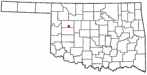
<span class="mw-page-title-main">Bethany, Oklahoma</span> City in Oklahoma, United States

Bethany is a city in Oklahoma County, Oklahoma, United States, and a part of the Oklahoma City metropolitan area. Bethany has a population of 20,831 at the 2020 census, a 9.3% increase from 2010. The community was founded in 1909 by followers of the Church of the Nazarene from Oklahoma City.

<span class="mw-page-title-main">Forest Park, Oklahoma</span> Town in Oklahoma, United States

Forest Park is a town in Oklahoma County, Oklahoma, United States, and a part of the Oklahoma City metropolitan area. The population was 998 at the 2010 census.

<span class="mw-page-title-main">Lake Aluma, Oklahoma</span> Town in Oklahoma, United States

Lake Aluma is a town in Oklahoma County, Oklahoma, United States, and a part of the Oklahoma City Metropolitan Area. The population was 88 at the 2010 census.

<span class="mw-page-title-main">Nicoma Park, Oklahoma</span> City in Oklahoma, United States

Nicoma Park is a city in Oklahoma County, Oklahoma, United States, and a part of the Oklahoma City metropolitan area. The name Nicoma is a portmanteau of the first three letters of Nichols, for G.A. Nichols, and the last three letters of Oklahoma. The population was 2,313 at the 2020 census, a 3.3% decrease from 2010.

<span class="mw-page-title-main">Smith Village, Oklahoma</span> Town in Oklahoma, United States

Smith Village is a town in Oklahoma County, Oklahoma, United States, and a part of the Oklahoma City Metropolitan Area. The population was 66 at the 2010 census.

<span class="mw-page-title-main">The Village, Oklahoma</span> City in Oklahoma, United States

The Village is a city in Oklahoma County, Oklahoma, United States, and a part of the Oklahoma City metropolitan area. The population was 9,538 at the 2020 Census.

<span class="mw-page-title-main">Valley Brook, Oklahoma</span> Town in Oklahoma, United States

Valley Brook is a town in Oklahoma County, Oklahoma, United States, and is part of the Oklahoma City Metropolitan Area. The population was 765 at the 2010 census.

<span class="mw-page-title-main">Warr Acres, Oklahoma</span> City in Oklahoma, United States

Warr Acres is a city in Oklahoma County, Oklahoma, United States, and a part of the Oklahoma City metropolitan area. It was established after World War II by C.B. Warr, a dynamic businessman, builder, and commercial developer. The population was 10,452 at the 2020 census, a 4.1% increase from 2010.

<span class="mw-page-title-main">Bethany, West Virginia</span> Town in West Virginia, United States

Bethany is a town in southern Brooke County, West Virginia, United States. The population was 756 at the 2020 census. It is part of the Weirton–Steubenville metropolitan area. It is best known as the home of Bethany College, a private liberal arts college that was the first institution of higher education in what is now West Virginia.

<span class="mw-page-title-main">Winfield, West Virginia</span> City in West Virginia, United States

Winfield is a city in and the county seat of Putnam County, West Virginia, United States, located along the Kanawha River. The population was 2,397 at the 2020 census. It is part of the Huntington–Ashland metropolitan area.

References

  1. "ArcGIS REST Services Directory". United States Census Bureau. Retrieved September 20, 2022.
  2. 1 2 U.S. Geological Survey Geographic Names Information System: Woodlawn Park, Oklahoma
  3. "U.S. Census website". United States Census Bureau . Retrieved October 31, 2008.
  4. "Census of Population and Housing". Census.gov. Retrieved June 4, 2015.
  5. "2020 CENSUS - SCHOOL DISTRICT REFERENCE MAP: Oklahoma County, OK" (PDF). U.S. Census Bureau . Retrieved January 28, 2024. - Woodlawn Park detail
  6. "Putnam City West Elementary School Boundaries". Putnam City Public Schools . Retrieved January 28, 2024. - Linked from here, compare to Woodlawn Park boundaries.
  7. "Putnam City West Middle School Boundaries". Putnam City Public Schools . Retrieved January 28, 2024. - Linked from here, compare to Woodlawn Park boundaries.
  8. "Putnam City West High School Boundaries". Putnam City Public Schools . Retrieved January 28, 2024. - Linked from here, compare to Woodlawn Park boundaries.