Cimarron City, Oklahoma

Last updated

Cimarron City, Oklahoma
OKMap-doton-CimarronCity.PNG
Location of Cimarron City, Oklahoma
Coordinates: 35°53′19″N97°36′08″W / 35.88861°N 97.60222°W / 35.88861; -97.60222
Country United States
State Oklahoma
County Logan
Area
[1]
  Total1.79 sq mi (4.64 km2)
  Land1.69 sq mi (4.37 km2)
  Water0.11 sq mi (0.27 km2)
Elevation
[2]
968 ft (295 m)
Population
 (2020)
  Total155
  Density91.93/sq mi (35.49/km2)
Time zone UTC-6 (Central (CST))
  Summer (DST) UTC-5 (CDT)
FIPS code 40-14500 [3]
GNIS feature ID2413203 [2]

Cimarron City is a town in Logan County, Oklahoma, United States. The population was 150 at the 2010 census, a 39.4 percent gain over the figure of 110 in 2000. [4] It is part of the Oklahoma City Metropolitan Statistical Area. Cimarron City is a combination bedroom and retirement community.

Contents

History

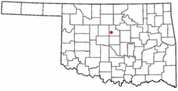
Cimarron City is a planned community that was founded in July 1973 by real estate developers. J. L. Swaim, a former Oklahoma resident residing in Chico, California, and real estate dealer Don McLaughlin, of Oklahoma City. Leon Spitz, an Oklahoma City engineer, designed the residential section. The community grew slowly, as homes were constructed for families and retirees who wanted to live amid a rural ambience. Residents who still work typically must commute to Oklahoma City, Guthrie, Edmond or Crescent. It incorporated in 1974, and was named for the Cimarron River, which flows through the southwestern part of the town. [5]

Geography

Cimarron City lies 2 miles (3.2 km) south of Crescent and 10 miles (16 km) west of Guthrie. [5]

According to the United States Census Bureau, the town has a total area of 1.7 square miles (4.4 km2), of which, 1.6 square miles (4.1 km2) of it is land and 0.1 square miles (0.26 km2) of it (7.56%) is water.

Demographics

Historical population
CensusPop.Note
1990 71
2000 11054.9%
2010 15036.4%
2020 1553.3%
U.S. Decennial Census [6]

As of the census [3] of 2000, there were 110 people, 44 households, and 30 families residing in the town. The population density was 69.2 inhabitants per square mile (26.7/km2). There were 49 housing units at an average density of 30.8 per square mile (11.9/km2). The racial makeup of the town was 90.91% White, 1.82% African American, 4.55% Native American, 0.91% from other races, and 1.82% from two or more races. Hispanic or Latino of any race were 1.82% of the population.

There were 44 households, out of which 34.1% had children under the age of 18 living with them, 54.5% were married couples living together, 9.1% had a female householder with no husband present, and 31.8% were non-families. 27.3% of all households were made up of individuals, and 6.8% had someone living alone who was 65 years of age or older. The average household size was 2.50 and the average family size was 3.03.

In the town, the population was spread out, with 28.2% under the age of 18, 2.7% from 18 to 24, 28.2% from 25 to 44, 30.9% from 45 to 64, and 10.0% who were 65 years of age or older. The median age was 40 years. For every 100 females, there were 120.0 males. For every 100 females age 18 and over, there were 125.7 males.

The median income for a household in the town was $34,219, and the median income for a family was $50,625. Males had a median income of $30,938 versus $9,583 for females. The per capita income for the town was $17,380. There were 10.3% of families and 14.3% of the population living below the poverty line, including 31.3% of under eighteens and 14.3% of those over 64.

Culture

The community was the fictional 1888 setting for the 1967–68 United States television series Cimarron Strip starring actor Stuart Whitman as a U.S. Marshal. However, in the film series the show's creator placed the community closer to the Cimarron Strip or Cherokee Strip of the Indian Territory panhandle area near the Cimarron River. Another U.S. dramatic television program, titled Cimarron City (TV series) (1958–60), was also set in the town.

Related Research Articles

<span class="mw-page-title-main">Payne County, Oklahoma</span> County in Oklahoma, United States

Payne County is located in the U.S. state of Oklahoma. As of the 2020 census, its population was 81,646. Its county seat is Stillwater. The county was created in 1890 as part of Oklahoma Territory and is named for Capt. David L. Payne, a leader of the "Boomers".

<span class="mw-page-title-main">Logan County, Oklahoma</span> County in Oklahoma, United States

Logan County is a county located in the U.S. state of Oklahoma. As of the 2020 census, the population was 49,555. Its county seat is Guthrie.

<span class="mw-page-title-main">Cimarron County, Oklahoma</span> County in Oklahoma, United States

Cimarron County is the westernmost county in the U.S. state of Oklahoma. Its county seat is Boise City. As of the 2020 census, its population was 2,296, making it the least-populous county in Oklahoma; and indeed, throughout most of its history, it has had both the smallest population and the lowest population density of any county in Oklahoma. Located in the Oklahoma Panhandle, Cimarron County contains the only community in the state (Kenton) that observes the Mountain Time Zone. Black Mesa, the highest point in the state, is in the northwest corner of the county. The Cimarron County community of Regnier has the distinction of being the driest spot in Oklahoma ranked by lowest annual average precipitation, at just 15.62 inches; at the same time, Boise City is the snowiest location in Oklahoma ranked by highest annual average snowfall, at 31.6 inches.

<span class="mw-page-title-main">Cimarron, Kansas</span> City in Gray County, Kansas

Cimarron is a city in and the county seat of Gray County, Kansas, United States. As of the 2020 census, the population of the city was 1,981.

<span class="mw-page-title-main">Forgan, Oklahoma</span> Town in Oklahoma, United States

Forgan is a town in Beaver County, Oklahoma, United States. As of the 2020 census, the town’s population was 450.

<span class="mw-page-title-main">Keyes, Oklahoma</span> Town in Oklahoma, United States

Keyes is a town in Cimarron County, Oklahoma, United States. As of the 2020 census, the town’s population was 276.

<span class="mw-page-title-main">Oilton, Oklahoma</span> City in Oklahoma, United States

Oilton is a city in Creek County, Oklahoma, United States. The population was 885 at the 2020 census, a 12.6% decline from the 1,013 recorded in 2010.

<span class="mw-page-title-main">Kingfisher, Oklahoma</span> City in Oklahoma, United States

Kingfisher is a city in and the county seat of Kingfisher County, Oklahoma,. The population was 4,903 at the time of the 2020 census. It is the former home and namesake of Kingfisher College. According to the Encyclopedia of Oklahoma History and Culture, Kingfisher is now primarily a bedroom community for people employed in Enid and Oklahoma City.

<span class="mw-page-title-main">Loyal, Oklahoma</span> Town in Oklahoma, United States

Loyal is a town in Kingfisher County, Oklahoma, United States. The population was 79 at the 2010 census.

<span class="mw-page-title-main">Cedar Valley, Oklahoma</span> City in Oklahoma, United States

Cedar Valley is a city in Logan County, Oklahoma, United States. The population was 288 at the 2010 census, nearly five times the figure of 58 in 2000. It is part of the Oklahoma City Metropolitan Statistical Area. It is primarily a bedroom community, since more than 90 percent of the employed inhabitants commute to work in other towns. The main attraction is Cedar Valley Golf Club, which is by far the largest business in town.

<span class="mw-page-title-main">Coyle, Oklahoma</span> Town in Oklahoma, United States

Coyle is a town in Logan County, Oklahoma, United States. The population was 325 at the 2010 census, compared to the figure of 337 in 2000. It is part of the Oklahoma City metropolitan area. The town was named for William Coyle, an influential Guthrie business man.

Meridian is a town in eastern Logan County, Oklahoma, United States. The population was 38 at the 2010 census, a decline of 29.5 percent from the figure of 54 in 2000. It is part of the Oklahoma City Metropolitan Statistical Area. The community name was chosen because of its location on the Indian meridian.

<span class="mw-page-title-main">Cleo Springs, Oklahoma</span> Town in Oklahoma, United States

Cleo Springs is a town in Major County, Oklahoma, United States. The population was 326 at the 2000 census.

<span class="mw-page-title-main">Lake Aluma, Oklahoma</span> Town in Oklahoma, United States

Lake Aluma is a town in Oklahoma County, Oklahoma, United States, and a part of the Oklahoma City Metropolitan Area. The population was 88 at the 2010 census.

<span class="mw-page-title-main">Osage, Oklahoma</span> Town in Oklahoma, United States

Osage is a town in Osage County, Oklahoma, United States. Also known as Osage City, it lies within the Osage Reservation on the shore of Lake Keystone. The population was 156 at the 2010 census, down 17 percent from the figure of 188 recorded in 2000.

<span class="mw-page-title-main">Perkins, Oklahoma</span> City in Oklahoma, United States

Perkins is a city in southern Payne County, Oklahoma, United States. The population was 2,831 at the 2010 census, an increase of 24.6 percent from the figure of 2,272 in 2000. The name is derived from Walden Perkins, a congressman who helped establish the local post office. The Iowa Tribe of Oklahoma is headquartered here.

<span class="mw-page-title-main">Ripley, Oklahoma</span> Town in Oklahoma, United States

Ripley is a town in southeastern Payne County, Oklahoma, United States. The population was 423 at the 2010 census, a decline of 9.2 percent from the figure of 444 in 2000. The town was named after Edward Ripley, the 14th president of the Atchison, Topeka and Santa Fe Railway.

<span class="mw-page-title-main">Freedom, Oklahoma</span> City in Oklahoma, United States

Freedom is a town in Woods County, Oklahoma, United States. It lies twenty-five miles west of Alva, on the banks of the Cimarron River. As of the 2010 census, the city population was 289.

<span class="mw-page-title-main">Mannford, Oklahoma</span> City in Oklahoma, United States

Mannford is a city in Creek County in the northeastern part of the U.S. state of Oklahoma. The population was 3,262 at the time of the 2020 census, up from 3,076 in 2010. The city sits next to Keystone Lake and claims to be the "Striped Bass Capital of the World".

<span class="mw-page-title-main">Cashion, Oklahoma</span> Town in Oklahoma, United States

Cashion is a town in Kingfisher and Logan counties in the U.S. state of Oklahoma. The Logan County portion of Cashion is part of the Oklahoma City Metropolitan Statistical Area. The town population was 802 at the 2010 census, up from 643 in 2000.

References

  1. "ArcGIS REST Services Directory". United States Census Bureau. Retrieved September 20, 2022.
  2. 1 2 U.S. Geological Survey Geographic Names Information System: Cimarron City, Oklahoma
  3. 1 2 "U.S. Census website". United States Census Bureau . Retrieved January 31, 2008.
  4. CensusViewer: Cimarron City, Oklahoma." Accessed May 28, 2015.
  5. 1 2 Dianna Everett, "Cimarron City," Encyclopedia of Oklahoma History and Culture. Accessed May 28, 2015.
  6. "Census of Population and Housing". Census.gov. Retrieved June 4, 2015.