Earlsboro, Oklahoma

Last updated

Earlsboro, Oklahoma
Earlsboro Town Hall, Earlsboro, Oklahoma.jpg
Earlsboro Town Hall
Nickname: 
The Boro
OKMap-doton-Earlsboro.PNG
Location of Earlsboro, Oklahoma
Coordinates: 35°19′41″N96°48′05″W / 35.32806°N 96.80139°W / 35.32806; -96.80139
Country United States
State Oklahoma
County Pottawatomie
Government
  MayorLaCosta Ann Rawls
Area
[1]
  Total9.31 sq mi (24.11 km2)
  Land9.29 sq mi (24.07 km2)
  Water0.02 sq mi (0.04 km2)
Elevation
[2]
1,017 ft (310 m)
Population
 (2020)
  Total594
  Density63.92/sq mi (24.68/km2)
Time zone UTC-6 (Central (CST))
  Summer (DST) UTC-5 (CDT)
ZIP code
74840
Area code 405
FIPS code 40-22500 [3]
GNIS feature ID2412458 [2]

Earlsboro is a town in Pottawatomie County, Oklahoma, United States. The population was 594 by the 2020 United States census. [4] It was once called "...the town that whisky built and oil broke." [5]

Contents

History

The town of Earlsborough (as it was spelled on the town plat) began in 1891, when the Choctaw Coal and Railway (later the Choctaw, Oklahoma and Gulf Railroad) built a line west from the Seminole Nation into Oklahoma Territory. The town was located one-half mile inside Oklahoma Territory. It was named for James Earls, a local African American who had served as an orderly for Confederate General Joseph Wheeler during the Civil War. The spelling of the town name changed when the Earlsboro post office opened on June 12, 1895. [5]

The town had an economic boom from the outset because Indian Territory was legally "dry," but Oklahoma Territory was not. The first three businesses were saloons, and it was said that 90 percent of the merchants were engaged in liquor sales. By 1905, the town had a population estimated at 500. [5] Many customers were visitors from Indian Territory.

Statehood brought prohibition to all of Oklahoma, and the population of Earlsboro quickly dropped to 387. The local economy subsequently relied on agriculture instead of liquor. Oil was struck nearby on March 1, 1926. The first well produced 200 barrels a day. News of the strike attracted workers, and the town population increased to an estimated ten thousand people within two months. The ensuing boom led to construction of a one hundred thousand dollar hotel, a large theater, and many different kinds of business. In 1929, the town passed a $225,000 bond issue to construct a water and sewer system. The population was officially 1,950 at the 1930 census. [5]

The oil boom turned into a bust when production declined precipitously in 1932. The newcomers, now deeply in debt, fled the scene, abandoning homes and businesses. The city went into bankruptcy, since it could no longer pay its debts. In 1959 the Daily Oklahoman reported that Earlsboro "was the town that whisky built and oil broke." [5]

On May 4, 2022, an EF2 tornado struck the southeastern part of town before looping around and striking the eastern half of the town, damaging homes, power lines, and buildings. An additional EF1 tornado began near the starting point of the first tornado, causing additional damage as it moved east. [6]

Geography

According to the United States Census Bureau, the town has a total area of 9.2 square miles (24 km2), of which 9.2 square miles (24 km2) is land and 0.04 square miles (0.10 km2) (0.22%) is water.

Demographics

Historical population
CensusPop.Note
1910 638
1920 317−50.3%
1930 1,950515.1%
1940 486−75.1%
1950 278−42.8%
1960 257−7.6%
1970 248−3.5%
1980 2667.3%
1990 535101.1%
2000 63318.3%
2010 628−0.8%
2020 594−5.4%
U.S. Decennial Census [7]

As of the census of 2010, there were 628 people living in the town. The population density was 68 inhabitants per square mile (26/km2). There were 260 housing units at an average density of 27 per square mile (10/km2). [8] The racial makeup of the town was 70.46% White, 11.22% African American, 12.16% Native American, 0.32% Asian, 0.16% from other races, and 5.69% from two or more races. Hispanic or Latino of any race were 1.42% of the population.

There were 229 households, [8] out of which 34.2% had children under the age of 18 living with them, 68.0% were married couples living together, 8.8% had a female householder with no husband present, and 19.7% were non-families. 18.0% of all households were made up of individuals, and 10.1% had someone living alone who was 65 years of age or older. The average household size was 2.78 and the average family size was 3.13.

In the town, the population was spread out, with 25.8% under the age of 18, 11.1% from 18 to 24, 25.6% from 25 to 44, 23.1% from 45 to 64, and 14.5% who were 65 years of age or older. The median age was 37 years. For every 100 females, there were 89.5 males. For every 100 females age 18 and over, there were 91.1 males.

The median income for a household in the town was $28,214, and the median income for a family was $32,396. Males had a median income of $30,956 versus $15,865 for females. The per capita income for the town was $12,488. About 11.3% of families and 12.6% of the population were below the poverty line, including 9.2% of those under age 18 and 20.7% of those age 65 or over.

Notable residents

Notable events

The podcast Song Salad, with hosts Shannon and Scott (featuring special guest Abby Trott), covered the town of Earlsboro in episode 66 (June 2017). https://soundcloud.com/songsaladpodcast/ep-66-shinda-ushi-dead-cows

Related Research Articles

<span class="mw-page-title-main">Marshall County, Oklahoma</span> County in Oklahoma, United States

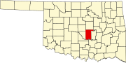
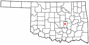
Marshall County is a county located on the south central border of Oklahoma. As of the 2020 census, the population was 15,312. Its county seat is Madill. The county was created at statehood in 1907 from the former Pickens County of the Chickasaw Nation. It was named to honor the maiden name of the mother of George Henshaw, a member of the 1906 Oklahoma Constitutional Convention. The county and its cities are part of the Texoma region.

<span class="mw-page-title-main">Tushka, Oklahoma</span> Town in Oklahoma, United States

Tushka is a town in Atoka County, Oklahoma, United States. The population was 312 at the 2010 census, a decline of 9.6 percent from the figure of 345 recorded in 2000.

<span class="mw-page-title-main">Bennington, Oklahoma</span> Incorporated Town in Oklahoma, United States

Bennington is an incorporated town in Bryan County, Oklahoma, United States. The population was 334 at the 2010 census.

<span class="mw-page-title-main">Bokchito, Oklahoma</span> Town in Oklahoma, United States

Bokchito is a town in Bryan County, Oklahoma, United States. The population was 632 at the 2010 census, an increase of 12.1 percent over the figure of 564 recorded in 2000. In the Choctaw language, "bok" means river, and "chito" means big or large, literally translating into "big creek".

<span class="mw-page-title-main">Boswell, Oklahoma</span> Town in Oklahoma, United States

Boswell is a town in Choctaw County, Oklahoma, United States. The population was 709 at the 2010 census.

<span class="mw-page-title-main">Fort Towson, Oklahoma</span> Town in Oklahoma, United States

Fort Towson is a town in Choctaw County, Oklahoma, United States. The population was 510 at the 2010 census, a 15.1 percent decline from the figure of 611 recorded in 2000. It was named for nearby Fort Towson, which had been established in May 1824 and named for General Nathan Towson, a hero of the War of 1812. The town of Fort Towson was established in 1902, after the Arkansas and Choctaw Railway reached eastern Choctaw County.

<span class="mw-page-title-main">Sawyer, Oklahoma</span> Town in Oklahoma, United States

Sawyer is a town in Choctaw County, Oklahoma, United States. The population was 321 at the 2010 census.

<span class="mw-page-title-main">Soper, Oklahoma</span> Town in Oklahoma, United States

Soper is a town in Choctaw County, Oklahoma, United States. The population was 261 at the 2010 census. The town was named for Pliny L. Soper, who was an attorney for the Arkansas and Choctaw Railway.

Whitefield is a town in northwestern Haskell County, Oklahoma, United States. The population was 377 at the 2020 census, compared with the figure of 391 recorded in 2010. It was named for Methodist bishop George Whitefield.

<span class="mw-page-title-main">Calvin, Oklahoma</span> Town in Oklahoma, United States

Calvin is a town in Hughes County, Oklahoma, United States. The population was 294 at the 2010 census.

<span class="mw-page-title-main">Howe, Oklahoma</span> Town in Oklahoma, United States

Howe is a town in Le Flore County, Oklahoma, United States. It is part of the Fort Smith, Arkansas-Oklahoma Metropolitan Statistical Area. The population was 802 at the 2010 census, a gain of 15.1 percent over the figure of 697 recorded in 2000. The town was once noted for producing coal and coke, but today is chiefly supported by agriculture.

<span class="mw-page-title-main">Spiro, Oklahoma</span> Town in Oklahoma, United States

Spiro is a town in Le Flore County, Oklahoma, United States. It is part of the Fort Smith, Arkansas-Oklahoma Metropolitan Statistical Area. The population was 2,164 at the 2010 census, a 2.8 percent decline from the figure of 2,227 recorded in 2000.

<span class="mw-page-title-main">Madill, Oklahoma</span> City in Oklahoma, United States

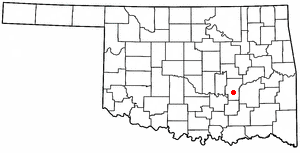
Madill is a city in and the county seat of Marshall County, Oklahoma, United States. It was named in honor of George Alexander Madill, an attorney for the St. Louis-San Francisco Railway. The population at the 2010 census was 3,770, an increase of 10.8 percent from 3,410 at the 2000 census. It is best known as the site of the annual National Sand Bass Festival. It is part of the Texoma region.

<span class="mw-page-title-main">Choctaw, Oklahoma</span> City in Oklahoma, United States

Choctaw is a city in Oklahoma County, Oklahoma, United States, with a population of 12,182 at the 2020 census, a 9.3% increase from 2010. It is the oldest chartered town in Oklahoma Territory. The city is located approximately 10 miles (16.1 km) east of Oklahoma City and is part of the Oklahoma City metropolitan area.

<span class="mw-page-title-main">Wynona, Oklahoma</span> Incorporated town in Osage County, Oklahoma

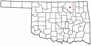
Wynona is an incorporated town in central Osage County, Oklahoma, United States. It was founded by a local Osage-Cherokee rancher, Antoine Rogers, in 1903. The population was 437 at the 2010 census, a 17.7 percent decline from 531 in 2000.

<span class="mw-page-title-main">Alderson, Oklahoma</span> Town in Oklahoma, United States

Alderson is a town in Pittsburg County, Oklahoma, United States. The population was 304 at the 2010 census.

<span class="mw-page-title-main">Crowder, Oklahoma</span> Town in Oklahoma, United States

Crowder is a town in Pittsburg County, Oklahoma, United States. The population was 430 at the 2010 census.

<span class="mw-page-title-main">Quinton, Oklahoma</span> Town in Oklahoma, United States

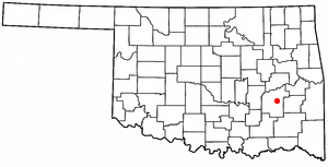
Quinton is a town in Pittsburg County, Oklahoma, United States. The population was 1,051 at the 2010 census. The town was named for Elizabeth Quinton, who lived to be 116 years old. Her family still resides in and around the town of Quinton. Web address https://townofquinton.com/
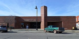
<span class="mw-page-title-main">Seminole, Oklahoma</span> City in Oklahoma, United States

Seminole is a city in Seminole County, Oklahoma, United States. The population was 7,488 at the 2010 census. Seminole experienced a large population growth in the 1920s due to an oil boom.

<span class="mw-page-title-main">Fanshawe, Oklahoma</span> Town in Oklahoma, United States

Fanshawe is a town in Latimer and Le Flore counties in the U.S. state of Oklahoma. As of the 2020 Census, the town had a total population of 317. The Le Flore County portion of Fanshawe is part of the Fort Smith, Arkansas-Oklahoma Metropolitan Statistical Area.

References

  1. "ArcGIS REST Services Directory". United States Census Bureau. Retrieved September 20, 2022.
  2. 1 2 U.S. Geological Survey Geographic Names Information System: Earlsboro, Oklahoma
  3. "U.S. Census website". United States Census Bureau . Retrieved January 31, 2008.
  4. "Earlsboro (town), Oklahoma". United States Census Bureau. Retrieved March 23, 2024.
  5. 1 2 3 4 5 Jeff Mize, "Earlsboro," Encyclopedia of Oklahoma History and Culture. Retrieved May 22, 2012.
  6. "NWS Damage Survey for May 2 and May 4 Tornado Events". Iowa Environmental Mesonet. National Weather Service in Norman, Oklahoma. May 6, 2022. Retrieved May 6, 2022.
  7. "Census of Population and Housing". Census.gov. Retrieved June 4, 2015.
  8. 1 2 "2010 City Population and Housing Occupancy Status". U.S. Census Bureau. Retrieved October 18, 2013.[ dead link ]