Sandborn is a town in Vigo Township, Knox County, Indiana, United States. The population was 359 at the 2020 census. It is the home of the annual Black Creek Festival.
Cotton Township is a township in Saint Louis County, Minnesota, United States. The population was 445 at the 2010 census.

Wildwood is a city in St. Louis County, Missouri, United States. It is located in the far western portion of the county. As of the 2020 census, the population was 35,417. Wildwood is the home of the Al Foster Trail, and numerous other trails, parks, and reserves such as Rockwoods Reservation and Babler State Park.

Randlett is a town in Cotton County, Oklahoma, United States. The population was 289 as of the 2020 United States census. Randlett is located about 22 driving miles south-southwest of the county seat of Walters, and is at the corner where US Route 277 and US Route 281 join US Route 70.

Depew is a town in Creek County, Oklahoma, United States. It is 41 miles southwest of Tulsa. The population was 411 at the 2020 census. The town was named in honor of New York Senator Chauncey Depew.

Breckinridge, sometimes spelled Breckenridge, is a town in Garfield County, Oklahoma, United States. The population was 199 as of the 2020 Census.

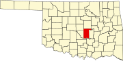
Tuttle is a city in Grady County, Oklahoma, United States. The population was 7,413 with the close of the 2020 census, seeing a 23.2% increase from 6,010 in 2010.

Gould is a town in Harmon County, Oklahoma, United States. The population was 141 at the 2010 census.

Spaulding is a town in Hughes County, Oklahoma, United States. Although it was initially established at the turn of the 20th century, it did not incorporate as a town until 1978. The population was 178 at the 2010 census, up from 62 in 2000, when the town's area was approximately one-third of its 2010 area.

Wetumka is a city in northern Hughes County, Oklahoma, United States. The population was 1,135 as of the 2020 Census. The Muscogee Creek who first settled it after removal in the 1830s named it for their ancestral town of Wetumpka in Alabama. Wetumka is a Muskogee language word meaning "rumbling waters."
Snyder is a city in Kiowa County, Oklahoma, United States. The population was 1,394 at the 2010 census. This figure represented a decline of 7.6 percent from 1,509 persons in 2000.

LeFlore is a town in LeFlore County, Oklahoma, United States. It is part of the Fort Smith, Arkansas-Oklahoma Metropolitan Statistical Area. The population was 198 at the 2010 census, an increase of 13.1 percent over the figure of 168 in 2000. Although the legal town name is spelled in the two-word form, the official federal name for the place and the postal name used is Leflore.

Schulter is a town in Okmulgee County, Oklahoma, United States. The population was 422 at the time of the 2020 census.

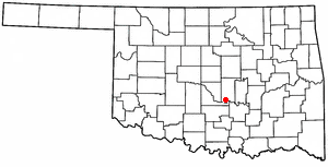
Roff is a town in Pontotoc County, Oklahoma, United States. The population was 725 at the 2010 census.

Brooksville is a town in Pottawatomie County, Oklahoma, United States. It is one of the thirteen existing all-black towns in Oklahoma. The population was 63 at the 2010 census, a 30 percent decline from the figure of 90 in 2000.
Wanette is a town in Pottawatomie County, Oklahoma, United States. The population was 279 at the time of the 2020 Census. Wanette is part of the Purcell-Lexington retail trade area and is within the Greater Oklahoma City Metropolitan Area.

Roland is a town in Sequoyah County, Oklahoma, United States. It is part of the Fort Smith, Arkansas-Oklahoma Metropolitan Statistical Area. The population was 3,169 at the 2010 census, compared to the figure of 2,842 recorded in 2000.

Davidson is a town in Tillman County, Oklahoma, United States. The population was 241 at the 2020 Census.

Onaka is a town in Faulk County, South Dakota, United States. The population was 13 at the 2020 census.

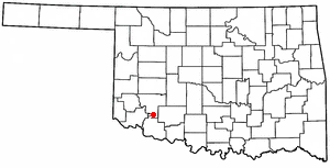
Chattanooga is a town in Comanche and Tillman counties in the U.S. state of Oklahoma. It is located on Oklahoma State Highway 36 about 23.7 driving miles southwest of Lawton. The population was 400 at the 2020 census. The Comanche County portion of Chattanooga is included in the Lawton, Oklahoma Metropolitan Statistical Area.