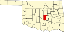
Macomb, Oklahoma

Last updated

Macomb, Oklahoma
Nickname: 
"Queen City of South Pottawatomie County" [1]
OKMap-doton-Macomb.PNG
Location of Macomb, Oklahoma
Coordinates: 35°08′52″N97°00′31″W / 35.14778°N 97.00861°W / 35.14778; -97.00861
Country United States
State Oklahoma
County Pottawatomie
Area
[2]
  Total0.09 sq mi (0.23 km2)
  Land0.09 sq mi (0.23 km2)
  Water0.00 sq mi (0.00 km2)
Elevation
[3]
991 ft (302 m)
Population
 (2020)
  Total22
  Density247.19/sq mi (95.09/km2)
Time zone UTC-6 (Central (CST))
  Summer (DST) UTC-5 (CDT)
ZIP code
74852
Area code(s) 405/572
FIPS code 40-45500 [4]
GNIS feature ID2412932 [3]
The historic U.S. Post Office building in downtown Macomb. Macombbank.jpg
The historic U.S. Post Office building in downtown Macomb.

Macomb is a town in Pottawatomie County, Oklahoma, United States. The population was 32 at the 2010 census, which represented a decline of 47.5 percent from the figure of 61 in 2000. [5]

Contents

History

The present town of Macomb began as a community named Burnett on the land allotment owned by on State Highway 59B when the Atchison, Topeka and Santa Fe Railway Burnett, entrepreneurs from Burnett, moved to the current site. A post office, originally designated as McComb, opened at the new site on May 29, 1903. The post office and the town had been named for a Santa Fe engineer named Macomb. The names of the town and post office were changed to Macomb on July 16, 1915, to correct the spelling. [1]

By the end of 1904, the town newspaper, McComb Herald, claimed the population was 350 and coined the nickname, "Queen City of South Pottawatomie County." [1] The 1910 census reported a population of only 166. The 1920 census showed 281 residents. Hard times came when a prolonged drought caused the cotton crops to fail. In 1930, there were only 197 inhabitants. People moved away from the area; the 1950 census reported 123 residents. The number fell to 61 by the 2000 census. [1]

Geography

Macomb is 10 miles (16 km) southwest of Tecumseh on State Highway 59B. [1]

According to the United States Census Bureau, the town has a total area of 0.1 square miles (0.26 km2), all land.

Demographics

Historical population
CensusPop.Note
1910 166
1920 28169.3%
1930 197−29.9%
1940 2012.0%
1950 123−38.8%
1960 76−38.2%
1970 41−46.1%
1980 5841.5%
1990 6410.3%
2000 61−4.7%
2010 32−47.5%
2020 22−31.2%
U.S. Decennial Census [6]

As of the census [4] of 2000, there were 61 people, 26 households, and 20 families residing in the town. The population density was 610 people per square mile. There were 26 housing units at an average density of 294.3 per square mile (113.6/km2). The racial makeup of the town was 85.2% White, 1.6% African American, 9.8% from other races, and 3.3% from two or more races. Hispanic or Latino of any race were 9.8% of the population.

There were 20 households, out of which 45.0% had children under the age of 18 living with them, 50.0% were married couples living together, 20.0% had a female householder with no husband present, and 15.0% were non-families. 10.0% of all households were made up of individuals, and 5.0% had someone living alone who was 65 years of age or older. The average household size was 3.05 and the average family size was 3.18.

In the town, the population was spread out, with 31.1% under the age of 18, 4.9% from 18 to 24, 27.9% from 25 to 44, 24.6% from 45 to 64, and 11.5% who were 65 years of age or older. The median age was 31 years. For every 100 females, there were 125.9 males. For every 100 females age 18 and over, there were 121.1 males.

The median income for a household in the town was $30,735, and the median income for a family was $34,583. Males had a median income of $25,000 versus $18,125 for females. The per capita income for the town was $15,006. There were 9.2% of families and 12.4% of the population living below the poverty line, including 37.5% of under eighteens and none of those over 64.

Related Research Articles

<span class="mw-page-title-main">Pottawatomie County, Oklahoma</span> County in Oklahoma, United States

Pottawatomie County is a county located in the U.S. state of Oklahoma. As of the 2020 census, the population was 72,454. Its county seat is Shawnee.

<span class="mw-page-title-main">Macomb, New York</span> Town in New York, United States

Macomb is a town in St. Lawrence County, New York, United States. The population was 906 at the 2010 census. The town is named after Alexander Macomb, who once owned much of northern New York as Macomb's Purchase.

<span class="mw-page-title-main">McComb, Ohio</span> Village in Ohio, United States

McComb is a village in Hancock County, Ohio, United States. The population was 1,558 at the time of the 2020 census. The village holds one school district, McComb Local School District.

<span class="mw-page-title-main">Oilton, Oklahoma</span> City in Oklahoma, United States

Oilton is a city in Creek County, Oklahoma, United States. The population was 885 at the 2020 census, a 12.6% decline from the 1,013 recorded in 2010.

<span class="mw-page-title-main">Manchester, Oklahoma</span> Town in Oklahoma, United States

Manchester is a town in Grant County, Oklahoma, United States. The population was 103 at the 2010 census, a decline of 1.0 percent from 104 at the 2000 census.

<span class="mw-page-title-main">Carney, Oklahoma</span> Town in Oklahoma, United States

Carney is a town in Lincoln County, Oklahoma, United States. As of the 2020 census, the population of the town was 545.

<span class="mw-page-title-main">Bethel Acres, Oklahoma</span> Town in Oklahoma, United States

Bethel Acres is a town in Pottawatomie County, Oklahoma. The population was 2,895 at the time of the 2010 census, an increase of 5.9 percent from the figure of 2,735 in 2000. It is primarily a bedroom community for people who work in the three nearby larger cities of Shawnee, Tecumseh and Oklahoma City.

<span class="mw-page-title-main">Brooksville, Oklahoma</span> Town in Oklahoma, United States

Brooksville is a town in Pottawatomie County, Oklahoma, United States. It is one of the thirteen existing all-black towns in Oklahoma. The population was 63 at the 2010 census, a 30 percent decline from the figure of 90 in 2000.

<span class="mw-page-title-main">Earlsboro, Oklahoma</span> Town in Oklahoma, United States

Earlsboro is a town in Pottawatomie County, Oklahoma, United States. The population was 628 at the 2010 census, a decline of 0.8 percent from the figure of 633 in 2000. It was once called "...the town that whisky built and oil broke."

<span class="mw-page-title-main">Johnson, Oklahoma</span> Town in Oklahoma, United States

Johnson is a town in north-central Pottawatomie County, Oklahoma, United States. The population was 247 at the 2010 census, a 10.8 percent increase from the figure of 223 in 2000.

St. Louis is a town in Pottawatomie County, Oklahoma, United States. The population was 158 at the 2010 census, a 23.3 percent decline from the figure of 206 in 2000.

<span class="mw-page-title-main">Tecumseh, Oklahoma</span> City in Oklahoma, United States

Tecumseh is a city in Pottawatomie County, Oklahoma. Its population was 6,457 at the 2010 census, a 5.9% increase from 6,098 in 2000. It was named for the noted Shawnee chief, Tecumseh. It was designated as the county seat at Oklahoma's statehood, but a county-wide election moved the seat to Shawnee in 1930.

<span class="mw-page-title-main">Tribbey, Oklahoma</span> Town in Oklahoma, United States

Tribbey is a town in Pottawatomie County, Oklahoma, United States.The community was named for Alpheus M. Tribbey, landowner. The population was 391 at the 2010 census, a 43.2 percent gain from the figure of 273 in 2000.

<span class="mw-page-title-main">Wanette, Oklahoma</span> Town in Oklahoma, United States

Wanette is a town in Pottawatomie County, Oklahoma, United States. The population was 350 at the 2010 census, a decline of 13 percent from the figure of 402 in 2000. Wanette is part of the Purcell-Lexington retail trade area and is within the Greater Oklahoma City Metropolitan Area.

<span class="mw-page-title-main">La Follette, Wisconsin</span> Town in Wisconsin, United States

La Follette is a town in Burnett County in the U.S. state of Wisconsin. The population was 536 at the 2010 census. The unincorporated communities of Coomer and Hertel are located in the town.

<span class="mw-page-title-main">Roosevelt, Burnett County, Wisconsin</span> Town in Wisconsin, United States

Roosevelt is a town in Burnett County in the U.S. state of Wisconsin. The population was 199 at the 2010 census. The unincorporated community of Timberland is located in the town.

<span class="mw-page-title-main">Trade Lake, Wisconsin</span> Town in Wisconsin, United States

Trade Lake is a town in Burnett County in the U.S. state of Wisconsin. The population was 823 in the 2010 census. The unincorporated communities of Four Corners and Trade Lake are located in the town. The unincorporated community of Pole Cat Crossing is also located partially in the town.

<span class="mw-page-title-main">Union, Burnett County, Wisconsin</span> Town in Wisconsin, United States

Union is a town in Burnett County in the U.S. state of Wisconsin. The population was 340 at the 2010 census.

<span class="mw-page-title-main">Wood River, Wisconsin</span> Town in Wisconsin, United States

Wood River is a town in Burnett County in the U.S. state of Wisconsin. The population was 953 at the 2010 census. The unincorporated community of Alpha is located within the town.

Grantsburg is a town in Burnett County in the U.S. state of Wisconsin. The population was 1,136 at the 2010 census. The village of Grantsburg is located within the town. The unincorporated communities of Branstad and Lind are located in the town.

References

  1. 1 2 3 4 5 Bessie Cope, "Macomb", Encyclopedia of Oklahoma History and Culture. Accessed May 23, 2015.
  2. "ArcGIS REST Services Directory". United States Census Bureau. Retrieved September 20, 2022.
  3. 1 2 U.S. Geological Survey Geographic Names Information System: Macomb, Oklahoma
  4. 1 2 "U.S. Census website". United States Census Bureau . Retrieved January 31, 2008.
  5. CensusViewer:Population of the City of Macomb, Oklahoma
  6. "Census of Population and Housing". Census.gov. Retrieved June 4, 2015.