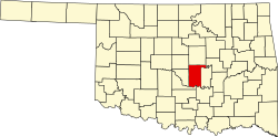
Wanette, Oklahoma

Last updated

Wanette, Oklahoma
OKMap-doton-Wanette.PNG
Location of Wanette, Oklahoma
Coordinates: 34°57′45″N97°01′54″W / 34.96250°N 97.03167°W / 34.96250; -97.03167
Country United States
State Oklahoma
County Pottawatomie
Area
[1]
  Total0.41 sq mi (1.05 km2)
  Land0.41 sq mi (1.05 km2)
  Water0.00 sq mi (0.00 km2)
Elevation
[2]
1,020 ft (310 m)
Population
 (2020)
  Total279
  Density687.19/sq mi (265.27/km2)
Time zone UTC-6 (Central (CST))
  Summer (DST) UTC-5 (CDT)
ZIP code
74878
Area code(s) 405/572
FIPS code 40-78200 [3]
GNIS feature ID2413446 [2]

Wanette is a town in Pottawatomie County, Oklahoma, United States. The population was 279 at the time of the 2020 Census. [4] Wanette is part of the Purcell-Lexington retail trade area and is within the Greater Oklahoma City Metropolitan Area.

Contents

History

The first settlement took place in 1868, when two settlers from Kansas built a two-story cabin. Other settlers followed. The community had several different names before a post office named Wanette opened on March 19, 1894. In 1903, the town moved one mile north to be on the Atchison, Topeka and Santa Fe Railway line between Newkirk and Pauls Valley [5]

By 1907, Wanette had a population of 739. The population peaked at 783 in 1920. The local economy was based on agriculture. Discovery of the Wanette-Asher oil field aided the economy during the 1930s, but did not prevent a population decline. The town still has an agricultural base, but by the beginning of the 21st Century had become a bedroom community for people working in Moore, Norman and Oklahoma City. [5]

Geography

According to the United States Census Bureau, the town has a total area of 0.4 square miles (1.0 km2), all land.

Demographics

Historical population
CensusPop.Note
1910 677
1920 78315.7%
1930 758−3.2%
1940 665−12.3%
1950 594−10.7%
1960 381−35.9%
1970 303−20.5%
1980 47356.1%
1990 346−26.8%
2000 40216.2%
2010 350−12.9%
2020 279−20.3%
U.S. Decennial Census [6]

As of the census [3] of 2000, there were 402 people, 147 households, and 108 families residing in the town. The population density was 978.8 inhabitants per square mile (377.9/km2). There were 168 housing units at an average density of 409.0 per square mile (157.9/km2). The racial makeup of the town was 88.31% White, 8.71% Native American, and 2.99% from two or more races. Hispanic or Latino of any race were 0.50% of the population.

There were 147 households, out of which 39.5% had children under the age of 18 living with them, 51.0% were married couples living together, 17.7% had a female householder with no husband present, and 25.9% were non-families. 24.5% of all households were made up of individuals, and 15.0% had someone living alone who was 65 years of age or older. The average household size was 2.73 and the average family size was 3.18.

In the town, the population was spread out, with 30.3% under the age of 18, 13.7% from 18 to 24, 23.1% from 25 to 44, 19.7% from 45 to 64, and 13.2% who were 65 years of age or older. The median age was 29 years. For every 100 females, there were 100.0 males. For every 100 females age 18 and over, there were 89.2 males.

The median income for a household in the town was $21,818, and the median income for a family was $23,000. Males had a median income of $21,731 versus $14,583 for females. The per capita income for the town was $10,740. About 20.2% of families and 21.0% of the population were below the poverty line, including 14.4% of those under age 18 and 30.6% of those age 65 or over.

Economy

The Wanette area economy has long been supported by agriculture. The main crops are cotton, pecans, oats, corn, alfalfa, and hay. Discovery of oil in the nearby Wanette-Asher field caused a brief boom during the early 1930s, which declined before 1940. [5]

Arts and culture

The Wanette–Byars Bridge is listed on the National Register of Historic Places.

Education

Wanette High School is located here.

Related Research Articles

<span class="mw-page-title-main">Pottawatomie County, Oklahoma</span> County in Oklahoma, United States

Pottawatomie County is a county located in the U.S. state of Oklahoma. As of the 2020 census, the population was 72,454. Its county seat is Shawnee.

<span class="mw-page-title-main">Bokchito, Oklahoma</span> Town in Oklahoma, United States

Bokchito is a town in Bryan County, Oklahoma, United States. The population was 632 at the 2010 census, an increase of 12.1 percent over the figure of 564 recorded in 2000. In the Choctaw language, "bok" means river, and "chito" means big or large, literally translating into "big creek".

<span class="mw-page-title-main">Union City, Oklahoma</span> Town in Oklahoma, United States

Union City is a town in Canadian County, Oklahoma, United States. The population was 1,645 at the 2010 census, a 19.6 percent increase from 1,375 in 2000. It is part of the Oklahoma City metropolitan statistical area.

<span class="mw-page-title-main">Carrier, Oklahoma</span> Town in Oklahoma, United States

Carrier is a town in Garfield County, Oklahoma, United States. The population was 85 at the 2010 census.

<span class="mw-page-title-main">Amber, Oklahoma</span> Town in Oklahoma, United States

Amber is a town in Grady County, Oklahoma, United States. The population was 413 at the 2020 census, a 1.4% decrease from 2010.

<span class="mw-page-title-main">Bradley, Oklahoma</span> Town in Oklahoma, United States

Bradley is a town in Grady County, Oklahoma, United States. The population was 78 at the 2020 United States census.

<span class="mw-page-title-main">Pocasset, Oklahoma</span> Town in Oklahoma, United States

Pocasset is a town in Grady County, Oklahoma, United States. The population was 183 at the 2020 census, a 17.3% increase from 2010.

<span class="mw-page-title-main">Martha, Oklahoma</span> Town in Oklahoma, United States

Martha is a town in Jackson County, Oklahoma, United States. The population was 162 as of the 2020 United States census. The town is located about 9 driving miles north-northwest of the county seat of Altus.

<span class="mw-page-title-main">Lone Wolf, Oklahoma</span> Town in Oklahoma, United States

Lone Wolf is a town in Kiowa County, Oklahoma, United States. The population was 438 at the 2010 census, a decline of 12.4 percent from 500 in 2000. The town was named for Chief Lone Wolf (1843–1923), a warrior chief of the Kiowa who fought to preserve his people's autonomy and way of life.

<span class="mw-page-title-main">Howe, Oklahoma</span> Town in Oklahoma, United States

Howe is a town in Le Flore County, Oklahoma, United States. It is part of the Fort Smith, Arkansas-Oklahoma Metropolitan Statistical Area. The population was 802 at the 2010 census, a gain of 15.1 percent over the figure of 697 recorded in 2000. The town was once noted for producing coal and coke, but today is chiefly supported by agriculture.

<span class="mw-page-title-main">Davenport, Oklahoma</span> Town in Oklahoma, United States

Davenport is a town in Lincoln County, Oklahoma, United States. The population was 814 at the 2010 census.

<span class="mw-page-title-main">Kendrick, Oklahoma</span> Town in Oklahoma, United States

Kendrick is a town in Lincoln County, Oklahoma, United States. The population was 139 at the 2010 census.

<span class="mw-page-title-main">Meeker, Oklahoma</span> Town in Oklahoma, United States

Meeker is a town in Lincoln County, Oklahoma, United States. The population was 1,145 at the 2010 census.

<span class="mw-page-title-main">Coyle, Oklahoma</span> Town in Oklahoma, United States

Coyle is a town in Logan County, Oklahoma, United States. The population was 325 at the 2010 census, compared to the figure of 337 in 2000. It is part of the Oklahoma City metropolitan area. The town was named for William Coyle, an influential Guthrie business man.

<span class="mw-page-title-main">Ringwood, Oklahoma</span> Town in Oklahoma, United States

Ringwood is a town in Major County, Oklahoma, United States. The population was 401 at the time of the 2020 Census. The town was given its name because it was ringed by woods from northwest to southeast; however, the town is no longer accurate to its name.

<span class="mw-page-title-main">Indianola, Pittsburg County, Oklahoma</span> Town in Oklahoma, United States

Indianola is a town in Pittsburg County, Oklahoma, United States. The population was 162 at the 2010 census, a loss of 15.2 percent compared to 191 at the 2000 census.

<span class="mw-page-title-main">Valley Park, Oklahoma</span> Town in Oklahoma, United States

Valley Park is a town in Rogers County, Oklahoma, United States. The population was 77 at the 2010 census, up 221 percent from the figure of 24 recorded in 2000.

<span class="mw-page-title-main">Bray, Oklahoma</span> Town in Oklahoma, United States

Bray is a town in Stephens County, Oklahoma, United States. The population was 1,209 at the 2010 census.

<span class="mw-page-title-main">Fanshawe, Oklahoma</span> Town in Oklahoma, United States

Fanshawe is a town in Latimer and Le Flore counties in the U.S. state of Oklahoma. As of the 2020 Census, the town had a total population of 317. The Le Flore County portion of Fanshawe is part of the Fort Smith, Arkansas-Oklahoma Metropolitan Statistical Area.

<span class="mw-page-title-main">Quay, Oklahoma</span> Census-designated place in Oklahoma, United States

Quay is an unincorporated community and census-designated place (CDP) located on the boundary line between Pawnee and Payne counties in the U.S. state of Oklahoma. The population was 47 at the 2000 census, when it was still a town; the community disincorporated on August 23, 2000. No population was recorded in the census of 2010. But the 2020 Census recorded 39 persons.

References

  1. "ArcGIS REST Services Directory". United States Census Bureau. Retrieved September 20, 2022.
  2. 1 2 U.S. Geological Survey Geographic Names Information System: Wanette, Oklahoma
  3. 1 2 "U.S. Census website". United States Census Bureau . Retrieved January 31, 2008.
  4. "Wanette (town), Oklahoma". United States Census Bureau. Retrieved March 23, 2024.
  5. 1 2 3 Beverly Mosman, "Wanette," Encyclopedia of Oklahoma History and Culture. Accessed May 21, 2012.
  6. "Census of Population and Housing". Census.gov. Retrieved June 4, 2015.