National Register of Historic Places listings in Pottawatomie County, Oklahoma

Last updated
Location of Pottawatomie County in Oklahoma Map of Oklahoma highlighting Pottawatomie County.svg
Location of Pottawatomie County in Oklahoma

This is a list of the National Register of Historic Places listings in Pottawatomie County, Oklahoma.

Contents

This is intended to be a complete list of the properties and districts on the National Register of Historic Places in Pottawatomie County, Oklahoma, United States. The locations of National Register properties and districts for which the latitude and longitude coordinates are included below, may be seen in a map. [1]

There are 19 properties and districts listed on the National Register in the county.

This National Park Service list is complete through NPS recent listings posted April 3, 2020. [2]
Map all coordinates using: OpenStreetMap  
Download coordinates as: KML  ·  GPX

Current listings

[3] Name on the Register [4] ImageDate listed [5] Location City or townDescription
1 Aldridge Hotel
Aldridge Hotel Aldridge Hotel 2012-09-26 18-11-21.jpg
Aldridge Hotel
June 2, 2000
(#00000622)
20–24 E. 9th St.
35°19′44″N96°55′19″W / 35.328889°N 96.921944°W / 35.328889; -96.921944 (Aldridge Hotel)
Shawnee
2 Barnard Elementary School
Barnard Elementary School Barnard Elementary School 2012-10-27 11-19-39.jpg
Barnard Elementary School
June 2, 2000
(#00000624)
315 E. Locust St.
35°15′15″N96°56′01″W / 35.254167°N 96.933611°W / 35.254167; -96.933611 (Barnard Elementary School)
Tecumseh
3 Beard Cabin
Beard Cabin Beard Cabin Shawnee OK.jpg
Beard Cabin
April 8, 1983
(#83002121)
614 E. Main St.
35°19′43″N96°54′59″W / 35.328655°N 96.916343°W / 35.328655; -96.916343 (Beard Cabin)
Shawnee
4 Bell Street Historic District
Bell Street Historic District Bell Street Historic District 2012-09-26 18-10-31.jpg
Bell Street Historic District
December 28, 2000
(#00001579)
Along N. Bell St. from E. 9th St. to E. Main St.
35°19′40″N96°55′18″W / 35.327778°N 96.921667°W / 35.327778; -96.921667 (Bell Street Historic District)
Shawnee
5 Billington Building
Billington Building Billington Building, Shawnee, OK 1.jpg
Billington Building
September 26, 1985
(#85002512)
23 E. 9th
35°19′43″N96°56′00″W / 35.328611°N 96.933333°W / 35.328611; -96.933333 (Billington Building)
Shawnee
6 H. T. Douglas Mansion and Garage
H. T. Douglas Mansion and Garage H- T- Douglas Mansion and Garage 2012-09-26 18-58-43.jpg
H. T. Douglas Mansion and Garage
September 26, 1985
(#85002517)
100 E. Federal St.
35°21′16″N96°55′17″W / 35.354444°N 96.921389°W / 35.354444; -96.921389 (H. T. Douglas Mansion and Garage)
Shawnee
7 Governors Mansion
Governors Mansion Governors Mansion 2012-09-26 19-04-31.jpg
Governors Mansion
January 21, 1983
(#83002122)
618 N. Park St.
35°20′09″N96°55′36″W / 35.335833°N 96.926667°W / 35.335833; -96.926667 (Governors Mansion)
Shawnee
8 Kerfoot House
Kerfoot House Kerfoot House 2012-09-26 19-03-05.jpg
Kerfoot House
January 21, 1983
(#83002123)
740 N. Beard St.
35°20′19″N96°55′27″W / 35.338611°N 96.924167°W / 35.338611; -96.924167 (Kerfoot House)
Shawnee
9 Nuckolls House
Nuckolls House Nuckolls House 2012-09-26 18-58-03.jpg
Nuckolls House
January 21, 1983
(#83002124)
200 E. Federal St.
35°21′17″N96°55′13″W / 35.354722°N 96.920278°W / 35.354722; -96.920278 (Nuckolls House)
Shawnee
10 Old Santa Fe Railroad Bridge
Old Santa Fe Railroad Bridge Wanette-Byars Bridge 2.jpg
Old Santa Fe Railroad Bridge
March 10, 2010
(#10000070)
Drummond Rd.
34°55′09″N97°03′01″W / 34.91925°N 97.050322°W / 34.91925; -97.050322 (Old Santa Fe Railroad Bridge)
Wanette Also known as the Wanette-Byers Bridge [6]
11 Pottawatomie County Courthouse
Pottawatomie County Courthouse Pottawatomie county oklahoma courthouse.jpg
Pottawatomie County Courthouse
August 24, 1984
(#84003424)
300 N. Broadway Ave.
35°19′51″N96°55′21″W / 35.330833°N 96.9225°W / 35.330833; -96.9225 (Pottawatomie County Courthouse)
Shawnee
12 Rose-Fast Site (34PT28)
Rose-Fast Site (34PT28) Address restricted.PNG
Rose-Fast Site (34PT28)
December 24, 1986
(#86003479)
Address Restricted
Harjo
13 Sacred Heart Mission Site
Sacred Heart Mission Site SA Church web.jpg
Sacred Heart Mission Site
September 15, 1983
(#83002125)
Off State Highway 39
35°00′04″N96°48′33″W / 35.001111°N 96.809169°W / 35.001111; -96.809169 (Sacred Heart Mission Site)
Asher
14 St. Gregory's Abbey and College
St. Gregory's Abbey and College Benedictine Hall Shawnee.jpg
St. Gregory's Abbey and College
August 15, 1975
(#75001572)
1900 W. MacArthur Dr.
35°22′03″N96°57′14″W / 35.3675°N 96.953889°W / 35.3675; -96.953889 (St. Gregory's Abbey and College)
Shawnee
15 Santa Fe Depot
Santa Fe Depot Santa Fe Depot, Shawnee, Oklahoma.jpg
Santa Fe Depot
June 5, 1974
(#74001667)
614 E. Main St.
35°19′41″N96°54′57″W / 35.328056°N 96.915833°W / 35.328056; -96.915833 (Santa Fe Depot)
Shawnee
16 Shawnee Friends Mission
Shawnee Friends Mission Shawnee Friends Mission near Shawnee, Oklahoma.jpg
Shawnee Friends Mission
March 7, 1973
(#73001569)
2 miles south of Shawnee
35°17′37″N96°55′28″W / 35.2937°N 96.9244°W / 35.2937; -96.9244 (Shawnee Friends Mission)
Shawnee
17 Squirrel Creek Bridge
Squirrel Creek Bridge Squirrel Creek Bridge 2012-09-25 12-20-47.jpg
Squirrel Creek Bridge
September 3, 2010
(#10000625)
Carries Rangeline Rd. over Squirrel Creek
35°18′01″N96°55′48″W / 35.300278°N 96.93°W / 35.300278; -96.93 (Squirrel Creek Bridge)
Shawnee vicinity
18 State National Bank Building
State National Bank Building State National Bank, Shawnee, Oklahoma.jpg
State National Bank Building
March 13, 2020
(#100005083)
2 E. Main St.
35°19′39″N96°55′24″W / 35.3274°N 96.9233°W / 35.3274; -96.9233 (State National Bank Building)
Shawnee
19 Walker House
Walker House Walker House 2012-09-26 19-01-59.jpg
Walker House
April 8, 1983
(#83002126)
1801 N. Broadway Ave.
35°21′03″N96°55′22″W / 35.350833°N 96.922778°W / 35.350833; -96.922778 (Walker House)
Shawnee

See also

Related Research Articles

National Register of Historic Places listings in Beckham County, Oklahoma Wikimedia list article

This is a list of the National Register of Historic Places listings in Beckham County, Oklahoma.

National Register of Historic Places listings in Bryan County, Oklahoma Wikimedia list article

This is a list of the National Register of Historic Places listings in Bryan County, Oklahoma.

National Register of Historic Places listings in Caddo County, Oklahoma Wikimedia list article

This is a list of the National Register of Historic Places listings in Caddo County, Oklahoma.

National Register of Historic Places listings in Canadian County, Oklahoma Wikimedia list article

This is a list of the National Register of Historic Places listings in Canadian County, Oklahoma.

National Register of Historic Places listings in Carter County, Oklahoma Wikimedia list article

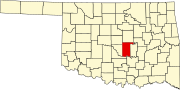
This is a list of the National Register of Historic Places listings in Carter County, Oklahoma.

National Register of Historic Places listings in Cimarron County, Oklahoma Wikimedia list article

This is a list of the National Register of Historic Places listings in Cimarron County, Oklahoma.

National Register of Historic Places listings in Cleveland County, Oklahoma Wikimedia list article

This is a list of the National Register of Historic Places listings in Cleveland County, Oklahoma.

National Register of Historic Places listings in Muskogee County, Oklahoma Wikimedia list article

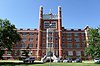
This is a list of the National Register of Historic Places listings in Muskogee County, Oklahoma.

National Register of Historic Places listings in Kay County, Oklahoma Wikimedia list article

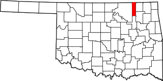
This is a list of the National Register of Historic Places listings in Kay County, Oklahoma.

National Register of Historic Places listings in Logan County, Oklahoma Wikimedia list article

This is a list of the National Register of Historic Places listings in Logan County, Oklahoma.

National Register of Historic Places listings in McCurtain County, Oklahoma Wikimedia list article

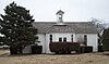
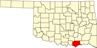
This is a list of the National Register of Historic Places listings in McCurtain County, Oklahoma.

National Register of Historic Places listings in McIntosh County, Oklahoma Wikimedia list article

This is a list of the National Register of Historic Places listings in McIntosh County, Oklahoma.

National Register of Historic Places listings in Murray County, Oklahoma Wikimedia list article

This is a list of the National Register of Historic Places listings in Murray County, Oklahoma.

National Register of Historic Places listings in Pawnee County, Oklahoma Wikimedia list article

This is a list of the National Register of Historic Places listings in Pawnee County, Oklahoma.

National Register of Historic Places listings in Payne County, Oklahoma Wikimedia list article

This is a list of the National Register of Historic Places listings in Payne County, Oklahoma.

National Register of Historic Places listings in Tillman County, Oklahoma Wikimedia list article

This is a list of the National Register of Historic Places listings in Tillman County, Oklahoma.

National Register of Historic Places listings in Wagoner County, Oklahoma Wikimedia list article

This is a list of the National Register of Historic Places listings in Wagoner County, Oklahoma.

National Register of Historic Places listings in Washington County, Oklahoma Wikimedia list article

This is a list of the National Register of Historic Places listings in Washington County, Oklahoma.

National Register of Historic Places listings in Washita County, Oklahoma Wikimedia list article

This is a list of the National Register of Historic Places listings in Washita County, Oklahoma.

National Register of Historic Places listings in Woodward County, Oklahoma Wikimedia list article

This is a list of the National Register of Historic Places listings in Woodward County, Oklahoma.

References

  1. The latitude and longitude information provided in this table was derived originally from the National Register Information System, which has been found to be fairly accurate for about 99% of listings. Some locations in this table may have been corrected to current GPS standards.
  2. "National Register of Historic Places: Weekly List Actions". National Park Service, United States Department of the Interior. Retrieved on April 3, 2020.
  3. Numbers represent an ordering by significant words. Various colorings, defined here, differentiate National Historic Landmarks and historic districts from other NRHP buildings, structures, sites or objects.
  4. "National Register Information System". National Register of Historic Places . National Park Service. March 13, 2009.
  5. The eight-digit number below each date is the number assigned to each location in the National Register Information System database, which can be viewed by clicking the number.
  6. "Wanette-Byers Bridge". March 21, 2010. Retrieved March 22, 2010.