Harjo | |
|---|---|
 Harjo Location within the state of Oklahoma  Harjo Harjo (the United States) | |
| Coordinates: 35°12′46″N96°49′33″W / 35.21278°N 96.82583°W | |
| Country | United States |
| State | Oklahoma |
| County | Pottawatomie |
| Time zone | UTC-6 (Central (CST)) |
| • Summer (DST) | UTC-5 (CDT) |
Harjo is an unincorporated community in Pottawatomie County, Oklahoma, United States. The name, Harjo means "brave beyond discretion" in the Muscogee language.
The post office was established on June 24, 1921, and discontinued on August 31, 1954.
Nearby is the Rose-Fast site (34PT28), a precontact Indian base camp dating from the Woodland period (circa 1 to 1000). The site was added to the NRHP in 1986.
Municipalities and communities of Pottawatomie County, Oklahoma, United States | ||
|---|---|---|
| Cities | 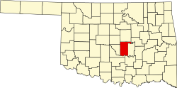 | |
| Towns | ||
| CDP | ||
| Other communities | ||
| Ghost towns | ||
| Footnotes | ‡This populated place also has portions in an adjacent county or counties | |
| | This Pottawatomie County, Oklahoma location article is a stub. You can help Wikipedia by expanding it. |