Counties of Oklahoma | |
---|---|
Location | State of Oklahoma |
Number | 77 |
Populations | 2,191 (Cimarron) – 808,866 (Oklahoma) |
Areas | 371 square miles (960 km2) (Marshall) – 2,251 square miles (5,830 km2) (Osage) |
Government | |
Subdivisions |
|
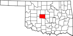
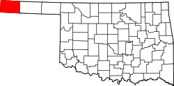
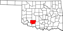
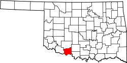
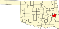
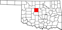
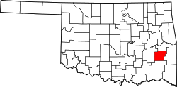
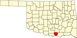
The U.S. state of Oklahoma has 77 counties. It is ranked 20th in size and 17th in the number of counties, between Mississippi with 82 counties and Arkansas with 75 counties. [1]
Oklahoma originally had seven counties (Logan, Cleveland, Oklahoma, Canadian, Kingfisher, Payne, and Beaver) when it was first organized as the Oklahoma Territory. These counties were designated numerically, first through seventh. New counties added after this were designated by letters of the alphabet. The first seven counties were later renamed. The Oklahoma Constitutional Convention named all of the counties that were formed when Oklahoma entered statehood in 1907. Only two counties have been formed since then. [2] Upon statehood, all Oklahoma counties allowed civil townships within their counties. A few years after statehood, a constitutional amendment allowed them to be abolished on a county-by-county basis, and by the mid-1930s, all Oklahoma counties had voted to do so. [3]
According to the Oklahoma Constitution, a county can be disorganized if the sum of all taxable property is less than $2.5 million. If so, then a petition must be signed by one-fourth of the population and then a vote would occur. If a majority votes for dissolution of the county, the county will be combined with an adjacent county with the lowest valuation of taxable property. [4]
The Federal Information Processing Standard (FIPS) code, which is used by the United States government to uniquely identify counties, is provided with each entry. The FIPS code for each county links to census data for that county.
The area in these tables is land area, and does not include water area.
Oklahoma's postal abbreviation is OK and its FIPS state code is 40.
County | FIPS code [5] | County seat [6] | Est. [6] | Origin | Etymology [7] | Density | Population [8] | Area [6] | Map |
---|---|---|---|---|---|---|---|---|---|
AdairCounty | 001 | Stilwell | 1907 | Cherokee lands [9] | William Penn Adair, Cherokee tribal leader and Confederate colonel in the American Civil War [9] | 34.07 | 19,627 | 576 sq mi (1,492 km2) | |
AlfalfaCounty | 003 | Cherokee | 1907 | Woods County | William H. "Alfalfa Bill" Murray, ninth Governor of Oklahoma; [10] also the alfalfa crops grown there [11] | 6.54 | 5,673 | 867 sq mi (2,246 km2) | |
AtokaCounty | 005 | Atoka | 1907 | Choctaw lands | Captain Atoka, a noted Choctaw leader and signer of the Treaty of Dancing Rabbit Creek [12] | 14.85 | 14,525 | 978 sq mi (2,533 km2) | |
BeaverCounty | 007 | Beaver | 1890 | Seventh County (entire panhandle until 1907) [13] | The Beaver River [14] | 2.77 | 5,018 | 1,814 sq mi (4,698 km2) | |
BeckhamCounty | 009 | Sayre | 1907 | Greer County and Roger Mills County [15] | J. C. W. Beckham, Governor of Kentucky [15] | 24.44 | 22,042 | 902 sq mi (2,336 km2) | |
BlaineCounty | 011 | Watonga | 1890 | Part of Cheyenne and Arapaho reservation. [16] | James G. Blaine, Speaker of the U. S. House of Representatives, U.S. Senator and Secretary of State [17] | 9.19 | 8,539 | 929 sq mi (2,406 km2) | |
BryanCounty | 013 | Durant | 1907 | Choctaw lands | William Jennings Bryan, Secretary of State, famous orator and three-time U.S. Presidential candidate [18] | 53.87 | 48,967 | 909 sq mi (2,354 km2) | |
CaddoCounty | 015 | Anadarko | 1901 | Indian Territory | From Indian word "Kaddi" meaning life or chief [19] | 20.51 | 26,214 | 1,278 sq mi (3,310 km2) | |
CanadianCounty | 017 | El Reno | 1901 | Part of Cheyenne and Arapaho reservation [20] | The Canadian River. [21] | 195.37 | 175,829 | 900 sq mi (2,331 km2) | |
CarterCounty | 019 | Ardmore | 1907 | Pickens County, Chickasaw Nation | A prominent family of early settlers [22] | 58.98 | 48,596 | 824 sq mi (2,134 km2) | |
CherokeeCounty | 021 | Tahlequah | 1907 | Originally settled by Cherokee Indians following the Trail of Tears | Cherokee Nation of Indians [23] | 64.16 | 48,185 | 751 sq mi (1,945 km2) | |
ChoctawCounty | 023 | Hugo | 1907 | Choctaw Nation | Choctaw Nation of Indians [24] | 18.44 | 14,276 | 774 sq mi (2,005 km2) | |
CimarronCounty | 025 | Boise City | 1907 | Seventh County (entire panhandle until 1907) [13] | Cimarron River [25] | 1.19 | 2,191 | 1,835 sq mi (4,753 km2) | |
ClevelandCounty | 027 | Norman | 1890 | County 3 in Oklahoma Territory. | Grover Cleveland, twice President of the United States [26] | 561.93 | 301,193 | 536 sq mi (1,388 km2) | |
CoalCounty | 029 | Coalgate | 1907 | Atoka County, Choctaw Nation | Coal, the primary economic product of the region at the time [27] | 10.17 | 5,266 | 518 sq mi (1,342 km2) | |
ComancheCounty | 031 | Lawton | 1907 | Kiowa, Comanche, and Apache reservation | The name Comanche comes from the Ute word kɨmantsi meaning 'enemy, stranger'. [28] | 113.73 | 121,574 | 1,069 sq mi (2,769 km2) | |
CottonCounty | 033 | Walters | 1912 | Lands of Quapaws, Choctaws, Chickasaws, Comanche Reservation, and Big Pasture | The principal economic base of the county, cotton [29] | 8.52 | 5,427 | 637 sq mi (1,650 km2) | |
CraigCounty | 035 | Vinita | 1907 | Cherokee Nation | Granville Craig, a prominent Cherokee planter [30] | 19.05 | 14,494 | 761 sq mi (1,971 km2) | |
CreekCounty | 037 | Sapulpa | 1907 | Creek Nation | Creek Nation of Indians [31] | 76.71 | 73,332 | 956 sq mi (2,476 km2) | |
CusterCounty | 039 | Arapaho | 1891 | Cheyenne-Arapaho Reservation | George A. Custer, United States Army cavalry commander during the Indian Wars [32] | 28.64 | 28,266 | 987 sq mi (2,556 km2) | |
DelawareCounty | 041 | Jay | 1907 | Delaware District of Cherokee Nation | Delaware Nation of Indians [2] | 56.28 | 41,703 | 741 sq mi (1,919 km2) | |
DeweyCounty | 043 | Taloga | 1892 | Cheyenne-Arapaho Reservation | Admiral George Dewey, hero of the Spanish–American War [33] | 4.29 | 4,286 | 1,000 sq mi (2,590 km2) | |
EllisCounty | 045 | Arnett | 1907 | Roger Mills and Woodward counties | Albert H. Ellis, member of the Oklahoma Constitutional Convention and first state Legislature [34] | 2.97 | 3,648 | 1,229 sq mi (3,183 km2) | |
GarfieldCounty | 047 | Enid | 1893 | Cherokee Outlet | James Garfield, President of the United States [35] | 58.62 | 62,023 | 1,058 sq mi (2,740 km2) | |
GarvinCounty | 049 | Pauls Valley | 1907 | Chickasaw Nation | Samuel Garvin, a prominent Chickasaw Indian and local merchant [36] | 31.97 | 25,865 | 809 sq mi (2,095 km2) | |
GradyCounty | 051 | Chickasha | 1907 | Pickens County, Chickasaw Nation | Henry W. Grady, editor of the Atlanta Constitution [37] | 52.11 | 57,375 | 1,101 sq mi (2,852 km2) | |
GrantCounty | 053 | Medford | 1892 | County L | Ulysses S. Grant, President of the United States [38] | 4.08 | 4,083 | 1,001 sq mi (2,593 km2) | |
GreerCounty | 055 | Mangum | 1896 | Greer County, Texas | John Alexander Greer, Lieutenant Governor of Texas [39] | 8.55 | 5,466 | 639 sq mi (1,655 km2) | |
HarmonCounty | 057 | Hollis | 1909 | Greer County | Judson Harmon, U.S. Attorney General and Governor of Ohio [40] | 4.45 | 2,392 | 538 sq mi (1,393 km2) | |
HarperCounty | 059 | Buffalo | 1893 | Woodward County | Oscar G. Harper, clerk of the Oklahoma Constitutional Convention [41] | 3.07 | 3,190 | 1,039 sq mi (2,691 km2) | |
HaskellCounty | 061 | Stigler | 1907 | San Bois County of the Choctaw Nation | Charles N. Haskell, first Governor of Oklahoma [42] | 20.51 | 11,832 | 577 sq mi (1,494 km2) | |
HughesCounty | 063 | Holdenville | 1907 | Choctaw Nation and Creek Nation lands | William C. Hughes, member of the Oklahoma Constitutional Convention [2] [43] | 16.65 | 13,436 | 807 sq mi (2,090 km2) | |
JacksonCounty | 065 | Altus | 1907 | Greer County | Either Stonewall Jackson, Confederate general during the American Civil War [44] or Andrew Jackson, seventh President of the United States [2] | 30.72 | 24,669 | 803 sq mi (2,080 km2) | |
JeffersonCounty | 067 | Waurika | 1907 | Comanche County and part of Chickasaw Nation | Thomas Jefferson, third President of the United States [45] | 7.04 | 5,347 | 759 sq mi (1,966 km2) | |
JohnstonCounty | 069 | Tishomingo | 1907 | Chickasaw Nation land | Douglas H. Johnston, Governor of the Chickasaw Nation [46] | 15.84 | 10,216 | 645 sq mi (1,671 km2) | |
KayCounty | 071 | Newkirk | 1895 | County K, Cherokee Strip | Originally designated as county "K" [47] | 47.49 | 43,641 | 919 sq mi (2,380 km2) | |
KingfisherCounty | 073 | Kingfisher | 1907 | Unassigned Lands | Either for the kingfisher bird [2] or King David Fisher, an early settler in the area [48] | 17.14 | 15,481 | 903 sq mi (2,339 km2) | |
KiowaCounty | 075 | Hobart | 1901 | Kiowa-Comanche-Apache Indian Reservations | Kiowa Nation of Indians [49] | 8.27 | 8,398 | 1,015 sq mi (2,629 km2) | |
LatimerCounty | 077 | Wilburton | 1907 | Choctaw Nation land | James S. Latimer, member of the Oklahoma Constitutional Convention [50] | 13.19 | 9,526 | 722 sq mi (1,870 km2) | |
LeFloreCounty | 079 | Poteau | 1907 | Choctaw Nation [51] | A Choctaw Indian family of French descent [2] | 31.27 | 49,596 | 1,586 sq mi (4,108 km2) | |
LincolnCounty | 081 | Chandler | 1891 | County A in Oklahoma Territory | Abraham Lincoln, the sixteenth president of the United States | 36.04 | 34,562 | 959 sq mi (2,484 km2) | |
LoganCounty | 083 | Guthrie | 1891 | County 1 in Oklahoma Territory | John A. Logan, American Civil War general | 71.18 | 53,029 | 745 sq mi (1,930 km2) | |
LoveCounty | 085 | Marietta | 1907 | Pickens County, Chickasaw Nation, Indian Territory | Overton Love, Chickasaw judge and prominent landowner | 19.99 | 10,296 | 515 sq mi (1,334 km2) | |
MajorCounty | 093 | Fairview | 1907 | Woods County, Oklahoma Territory | John C. Major, member of the Oklahoma Constitutional Convention | 7.92 | 7,581 | 957 sq mi (2,479 km2) | |
MarshallCounty | 095 | Madill | 1907 | Pickens County, Chickasaw Nation, Indian Territory [52] | The maiden name of a member of the Constitutional Convention's mother | 43.05 | 15,970 | 371 sq mi (961 km2) | |
MayesCounty | 097 | Pryor | 1907 | Saline District, Cherokee Nation [53] | Cherokee leader Samuel Houston Mayes | 60.81 | 39,889 | 656 sq mi (1,699 km2) | |
McClainCounty | 087 | Purcell | 1907 | Chickasaw Nation land | Charles M. McClain, member of the Oklahoma Constitutional Convention | 82.58 | 47,072 | 570 sq mi (1,476 km2) | |
McCurtainCounty | 089 | Idabel | 1907 | [54] | The McCurtain family, a prominent Choctaw landowning group | 16.56 | 30,660 | 1,852 sq mi (4,797 km2) | |
McIntoshCounty | 091 | Eufaula | 1907 | Creek Nation land [55] | The McIntosh family, a prominent Creek landowning group | 31.62 | 19,603 | 620 sq mi (1,606 km2) | |
MurrayCounty | 099 | Sulphur | 1907 | Chickasaw Nation land | Governor of Oklahoma William H. "Alfalfa Bill" Murray | 32.90 | 13,754 | 418 sq mi (1,083 km2) | |
MuskogeeCounty | 101 | Muskogee | 1907 | Muskogee District of Creek Nation and part of Illinois and Canadian Districts of Cherokee Nation [56] | Muskogee Nation of Indians | 81.91 | 66,677 | 814 sq mi (2,108 km2) | |
NobleCounty | 103 | Perry | 1897 | County P in Oklahoma Territory. [57] | U.S. Secretary of the Interior John Willock Noble | 14.80 | 10,832 | 732 sq mi (1,896 km2) | |
NowataCounty | 105 | Nowata | 1907 | Cooweescoowee District of Cherokee Nation [58] | The town of Nowata, Oklahoma. The exact origin is unknown, but the two most common stories are that railroad surveyors used the Delaware word noweta for welcome or that a sign was posted indicating that local springs had no water: No wata | 16.70 | 9,438 | 565 sq mi (1,463 km2) | |
OkfuskeeCounty | 107 | Okemah | 1907 | Creek Nation land | Creek town of the same name in Cleburn County, Alabama | 18.08 | 11,300 | 625 sq mi (1,619 km2) | |
OklahomaCounty | 109 | Oklahoma City | 1891 | Unassigned Lands in Indian Territory, the County 2 in Oklahoma Territory [59] | From two Choctaw words okla and humma, meaning people and red | 1,140.85 | 808,866 | 709 sq mi (1,836 km2) | |
OkmulgeeCounty | 111 | Okmulgee | 1907 | Creek Nation land | Creek word meaning boiling water | 53.13 | 37,035 | 697 sq mi (1,805 km2) | |
OsageCounty | 113 | Pawhuska | 1907 | Coterminous with Osage Reservation | The Osage Indian Reservation, inhabited by the Osage Nation | 20.49 | 46,130 | 2,251 sq mi (5,830 km2) | |
OttawaCounty | 115 | Miami | 1907 | Multiple tribal reservations in Indian Territory. [60] | Ottawa Native American people | 64.30 | 30,287 | 471 sq mi (1,220 km2) | |
PawneeCounty | 117 | Pawnee | 1897 | Cherokee Outlet, then County Q in Oklahoma Territory [61] | The Skidi Pawnee Native American people | 27.83 | 15,864 | 570 sq mi (1,476 km2) | |
PayneCounty | 119 | Stillwater | 1890 | County 6 in Oklahoma Territory in 1889, renamed to Payne County in 1907 [62] | David L. Payne, the key figure in opening Oklahoma to white settlement | 121.50 | 83,352 | 686 sq mi (1,777 km2) | |
PittsburgCounty | 121 | McAlester | 1907 | Choctaw Nation land [63] | Pittsburgh, Pennsylvania | 33.29 | 43,479 | 1,306 sq mi (3,383 km2) | |
PontotocCounty | 123 | Ada | 1907 | Chickasaw Nation [64] | Pontotoc is a Chickasaw word meaning cat tails growing on the prairie | 53.33 | 38,396 | 720 sq mi (1,865 km2) | |
PottawatomieCounty | 125 | Shawnee | 1891 | Creek Nation and Seminole Nation lands. [65] | The Pottawatomie Native American people | 93.64 | 73,791 | 788 sq mi (2,041 km2) | |
PushmatahaCounty | 127 | Antlers | 1907 | Pushmataha District of the Choctaw Nation [66] | The Pushmataha District of the Choctaw Nation | 7.73 | 10,800 | 1,397 sq mi (3,618 km2) | |
Roger MillsCounty | 129 | Cheyenne | 1895 | County F in Oklahoma Territory [67] | U.S. Senator Roger Q. Mills | 2.89 | 3,295 | 1,142 sq mi (2,958 km2) | |
RogersCounty | 131 | Claremore | 1907 | Cooweescoowee District, Cherokee Nation, Indian Territory [68] | Clem V. Rogers, a member of the Oklahoma Constitutional Convention and the father of entertainer Will Rogers | 148.52 | 100,248 | 675 sq mi (1,748 km2) | |
SeminoleCounty | 133 | Wewoka | 1907 | Seminole Nation [69] | The Seminole Native American people | 37.29 | 23,565 | 632 sq mi (1,637 km2) | |
SequoyahCounty | 135 | Sallisaw | 1907 | Sequoyah District and part of Illinois District, Cherokee Nation | Sequoyah (George Guess), invented the Cherokee syllabary [70] | 59.79 | 40,291 | 674 sq mi (1,746 km2) | |
StephensCounty | 137 | Duncan | 1907 | Comanche County, Oklahoma Territory | John Hall Stephens, a Texas congressman and advocate of Oklahoma statehood | 50.19 | 44,014 | 877 sq mi (2,271 km2) | |
TexasCounty | 139 | Guymon | 1907 | Seventh County (entire panhandle until 1907) [13] | The neighboring U.S. state of Texas | 10.00 | 20,371 | 2,037 sq mi (5,276 km2) | |
TillmanCounty | 141 | Frederick | 1907 | Comanche County, Oklahoma [71] | U.S. Senator Benjamin Tillman of South Carolina | 7.88 | 6,869 | 872 sq mi (2,258 km2) | |
TulsaCounty | 143 | Tulsa | 1907 | Cherokee Nation and Creek Nation land. | Derived from Tulsey Town, Alabama, an old Creek settlement. | 1,198.01 | 682,868 | 570 sq mi (1,476 km2) | |
WagonerCounty | 145 | Wagoner | 1907 | Cherokee Nation land [72] | Bailey P. Waggoner, attorney of the Missouri Pacific Railroad, which established the town of Wagoner [7] | 158.58 | 89,280 | 563 sq mi (1,458 km2) | |
WashingtonCounty | 147 | Bartlesville | 1907 | Cooweescoowee District of Cherokee Nation. [73] | First President of the United States George Washington | 128.79 | 53,706 | 417 sq mi (1,080 km2) | |
WashitaCounty | 149 | New Cordell | 1897 | County H in Oklahoma Territory [74] | The Washita River | 10.69 | 10,736 | 1,004 sq mi (2,600 km2) | |
WoodsCounty | 151 | Alva | 1893 | County M in Oklahoma Territory. [75] | Kansas populist and territorial legislator Samuel Newitt Wood | 6.65 | 8,564 | 1,287 sq mi (3,333 km2) | |
WoodwardCounty | 153 | Woodward | 1893 | County N in Oklahoma Territory [76] | Santa Fe Railroad director B. W. Woodward | 16.06 | 19,947 | 1,242 sq mi (3,217 km2) |
Choctaw is a city in Oklahoma County, Oklahoma, United States, with a population of 12,182 at the 2020 census, a 9.3% increase from 2010. It is the oldest chartered town in Oklahoma Territory. The city is located approximately 10 miles (16.1 km) east of Oklahoma City and is part of the Oklahoma City metropolitan area.
Charles Bradford Henry is an American lawyer and politician who served as the 26th governor of Oklahoma from 2003 to 2011. A Democrat, he previously served in the Oklahoma Senate from 1992 to 2003.
The lieutenant governor of Oklahoma is the second-highest executive official of the state government of Oklahoma. As first in the gubernatorial line of succession, the lieutenant governor becomes the new governor of Oklahoma upon the death, resignation, or removal of the governor. The lieutenant governor also serves as the president of the Oklahoma Senate, and may cast a vote to break ties in that chamber.
Southwest Oklahoma is a geographical name for the southwest portion of the state of Oklahoma, typically considered to be south of the Canadian River, extending eastward from the Texas border to a line roughly from Weatherford, to Anadarko, to Duncan. Geologically, the region is defined by a failed continental rift known as the Southern Oklahoma Aulacogen. The austere nature of the prairie landscape with intermittent island ranges has made it a favorable place for artists and photographers alike. For tourism purposes, the Oklahoma Tourism and Recreation Department has designated Southwestern Oklahoma as Great Plains Country, and defined it to consist of 14 counties including Roger Mills, Custer, Beckham, Washita, Caddo, Kiowa, Greer, Harmon, Jackson, Comanche, Tillman, Cotton, Stephens, and Jefferson counties.
Day County was one of the original counties of Oklahoma Territory. Day County was in the western part of the territory, along the Texas border. When it was originally established in 1890, it was known as E County. It was later named for Charles Day, the contractor who built the first courthouse in the county seat, the now-defunct town of Ioland, Oklahoma.
Ambrosia Lake is a uranium mining district in McKinley and Cibola counties in New Mexico north of Grants that was heavily mined for uranium starting in the 1950s. It is in an anticlinal dome.
The history of Cleveland County, Oklahoma refers to the history of a county in the U.S. state of Oklahoma, and the land on which it developed prior to 1907 statehood. Prior to European colonization, the land represented the edge of the domain of the Plains Indians. France and Spain both colonized and explored the area before it became part of the United States via the Louisiana Purchase. It became part of the territory of the United States and tribal land and eventually part of the U.S. state of Oklahoma.
Webbers Falls Lake, also known as Webbers Falls Reservoir, is a reservoir created by a lock and dam on the Arkansas River in Muskogee County, Oklahoma. The normal elevation is 490 feet (150 m). It has 157 miles (253 km) of shoreline and a surface area of 11,600 acres (47,000,000 m2). The drainage area of the lake is 97,033 square miles (251,310 km2). It is an integral part of the McClellan-Kerr Arkansas River Navigation System, which was completed in 1971.
The First Oklahoma Legislature was the first meeting of the legislative branch of the government of Oklahoma, composed of the Oklahoma Senate and the Oklahoma House of Representatives. The meeting took place from December 2, 1907, to May 26, 1908, in the Guthrie City Hall Building during the first year of the only term of Governor Charles Haskell.
The Second Oklahoma Legislature was a meeting of the legislative branch of the government of Oklahoma, composed of the Oklahoma Senate and the Oklahoma House of Representatives, during the only term of Governor Charles Haskell. State legislators elected in 1908 met in the Guthrie City Hall Building from January 5 to March 12, 1909. The state legislature also met in special session from January 20 to March 19, 1910.
The Eighth Oklahoma Legislature was a meeting of the legislative branch of the government of Oklahoma, composed of the Oklahoma Senate and the Oklahoma House of Representatives. The state legislature met in Oklahoma City, in regular session from January 4 to April 2, 1921, and in special session from April 25 to May 21, 1921, during the third year of the term of Governor James B.A. Robertson. It was the first time, Republicans took control of the Oklahoma House of Representatives. In 1920, Bessie McColgin, a Republican, became the first woman elected to the Oklahoma House of Representatives. Lamar Looney, Oklahoma's first female state senator and a Democrat, was also elected in 1920.
The Ninth Oklahoma Legislature was a meeting of the legislative branch of the government of Oklahoma, composed of the Oklahoma Senate and the Oklahoma House of Representatives. The state legislature met in Oklahoma City, in regular session from January 2 to March 31, 1923, during the short term of Governor Jack C. Walton, and in two special sessions after his impeachment.