Texas County, Oklahoma | |
|---|---|
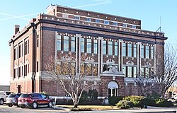 Texas County Courthouse in Guymon (2012) | |
 Location within the U.S. state of Oklahoma | |
| Coordinates: 36°45′N101°29′W / 36.75°N 101.48°W | |
| Country | |
| State | |
| Founded | 1907 |
| Named after | Texas |
| Seat | Guymon |
| Largest city | Guymon |
| Area | |
• Total | 2,049 sq mi (5,310 km2) |
| • Land | 2,041 sq mi (5,290 km2) |
| • Water | 7.4 sq mi (19 km2) 0.4% |
| Population (2020) | |
• Total | 21,384 |
| • Density | 10.48/sq mi (4.045/km2) |
| Time zone | UTC−6 (Central) |
| • Summer (DST) | UTC−5 (CDT) |
| Congressional district | 3rd |
| Website | texas |
Texas County is a county located in the panhandle of the U.S. state of Oklahoma. Its county seat is Guymon. As of the 2020 census, the population was 21,384. [1] It is the second largest county in Oklahoma, based on land area, and is named for Texas, the state that adjoins the county to its south. [2] Texas County comprises the Guymon, OK Micropolitan Statistical Area. The county economy is largely based on farming and cattle production. It is one of the top-producing counties in the U.S. for wheat, cattle, and hogs. It also lies within the noted Hugoton-Panhandle natural gas field. [2]
Contents
- History
- Geography
- Adjacent counties
- National protected area
- Demographics
- 2020 census
- 2010 census
- Politics
- Economy
- Education
- Transportation
- Major highways
- Airports
- Communities
- Cities
- Towns
- Census-designated places
- Unincorporated communities
- NRHP sites
- See also
- References
- External links
Being 50.6% Hispanic, Texas is also Oklahoma's only Hispanic-majority county as of 2020. [3]

