Haskell County | |
---|---|
Coordinates: 35°14′N95°07′W / 35.23°N 95.11°W | |
Country | United States |
State | Oklahoma |
Founded | 1907 |
Named for | Charles N. Haskell |
Seat | Stigler |
Largest city | Stigler |
Area | |
• Total | 625 sq mi (1,620 km2) |
• Land | 577 sq mi (1,490 km2) |
• Water | 49 sq mi (130 km2) 7.8%% |
Population (2020) | |
• Total | 11,561 |
• Density | 18/sq mi (7.1/km2) |
Time zone | UTC−6 (Central) |
• Summer (DST) | UTC−5 (CDT) |
Congressional district | 2nd |
Haskell County is a county located in the southeast quadrant of the U.S. state of Oklahoma. As of the 2020 census, the population was 11,561. [1] Its county seat is Stigler. [2] The county is named in honor of Charles N. Haskell, the first governor of Oklahoma.
The area now comprising Haskell County was created at statehood primarily from the former Sans Bois County of the Choctaw Nation in Indian Territory. Sans Bois County was part of the Moshulatubbee District, one of three administrative super-regions comprising the Choctaw Nation. Small portions of present-day Haskell County fell within Gaines County and Skullyville County, Choctaw Nation.
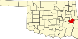
In 1908 county voters picked Stigler over Keota and Whitefield as the county seat. [3]
Underground coal mining was undertaken here in the early 20th century, creating jobs and attracting railroad construction to southern Haskell County. The San Bois Coal Company built more than four hundred company houses in McCurtain and Chant (two towns that eventually merged into one) for their miners. In 1912 a large, underground explosion rocked the Number Two mine at McCurtain, killing 73 (seventy-three) miners and bankrupting the San Bois Company. [3] The McCurtain disaster and the declining demand for coal in the 1920s halted underground coal mining in the county.
Strip mining continued. The Lone Star Steel Company became the county's leading coal producer. Haskell County was the source of 20 percent of Oklahoma's coal production between 1950 and 1980. [4]
Agriculture was the most important component of the county economy in the early 20th century. Cotton was the most important crop, followed by corn and oats. The collapse of cotton prices and the Great Depression caused a drop in population as well as farm acreage. In 1934 the Federal Emergency Relief Administration helped over 85 percent of Haskell County's population. Ranching supplanted farming, which was forced to diversify. By 1964, livestock accounted for about 70 percent of the county's revenues. [3]
According to the U.S. Census Bureau, the county has a total area of 625 square miles (1,620 km2), of which 577 square miles (1,490 km2) is land and 49 square miles (130 km2) (7.8%) is water. [5] The county elevation varies because of the Sans Bois Mountains in the southern part of the county from 500 feet (150 m) to 1,500 feet (460 m). [3]
The relatively large water area results from the presence of Eufaula Lake and the Robert S. Kerr Reservoir. The South Canadian River forms the northern border with McIntosh and Muskogee counties before draining into the Arkansas River at the Robert S. Kerr Reservoir. The Arkansas is the northeastern border with Sequoyah County. [3]
Census | Pop. | Note | %± |
---|---|---|---|
1910 | 18,875 | — | |
1920 | 19,397 | 2.8% | |
1930 | 16,216 | −16.4% | |
1940 | 17,324 | 6.8% | |
1950 | 13,313 | −23.2% | |
1960 | 9,121 | −31.5% | |
1970 | 9,578 | 5.0% | |
1980 | 11,010 | 15.0% | |
1990 | 10,940 | −0.6% | |
2000 | 11,792 | 7.8% | |
2010 | 12,769 | 8.3% | |
2020 | 11,561 | −9.5% | |
U.S. Decennial Census [6] 1790-1960 [7] 1900-1990 [8] 1990-2000 [9] 2010 [10] |
As of the 2010 United States Census, there were 12,769 people living in the county. 74.9% were White, 15.9% Native American, 0.5% Asian, 0.4% Black or African American, 1.2% of some other race and 7.0% of two or more races. 3.3% were Hispanic or Latino (of any race). 8.4% were of American, 7.3% German, 6.4% Irish and 5.0% English ancestry. [11]
As of the census [12] of 2000, there were 11,792 people, 4,624 households, and 3,380 families living in the county. The population density was 20 people per square mile (8/km2). There were 5,573 housing units at an average density of 10 per square mile (4/km2). The racial makeup of the county was 78.24% White, 0.61% Black or African American, 14.60% Native American, 0.29% Asian, 0.45% from other races, and 5.81% from two or more races. 1.50% of the population were Hispanic or Latino of any race.
There were 4,624 households, out of which 31.70% had children under the age of 18 living with them, 60.60% were married couples living together, 9.10% had a female householder with no husband present, and 26.90% were non-families. 24.70% of all households were made up of individuals, and 13.00% had someone living alone who was 65 years of age or older. The average household size was 2.52 and the average family size was 3.00.
In the county, the population was spread out, with 26.00% under the age of 18, 8.10% from 18 to 24, 24.50% from 25 to 44, 24.20% from 45 to 64, and 17.20% who were 65 years of age or older. The median age was 39 years. For every 100 females there were 95.70 males. For every 100 females age 18 and over, there were 92.40 males.
The median income for a household in the county was $24,553, and the median income for a family was $29,872. Males had a median income of $25,493 versus $17,462 for females. The per capita income for the county was $13,775. About 16.10% of families and 20.50% of the population were below the poverty line, including 25.10% of those under age 18 and 18.60% of those age 65 or over.
Despite the county being home to a significant Native American population and a wide Democratic registration advantage, the county has not voted that way in presidential elections in the 21st century. Unlike other Native-administered counties, however, the rightward shift only increased after the 2004 election, with the GOP hitting well over 70% of the vote in the county in the Barack Obama era and topping out with 83.1% for Donald Trump in 2020.
Voter Registration and Party Enrollment as of January 15, 2019 [13] | |||||
---|---|---|---|---|---|
Party | Number of Voters | Percentage | |||
Democratic | 4,387 | 63.42% | |||
Republican | 1,984 | 28.68% | |||
Others | 546 | 7.90% | |||
Total | 6,917 | 100% |
Year | Republican | Democratic | Third party | |||
---|---|---|---|---|---|---|
No. | % | No. | % | No. | % | |
2020 | 4,165 | 83.07% | 783 | 15.62% | 66 | 1.32% |
2016 | 3,701 | 78.11% | 882 | 18.62% | 155 | 3.27% |
2012 | 3,069 | 72.31% | 1,175 | 27.69% | 0 | 0.00% |
2008 | 3,207 | 68.51% | 1,474 | 31.49% | 0 | 0.00% |
2004 | 2,946 | 55.33% | 2,378 | 44.67% | 0 | 0.00% |
2000 | 2,039 | 44.06% | 2,510 | 54.24% | 79 | 1.71% |
1996 | 1,442 | 30.01% | 2,762 | 57.48% | 601 | 12.51% |
1992 | 1,461 | 26.34% | 3,069 | 55.34% | 1,016 | 18.32% |
1988 | 1,822 | 37.73% | 2,963 | 61.36% | 44 | 0.91% |
1984 | 2,417 | 48.52% | 2,535 | 50.89% | 29 | 0.58% |
1980 | 2,024 | 40.39% | 2,874 | 57.35% | 113 | 2.26% |
1976 | 1,401 | 29.08% | 3,388 | 70.32% | 29 | 0.60% |
1972 | 2,815 | 63.12% | 1,408 | 31.57% | 237 | 5.31% |
1968 | 1,516 | 37.05% | 1,563 | 38.20% | 1,013 | 24.76% |
1964 | 1,355 | 34.77% | 2,542 | 65.23% | 0 | 0.00% |
1960 | 1,858 | 52.04% | 1,712 | 47.96% | 0 | 0.00% |
1956 | 1,758 | 42.47% | 2,381 | 57.53% | 0 | 0.00% |
1952 | 1,872 | 41.68% | 2,619 | 58.32% | 0 | 0.00% |
1948 | 1,390 | 30.24% | 3,206 | 69.76% | 0 | 0.00% |
1944 | 2,102 | 41.70% | 2,924 | 58.00% | 15 | 0.30% |
1940 | 2,661 | 40.53% | 3,896 | 59.34% | 9 | 0.14% |
1936 | 2,182 | 35.51% | 3,961 | 64.47% | 1 | 0.02% |
1932 | 1,439 | 24.83% | 4,357 | 75.17% | 0 | 0.00% |
1928 | 2,580 | 53.95% | 2,172 | 45.42% | 30 | 0.63% |
1924 | 1,935 | 40.18% | 2,480 | 51.50% | 401 | 8.33% |
1920 | 2,673 | 52.67% | 2,201 | 43.37% | 201 | 3.96% |
1916 | 976 | 33.13% | 1,486 | 50.44% | 484 | 16.43% |
1912 | 902 | 30.32% | 1,388 | 46.66% | 685 | 23.03% |
Stigler is home to the Haskell County Courthouse, which has become notable for erecting marble statues of the Ten Commandments and the Mayflower Compact on the front lawn (see Separation of church and state in the United States ). In the seventh commandment, the word "adultery" is misspelled.
A unanimous federal appeals court ruled that county commissioners in Haskell County, Oklahoma unconstitutionally sought to promote their personal religious beliefs by erecting a Ten Commandments monument on the front lawn of the county's courthouse. The decision by the U.S. Tenth Circuit Court of Appeals comes in a challenge filed by the American Civil Liberties Union and the ACLU of Oklahoma on behalf of a local resident.
After the court decision, the marble statue was moved approximately 600 feet east to private property. Therefore, the statue was still displayed on the main street, available to anyone who desired to view and read the information.
The following sites in Haskell County are listed on the National Register of Historic Places:
Pushmataha County is a county in the southeastern part of the U.S. state of Oklahoma. As of the 2010 census, the population was 11,572. Its county seat is Antlers.
Pittsburg County is a county located in the U.S. state of Oklahoma. As of the 2010 census, the population was 45,837. Its county seat is McAlester. The county was formed from part of the Choctaw Nation in Indian Territory in 1907. County leaders believed that its coal production compared favorably with Pittsburgh, Pennsylvania at the time of statehood.
Muskogee County is a county located in the U.S. state of Oklahoma. As of the 2020 census, the population was 66,339. The county seat is Muskogee. The county and city were named for the Muscogee (Creek) Nation. The official spelling of the name was changed to Muskogee by the post office in 1900.
McCurtain County is in the southeastern corner of the U.S. state of Oklahoma. As of the 2020 census, its population was 30,814. Its county seat is Idabel. It was formed at statehood from part of the earlier Choctaw Nation in Indian Territory. The name honors an influential Choctaw family who lived in the area. Green McCurtain was the last chief when Oklahoma became a state in 1907.
Le Flore County is a county along the eastern border of the U.S state of Oklahoma. As of the 2020 census, the population was 48,129. Its county seat is Poteau. The county is part of the Fort Smith metropolitan area and the name honors a Choctaw family named LeFlore. The United States District Court for the Eastern District of Oklahoma is the federal district court with jurisdiction in LeFlore County.
Latimer County is a county located in the southeastern part of the U.S. state of Oklahoma. Its county seat is Wilburton. As of the 2020 census, the population was 9,444. The county was created at statehood in 1907 and named for James L. Latimer, a delegate from Wilburton to the 1906 state Constitutional Convention. Prior to statehood, it had been for several decades part of Gaines County, Sugar Loaf County, and Wade County in the Choctaw Nation.
Choctaw County is a county located in the U.S. state of Oklahoma. As of the 2020 census, the population was 14,204. Its county seat is Hugo.
Hugo is a city in and the county seat of Choctaw County, Oklahoma, United States. It is located in southeastern Oklahoma, approximately 9 miles (14 km) north of the Texas state line. As of the 2010 census, the city population was 5,310.
Keota is a town in northeastern Haskell County, Oklahoma, United States. The population was 438 at the 2020 census, a 22.3 percent decrease over the figure of 564 recorded in 2010.
Kinta is a town in Haskell County, Oklahoma, United States. The population was 297 at the 2010 census, an increase of 22.2 percent over the figure of 243 recorded in 2000.
McCurtain is a town in Haskell County, Oklahoma, United States. The population was 357 at the 2020 census, a 30.8% decrease over the figure of 516 recorded in 2010. A coal mine disaster in 1912 killed 73 miners and ended McCurtain's prosperity. The mine explosion remains one of the worst disasters in Oklahoma history.
Stigler is a city in and county seat of Haskell County, Oklahoma. The population was 2,685 at the time of the 2010 census, down from 2,731 recorded in 2000.
Tamaha is a town in Haskell County, Oklahoma, United States. The population was 176 at the 2010 census, a decline of 11.1 percent from the figure of 198 in 2000. Tamaha is a Choctaw word meaning town.
Whitefield is a town in northwestern Haskell County, Oklahoma, United States. The population was 391 at the 2010 census, compared with the figure of 231 recorded in 2000. It was named for Methodist bishop George Whitefield.
Valliant is a town in McCurtain County, Oklahoma, United States. The population was 754 at the 2010 census.
Greenwood "Green" McCurtain was a tribal administrator and Principal Chief of the Choctaw Republic, serving a total of four elected two-year terms. He was the third of his brothers to be elected as chief. He was a Republican in the late 19th century, leaning toward allotment and assimilation when the nation was under pressure by the United States government, as he believed the Choctaw needed to negotiate to secure their best outcome prior to annexation.
The Edmund McCurtain House, in Haskell County, Oklahoma near Kinta, Oklahoma, was built in 1866. It was listed on the National Register of Historic Places in 1980.
Sans Bois County was a political subdivision of the Choctaw Nation of Indian Territory, prior to Oklahoma being admitted as a state. The county formed part of the Nation's Moshulatubbee District, or First District, one of three administrative super-regions.
Gaines County was a political subdivision of the Choctaw Nation of Indian Territory, prior to Oklahoma being admitted as a state. The county formed part of the Nation's Moshulatubbee District, or First District, one of three administrative super-regions.
Tobucksy County was a political subdivision of the Choctaw Nation of Indian Territory, prior to Oklahoma becoming a state. It was part of the Moshulatubbee District, or First District, one of three administrative super-regions.