Whitefield, Oklahoma

Last updated

Whitefield, Oklahoma
USA Oklahoma location map.svg
Red pog.svg
Whitefield, Oklahoma
Location of Whitefield, Oklahoma
Coordinates: 35°15′16″N95°14′21″W / 35.25444°N 95.23917°W / 35.25444; -95.23917
Country United States
State Oklahoma
County Haskell
Area
[1]
  Total1.87 sq mi (4.85 km2)
  Land1.71 sq mi (4.42 km2)
  Water0.16 sq mi (0.42 km2)
Elevation
[2]
548 ft (167 m)
Population
 (2020)
  Total371
  Density217.21/sq mi (83.89/km2)
Time zone UTC-6 (Central (CST))
  Summer (DST) UTC-5 (CDT)
ZIP code
74472
Area code(s) 539/918
FIPS code 40-80800 [3]
GNIS feature ID2413479 [2]

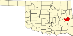
Whitefield is a town in northwestern Haskell County, Oklahoma, United States. The population was 377 at the 2020 census, [4] compared with the figure of 391 recorded in 2010. It was named for Methodist bishop George Whitefield (1714 - 1770). [5]

Contents

History

At the time of its founding, the community that became Whitefield was located in the Moshulatubbee District of the Choctaw Nation, in the Indian Territory. [6]

Whitefield's history can be traced to the American Civil War, when the Confederate Army established Camp Pike for two thousand Confederate soldiers in 1861. The camp was named for Confederate Brigadier General Albert Pike, who had persuaded the Five Civilized Tribes to ally with the Confederacy. [5]

After the end of the Civil War, Camp Pike became a Choctaw trading post. The trading post and the adjacent community were renamed as Oklahoma, Indian Territory. Its clientele were not only members of the Choctaw tribe, but also white settlers who had permits from the tribe to farm land in the Choctaw Nation. Occasionally, it was patronized by white outlaws such as Belle Starr, who were hiding from the law in the mountains of southern Oklahoma.The Post Office wanted to change the name because of confusion with another post office already known as Oklahoma Station. In 1888, the local residents voted to accept Whitfield as the name of the settlement and post office. [5] The post office at Whitefield, Indian Territory, which had originally been established as Oklahoma, Indian Territory on December 21, 1881, was reestablished on November 27, 1888. It was named for Bishop George Whitefield, an early-day Methodist leader. [7]

Whitefield existed primarily as a town to support the nearby farms. By 1911, it counted approximately 500 residents. Improvements included two groceries, two general stores, a cotton gin and mill, a drugstore, a doctor, and a blacksmith. It had about 300 residents by 1920. Reportedly, the population declined sharply with the onset of the Great Depression. Whitfield incorporated in 1978, so its first Federal Census in 1980 recorded 240 people. [5] The population has trended upward since that year.

Geography

Whitefield is located in northwestern Haskell County on high ground south of the Canadian River.

Oklahoma State Highways 2 and 9 intersect in the center of Whitefield. OK-2 leads north 16 miles (26 km) to Interstate 40 near Warner and south 10 miles (16 km) to Kinta, while OK-9 leads east 6 miles (10 km) to Stigler, the Haskell county seat, and west 23 miles (37 km) to Eufaula.

According to the United States Census Bureau, the town has a total area of 1.9 square miles (4.8 km2), of which 1.7 square miles (4.4 km2) are land and 0.2 square miles (0.4 km2), or 8.81%, are water. [4]

Demographics

Historical population
CensusPop.Note
1980 240
1990 2535.4%
2000 231−8.7%
2010 39169.3%
2020 371−5.1%
U.S. Decennial Census [8]

As of the census [3] of 2000, there were 231 people, 99 households, and 73 families residing in the town. The population density was 94.4 inhabitants per square mile (36.4/km2). There were 110 housing units at an average density of 44.9 per square mile (17.3/km2). The racial makeup of the town was 77.92% White, 12.99% Native American, 0.43% Asian, and 8.66% from two or more races.

There were 99 households, out of which 27.3% had children under the age of 18 living with them, 61.6% were married couples living together, 10.1% had a female householder with no husband present, and 25.3% were non-families. 24.2% of all households were made up of individuals, and 15.2% had someone living alone who was 65 years of age or older. The average household size was 2.33 and the average family size was 2.74.

In the town, the population was spread out, with 22.1% under the age of 18, 6.5% from 18 to 24, 26.4% from 25 to 44, 28.1% from 45 to 64, and 16.9% who were 65 years of age or older. The median age was 41 years. For every 100 females, there were 94.1 males. For every 100 females age 18 and over, there were 104.5 males.

The median income for a household in the town was $21,389, and the median income for a family was $33,125. Males had a median income of $26,786 versus $15,000 for females. The per capita income for the town was $14,306. About 15.7% of families and 23.2% of the population were below the poverty line, including 27.5% of those under the age of eighteen and 33.3% of those 65 or over.

Governance

Town Council

Whitefield has a Mayor - Trustees form of government. Town officials are:

City departments

Related Research Articles

<span class="mw-page-title-main">LeFlore County, Oklahoma</span> County in Oklahoma, United States

LeFlore County is a county along the eastern border of the U.S state of Oklahoma. As of the 2020 census, the population was 48,129. Its county seat is Poteau. The county is part of the Fort Smith metropolitan area and the name honors a Choctaw family named LeFlore. The United States District Court for the Eastern District of Oklahoma is the federal district court with jurisdiction in LeFlore County.

<span class="mw-page-title-main">Haskell County, Oklahoma</span> County in Oklahoma, United States

Haskell County is a county located in the southeast quadrant of the U.S. state of Oklahoma. As of the 2020 census, the population was 11,561. Its county seat is Stigler. The county is named in honor of Charles N. Haskell, the first governor of Oklahoma.

<span class="mw-page-title-main">Bryan County, Oklahoma</span> County in Oklahoma, United States

Bryan County is a county in the U.S. state of Oklahoma. As of the 2020 census, the population was 46,067. Its county seat is Durant. It is the only county in the United States named for Democratic politician William Jennings Bryan.

<span class="mw-page-title-main">Bokchito, Oklahoma</span> Town in Oklahoma, United States

Bokchito is a town in Bryan County, Oklahoma, United States. The population was 632 at the 2010 census, an increase of 12.1 percent over the figure of 564 recorded in 2000. In the Choctaw language, "bok" means river, and "chito" means big or large, literally translating into "big creek".

<span class="mw-page-title-main">Boswell, Oklahoma</span> Town in Oklahoma, United States

Boswell is a town in Choctaw County, Oklahoma, United States. The population was 709 at the 2010 census.

<span class="mw-page-title-main">Fort Towson, Oklahoma</span> Town in Oklahoma, United States

Fort Towson is a town in Choctaw County, Oklahoma, United States. The population was 510 at the 2010 census, a 15.1 percent decline from the figure of 611 recorded in 2000. It was named for nearby Fort Towson, which had been established in May 1824 and named for General Nathan Towson, a hero of the War of 1812. The town of Fort Towson was established in 1902, after the Arkansas and Choctaw Railway reached eastern Choctaw County.

Keota is a town in southeastern Haskell County, Oklahoma, United States. The population was 438 at the 2020 census, a 22.3 percent decrease over the figure of 564 recorded in 2010.

Kinta is a town in Haskell County, Oklahoma, United States. The population was 297 at the 2010 census, an increase of 22.2 percent over the figure of 243 recorded in 2000.

McCurtain is a town in Haskell County, Oklahoma, United States. The population was 357 at the 2020 census, a 30.8% decrease over the figure of 516 recorded in 2010. A coal mine disaster in 1912 killed 73 miners and ended McCurtain's prosperity. The mine explosion remains one of the worst disasters in Oklahoma history.

<span class="mw-page-title-main">Stigler, Oklahoma</span> City in Oklahoma, United States

Stigler is a city in and county seat of Haskell County, Oklahoma. The population was 2,685 at the time of the 2010 census, down from 2,731 recorded in 2000.

Tamaha is a town in Haskell County, Oklahoma, United States. The population was 152 at the time of the 2020 United States census. Tamaha is a Choctaw word meaning "town."

<span class="mw-page-title-main">Fort Coffee, Oklahoma</span> Town in Oklahoma, United States

Fort Coffee is a town in Le Flore County, Oklahoma, United States. Originally constructed as a U. S. Army fort in 1834, it was named for U. S. General John Coffee, a veteran of the Seminole Wars. It is part of the Fort Smith, Arkansas-Oklahoma Metropolitan Statistical Area. The population was 424 at the 2010 census, a gain of 2.9 percent over the figure of 412 in 2000.

<span class="mw-page-title-main">Wister, Oklahoma</span> Town in Oklahoma, United States

Wister is a town in Le Flore County, Oklahoma, United States. It is part of the Fort Smith metropolitan area. The population was 1,102 at the 2010 census. Wister is named for Gutman G. Wister, an official with the Choctaw, Oklahoma and Gulf Railroad.

<span class="mw-page-title-main">Haskell, Oklahoma</span> Town in Oklahoma, United States

Haskell is a city, as of March 2024, in Muskogee County, Oklahoma, United States. The population was 2,007 at the 2010 census, a gain of 13.7 percent over the figure of 1,765 recorded in 2000. Haskell was established in 1904 on the Midland Valley Railroad. It was named for town site developer Charles N. Haskell, who would become the first governor of the State of Oklahoma in 1907.

<span class="mw-page-title-main">Alderson, Oklahoma</span> Town in Oklahoma, United States

Alderson is a town in Pittsburg County, Oklahoma, United States. The population was 304 at the 2010 census.

<span class="mw-page-title-main">Crowder, Oklahoma</span> Town in Oklahoma, United States

Crowder is a town in Pittsburg County, Oklahoma, United States. The population was 430 at the 2010 census.

<span class="mw-page-title-main">Haileyville, Oklahoma</span> City in Oklahoma, United States

Haileyville is a city in Pittsburg County, Oklahoma, United States. The population was 716 at the time of the 2020 United States census.

<span class="mw-page-title-main">Quinton, Oklahoma</span> Town in Oklahoma, United States

Quinton is a town in Pittsburg County, Oklahoma, United States. The population was 1,051 at the 2010 census. The town was named for Elizabeth Quinton, who lived to be 116 years old. Her family still resides in and around the town of Quinton. Web address https://townofquinton.com/

<span class="mw-page-title-main">Earlsboro, Oklahoma</span> Town in Oklahoma, United States

Earlsboro is a town in Pottawatomie County, Oklahoma, United States. The population was 594 by the 2020 United States census. It was once called "...the town that whisky built and oil broke."

<span class="mw-page-title-main">Fanshawe, Oklahoma</span> Town in Oklahoma, United States

Fanshawe is a town in Latimer and Le Flore counties in the U.S. state of Oklahoma. As of the 2020 Census, the town had a total population of 317. The Le Flore County portion of Fanshawe is part of the Fort Smith, Arkansas-Oklahoma Metropolitan Statistical Area.

References

  1. "ArcGIS REST Services Directory". United States Census Bureau. Retrieved September 20, 2022.
  2. 1 2 U.S. Geological Survey Geographic Names Information System: Whitefield, Oklahoma
  3. 1 2 "U.S. Census website". United States Census Bureau . Retrieved January 31, 2008.
  4. 1 2 "Geographic Identifiers: 2010 Census Summary File 1 (G001): Whitefield town, Oklahoma". American Factfinder. U.S. Census Bureau. Archived from the original on February 13, 2020. Retrieved January 16, 2018.
  5. 1 2 3 4 Hyder, Glenn O. "Whitefield." Encyclopedia of Oklahoma History and Culture. Accessed October 18, 2016.
  6. Morris, John W. Historical Atlas of Oklahoma (Norman: University of Oklahoma Press, 1986), plate 38.
  7. Shirk, George H. Oklahoma Place Names (Norman: University of Oklahoma Press, pp. 154 & 221.
  8. "Census of Population and Housing". Census.gov. Retrieved June 4, 2015.