Tamaha, Oklahoma

Last updated

Tamaha, Oklahoma
USA Oklahoma location map.svg
Red pog.svg
Tamaha, Oklahoma
Location of Tamaha, Oklahoma
Coordinates: 35°23′51″N94°59′15″W / 35.39750°N 94.98750°W / 35.39750; -94.98750
Country United States
State Oklahoma
County Haskell
Area
[1]
  Total6.45 sq mi (16.71 km2)
  Land6.43 sq mi (16.65 km2)
  Water0.02 sq mi (0.06 km2)
Elevation
[2]
479 ft (146 m)
Population
 (2020)
  Total152
  Density23.65/sq mi (9.13/km2)
Time zone UTC-6 (Central (CST))
  Summer (DST) UTC-5 (CDT)
ZIP code
74462
Area code(s) 539/918
FIPS code 40-72400 [3]
GNIS feature ID2413365 [2]

Tamaha is a town in Haskell County, Oklahoma, United States. The population was 152 at the time of the 2020 United States census. [4] Tamaha is a Choctaw word meaning "town." [5]

Contents

Geography

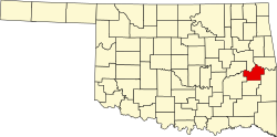
Tamaha is located on the banks of the Arkansas River, 13 miles (21 km) north northeast of Stigler and 6 miles (9.7 km) south of Vian. [5]

According to the United States Census Bureau, the town has a total area of 6.4 square miles (17 km2), of which 6.4 square miles (17 km2) is land and 0.16% is water.

History

Tamaha began as a riverboat landing on the Arkansas River in the 1830s. Initially, the community was called Pleasant Bluff, after a nearby geographic feature. During the Civil War, the Union steamer, J. R. Williams, had carried supplies for the Union army between Fort Smith, Arkansas and Fort Gibson in Indian Territory. On June 15, 1864, Confederate forces under Colonel Stand Watie attacked with cannon and small arms fire as the ship negotiated a bend at Pleasant Bluff. The ship was crippled and ran aground, where the Confederates captured it. According to the Encyclopedia of Oklahoma History and Culture, the rusted skeleton of the steamer remains where it was grounded. [5]

At the time of its founding, Tamaha was located in the Moshulatubbee District of the Choctaw Nation. [6]

The town grew slowly after the Civil War. The name changed to Tamaha in 1884, when a post office was established. It had a population of 237 in 1900, increasing to 501 in 1920. However, riverboat traffic, the major source of business, ceased in 1912, Two fires, one in 1919 and the other in 1930, destroyed much of the town. The population fell to 202 in 1930 and declined to its historic low of 80 in 1960. Most of the former residents moved to the nearby town of Stigler. The post office closed in 1954. In the 21st century, the main source of business is travel by vacationers, attracted by the nearby Robert S. Kerr Reservoir. The only physical link to the town's past is the Tamaha Jail and Ferry Landing, included on the National Register of Historic Places listings in Haskell County, Oklahoma (NR 80003266). [5]

Demographics

Historical population
CensusPop.Note
1900 237
1910 498110.1%
1920 5010.6%
1930 202−59.7%
1940 24521.3%
1950 117−52.2%
1960 80−31.6%
1970 833.8%
1980 14574.7%
1990 18829.7%
2000 37297.9%
2010 176−52.7%
2020 152−13.6%
U.S. Decennial Census [7]

As of the census [3] of 2000, there were 198 people, 73 households, and 54 families residing in the town. The population density was 30.8 inhabitants per square mile (11.9/km2). There were 109 housing units at an average density of 17.0 per square mile (6.6/km2). The racial makeup of the town was 84.34% White, 8.59% Native American, and 7.07% from two or more races.

There were 73 households, out of which 23.3% had children under the age of 18 living with them, 64.4% were married couples living together, 6.8% had a female householder with no husband present, and 24.7% were non-families. 20.5% of all households were made up of individuals, and 11.0% had someone living alone who was 65 years of age or older. The average household size was 2.71 and the average family size was 3.16.

In the town, the population was spread out, with 24.7% under the age of 18, 4.0% from 18 to 24, 21.2% from 25 to 44, 29.8% from 45 to 64, and 20.2% who were 65 years of age or older. The median age was 44 years. For every 100 females, there were 112.9 males. For every 100 females age 18 and over, there were 109.9 males.

The median income for a household in the town was $29,250, and the median income for a family was $35,938. Males had a median income of $27,500 versus $16,563 for females. The per capita income for the town was $11,628. About 4.3% of families and 8.9% of the population were below the poverty line, including none of those under the age of eighteen and 22.6% of those 65 or over.

Tamaha is the setting for the 2024 Marvel television miniseries Echo , [8] although actual filming took place in Georgia. [9]

Related Research Articles

<span class="mw-page-title-main">LeFlore County, Oklahoma</span> County in Oklahoma, United States

LeFlore County is a county along the eastern border of the U.S state of Oklahoma. As of the 2020 census, the population was 48,129. Its county seat is Poteau. The county is part of the Fort Smith metropolitan area and the name honors a Choctaw family named LeFlore. The United States District Court for the Eastern District of Oklahoma is the federal district court with jurisdiction in LeFlore County.

<span class="mw-page-title-main">Haskell County, Oklahoma</span> County in Oklahoma, United States

Haskell County is a county located in the southeast quadrant of the U.S. state of Oklahoma. As of the 2020 census, the population was 11,561. Its county seat is Stigler. The county is named in honor of Charles N. Haskell, the first governor of Oklahoma.

<span class="mw-page-title-main">Bryan County, Oklahoma</span> County in Oklahoma, United States

Bryan County is a county in the U.S. state of Oklahoma. As of the 2020 census, the population was 46,067. Its county seat is Durant. It is the only county in the United States named for Democratic politician William Jennings Bryan.

<span class="mw-page-title-main">Bennington, Oklahoma</span> Incorporated Town in Oklahoma, United States

Bennington is an incorporated town in Bryan County, Oklahoma, United States. The population was 334 at the 2010 census.

<span class="mw-page-title-main">Boswell, Oklahoma</span> Town in Oklahoma, United States

Boswell is a town in Choctaw County, Oklahoma, United States. The population was 709 at the 2010 census.

<span class="mw-page-title-main">Fort Towson, Oklahoma</span> Town in Oklahoma, United States

Fort Towson is a town in Choctaw County, Oklahoma, United States. The population was 510 at the 2010 census, a 15.1 percent decline from the figure of 611 recorded in 2000. It was named for nearby Fort Towson, which had been established in May 1824 and named for General Nathan Towson, a hero of the War of 1812. The town of Fort Towson was established in 1902, after the Arkansas and Choctaw Railway reached eastern Choctaw County.

Keota is a town in southeastern Haskell County, Oklahoma, United States. The population was 438 at the 2020 census, a 22.3 percent decrease over the figure of 564 recorded in 2010.

Kinta is a town in Haskell County, Oklahoma, United States. The population was 297 at the 2010 census, an increase of 22.2 percent over the figure of 243 recorded in 2000.

McCurtain is a town in Haskell County, Oklahoma, United States. The population was 357 at the 2020 census, a 30.8% decrease over the figure of 516 recorded in 2010. A coal mine disaster in 1912 killed 73 miners and ended McCurtain's prosperity. The mine explosion remains one of the worst disasters in Oklahoma history.

<span class="mw-page-title-main">Stigler, Oklahoma</span> City in Oklahoma, United States

Stigler is a city in and county seat of Haskell County, Oklahoma. The population was 2,685 at the time of the 2010 census, down from 2,731 recorded in 2000.

Whitefield is a town in northwestern Haskell County, Oklahoma, United States. The population was 377 at the 2020 census, compared with the figure of 391 recorded in 2010. It was named for Methodist bishop George Whitefield.

<span class="mw-page-title-main">Arkoma, Oklahoma</span> Town in Oklahoma, United States

Arkoma is a town in LeFlore County, Oklahoma, United States. It is part of the Fort Smith, Arkansas-Oklahoma Metropolitan Statistical Area. The population was 1,989 at the 2010 census, a decline from 2,180 in 2000. The name of the town is a portmanteau of Arkansas and Oklahoma. Throughout its history, Arkoma has served as a "bedroom community" because many residents commuted to work in Fort Smith.

<span class="mw-page-title-main">Cowlington, Oklahoma</span> Town in Oklahoma, United States

Cowlington is a town in LeFlore County, Oklahoma. It is part of the Fort Smith metropolitan area. The population was 155 at the time of the 2010 census, a gain of 16.5 percent over the figure of 133 recorded in 2000.

<span class="mw-page-title-main">Fort Coffee, Oklahoma</span> Town in Oklahoma, United States

Fort Coffee is a town in Le Flore County, Oklahoma, United States. Originally constructed as a U. S. Army fort in 1834, it was named for U. S. General John Coffee, a veteran of the Seminole Wars. It is part of the Fort Smith, Arkansas-Oklahoma Metropolitan Statistical Area. The population was 424 at the 2010 census, a gain of 2.9 percent over the figure of 412 in 2000.

<span class="mw-page-title-main">LeFlore, Oklahoma</span> Town in Oklahoma, United States

LeFlore is a town in LeFlore County, Oklahoma, United States. It is part of the Fort Smith, Arkansas-Oklahoma Metropolitan Statistical Area. The population was 198 at the 2010 census, an increase of 13.1 percent over the figure of 168 in 2000. Although the legal town name is spelled in the two-word form, the official federal name for the place and the postal name used is Leflore.

<span class="mw-page-title-main">Pocola, Oklahoma</span> Town in Oklahoma, United States

Pocola is a town in Le Flore County, Oklahoma, United States. It is part of the Fort Smith, Arkansas-Oklahoma metropolitan area. The population was 4,056 in 2010, a gain of 1.6 percent over the figure of 3,994 recorded in 2000. Pocola is a Choctaw word meaning "ten", the approximate distance in miles from Fort Smith, Arkansas.

<span class="mw-page-title-main">Talihina, Oklahoma</span> Town in Oklahoma, United States

Talihina is a town in LeFlore County, Oklahoma, United States, its name originating from two Choctaw words, tully and hena, meaning "iron road," a reference to the railroad around which the town was built. It is part of the Fort Smith, Arkansas–Oklahoma Metropolitan Statistical Area. The population was 925 at the time of the 2020 Census.

<span class="mw-page-title-main">Wister, Oklahoma</span> Town in Oklahoma, United States

Wister is a town in Le Flore County, Oklahoma, United States. It is part of the Fort Smith metropolitan area. The population was 1,102 at the 2010 census. Wister is named for Gutman G. Wister, an official with the Choctaw, Oklahoma and Gulf Railroad.

<span class="mw-page-title-main">Longtown, Oklahoma</span> CDP in Oklahoma, United States

Longtown is a census-designated place (CDP) and unincorporated community in Pittsburg County, Oklahoma, United States. The population was 2,397 at the 2000 census.

<span class="mw-page-title-main">Fanshawe, Oklahoma</span> Town in Oklahoma, United States

Fanshawe is a town in Latimer and Le Flore counties in the U.S. state of Oklahoma. As of the 2020 Census, the town had a total population of 317. The Le Flore County portion of Fanshawe is part of the Fort Smith, Arkansas-Oklahoma Metropolitan Statistical Area.

References

  1. "ArcGIS REST Services Directory". United States Census Bureau. Retrieved September 20, 2022.
  2. 1 2 U.S. Geological Survey Geographic Names Information System: Tamaha, Oklahoma
  3. 1 2 "U.S. Census website". United States Census Bureau . Retrieved January 31, 2008.
  4. "Tamaha (town), Oklahoma". United States Census Bureau. Retrieved March 20, 2024.
  5. 1 2 3 4 Hyder, Glenn O. Encyclopedia of Oklahoma History and Culture. "Tamaha." Retrieved August 25, 2012.
  6. Morris, John W. Historical Atlas of Oklahoma (Norman: University of Oklahoma Press, 1986), plate 38.
  7. "Census of Population and Housing". Census.gov. Retrieved June 4, 2015.
  8. Hayes, Jana; McDonnell, Brandy (January 10, 2024). "What to know about Marvel's 'Echo' series: where to watch, what Oklahoma town it's set in". The Oklahoman.
  9. "Where was Echo filmed? The real Tamaha town and the Black Crow's Skatelife locations". Atlas of Wonder. Retrieved March 20, 2024.