Okmulgee County | |
---|---|
Coordinates: 35°38′N95°58′W / 35.64°N 95.97°W | |
Country | United States |
State | Oklahoma |
Founded | 1907 |
Seat | Okmulgee |
Largest city | Okmulgee |
Area | |
• Total | 702 sq mi (1,820 km2) |
• Land | 697 sq mi (1,810 km2) |
• Water | 5.0 sq mi (13 km2) 0.7%% |
Population (2020) | |
• Total | 36,706 |
• Density | 52/sq mi (20/km2) |
Congressional district | 2nd |
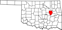
Okmulgee County is a county in the U.S. state of Oklahoma. As of the 2020 census, the population was 36,706. [1] The county seat is Okmulgee. [2] Located within the Muscogee Nation Reservation, the county was created at statehood in 1907. The name Okmulgee is derived from the Hitchita (Lower Creek) word okimulgi, meaning "boiling waters". [3]
Okmulgee County is included in the Tulsa, OK metropolitan statistical area.
The Creek Nation was removed into this part of Indian Territory along the Trail of Tears after signing treaties exchanging their land in Georgia and Alabama in 1826 and 1832. The actual move occurred over the period from 1827 to 1836. The Creek Nation government, led by chief Samuel Checote, revised its constitution in 1867 and designated Okmulgee as its capital in 1868. The U.S. Post Office opened in Okmulgee on April 29, 1869. The Creek Nation built its capitol, a log building, in 1869. The building was rebuilt of stone in 1878. [3]
Okmulgee County was formed on July 16, 1907, from Muskogee land, with a population of 14,362. County government offices were located in the Creek Council House until 1916, when the present Okmulgee County Courthouse was built. The former council building was then repurposed. The county's population was 21,115 in 1910 and increased to a high of 56,558 by 1930. [3]
Railroads came to the area in 1900, when the St. Louis, Oklahoma and Southern Railway (later the St. Louis and San Francisco Railway or Frisco) built a line from Sapulpa, Oklahoma via Okmulgee to a place near the Red River. The Shawnee, Oklahoma and Missouri Coal and Railway (later also acquired by the Frisco) built a line from Muskogee to Okmulgee in 1902–03. It was abandoned in 1973. The Missouri, Oklahoma and Gulf Railway (purchased by the Kansas, Oklahoma and Gulf Railway in 1919) ran through Dewar, Oklahoma beginning in 1909, and the Okmulgee Northern Railway operated between Okmulgee and Deep Fork from 1916 to 1964. [3]
In 1918, the boundary between Okmulgee County and McIntosh County was realigned, moving the towns of Grayson [4] and Hoffman [5] from McIntosh into Okmulgee County.
The Creek Council House still stands today. While ownership of the building changed over the years, the City of Okmulgee in November 2010 sold the building back to the tribe for $3.2 million. [6] The building currently houses the Creek Council House Museum, with artifacts and exhibits about the history of the Muscogee tribe and the arts and crafts of other Native American tribes.
According to the U.S. Census Bureau, the county has a total area of 702 square miles (1,820 km2), of which 697 square miles (1,810 km2) is land and 5.0 square miles (13 km2) (0.7%) is water. [7] Lake Henryetta, Okmulgee Lake, Nichols Lake, most of Dripping Springs Lake, and the tip of Oklahoma's largest lake, [8] Lake Eufaula, lie within the county. [9] The Deep Fork of the North Canadian River is the principal waterway in the county. [3] The eastern part of the county is within the Eastern Lowlands physiographic region and the western part is in the Osage Plains. Okmulgee Park and Dripping Springs Park lie west and southwest of the city of Okmulgee. Deep Fork National Wildlife Refuge lies within the southern part of the county. [9] The area known as the High Spring Mountains is in the eastern part of the county south of Eram, and extending further south into McIntosh County in the Hitchita vicinity. [10]
Census | Pop. | Note | %± |
---|---|---|---|
1910 | 21,115 | — | |
1920 | 55,072 | 160.8% | |
1930 | 56,558 | 2.7% | |
1940 | 50,101 | −11.4% | |
1950 | 44,561 | −11.1% | |
1960 | 36,945 | −17.1% | |
1970 | 35,358 | −4.3% | |
1980 | 39,169 | 10.8% | |
1990 | 36,490 | −6.8% | |
2000 | 39,685 | 8.8% | |
2010 | 40,069 | 1.0% | |
2020 | 36,706 | −8.4% | |
U.S. Decennial Census [11] 1790-1960 [12] 1900-1990 [13] 1990-2000 [14] 2010 [15] |
As of the census [16] of 2000, there were 39,685 people, 15,300 households, and 10,694 families residing in the county. The population density was 22/km2 (57/mi2). There were 17,316 housing units at an average density of 10/km2 (25/mi2). The racial makeup of the county was 69.73% White, 10.20% Black or African American, 12.85% Native American, 0.19% Asian, 0.02% Pacific Islander, 0.61% from other races, and 6.40% from two or more races. 1.95% of the population were Hispanic or Latino of any race. As of 2020, its population declined to 36,706. [15]
There were 15,300 households, out of which 32.00% had children under the age of 18 living with them, 52.80% were married couples living together, 13.10% had a female householder with no husband present, and 30.10% were non-families. 27.10% of all households were made up of individuals, and 12.60% had someone living alone who was 65 years of age or older. The average household size was 2.53 and the average family size was 3.06.
In the county, the population was spread out, with 26.90% under the age of 18, 9.50% from 18 to 24, 25.30% from 25 to 44, 23.30% from 45 to 64, and 15.10% who were 65 years of age or older. The median age was 37 years. For every 100 females, there were 95.20 males. For every 100 females age 18 and over, there were 90.80 males.
The median income for a household in the county was $27,652, and the median income for a family was $33,987. Males had a median income of $29,935 versus $20,861 for females. The per capita income for the county was $14,065. About 14.90% of families and 18.90% of the population were below the poverty line, including 24.90% of those under age 18 and 15.50% of those age 65 or over.
Okmulgee County government has three commissioners, one for each of the three Districts. [17] County services, including the District Court, Assessor, County Clerk, Jail, and Sheriff's office, are all located between 6th and 8th St, and Alabama and Seminole Avenues, in the City of Okmulgee. [18]
Despite a sizable Democratic registration advantage, the county—like every Oklahoma county since 2000—has favored the Republican candidate for President in every election since 2000, the Republican margin of victory increasing with every election.
Voter Registration and Party Enrollment as of January 15, 2019 [19] | |||||
---|---|---|---|---|---|
Party | Number of Voters | Percentage | |||
Democratic | 9,872 | 49.26% | |||
Republican | 7,412 | 36.99% | |||
Others | 2,755 | 13.75% | |||
Total | 20,039 | 100% |
Year | Republican | Democratic | Third party | |||
---|---|---|---|---|---|---|
No. | % | No. | % | No. | % | |
2020 | 9,668 | 67.55% | 4,357 | 30.44% | 288 | 2.01% |
2016 | 8,944 | 64.12% | 4,385 | 31.44% | 620 | 4.44% |
2012 | 7,731 | 58.73% | 5,432 | 41.27% | 0 | 0.00% |
2008 | 8,727 | 58.50% | 6,191 | 41.50% | 0 | 0.00% |
2004 | 8,363 | 53.17% | 7,367 | 46.83% | 0 | 0.00% |
2000 | 5,797 | 43.99% | 7,186 | 54.53% | 195 | 1.48% |
1996 | 4,246 | 31.84% | 7,555 | 56.65% | 1,536 | 11.52% |
1992 | 4,586 | 29.74% | 7,767 | 50.37% | 3,068 | 19.89% |
1988 | 5,674 | 40.52% | 8,262 | 59.00% | 68 | 0.49% |
1984 | 8,704 | 53.76% | 7,380 | 45.59% | 105 | 0.65% |
1980 | 6,652 | 46.57% | 7,236 | 50.65% | 397 | 2.78% |
1976 | 5,333 | 38.19% | 8,499 | 60.87% | 131 | 0.94% |
1972 | 8,706 | 63.82% | 4,494 | 32.94% | 442 | 3.24% |
1968 | 4,709 | 34.81% | 6,089 | 45.02% | 2,728 | 20.17% |
1964 | 4,704 | 31.57% | 10,195 | 68.43% | 0 | 0.00% |
1960 | 7,107 | 49.46% | 7,262 | 50.54% | 0 | 0.00% |
1956 | 6,703 | 46.78% | 7,626 | 53.22% | 0 | 0.00% |
1952 | 6,717 | 39.91% | 10,115 | 60.09% | 0 | 0.00% |
1948 | 4,368 | 29.44% | 10,467 | 70.56% | 0 | 0.00% |
1944 | 5,430 | 35.74% | 9,737 | 64.09% | 25 | 0.16% |
1940 | 6,696 | 37.63% | 11,016 | 61.90% | 84 | 0.47% |
1936 | 4,975 | 29.11% | 12,061 | 70.56% | 57 | 0.33% |
1932 | 4,762 | 29.67% | 11,287 | 70.33% | 0 | 0.00% |
1928 | 9,149 | 60.77% | 5,834 | 38.75% | 73 | 0.48% |
1924 | 6,015 | 46.85% | 5,927 | 46.17% | 896 | 6.98% |
1920 | 5,367 | 51.33% | 4,495 | 42.99% | 593 | 5.67% |
1916 | 1,860 | 36.91% | 2,406 | 47.75% | 773 | 15.34% |
1912 | 1,140 | 38.68% | 1,243 | 42.18% | 564 | 19.14% |
The following sites in Okmulgee County are listed on the National Register of Historic Places:
Washington County is a county located in the northeastern part of the U.S. state of Oklahoma. As of the 2020 census, the population was 52,455. Its county seat is Bartlesville. Named for President George Washington, it is the second smallest county in Oklahoma in total area, adjacent to the largest county in Oklahoma, Osage County.
Tulsa County is located in the U.S. state of Oklahoma. As of the 2020 census, the population was 669,279, making it the second-most populous county in the state, behind only Oklahoma County. Its county seat and largest city is Tulsa, the second-largest city in the state. Founded at statehood, in 1907, it was named after the previously established city of Tulsa. Before statehood, the area was part of both the Creek Nation and the Cooweescoowee District of Cherokee Nation in Indian Territory.
Pittsburg County is a county located in the U.S. state of Oklahoma. As of the 2020 census, the population was 43,773. Its county seat is McAlester. The county was formed from part of the Choctaw Nation in Indian Territory in 1907. County leaders believed that its coal production compared favorably with Pittsburgh, Pennsylvania at the time of statehood.
Okfuskee County is a county located in the U.S. state of Oklahoma. As of the 2020 census, its population was 11,310. Its county seat is Okemah. The county is named for a former Muscogee town in present Cleburne County, Alabama, that in turn was named for the Okfuskee, a Muscogee tribe.
Muskogee County is a county located in the U.S. state of Oklahoma. As of the 2020 census, the population was 66,339. The county seat is Muskogee. The county and city were named for the Muscogee (Creek) Nation. The official spelling of the name was changed to Muskogee by the post office in 1900.
McIntosh County is a county located in the U.S. state of Oklahoma. As of the 2020 census, the population was 18,941. Its county seat is Eufaula. The county is named for an influential Muscogee Creek family, whose members led the migration of the Lower Towns to Indian Territory and served as leaders for generations.
Creek County is a county located in the U.S. state of Oklahoma. As of the 2020 census, the population was 71,754. Its county seat is Sapulpa.
Mounds is a town in Creek County, Oklahoma, United States. It is located just south of Tulsa; the town's population was 932 at the 2020 census.
Wetumka is a city in northern Hughes County, Oklahoma, United States. The population was 1,282 at the 2010 census, a decline of 11.7 percent from the figure of 1,451 recorded in 2000. First settled by the Muscogee Creek after removal in the 1830s, they named it for their ancestral town of Wetumpka, in Alabama. Wetumka is a Muskogee language word meaning "rumbling waters."
Checotah is a town in McIntosh County, Oklahoma, United States. It was named for Samuel Checote, the first chief of the Creek Nation elected after the Civil War. Its population was 3,481 at the 2000 census. According to Census 2010, the population has decreased to 3,335; a 4.19% loss.
Eufaula is a city and county seat of McIntosh County, Oklahoma, United States. The population was 2,813 at the 2010 census, an increase of 6.6 percent from 2,639 in 2000. Eufaula is in the southern part of the county, 30 miles (48 km) north of McAlester and 32 miles (51 km) south of Muskogee.
Hitchita is a town in McIntosh County, Oklahoma, United States. The Encyclopedia of Oklahoma History and Culture says that the town was named for a band of Muskhogean Indians that had been absorbed into the Creek tribe. The population was 88 at the 2010 census, a decline of 22.1 percent from 113 in 2000.
Grayson is a town in Okmulgee County, Oklahoma, United States. The population was 159 at the 2010 census, an increase of 18.7 percent from the figure of 134 recorded in 2000.
Henryetta is a city in Okmulgee County, Oklahoma, United States. The population was 5,927 at the 2010 census, down 2.8 percent from the figure of 6,096 recorded in 2000.
Morris is a city in Okmulgee County, Oklahoma, United States. The population was 1,494 at the 2010 census, an increase of 14.3% from the figure of 1,294 recorded in 2000.
Okmulgee is a city in, and the county seat of, Okmulgee County, Oklahoma. The name is from the Mvskoke word okimulgee, which means "boiling waters". The site was chosen because of the nearby rivers and springs. Okmulgee is 38 miles south of Tulsa and 13 miles north of Henryetta via US-75. Okmulgee is part of the Tulsa Metropolitan Area.
Schulter is a town in Okmulgee County, Oklahoma, United States. The population was 509 at the 2010 census, a decrease of 15.2 percent from the figure of 600 recorded in 2000.
U.S. Route 266 is a 43.09-mile (69.35 km), east–west U.S. Numbered Highway in Okmulgee, McIntosh, and Muskogee counties in Oklahoma, United States, that connects U.S. Route 62 U.S. Route 75 in Henryetta with U.S. Route 64 in Warner. The highway no longer meets the former route of its parent, U.S. Route 66, and is closely paralleled by Interstate 40 (I-40), which replaced US 266 as the major east–west highway east of Oklahoma City during the 1960s.
The Tulsa metropolitan area, officially defined as the Tulsa metropolitan statistical area is a metropolis in northeastern Oklahoma centered around the city of Tulsa and encompassing Tulsa, Rogers, Wagoner, Osage, Creek, Okmulgee and Pawnee counties. It had a population of 1,023,988 according to the 2021 U.S. census estimates.