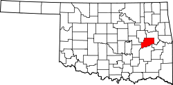
Hitchita, Oklahoma

Last updated

Hitchita, Oklahoma
OKMap-doton-Hitchita.PNG
Location of Hitchita, Oklahoma
Coordinates: 35°31′11″N95°45′06″W / 35.51972°N 95.75167°W / 35.51972; -95.75167
Country United States
State Oklahoma
County McIntosh
Area
[1]
  Total0.11 sq mi (0.29 km2)
  Land0.11 sq mi (0.29 km2)
  Water0.00 sq mi (0.00 km2)
Elevation
[2]
653 ft (199 m)
Population
 (2020)
  Total60
  Density540.54/sq mi (209.19/km2)
Time zone UTC-6 (Central (CST))
  Summer (DST) UTC-5 (CDT)
ZIP code
74438
Area code(s) 539/918
FIPS code 40-34900 [3]
GNIS feature ID2412758 [2]

Hitchita is a town in McIntosh County, Oklahoma, United States. The Encyclopedia of Oklahoma History and Culture says that the town was named for a band of Muskhogean Indians that had been absorbed into the Creek tribe. [4] The population was 88 at the 2010 census, a decline of 22.1 percent from 113 in 2000. [5]

Contents

Geography

Hitchita is located in the vicinity of the area known as the High Spring Mountains. [6]

According to the United States Census Bureau, the town has a total area of 0.1 square miles (0.26 km2), all land.

Hitchita is southeast of Okmulgee, northeast of Henryetta, and directly north of Oklahoma’s largest lake, [7] Lake Eufaula. [8]

Demographics

Historical population
CensusPop.Note
1920 264
1930 228−13.6%
1940 206−9.6%
1950 141−31.6%
1960 120−14.9%
1970 16033.3%
1980 126−21.2%
1990 118−6.3%
2000 113−4.2%
2010 88−22.1%
2020 60−31.8%
U.S. Decennial Census [9]

As of the census [3] of 2000, there were 113 people, 44 households, and 31 families residing in the town. The population density was 951.1 inhabitants per square mile (367.2/km2). There were 51 housing units at an average density of 429.2 per square mile (165.7/km2). The racial makeup of the town was 82.30% White, 0.88% African American, 9.73% Native American, and 7.08% from two or more races.

There were 44 households, out of which 27.3% had children under the age of 18 living with them, 63.6% were married couples living together, 4.5% had a female householder with no husband present, and 27.3% were non-families. 25.0% of all households were made up of individuals, and 15.9% had someone living alone who was 65 years of age or older. The average household size was 2.57 and the average family size was 3.09.

In the town, the population was spread out, with 21.2% under the age of 18, 8.8% from 18 to 24, 25.7% from 25 to 44, 22.1% from 45 to 64, and 22.1% who were 65 years of age or older. The median age was 42 years. For every 100 females, there were 88.3 males. For every 100 females age 18 and over, there were 93.5 males.

The median income for a household in the town was $20,536, and the median income for a family was $22,321. Males had a median income of $18,750 versus $12,500 for females. The per capita income for the town was $11,695. There were 14.3% of families and 22.6% of the population living below the poverty line, including 38.9% of under eighteens and 12.1% of those over 64.

Notable person

Related Research Articles

<span class="mw-page-title-main">Okmulgee County, Oklahoma</span> County in Oklahoma, United States

Okmulgee County is a county in the U.S. state of Oklahoma. As of the 2020 census, the population was 36,706. The county seat is Okmulgee. Located within the Muscogee Nation Reservation, the county was created at statehood in 1907. The name Okmulgee is derived from the Hitchita word okimulgi, meaning "boiling waters".

<span class="mw-page-title-main">McIntosh County, Oklahoma</span> County in Oklahoma, United States

McIntosh County is a county located in the U.S. state of Oklahoma. As of the 2020 census, the population was 18,941. Its county seat is Eufaula. The county is named for an influential Muscogee Creek family, whose members led the migration of the Lower Towns to Indian Territory and served as leaders for generations.

<span class="mw-page-title-main">Prince's Lakes, Indiana</span> Town in Indiana, United States

Prince's Lakes is a town in Nineveh Township, Johnson County, Indiana, United States. The population was 1,312 at the 2010 census.

<span class="mw-page-title-main">Goshen, Massachusetts</span> Town in Massachusetts, United States

Goshen is a town in Hampshire County, Massachusetts, United States. The population was 960 at the 2020 census. It is part of the Springfield, Massachusetts Metropolitan Statistical Area. The town has a rural atmosphere, with one general store, a post office, a fire station, a regional elementary school in nearby Chesterfield, and a town hall. The town encompasses both the Upper and Lower Highland lakes, Upper being a part of the D.A.R. State Forest. The Lower Highland Lake is privately held by a homeowners' association for families who own yearlong and summer properties on the lake.

<span class="mw-page-title-main">Vergas, Minnesota</span> City in Minnesota, United States

Vergas is a city in northern Otter Tail County, Minnesota, United States. The population was 348 at the 2020 census.

<span class="mw-page-title-main">Indiahoma, Oklahoma</span> Town in Oklahoma, United States

Indiahoma is a town in Comanche County, Oklahoma, United States. It is located just south of US Route 62, about 24.4 driving miles west of Lawton.

<span class="mw-page-title-main">Willow, Oklahoma</span> Town in Oklahoma, United States

Willow is a town in Greer County, Oklahoma, United States. The population was 119 as of the 2020 United States census. It is situated about 13 miles north of the county seat of Mangum, just west of the concurrent US Route 283 and Oklahoma State Highway 34.

<span class="mw-page-title-main">Stuart, Oklahoma</span> Town in Oklahoma, United States

Stuart is a town in southeastern Hughes County, Oklahoma, United States. The population was 180 at the 2010 census, down from 220 in 2000.

<span class="mw-page-title-main">Carney, Oklahoma</span> Town in Oklahoma, United States

Carney is a town in Lincoln County, Oklahoma, United States. As of the 2020 census, the population of the town was 545.

<span class="mw-page-title-main">Warwick, Oklahoma</span> Town in Oklahoma, United States

Warwick is a town in Lincoln County, Oklahoma, United States. The population was 184 at the 2020 census, up from 148 in 2010.

<span class="mw-page-title-main">Grand Lake Towne, Oklahoma</span> Town in Oklahoma, United States

Grand Lake Towne is a town in Mayes County, Oklahoma, United States. The population was 74 at the 2010 census.

<span class="mw-page-title-main">Checotah, Oklahoma</span> Town in Oklahoma, United States

Checotah is a town in McIntosh County, Oklahoma, United States. It was named for Samuel Checote, the first chief of the Creek Nation elected after the Civil War. Its population was 3,481 at the 2000 census. According to Census 2010, the population has decreased to 3,335; a 4.19% loss.

Shady Grove is a census-designated place (CDP) in McIntosh County, Oklahoma, United States. The population was 199 at the 2010 census, a decrease of 14.4 percent from 229 in 2000. This is not to be confused with the similarly-named Shady Grove in Cherokee County, or the Shady Grove in Pawnee County.

Texanna is a census-designated place (CDP) in McIntosh County, Oklahoma, United States. The population was 2,083 at the 2000 census.

<span class="mw-page-title-main">Lake Aluma, Oklahoma</span> Town in Oklahoma, United States

Lake Aluma is a town in Oklahoma County, Oklahoma, United States, and a part of the Oklahoma City Metropolitan Area. The population was 88 at the 2010 census.

<span class="mw-page-title-main">Morris, Oklahoma</span> City in Oklahoma, United States

Morris is a city in Okmulgee County, Oklahoma, United States. The population was 1,299 at the 2020 census.

<span class="mw-page-title-main">Schulter, Oklahoma</span> Town in Oklahoma, United States

Schulter is a town in Okmulgee County, Oklahoma, United States. The population was 422 at the time of the 2020 census.

<span class="mw-page-title-main">Westport, Oklahoma</span> Town in Oklahoma, United States

Westport is a town in Pawnee County, Oklahoma, United States. The population was 298 at the 2010 census, a gain of 12.9 percent over the figure of 264 in 2000.

<span class="mw-page-title-main">Johnson, Oklahoma</span> Town in Oklahoma, United States

Johnson is a town in north-central Pottawatomie County, Oklahoma, United States. The population was 247 at the 2010 census, a 10.8 percent increase from the figure of 223 in 2000.

<span class="mw-page-title-main">East Troy (town), Wisconsin</span> Civil town in Walworth County, Wisconsin

East Troy is a town in Walworth County, Wisconsin, United States. The population was 3,392 as of the 2020 census. The unincorporated communities of Hilburn, Lake Beulah, and Potter Lake are located in the town, as was the ghost town of Army Lake. East Troy is also home to several summer camps.

References

  1. "ArcGIS REST Services Directory". United States Census Bureau. Retrieved September 20, 2022.
  2. 1 2 U.S. Geological Survey Geographic Names Information System: Hitchita, Oklahoma
  3. 1 2 "U.S. Census website". United States Census Bureau . Retrieved January 31, 2008.
  4. 1 2 Davis, Philip B. Encyclopedia of Oklahoma History and Culture "Hitchita." Retrieved August 26, 2012.
  5. CensusViewer: Population of the City of Hitchita, Oklahoma
  6. "High Spring Mountains, Oklahoma". Google Maps. Retrieved June 30, 2020.
  7. "Lake Eufaula". TravelOK.com. Retrieved April 3, 2020.
  8. "Hitchita, Oklahoma". Google Maps. Retrieved July 18, 2020.
  9. "Census of Population and Housing". Census.gov. Retrieved June 4, 2015.