Texanna, Oklahoma | |
|---|---|
 Texanna  Texanna | |
| Coordinates: 35°21′26″N95°30′17″W / 35.35722°N 95.50472°W | |
| Country | United States |
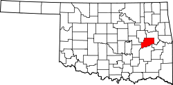
| State | Oklahoma |
| County | McIntosh |
| Area | |
• Total | 39.95 sq mi (103.48 km2) |
| • Land | 39.70 sq mi (102.82 km2) |
| • Water | 0.26 sq mi (0.66 km2) |
| Elevation | 702 ft (214 m) |
| Population | |
• Total | 2,293 |
| • Density | 57.76/sq mi (22.30/km2) |
| Time zone | UTC-6 (Central (CST)) |
| • Summer (DST) | UTC-5 (CDT) |
| ZIP Codes | |
| Area codes | 539/918 |
| FIPS code | 40-72950 [4] |
| GNIS feature ID | 2410073 [2] |
Texanna is an unincorporated community and census-designated place (CDP) in McIntosh County, Oklahoma, United States. As of the 2020 census, the community had 2,293 residents. [3]
Contents
Established in District 12 of the old Indian Territory, its post office existed from June 27, 1888, until July 16, 1940. Texanna's population in the 1905 Territorial Census was 200. It is said to have been named for a settlement of Texas Cherokees. Residents of Texanna now have a Eufaula or Checotah postal address.